Old Maps of Assumption Parish, Louisiana for Hiking & Exploration
Hike through history with 124 historic maps of Assumption Parish. Explore old trails, ghost towns, and forgotten backroads — perfect for outdoor adventurers and local explorers.
- Rediscover forgotten places: Map out old mining camps, roads, and footpaths that no longer exist on modern maps.
- Layer with modern tools: Combine with LiDAR or satellite views to plan hikes through historical terrain.
- Made for exploration: Popular among hikers, overlanders, and local history lovers.
Use these maps to find adventure and explore the hidden past of Assumption Parish.
Assumption Parish, LA maps
(124)- 1892 Map of Gibson
 1892 Gibson1892 Print · USGSCoastal Louisiana in the early 1890s is captured here as a landscape of bayous and new rail lines. Genealogists and historians can trace family land along Bayou Black or locate old railway stops at Gibson, Chacahoula, and Schriever.4 unique versions available
 - 1892 Map of Donaldsonville
 1892 Donaldsonville1892 Print · USGSLouisiana river life in the early 1890s centered on the great meanders and landings of the river parishes. Genealogists and historians can trace the early footprints of Donaldsonville, locate the Indian Mounds, and see the impact of the Nita Crevasse on the shoreline.12 unique versions available
 - 1892 Map of Thibodaux, 1898 Print
 1892 Thibodaux1898 Print · USGSCajun country at the end of the nineteenth century is defined here by the winding course of Bayou Lafourche and its riverside communities. Genealogists and local historians can trace the early footprints of Thibodeaux and Labadieville alongside rail lines like the Southern Pacific Railroad.3 unique versions available
 - 1897 Map of Gibson
 1897 Gibson1897 Print · USGSCoastal Louisiana in the late nineteenth century was a world defined by its waterways and the rising influence of the rail. Genealogists and researchers can trace the early layout of bayou settlements like Schriever, Ellendale, and Chacahoula along the Southern Pacific Railroad.
 - 1927 Map of Thibodaux NW
 1927 Thibodaux NW1927 Print · USGSAssumption Parish at the end of the 1920s reveals the intricate ribbon-strip land patterns along the bayous. Genealogists and historians can trace family-named settlements like Albemarle, Aurelia, and Bertie, or locate the St Thomas Sch and Woodlawn Ch.
 - 1932 Map of Thibodaux SW
 1932 Thibodaux SW1932 Print · USGSBayou Lafourche during the early thirties is a landscape of expansive sugar estates and bustling rail lines. Genealogists can locate family lands and landmarks like Labadieville, Cedar Grove Plantation, and the Brule Guillot Sch.
 - 1935 Map of Morgan City
 1935 Morgan City1935 Print · USGSIn the mid-thirties, the Atchafalaya delta was a vital crossroads of the Old Spanish Trail and Southern Pacific rail lines. Genealogists and historians can trace family locations from Fairview Plantation to the Bradley Family Cem and the Bayou Black Settlement.
 - 1935 Map of Chicot Lake, 1938 Print
 1935 Chicot Lake1938 Print · USGSInland Iberville Parish in the 1930s reveals a complex delta landscape managed by the Corps of Engineers. Researchers can trace the river-bound economy of the era through the Jack Miller Store, the Indian Mound, and the dredging of the Logging Canal.
 - 1936 Map of White Castle, 1937 Print
 1936 White Castle1937 Print · USGSThe Mississippi River corridor and its sprawling plantation estates are captured here in the mid-1930s. Researchers can trace family roots at Pierre Part Settlement or locate landmarks like the Leper Colony and St Marys Ch & Cem.2 unique versions available
 - 1938 Map of Labadieville
 1938 Labadieville1938 Print · USGSAssumption Parish at the end of the Depression era remains a landscape of sprawling cane plantations and active bayou commerce. Genealogists and historians can trace family locations from Labadieville to rural outposts like Brule Guillot and New Belmont Ch.
 - 1939 Map of Donaldsonville, 1953 Print
 1939 Donaldsonville1953 Print · USGSLouisiana's river parishes are captured here in the late 1930s, showing a landscape defined by the winding Mississippi River and its rich agricultural traditions. Genealogists and historians can trace family roots through numerous combined school and church sites like Little Zion Sch Ch & Cem or the sprawling riverside Monroe Plantation.5 unique versions available
 - 1939 Map of Gibson, 1956 Print
 1939 Gibson1956 Print · USGSCoastal Louisiana at the end of the thirties was a world of rail-side settlements and bayou-based commerce. You can trace the lineage of small parish communities through Beattieville Gray P O, Mt Pilgrim Ch, and the Halfway Cem.
 - 1940 Map of Madewood
 1940 Madewood1940 Print · USGSAssumption Parish at the end of the 1930s shows a landscape defined by the sugar economy and the wetlands. Genealogists and historians can trace family locations along Bayou Lafourche through old settlements like Madewood, Albemarle, and Aurelia.2 unique versions available
 - 1941 Map of Gibson
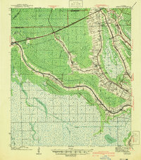 1941 Gibson1941 Print · USGSCajun country and the sugarcane belt are mapped here just before the war, showing the rail-and-water corridors of the southern parishes. Genealogists can trace family names and local landmarks through sites like Beattleville Gray P O, Bull Run Sch, and Halfway Cem.
 - 1944 Map of Gibson
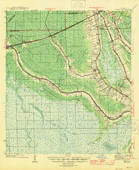 1944 Gibson1944 Print · USGSCoastal Louisiana during the mid-forties reveals a landscape defined by delta bayous and early industrial rail lines. Genealogists can locate family landmarks like Mt Pilgrim Ch, St Johns Ch, and the Beattieville Gray PO.
 - 1945 Map of New Orleans
 1945 New Orleans1945 Print · USGSCoastal Louisiana and the Mississippi delta are captured here just after the war, showing the region's transition into a modern industrial and transit hub. Genealogists can trace family settlements along Bayou Teche or identify rail stops for the Illinois Central and Texas & Pacific lines.
 - 1947 Map of Donaldsonville
 1947 Donaldsonville1947 Print · USGSThe Mississippi River corridor near Donaldsonville comes to life in this mid-century survey of the river's winding path and industrial shoreline. Researchers can trace the rail lines of the Texas and Pacific, find the Saulsberg Refinery, and locate rural landmarks like the Brulie Maurin Sch.
 - 1948 Map of Foster, 1951 Print
 1948 Foster1951 Print · USGSSt. Martin and St. Mary Parishes are shown at a post-war turning point, where Bayou Teche's plantation heritage meets the industrial era. Family historians can locate specific sites like Verdunville, Butler Ch & Cem, and the river-based community at Irish Bend.
 - 1953 Map of Napoleonville
 1953 Napoleonville1953 Print · USGSAssumption Parish sugar plantations and the emerging oil industry define this mid-century landscape. Researchers can trace historic family landholdings like Little Texas Plantation or follow the rail lines through Napoleonville and Paincourtville.2 unique versions available
 - 1954 Map of Chicot Lake
 1954 Chicot Lake1954 Print · USGSIberville and St. Martin Parishes are captured here in the mid-fifties, showing a watery landscape defined by the Atchafalaya Basin Floodway. Genealogists and historians can trace community landmarks like the Bayou Plaquemine Mission, the Jack Miller Store, and the Bayou Sorrel Baptist Hospital.
 - 1954 Map of Morgan City
 1954 Morgan City1954 Print · USGSCoastal Louisiana in the mid-fifties shows a dynamic intersection of rail, road, and river traffic centered on the deep waters of Berwick Bay. Researchers can trace old family sites at Fairview Plantation, locate the Bayou L'Ourse Sch., or study the era's energy growth at the Bateman Lake Oil Field.
 - 1954 Map of Baton Rouge, 1974 Print
 1954 Baton Rouge1974 Print · USGSSoutheast Louisiana in the mid-fifties is captured here during a period of transition for its river and rail economies. Researchers can trace the path of the Mississippi River and find landmarks like the Bonnet Carre Spillway and Bayou Plaquemine.2 unique versions available
 - 1955 Map of Thibodaux
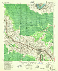 1955 Thibodaux1955 Print · USGSCoastal Louisiana in the mid-fifties is defined by the winding Bayou Lafourche and the massive Mississippi River. Genealogists and historians can trace numerous family-named sites and plantation tracts, including Laurel Valley Plantation, the New Belmont Ch, Sch & Cem, and the river landing at Moonshine.
 - 1955 Map of Chicot Lake
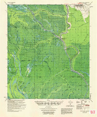 1955 Chicot Lake1955 Print · USGSIberville Parish and the deep Atchafalaya Basin are captured here in the mid-fifties, showing a landscape defined by oil fields and swamp settlements. Researchers can trace the vanished social hubs of the basin at the Jack Miller Store, the Bayou Pigeon Sch, and the Bayou Plaquemine Mission.
 - 1956 Map of Baton Rouge
 1956 Baton Rouge1956 Print · USGSSouth Louisiana at the height of the mid-century oil boom shows a landscape of river oxbows and rising industry. Researchers can trace family roots through river towns like Scotlandville or locate early industrial sites and Oil wells near Lake Maurepas.
Showing maps 1-25 of 124
Top cities of Assumption Parish
Frequently asked questions
- What are the different types of historical maps available for Assumption Parish?
- What is the oldest map of Assumption Parish?
- Where can I purchase historical maps of Assumption Parish for my home or office?
- Where can I download high-res historical maps of Assumption Parish?
- Are there historical topographic maps available for Assumption Parish?
- Is there historical aerial imagery available for Assumption Parish?
- Where are historical maps of Assumption Parish sourced from?