1990s Maps of Beauregard Parish, Louisiana
Explore 9 historic maps of Beauregard Parish from the 1990s. These maps offer a rare glimpse into what life looked like during the 1990s — showing old roads, neighborhoods, homes, and landmarks that have changed or disappeared over time.
Whether you're researching your family's past, planning a metal detecting trip, or studying how Beauregard Parish's landscape evolved across the 1990s, these high-resolution maps are a powerful tool for exploring the history of this region.
- Focus on a specific era: All maps on this page are from the 1990s, giving you a focused view of this time period.
- See what’s changed: Compare century-old streets, trails, and buildings to today's modern landscape using overlays and satellite layers.
- Research with precision: Use these maps for genealogy, historical research, land use analysis, or educational projects.
- View, download, or print: Maps are fully viewable online in high resolution, and can be downloaded or printed for your own records.
Start exploring Beauregard Parish's history through authentic maps from the 1990s. This is your window into the past.
Beauregard Parish, LA maps
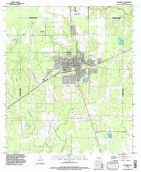
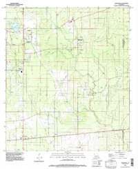
(9)- 1994 Map of Gordon, 1996 Print
 1994 Gordon1996 Print · USGSThe Beauregard and Calcasieu Parish border comes into focus in the mid-1990s, showing a landscape shaped by timber and oil. Genealogists can locate Gillie Cem and Alston Cem while tracing landmarks like the Lookout Tower and Boy Scout Camp.
 - 1994 Map of Le Blanc, 1996 Print
 1994 Le Blanc1996 Print · USGSAllen Parish is defined by its winding waterways and rural settlements in the mid-1990s. Genealogists and local historians can trace the community of Le Blanc, locate a country Cem, and follow the confluence of Whisky Chitto Creek and the Calcasieu River.
 - 1994 Map of De Quincy, 1996 Print
 1994 De Quincy1996 Print · USGSCalcasieu Parish in the mid-1990s was a landscape defined by the intersection of rail, timber, and the energy industry. Researchers can trace the layout of De Quincy and locate outlying communities like Hargrove or the resource-rich North De Quincy Oil Field.
 - 1994 Map of Gaytine, 1996 Print
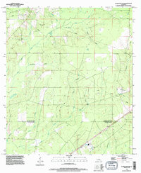
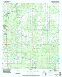
 1994 Gaytine1996 Print · USGSThe rural borders of Beauregard, Allen, and Calcasieu Parishes come together in the mid-1990s. Researchers can trace the local drainage along Indian Bayou and Marsh Bayou or locate small settlements like Gaytine and Turps.
 - 1994 Map of Clark Hollow, 1996 Print
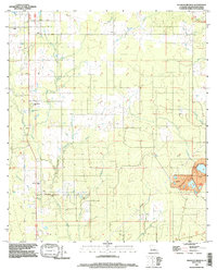
 1994 Clark Hollow1996 Print · USGSThe borderlands of Beauregard and Calcasieu Parishes are captured here in the mid-1990s, showing a landscape defined by timber, oil extraction, and deep watercourses. Researchers can locate family sites at Hyatt Cem or trace the drainage of Mule Pond and Sweet Gum Gully.
 - 1994 Map of Rosepine, 1997 Print
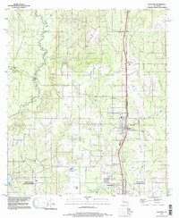 1994 Rosepine1997 Print · USGSRosepine and the northern outskirts of Deridder are captured in the mid-nineties, documenting the transition between Vernon and Beauregard Parishes. Researchers can trace the winding course of the Anacoco River and locate local landmarks such as the Minnow Ponds, Ludington, and Pinewood.
 - 1994 Map of Boneset Creek, 1997 Print
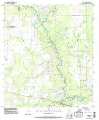
 1994 Boneset Creek1997 Print · USGSNorth of Bundick Lake in the 1990s, this Beauregard Parish landscape was defined by its intricate network of creek branches and rural industry. Researchers can trace family sites at several Cem locations and explore the area around Longacre and Bundick Creek.
 - 1994 Map of Redhead Branch, 1997 Print
 1994 Redhead Branch1997 Print · USGSLouisiana timberlands and the quiet settlement of Tulla define this part of Beauregard Parish in the mid-nineties. Trace rural family lands along the winding Redhead Branch or locate old industrial sites like the southeastern Gravel Pit.
 - 1994 Map of Longville, 1997 Print
 1994 Longville1997 Print · USGSThe piney woods of Beauregard Parish are captured in the mid-1990s as a landscape of gas infrastructure and rural crossroads. Genealogists and historians can locate small settlements like Edith and Burnett or trace the waters of Longville Lake.
End of results
Showing maps 1-9 of 9
Top cities of Beauregard Parish
Frequently asked questions
- What are the different types of historical maps available for Beauregard Parish?
- What is the oldest map of Beauregard Parish?
- Where can I purchase historical maps of Beauregard Parish for my home or office?
- Where can I download high-res historical maps of Beauregard Parish?
- Are there historical topographic maps available for Beauregard Parish?
- Is there historical aerial imagery available for Beauregard Parish?
- Where are historical maps of Beauregard Parish sourced from?