Old Maps of Beauregard Parish, Louisiana for Hiking & Exploration
Hike through history with 275 historic maps of Beauregard Parish. Explore old trails, ghost towns, and forgotten backroads — perfect for outdoor adventurers and local explorers.
- Rediscover forgotten places: Map out old mining camps, roads, and footpaths that no longer exist on modern maps.
- Layer with modern tools: Combine with LiDAR or satellite views to plan hikes through historical terrain.
- Made for exploration: Popular among hikers, overlanders, and local history lovers.
Use these maps to find adventure and explore the hidden past of Beauregard Parish.
Beauregard Parish, LA maps
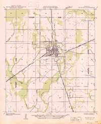
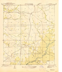
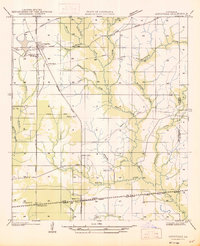
(275)- 1935 Map of Mittie
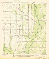 1935 Mittie1935 Print · USGSAllen Parish was a landscape in transition during the mid-1930s as timber rail lines gave way to new state highways. Genealogists and local historians can trace the foundations of Mittie and Simmons Settlement alongside the Cherry Grove Ch and an Old Logging Railroad Grade.
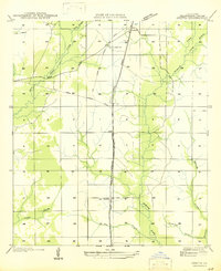
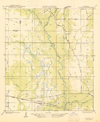
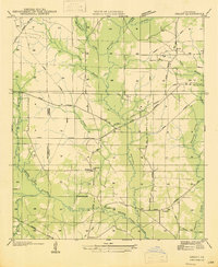
 - 1935 Map of Gordon
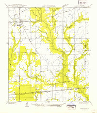
 1935 Gordon1935 Print · USGSLouisiana timber and rail history intersect at the small settlement of Gordon during the mid-1930s. Genealogists and researchers can trace early transport networks through the Old Logging Railroad, Pilgrims Rest Ch, and the Missouri Pacific line.
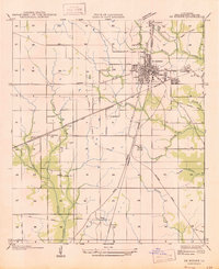
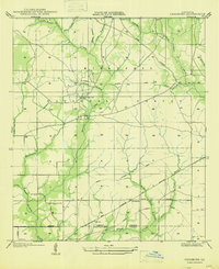
 - 1935 Map of Gaytine
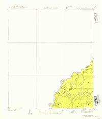
 1935 Gaytine1935 Print · USGSSouthwestern Louisiana's wetlands and timber country are captured here in the mid-1930s as the logging era left its mark on the landscape. Researchers can trace old industrial footprints through the Old Logging Railroad Grade and find small communities like Gaytine and Turps.
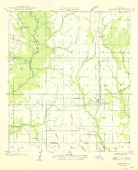
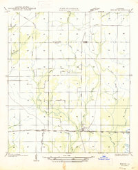
 - 1935 Map of Longville
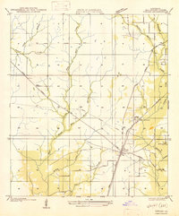
 1935 Longville1935 Print · USGSLouisiana's timber country comes to life in the 1930s as logging railroads and spurs weave through the forests of Beauregard and Allen Parishes. Researchers can trace the development of Longville and find local landmarks like Center Ridge Ch and Kernan Sch.
 - 1935 Map of Wilson Lake, 1954 Print
 1935 Wilson Lake1954 Print · USGSThe Louisiana and Texas borderlands come to life in this mid-1930s survey of the Sabine River bottoms. Genealogists and historians can trace the original river channels and oxbows like Wilson Lake, Old River, and the curiously named Bugger Branch.2 unique versions available
 - 1946 Map of Merryville
 1946 Merryville1946 Print · USGSMerryville and the Sabine River basin are shown here during the mid-forties, capturing the intersection of river transport and the timber industry. Genealogists can locate family landmarks like Hennigan Cem, Bethlehem Ch, and the site of Clines Ferry.
 - 1947 Map of Singer
 1947 Singer1947 Print · USGSMid-century Beauregard Parish was a landscape of timber and rail, centered on the small hub of Singer. Genealogists and historians can trace the legacy of local families through landmarks like Newlin Cem, Holly Grove Ch, and the extensive Old Logging Railroad Grade.
 - 1947 Map of Gaytine
 1947 Gaytine1947 Print · USGSLouisiana's bayou country is captured in the mid-1930s as the timber and rail era left its mark across Beauregard Parish. Researchers can trace the path of the Southern Pacific and the Old Logging Railroad Grade near Gaytine and Turps.
 - 1947 Map of Pujo
 1947 Pujo1947 Print · USGSLouisiana's timber country near the border of Vernon and Beauregard Parishes is captured here just after the war. You can trace the legacy of the local lumber industry through several segments of Old Logging Railroad Grade and find family-history landmarks like Damascene Ch and Neale.
 - 1947 Map of Carter Creek
 1947 Carter Creek1947 Print · USGSThe Louisiana-Texas borderlands along the Sabine River are documented here in the mid-1940s, showing a landscape shaped by river bends and logging. Researchers can trace the Old Logging Railroad Grade and locate family landmarks like Duetts Ch and Clarks Cem.
 - 1947 Map of DeQuincy
 1947 DeQuincy1947 Print · USGSDe Quincy functioned as a vital rail crossroads in the late 1930s, situated at the meeting point of the Calcasieu and Beauregard parishes. Genealogists and historians can trace old homesteads near Rigmaiden Cem and the rail-side settlements at Sompayrac and Perkins.
 - 1947 Map of Oretta
 1947 Oretta1947 Print · USGSBeauregard Parish timber and rail operations are preserved here during the mid-forties, showing the vital connection between industry and small settlements. Trace the footprints of Oretta, Juanita, and the Old Logging Railroad Grade through the piney woods.
 - 1947 Map of DeRidder
 1947 DeRidder1947 Print · USGSBeauregard Parish in the mid-1940s was a critical juncture for the timber and rail industries. Genealogists and historians can locate defunct logging camps and community landmarks such as Grabow, Bon Ami, and the Old Hickman Sch along the Kansas City Southern tracks.
 - 1947 Map of Rosepine
 1947 Rosepine1947 Print · USGSLouisiana's western pine forests come into focus in the mid-1940s as the logging industry evolved along the rail corridors. Genealogists and researchers can trace the old paths between Neame and Rosepine, locating family landmarks like Walnut Grove Ch and Miller Cem.
 - 1947 Map of Kernan
 1947 Kernan1947 Print · USGSBeauregard Parish was a landscape of timber and transit in the late 1940s, where rural life centered on rail sidings and creek crossings. You can trace the Old Logging Railroad Grade across the parish or locate Kernan near the Bear Ch.
 - 1947 Map of Knight
 1947 Knight1947 Print · USGSLouisiana's timber country comes into focus in the mid-1940s, showing a landscape shaped by logging and early parish roads. Genealogists and historians can trace the foundations of local life at Mt Carmel Ch and the path of the Logging Railroad.
 - 1947 Map of Le Blanc
 1947 Le Blanc1947 Print · USGSSouthwestern Louisiana's wetland and timber country is captured here during the mid-1940s. Trace family roots at Le Blanc or Harmony Ch, and follow the path of the Old Logging Railroad Grade through the Calcasieu River basin.
 - 1947 Map of Ikes
 1947 Ikes1947 Print · USGSBeauregard Parish in the mid-1930s and 1940s reveals a landscape defined by logging history and rural settlement patterns. Researchers can trace family sites near Whittaker Cem, Ikes, and the rail lines of the Gulf Colorado and Santa Fe.
 - 1947 Map of Chasmore
 1947 Chasmore1947 Print · USGSThe timberlands of Vernon and Beauregard Parishes are captured here in the mid-1940s, highlighting the industrial footprint of the Kisatchie National Forest. Researchers can trace old logging lines and family landmarks like Davis Mill Sch, Chasmore, and Providence Ch.
 - 1947 Map of Reeves
 1947 Reeves1947 Print · USGSAllen Parish and the surrounding piney woods come into focus during the late 1940s, highlighting the area's transition from timber territory to a rail-connected hub. Researchers can trace the path of the Old Logging Railroad Grade near the settlements of Bel and Reeves.
 - 1947 Map of Wilson Lake
 1947 Wilson Lake1947 Print · USGSThe Sabine River bottomlands at the Texas-Louisiana border are captured here during the mid-1930s, revealing a shifting landscape of river channels and marsh. Researchers can trace the complex meanders of Old River, Middle River, and the banks of Wilson Lake.
 - 1947 Map of Hyatt
 1947 Hyatt1947 Print · USGSBeauregard Parish in the late 1930s and 1940s reveals a landscape still defined by its timber roots. Genealogists and historians can trace the paths of the Old Logging Railroad near early settlements like Hyatt and Fields P.O.
 - 1947 Map of Longville
 1947 Longville1947 Print · USGSThe timber-rich corridor of Beauregard Parish is captured here during the 1930s, when logging infrastructure and rural rail spurs defined the local economy. Genealogists and historians can trace family locations near Longville, Magnolia Ch, and the Kernan Sch.
 - 1947 Map of Grant
 1947 Grant1947 Print · USGSAllen Parish and Beauregard Parish were still heavily marked by timber industry infrastructure in the mid-1940s. Genealogists and historians can trace family locations near Grant, the Hamilton Cem, and rural centers like Fairview Sch or Palestine Ch.
 - 1947 Map of Bivens
 1947 Bivens1947 Print · USGSWestern Louisiana near the Texas border is captured here during the mid-century, showing the timber-driven landscape of Beauregard Parish. Researchers can trace defunct transport routes like the Old Logging Railroad Grade and find family-history landmarks such as Green Oak Ch and the settlement of Bivens.
Showing maps 1-25 of 275
Top cities of Beauregard Parish
Frequently asked questions
- What are the different types of historical maps available for Beauregard Parish?
- What is the oldest map of Beauregard Parish?
- Where can I purchase historical maps of Beauregard Parish for my home or office?
- Where can I download high-res historical maps of Beauregard Parish?
- Are there historical topographic maps available for Beauregard Parish?
- Is there historical aerial imagery available for Beauregard Parish?
- Where are historical maps of Beauregard Parish sourced from?