1950s Maps of Beauregard Parish, Louisiana
Explore 31 historic maps of Beauregard Parish from the 1950s. These maps offer a rare glimpse into what life looked like during the 1950s — showing old roads, neighborhoods, homes, and landmarks that have changed or disappeared over time.
Whether you're researching your family's past, planning a metal detecting trip, or studying how Beauregard Parish's landscape evolved across the 1950s, these high-resolution maps are a powerful tool for exploring the history of this region.
- Focus on a specific era: All maps on this page are from the 1950s, giving you a focused view of this time period.
- See what’s changed: Compare century-old streets, trails, and buildings to today's modern landscape using overlays and satellite layers.
- Research with precision: Use these maps for genealogy, historical research, land use analysis, or educational projects.
- View, download, or print: Maps are fully viewable online in high resolution, and can be downloaded or printed for your own records.
Start exploring Beauregard Parish's history through authentic maps from the 1950s. This is your window into the past.
Beauregard Parish, LA maps
(31)- 1950 Map of Dry Creek, 1952 Print
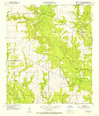
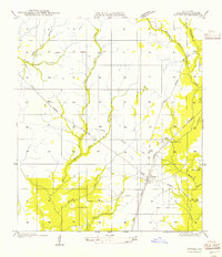
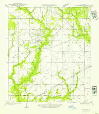
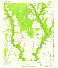
 1950 Dry Creek1952 Print · USGSLouisiana's Beauregard Parish was a landscape of small crossroads and creek-side settlements in the early fifties. Researchers can trace rural lineages through sites like Shiloh Cem, the town of Dry Creek, and local landmarks like Midway Ch.
 - 1951 Map of Sugartown, 1952 Print
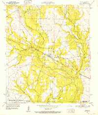
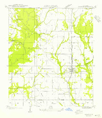
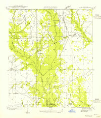
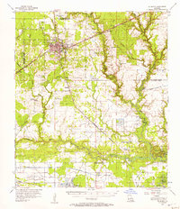
 1951 Sugartown1952 Print · USGSThe rural pine woods of eastern Beauregard Parish come alive in the early fifties, centered on the historic crossroads of Sugartown. Genealogists can locate family landmarks like Cole Cem and Smyrna Ch along the banks of Whisky Chitto Creek.
 - 1951 Map of Pitkin, 1952 Print
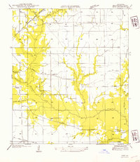
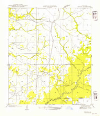
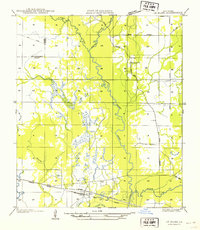
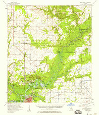
 1951 Pitkin1952 Print · USGSLouisiana's timber and rail country comes to life in the early fifties, centered on the community of Pitkin and the Kisatchie National Forest. Genealogists can trace local landmarks like Mathis Cem, Simmons Mill Ch, and the winding path of the Atchison Topeka and Santa Fe.
 - 1952 Map of Lake Charles
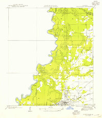
 1952 Lake Charles1952 Print · USGSSouthwest Louisiana is captured here in the mid-fifties, showing a landscape defined by the rise of the petrochemical industry and deep-water navigation. Researchers can trace family roots through numerous small-town settlements and oil developments like Nibletts Bluff, the Lockport Oil Field, and Starks.
 - 1954 Map of Pujo
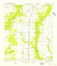
 1954 Pujo1954 Print · USGSBeauregard Parish timberlands are shown in the mid-1950s as the era of heavy logging gave way to rural settlement. Researchers can trace the path of the Old Logging Railroad Grade or locate early community centers like Damascene Ch and Neale.
 - 1954 Map of Merryville
 1954 Merryville1954 Print · USGSMerryville and the Sabine River borderlands are shown here in the mid-1950s, during an era defined by timber and rail transit. Genealogists and local historians can trace family-named sites like Hennican Cem, the path of an old Logging Railroad, and the location of Clines Ferry (Abandoned).
 - 1954 Map of Ikes
 1954 Ikes1954 Print · USGSBeauregard Parish in the mid-1950s reflects a landscape shaped by logging history and rural community life. Researchers can trace the Old Logging Railroad Grade and locate ancestral sites like Whittaker Cem or the settlement at Ikes.
 - 1954 Map of Singer
 1954 Singer1954 Print · USGSLouisiana's timber and rail country is captured here during the mid-1950s, centered on the community of Singer. Genealogists and historians can trace local landmarks like Newlin Cem, Holly Grove Ch, and the remnant Old Logging Railroad Grade.
 - 1954 Map of DeRidder
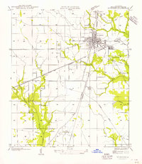
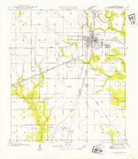 1954 DeRidder1954 Print · USGSDe Ridder and Beauregard Parish are shown here during the mid-century, highlighting a landscape shaped by rail and timber. Researchers can trace historic sites like Old Hickman Sch, the settlement of Bon Ami, and extensive Old Logging Railroad Grades.
 - 1954 Map of Rosepine
 1954 Rosepine1954 Print · USGSThe pine woods of western Louisiana are captured here during a period of transition for the local timber industry. Researchers can trace the legacy of old company towns and rural life through landmarks like Neame, the Old Logging Railroad, and Cypress Creek Ch.
 - 1954 Map of Knight
 1954 Knight1954 Print · USGSVernon and Beauregard Parishes are captured here in the mid-1930s as the local timber industry left its mark on the landscape. Researchers can trace defunct transport networks like the Logging Railroad Grade and find family landmarks including Mt Carmel Ch and Knight.
 - 1954 Map of Bivens
 1954 Bivens1954 Print · USGSThe Sabine River bottomlands of Beauregard Parish were still defined by rail and river trade during the mid-twentieth century. Genealogists and local historians can trace the foundations of Merryville and Bivens, or locate the Green Oak Ch and old logging railroad grades.
 - 1954 Map of Chasmore
 1954 Chasmore1954 Print · USGSVernon and Beauregard Parishes are captured here in the mid-1930s as the regional timber industry left its mark on the land. Researchers can trace the legacy of logging through the Old Logging Railroad Grade and locate rural landmarks like Davis Mill Sch and Providence Ch.
 - 1954 Map of Sugrue
 1954 Sugrue1954 Print · USGSLouisiana's timber country is captured here in the mid-1950s, showing a landscape defined by the Kisatchie National Forest and active rail lines. Researchers can trace rural life through landmarks like Gravel Hill Ch, Cole Center, and the winding Whisky Chitto Creek.
 - 1954 Map of Le Blanc
 1954 Le Blanc1954 Print · USGSThe rural borders of Allen and Beauregard parishes are captured here in the mid-twentieth century, showcasing a landscape shaped by timber and rail. Researchers can trace the junction of the Missouri Pacific railroad at Le Blanc and locate the historic Harmony Ch.
 - 1954 Map of Lake Charles, 1964 Print
 1954 Lake Charles1964 Print · USGSSouthwest Louisiana in the mid-fifties is defined by its massive petroleum industry and its complex network of bayous and rail lines. Researchers can trace the development of the Sulphur Mines Oil Field or locate historic settlements like Longville and De Quincy.3 unique versions available
 - 1955 Map of Hyatt
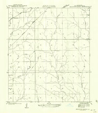
 1955 Hyatt1955 Print · USGSBeauregard Parish was a landscape of timber and rural outposts in the 1930s, caught between the era of rail logging and modern highways. You can trace the Old Logging Railroad Grade near Hyatt and locate the old Fields P. O..
 - 1956 Map of Oretta
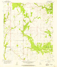
 1956 Oretta1956 Print · USGSMid-century Beauregard Parish reveals a landscape shaped by timber and transit during this era of transition. Genealogists and historians can trace the development of Oretta, Seale, and Juanita along the Kansas City Southern Railroad.
 - 1956 Map of DeRidder
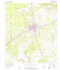
 1956 DeRidder1956 Print · USGSBeauregard Parish in the mid-1930s was a critical rail junction where timber and transport intersected. Genealogists and historians can locate rural landmarks like Pine Ridge Ch and Old Hickman Sch or trace the Old Logging Railroad Grade near Carson.
 - 1956 Map of Beckwith School
 1956 Beckwith School1956 Print · USGSBeauregard Parish in the mid-fifties is captured here as a landscape shaped by timber and rail. Genealogists and local historians can trace the paths of an Old Logging Railroad Grade and find the location of the Beckwith Sch and the settlement of Carson.
 - 1956 Map of Gaytine, 1957 Print
 1956 Gaytine1957 Print · USGSSouthwest Louisiana in the mid-fifties is seen here as a landscape of rural bayous and timber-era rail stops. Researchers can trace the Southern Pacific line through small settlements like Gaytine and Turps or follow the waters of Marsh Bayou.2 unique versions available
 - 1956 Map of De Quincy, 1957 Print
 1956 De Quincy1957 Print · USGSMid-century Calcasieu Parish is captured here at the intersection of heavy rail and the emerging oil industry. Genealogists and historians can trace the growth of De Quincy through its Ward Sch and High Sch or locate family sites near Humphries Cem and Perkins.3 unique versions available
 - 1956 Map of Gordon, 1957 Print
 1956 Gordon1957 Print · USGSThe timber and oil lands of the Beauregard-Calcasieu border are captured here in the mid-fifties as industrial infrastructure expanded. Researchers can trace family roots at Gillie Cem, find old congregations like Pilgrim Rest Ch, or locate the Gordon rail siding.2 unique versions available
 - 1956 Map of De Quincy, 1957 Print
 1956 De Quincy1957 Print · USGSCalcasieu Parish comes alive in the mid-1950s as a bustling crossroads of rail, river commerce, and oil extraction. Researchers can trace the heritage of local families at Rigmaiden Cemetery, explore the rail junction at De Quincy, and locate rural landmarks like New Hope Church.3 unique versions available
 - 1957 Map of Moss Bluff, 1958 Print
 1957 Moss Bluff1958 Print · USGSCalcasieu Parish and its surrounding bayous are captured here in the late fifties as the river economy transitions toward industry. Researchers can trace family roots at Birdnest Cem or locate historic river crossings like Perkins Ferry.3 unique versions available
Showing maps 1-25 of 31
Top cities of Beauregard Parish
Frequently asked questions
- What are the different types of historical maps available for Beauregard Parish?
- What is the oldest map of Beauregard Parish?
- Where can I purchase historical maps of Beauregard Parish for my home or office?
- Where can I download high-res historical maps of Beauregard Parish?
- Are there historical topographic maps available for Beauregard Parish?
- Is there historical aerial imagery available for Beauregard Parish?
- Where are historical maps of Beauregard Parish sourced from?