1980s Maps of Caddo Parish, Louisiana
Explore 23 historic maps of Caddo Parish from the 1980s. These maps offer a rare glimpse into what life looked like during the 1980s — showing old roads, neighborhoods, homes, and landmarks that have changed or disappeared over time.
Whether you're researching your family's past, planning a metal detecting trip, or studying how Caddo Parish's landscape evolved across the 1980s, these high-resolution maps are a powerful tool for exploring the history of this region.
- Focus on a specific era: All maps on this page are from the 1980s, giving you a focused view of this time period.
- See what’s changed: Compare century-old streets, trails, and buildings to today's modern landscape using overlays and satellite layers.
- Research with precision: Use these maps for genealogy, historical research, land use analysis, or educational projects.
- View, download, or print: Maps are fully viewable online in high resolution, and can be downloaded or printed for your own records.
Start exploring Caddo Parish's history through authentic maps from the 1980s. This is your window into the past.
Caddo Parish, LA maps
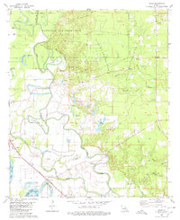
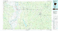
(23)- 1980 Map of Shreveport East
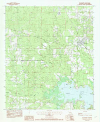
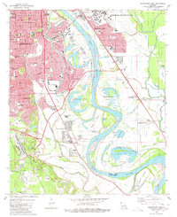 1980 Shreveport East1980 Print · USGSThe riverfront and expanding suburbs of Shreveport and Bossier City are captured here during the late 1970s. Researchers can trace local landmarks like Centenary College, Red River Cem, and the development of Anderson Island.3 unique versions available
 - 1980 Map of Elm Grove
 1980 Elm Grove1980 Print · USGSThe Red River bottomlands near the Bossier-Caddo Parish line are shown here in the late seventies, where river bends and bayous dictate the local geography. Genealogists can locate rural landmarks like Mechanicsville, George Washington Carver School, and the Mt Pleasant Church near Lachute.2 unique versions available
 - 1980 Map of Wallace Lake
 1980 Wallace Lake1980 Print · USGSNorthwest Louisiana in the late seventies is captured here at the junction of Caddo and De Soto Parishes. Trace the rail lines of the Kansas City Southern or locate old community centers like Frierson, St Elizabeth Ch, and Antioch Cem.2 unique versions available
 - 1980 Map of Clear Lake
 1980 Clear Lake1980 Print · USGSLouisiana's bayou country is captured here in the 1970s, showing a transition between the Red River wetlands and local industry. Genealogists can locate family landmarks like Star Point, the New Friendship Cem, and Red Lake Ch.2 unique versions available
 - 1980 Map of Sligo
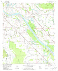
 1980 Sligo1980 Print · USGSThe Red River floodplain southeast of Bossier City comes into focus during the late 1970s as a landscape of military reserves and active oil fields. You can trace family roots at Oakland Cem and Mayflower Cem, or locate landmarks in Sligo and Taylortown.
 - 1980 Map of North Highlands, 1981 Print
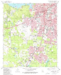
 1980 North Highlands1981 Print · USGSShreveport and North Highlands are shown in a period of significant suburban and industrial expansion in the early eighties. Genealogists and local historians can locate many community landmarks, including Walker Hill Cem, Southern University, and St Luke Ch.3 unique versions available
 - 1980 Map of Shreveport West, 1981 Print
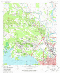
 1980 Shreveport West1981 Print · USGSShreveport and the Caddo Parish suburbs are captured here during a period of significant westward growth. Genealogists and local historians can trace family plots across Forest Park West Cemetery or locate community anchors like Summer Grove and Union Mission Church.2 unique versions available
 - 1982 Map of Stonewall
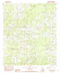
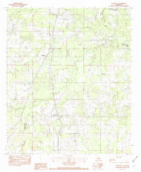 1982 Stonewall1982 Print · USGSNorth Louisiana's parish borderlands come into focus in the early eighties as the rail-and-creek landscape of the region is documented. Trace the path of the Kansas City Southern Ry through Stonewall and Keithville alongside Boggy Bayou and Strong Landing Strip.2 unique versions available
 - 1982 Map of Mooringsport
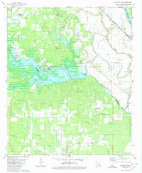
 1982 Mooringsport1982 Print · USGSMooringsport and Oil City appear in the early eighties as industrial and lakeside hubs along the shores of CADDO LAKE. Trace old family landmarks and local waterways like Myricks, PINE ISLAND, and the engineering of the SHREVEPORT WATERWAY.2 unique versions available
 - 1982 Map of Blanchard
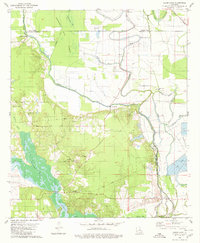
 1982 Blanchard1982 Print · USGSCaddo Parish in the early 1980s shows the growth of Blanchard and the rural character of Longwood near the shoreline. Trace the winding paths of Piney Bayou and Republican Bayou as they reach the islands and points of Cross Lake.2 unique versions available
 - 1982 Map of Greenwood
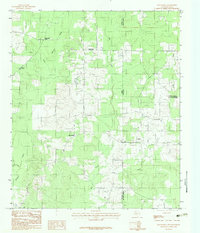
 1982 Greenwood1982 Print · USGSCaddo Parish in the early eighties shows the westward growth of the Shreveport area toward the Louisiana-Texas border. Genealogists and local historians can locate old burial sites marked Cem and trace rural landmarks like Hicks Crossing and Lake Hayes.
 - 1982 Map of Dixie
 1982 Dixie1982 Print · USGSThe alluvial plains of Northwest Louisiana are captured here in the early eighties as the river dictates the local geography. Researchers can trace the legacy of Sentell Plantation, the small community of Belcher, and the winding course of Red River oxbows.
 - 1982 Map of Spring Ridge
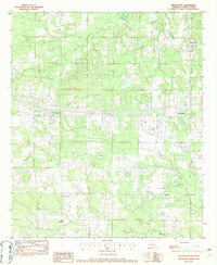
 1982 Spring Ridge1982 Print · USGSSouthern Caddo Parish in the early 1980s remains a landscape of bayous and small rural crossroads. Researchers can trace land boundaries along Boggy Bayou or locate local landmarks like the Spring Ridge settlement and the Caddo Correctional Institute.
 - 1983 Map of Old Panola
 1983 Old Panola1983 Print · USGSThe Texas-Louisiana state line comes alive in the early eighties as a network of rural parishes and quiet creek bottoms. Genealogists and historians can trace family locations through Centennial Cem, Shiloh Ch, and the old settlement of Old Panola.
 - 1984 Map of Tyler
 1984 Tyler1984 Print · USGSEast Texas at the peak of its reservoir-building era shows a landscape defined by new lakes and established rail corridors. Trace the path of the St Louis Southwestern RR or locate industrial sites like the Longhorn Ordnance Works.3 unique versions available
 - 1984 Map of Shreveport
 1984 Shreveport1984 Print · USGSNorthern Louisiana at the peak of the 1980s reveals a landscape of massive water management projects and Cold War military hubs. Trace the rail lines of the Kansas City Southern Ry past Barksdale Air Force Base and the high ground of Driskill Mountain.2 unique versions available
 - 1985 Map of Shreveport South
 1985 Shreveport South1985 Print · USGSNorthwest Louisiana in the mid-eighties shows a landscape defined by the Red River and a transition from urban centers to deep timberland. Researchers can trace the rail-and-river economy through landmarks like Barksdale Air Force Base, the Sligo Oil and Gas Field, and Lake Bistineau.2 unique versions available
 - 1986 Map of Marshall
 1986 Marshall1986 Print · USGSEast Texas and the Louisiana borderlands are shown in the mid-1980s during a period of sustained industrial and energy production. Researchers can trace family roots through settlements like Ebenezer or study the impact of the Longhorn Army Ammunition Plant and Rodessa Oil Field.2 unique versions available
 - 1986 Map of Texarkana
 1986 Texarkana1986 Print · USGSThe Texas-Arkansas borderlands are captured here in the mid-eighties as a hub of military industry and river-basin geography. Genealogists and local historians can locate rural landmarks like Red Hill Cem, Coopers Chapel, and the Lone Star Army Ammunition Plant.
 - 1986 Map of Magnolia
 1986 Magnolia1986 Print · USGSThe Arkansas-Louisiana borderlands in the mid-1980s are defined by the river systems and the reach of the petroleum industry. Genealogists and historians can trace the St Louis Southwestern Railroad through Stamps or locate rural sites like Cleveland Cem and Brightstar.2 unique versions available
 - 1986 Map of Henderson
 1986 Henderson1986 Print · USGSEast Texas and the Louisiana borderlands come into focus in the 1980s as industrial energy production meets quiet rural townships. Researchers can trace family sites and local landmarks from Elysian Fields to Old Panola, alongside major features like the Strip Mine and Martin Lake State Park.2 unique versions available
 - 1986 Map of Shreveport North
 1986 Shreveport North1986 Print · USGSNorthern Louisiana in the mid-eighties shows a landscape of expansive river bottoms and growing suburban centers. Genealogists and historians can trace the development of Shreveport, the infrastructure of Barksdale Air Force Base, and rural life in Rocky Mount.2 unique versions available
 - 1989 Map of El Dorado, 1990 Print
 1989 El Dorado1990 Print · USGSThe Arkansas-Louisiana borderlands in the late eighties show a landscape of heavy industry and wildlife conservation centered on the Ouachita River. Researchers can trace the legacy of timber and transport via the Missouri Pacific RR, Poison Springs State Forest, and the vast Felsenthal Pool.
End of results
Showing maps 1-23 of 23
Top cities of Caddo Parish
- Shreveport historical maps
- Vivian historical maps
- Blanchard historical maps
- Greenwood historical maps
- Oil City historical maps
- Mooringsport historical maps
See more
Frequently asked questions
- What are the different types of historical maps available for Caddo Parish?
- What is the oldest map of Caddo Parish?
- Where can I purchase historical maps of Caddo Parish for my home or office?
- Where can I download high-res historical maps of Caddo Parish?
- Are there historical topographic maps available for Caddo Parish?
- Is there historical aerial imagery available for Caddo Parish?
- Where are historical maps of Caddo Parish sourced from?