Old Maps of Fairfield, Louisiana for Metal Detecting
Plan your next treasure hunt with 13 historic maps of Fairfield. Find old homesites, ghost towns, trails, and gathering spots that may be lost to time — perfect for identifying promising metal detecting locations.
- Locate forgotten sites: Uncover places like long-lost settlements, abandoned rail lines, or gathering spots.
- Plan better hunts: Use map overlays combined with LiDAR or satellite views to narrow in on historically rich areas.
- Made for detectorists: Thousands of hobbyists use these maps to discover relics, coins, and hidden history.
Use these historic maps to boost your research and find new opportunities beneath the surface of Fairfield.
Fairfield, LA maps
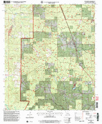
(13)- 1932 Map of Colfax SE
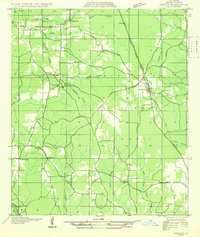 1932 Colfax SE1932 Print · USGSGrant Parish in the early thirties shows a rural landscape defined by the nascent Kisatchie National Forest and local timber corridors. Researchers can locate community landmarks such as Faircloth, Dry Prong, and rural schoolhouses like Black Cr Sch.
 - 1936 Map of Colfax
 1936 Colfax1936 Print · USGSGrant Parish in the mid-1930s is defined by the sweeping course of the Red River and the expanding reaches of Lake Iatt. Local researchers can trace old family sites and rural institutions like Parsons Cem, Summerfield, and the Oak Grove Sch.2 unique versions available
 - 1953 Map of Alexandria, 1963 Print
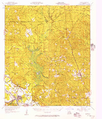
 1953 Alexandria1963 Print · USGSCentral Louisiana during the early fifties is mapped here at the intersection of the piney woods and the Red River valley. Genealogists and historians can trace the rail-and-river network connecting towns like Alexandria, Natchitoches, and the grounds of Camp Beauregard.3 unique versions available
 - 1955 Map of Alexandria
 1955 Alexandria1955 Print · USGSCentral Louisiana in the mid-fifties is a landscape of river-port cities, sprawling timberlands, and massive military reservations. Genealogists and historians can trace the rail networks of the Texas & Pacific RR and locate sites like Camp Polk Military Reservation and Natchitoches.
 - 1956 Map of Colfax, 1957 Print
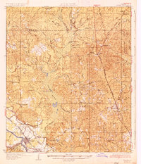
 1956 Colfax1957 Print · USGSGrant and Winn Parishes come into focus during the mid-1950s, showing a landscape defined by forest reserves and rail-line settlements. Genealogists and historians can trace local roots through landmarks like Hebron Ch & Cem, Summerfield Sch, and McNeeley.3 unique versions available
 - 1985 Map of Dry Prong
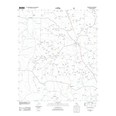
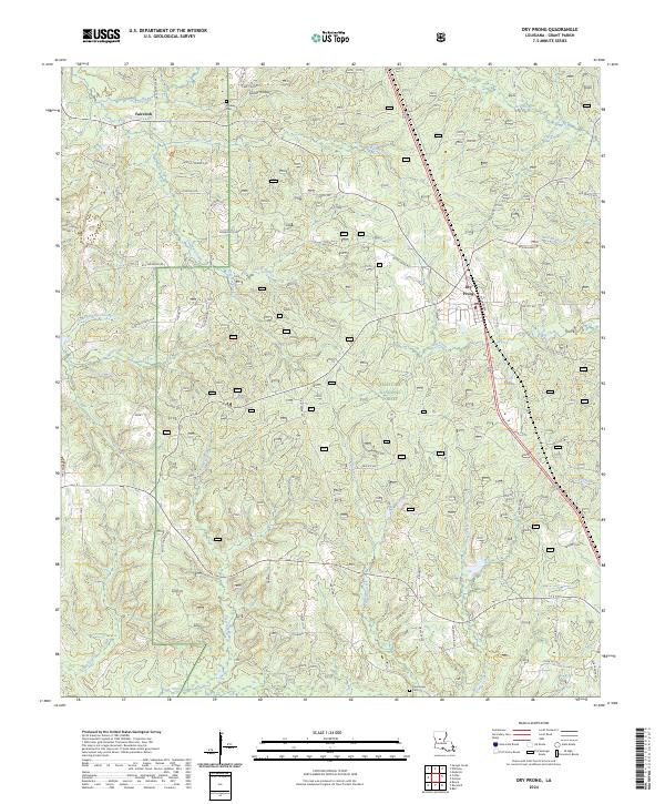
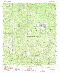 1985 Dry Prong1985 Print · USGSGrant Parish settlement during the mid-eighties centered on the timberlands of the Kisatchie National Forest. Researchers can trace old family sites and rural infrastructure through locations like Dry Prong, Fairfield, and several local Cem markers.
 - 1986 Map of Winnfield
 1986 Winnfield1986 Print · USGSCentral Louisiana in the mid-1980s was a landscape of timber towns and rail junctions woven through the Kisatchie National Forest. Researchers can trace the legacy of the lumber and rail eras through settlements like Good Pine, Packton, and Zenoria.2 unique versions available
 - 2003 Map of Dry Prong, 2005 Print
 2003 Dry Prong2005 Print · USGSDry Prong and the central Louisiana woodlands are documented here just after the turn of the millennium. Researchers can trace local landmarks like Grant Parish High School, find family sites at Oak Grove, or locate early settlements such as Fairfield and Faircloth.
 - 2012 Map of Dry Prong, 2012 Print
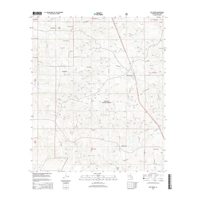
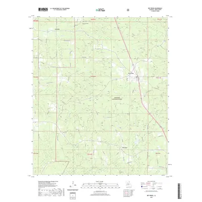
 2012 Dry Prong2012 Print · USGSCovers Fairfield, including Dry Prong, Faircloth, and other nearby areas
 - 2015 Map of Dry Prong, 2015 Print
 2015 Dry Prong2015 Print · USGSCovers Fairfield, including Dry Prong, Faircloth, and other nearby areas
 - 2018 Map of Dry Prong, 2018 Print
 2018 Dry Prong2018 Print · USGSCovers Fairfield, including Dry Prong, Faircloth, and other nearby areas
 - 2020 Map of Dry Prong, 2020 Print
 2020 Dry Prong2020 Print · USGSCovers Fairfield, including Dry Prong, Faircloth, and other nearby areas
 - 2024 Map of Dry Prong, 2024 Print
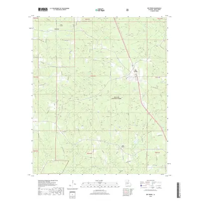
 2024 Dry Prong2024 Print · USGSThe piney woods of central Louisiana come into focus here during the early twenty-first century. Genealogists can trace family footprints along Moore Cemetery Rd and locate Midway Cem or the rural community of Faircloth.
End of results
Showing maps 1-13 of 13
Top cities near Fairfield
- Alexandria historical maps
- Pineville historical maps
- Ball historical maps
- Colfax historical maps
- Boyce historical maps
- Dry Prong historical maps
See more
Frequently asked questions
- What are the different types of historical maps available for Fairfield?
- What is the oldest map of Fairfield?
- Where can I purchase historical maps of Fairfield for my home or office?
- Where can I download high-res historical maps of Fairfield?
- Are there historical topographic maps available for Fairfield?
- Is there historical aerial imagery available for Fairfield?
- Where are historical maps of Fairfield sourced from?