Old Maps of Jackson Parish, Louisiana for Metal Detecting
Plan your next treasure hunt with 103 historic maps of Jackson Parish. Find old homesites, ghost towns, trails, and gathering spots that may be lost to time — perfect for identifying promising metal detecting locations.
- Locate forgotten sites: Uncover places like long-lost settlements, abandoned rail lines, or gathering spots.
- Plan better hunts: Use map overlays combined with LiDAR or satellite views to narrow in on historically rich areas.
- Made for detectorists: Thousands of hobbyists use these maps to discover relics, coins, and hidden history.
Use these historic maps to boost your research and find new opportunities beneath the surface of Jackson Parish.
Jackson Parish, LA maps
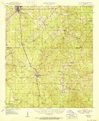
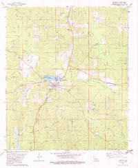
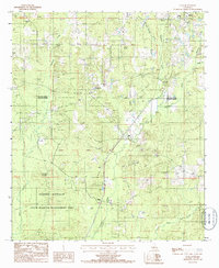
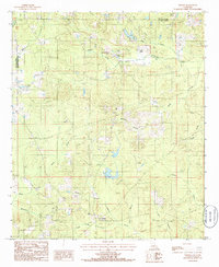
(103)- 1947 Map of Goldonna
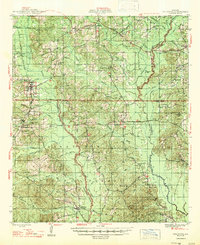 1947 Goldonna1947 Print · USGSNorth Louisiana's timber and rail country is captured here just after the war, showing the rural communities of Natchitoches and Bienville Parishes. Researchers can locate local landmarks like Blooms Mill, trace the Louisiana and Arkansas Railroad, or find old school sites like Readhimer Sch.
 - 1947 Map of Bienville, 1963 Print
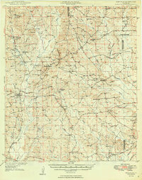
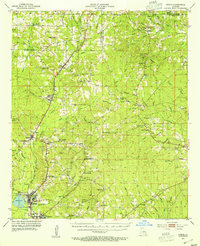
 1947 Bienville1963 Print · USGSNorth central Louisiana is shown here in the mid-forties, characterized by a mix of timber, rail, and early gas exploration. Researchers can find numerous rural landmarks like Raspberry School, the Louisiana and Arkansas Railroad, and Driskill Mountain.2 unique versions available
 - 1949 Map of Bienville
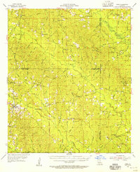
 1949 Bienville1949 Print · USGSNorthern Louisiana hill country is documented here in the late 1940s, showing the rural communities of Bienville Parish and its neighbors. Researchers can locate dozens of country churches and schools, including Raspberry School and Mt Villa Ch Cem, or trace the Louisiana and North West Railroad.2 unique versions available
 - 1949 Map of Jonesboro, 1958 Print
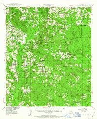
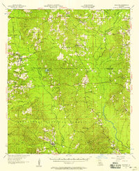
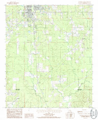
 1949 Jonesboro1958 Print · USGSJackson and Winn Parish come alive in the late 1940s, showing a landscape of timberlands and rail-centered settlements. Researchers can trace rural life through landmarks like Gaars Mill Sch, Zion Hill Ch, and the Winona Lookout Tower.3 unique versions available
 - 1950 Map of Jonesboro
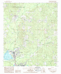
 1950 Jonesboro1950 Print · USGSJackson and Winn Parish communities are captured here in the mid-twentieth century as the timber and rail economy flourished. Researchers can trace the Chicago Rock Island and Pacific rail line between Jonesboro and Dodson, locating rural landmarks like Mt Hebron Sch and Zion Hill Ch.2 unique versions available
 - 1953 Map of Chatham, 1954 Print
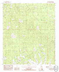
 1953 Chatham1954 Print · USGSLouisiana's piney hills and creek bottoms are meticulously detailed here in the early fifties, showing a network of rural parishes. Researchers can locate family landmarks like Mt Moriah Cem, the settlement of Indian Village, and the Old Railroad Grade.3 unique versions available
 - 1953 Map of Hodge, 1954 Print
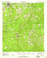
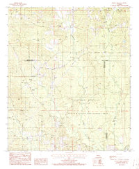
 1953 Hodge1954 Print · USGSJackson Parish in the early fifties shows a landscape of timber and rail, centered on the busy mills of Hodge and Jonesboro. Genealogists and historians can trace the foundations of local life at China Grove Sch and Saints Rest Ch.5 unique versions available
 - 1954 Map of Sikes, 1955 Print
 1954 Sikes1955 Print · USGSThe North Louisiana timber and rail corridor comes to life in the mid-fifties, centered on the community of Sikes. Genealogists and historians can trace family burial grounds like Womack Cem and Newsom Cem or locate rural landmarks such as Asbury Sch and Sikes Spur.4 unique versions available
 - 1955 Map of Shreveport
 1955 Shreveport1955 Print · USGSNorthern Louisiana in the mid-fifties is captured here as a landscape of military bases, vast oil fields, and burgeoning college towns. Genealogists and historians can trace the rail-and-river economy through the Monroe Gas Field, Grambling College, and Barksdale Air Force Base.3 unique versions available
 - 1956 Map of Shreveport
 1956 Shreveport1956 Print · USGSNorthern Louisiana during the mid-fifties presents a complex landscape of booming oil fields and strategic military installations. Genealogists and historians can trace the infrastructure of the Monroe Gas Field and family-named locales from Cotton Valley to Jonesboro.
 - 1957 Map of Goldonna
 1957 Goldonna1957 Print · USGSThe rural pine woods of Natchitoches and Bienville Parishes are captured here in the late fifties, just as local landmarks were beginning to change. Genealogists can locate family sites such as Morning Star Ch, Goldonna Cem, and the Pleasant Ridge Sch.3 unique versions available
 - 1982 Map of Chatham
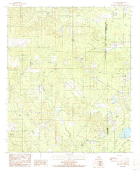
 1982 Chatham1982 Print · USGSJackson Parish in the early eighties centers on the industrial and rail hub of Chatham, where energy production and timber transport define the rural landscape. Genealogists can trace family names through several rural burial sites, including Brooklyn Ch Cem, Wyatt Cem, and Bethel Cem.
 - 1982 Map of Chatham SE
 1982 Chatham SE1982 Print · USGSThe rural borderlands of Jackson, Ouachita, and Caldwell Parishes come into focus during the early eighties as a landscape of timber and rail. Researchers can trace family-named routes like Sam Brown Road and locate rural landmarks including Phantom Ch and Head Cem.
 - 1982 Map of Eros, 1983 Print
 1982 Eros1983 Print · USGSNorth central Louisiana during the early eighties shows a landscape of small timber-and-gas settlements along the parish lines. Researchers can trace family sites like Old Zeigler Cem and Bonett Cem or explore the rural layout of Eros and Indian Village.
 - 1984 Map of Shreveport
 1984 Shreveport1984 Print · USGSNorthern Louisiana at the peak of the 1980s reveals a landscape of massive water management projects and Cold War military hubs. Trace the rail lines of the Kansas City Southern Ry past Barksdale Air Force Base and the high ground of Driskill Mountain.2 unique versions available
 - 1985 Map of Monroe South
 1985 Monroe South1985 Print · USGSNorth Central Louisiana in the mid-1980s was a hub of timber production and rail transport spanning from the Dugdemona River to the Ouachita valley. Family researchers and historians can trace the rail lines of the Midsouth Railroad through Jonesboro or find local landmarks like Mineral Springs and Punkin Center.2 unique versions available
 - 1985 Map of Weston, 1986 Print
 1985 Weston1986 Print · USGSThe rural borderlands of Jackson and Winn Parishes come into focus in the mid-1980s, showcasing the piney woods landscape. Genealogists and historians can trace family locations near Weston, Walker, and the winding banks of Hurricane Creek.
 - 1985 Map of Clay, 1986 Print
 1985 Clay1986 Print · USGSNorthern Louisiana timber and hill country are captured here in the mid-eighties, revealing a landscape of small settlements and resource extraction. Researchers can trace family roots at several rural cemeteries or locate the old Gravel Pit Redwine and Ansley.
 - 1985 Map of Jonesboro South, 1986 Print
 1985 Jonesboro South1986 Print · USGSJackson and Winn Parishes come to life in this mid-eighties survey of the north-central Louisiana timberlands. Genealogists and local historians can trace the rural landscape from the edge of Jonesboro down to smaller communities like Wyatt and Gansville.
 - 1985 Map of Jonesboro North, 1986 Print
 1985 Jonesboro North1986 Print · USGSNorth Louisiana's timber and river corridor is captured here in the mid-eighties as industry and wilderness meet. Researchers can trace the development of the Dugdemona River valley from the industrial hubs of Hodge and North Hodge to the rural crossroads of Punkin Center and Hilltop.
 - 1985 Map of Curr Creek, 1986 Print
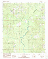
 1985 Curr Creek1986 Print · USGSJackson Parish in the 1980s is shown as a landscape of timbered ridges and winding waterways. Genealogists and local historians can trace family landmarks like a secluded Cem or the strategically placed Lookout Tower near Curr Creek.
 - 1985 Map of Vernon, 1986 Print
 1985 Vernon1986 Print · USGSThe northern Louisiana parishes of Lincoln and Jackson are shown in the mid-1980s, featuring a landscape of creek-cut hills and quiet timberlands. Researchers can find old family sites near Buckenham Hill or trace rural church and burial locations marked simply as Cem near Vernon and Kelleys.
 - 1986 Map of Wilson Creek
 1986 Wilson Creek1986 Print · USGSNorth Louisiana’s piney woods and bottomlands are documented here in the mid-1980s, showcasing the rural reach of the Dugdemona River. Genealogists can trace family footprints near the settlement of Wilson or along the banks of Wilson Creek.
 - 1986 Map of Danville
 1986 Danville1986 Print · USGSThe tri-parish border of Bienville, Jackson, and Winn parishes is captured here in the mid-1980s, centered on the logging and river lands of Danville. Researchers can trace rural landmarks like Horner Lake, several parish Cem locations, and the meandering Dugdemona River.
 - 1986 Map of Mount Olive
 1986 Mount Olive1986 Print · USGSNorth-central Louisiana in the 1980s reveals a landscape of piney woods and creek bottoms at the junction of two parishes. Trace local landmarks like Mt Olive and New Friendship, or locate old resource sites like the Sand Hill and various sand pits.
Showing maps 1-25 of 103
Top cities of Jackson Parish
- Jonesboro historical maps
- Chatham historical maps
- Hodge historical maps
- North Hodge historical maps
- East Hodge historical maps
- Eros historical maps
See more
Frequently asked questions
- What are the different types of historical maps available for Jackson Parish?
- What is the oldest map of Jackson Parish?
- Where can I purchase historical maps of Jackson Parish for my home or office?
- Where can I download high-res historical maps of Jackson Parish?
- Are there historical topographic maps available for Jackson Parish?
- Is there historical aerial imagery available for Jackson Parish?
- Where are historical maps of Jackson Parish sourced from?