2020s Maps of Kenner, Louisiana
Explore 8 historic maps of Kenner from the 2020s. These maps offer a rare glimpse into what life looked like during the 2020s — showing old roads, neighborhoods, homes, and landmarks that have changed or disappeared over time.
Whether you're researching your family's past, planning a metal detecting trip, or studying how Kenner's landscape evolved across the 2020s, these high-resolution maps are a powerful tool for exploring the history of this region.
- Focus on a specific era: All maps on this page are from the 2020s, giving you a focused view of this time period.
- See what’s changed: Compare century-old streets, trails, and buildings to today's modern landscape using overlays and satellite layers.
- Research with precision: Use these maps for genealogy, historical research, land use analysis, or educational projects.
- View, download, or print: Maps are fully viewable online in high resolution, and can be downloaded or printed for your own records.
Start exploring Kenner's history through authentic maps from the 2020s. This is your window into the past.
Kenner, LA maps
(8)- 2020 Map of Indian Beach, 2020 Print
 2020 Indian Beach2020 Print · USGSCovers Kenner, including Indian Beach, Westgate, and other nearby areas
 - 2020 Map of La Branche, 2020 Print
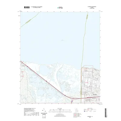 2020 La Branche2020 Print · USGSCovers Kenner, including La Branche, Jefferson Parish, and other nearby areas
 - 2020 Map of New Orleans West, 2020 Print
 2020 New Orleans West2020 Print · USGSCovers Kenner, including New Orleans, Metairie, and other nearby areas
 - 2020 Map of Luling, 2020 Print
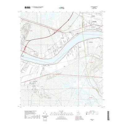 2020 Luling2020 Print · USGSCovers Kenner, including Corso, Frellsen, and other nearby areas
 - 2024 Map of La Branche, 2024 Print
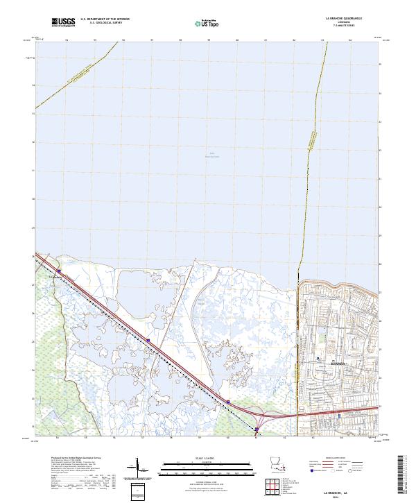 2024 La Branche2024 Print · USGSThe Louisiana shoreline meets suburban growth in the early twenty-first century as the marshland of ST. CHARLES PARISH transitions into the city. Researchers can trace the winding paths of Bayou La Branche and Bayou Piquant or explore the street grids of Kenner.
 - 2024 Map of Indian Beach, 2024 Print
 2024 Indian Beach2024 Print · USGSJefferson Parish's northern lakefront comes into focus in this contemporary survey of the Louisiana coast. Genealogists and local historians can trace the street-level detail of residential neighborhoods like Bucktown, Indian Beach, and the community surrounding Herzing College.
 - 2024 Map of Luling, 2024 Print
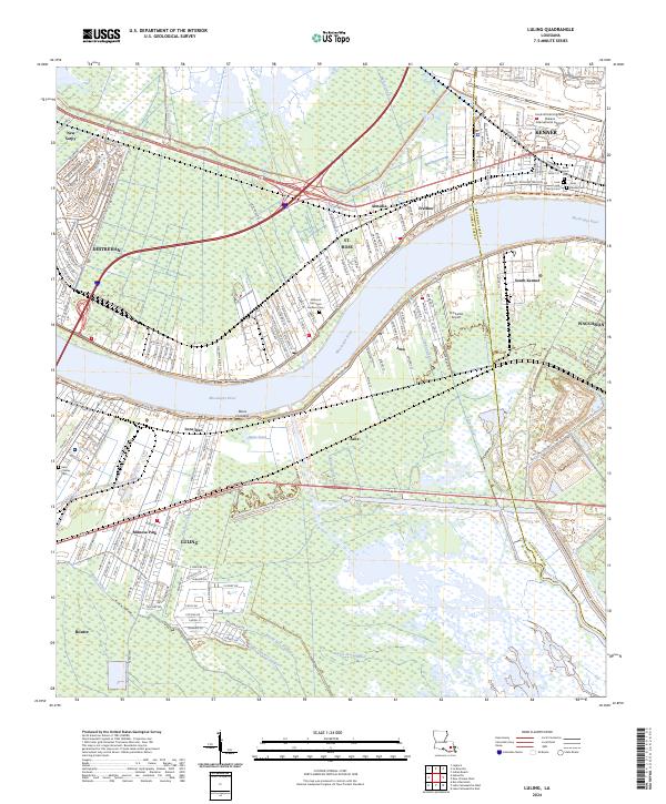 2024 Luling2024 Print · USGSThe River Parishes come alive in this contemporary survey of the Mississippi corridor. Trace the evolution of riverfront towns from Destrehan to Luling, and locate family sites like Saint Charles Cem or the Jefferson Memorial Gardens Cem.
 - 2024 Map of New Orleans West, 2024 Print
 2024 New Orleans West2024 Print · USGSJefferson Parish is shown in high detail during its contemporary era of dense suburban growth and river industry. Trace family roots and local landmarks from Bonnabel Place to Westwego, including Walnut Street Ferry and Shrewsbury Camp Parapet Cem.
End of results
Showing maps 1-8 of 8
Top cities near Kenner
- New Orleans historical maps
- Metairie historical maps
- Algiers historical maps
- Gretna historical maps
- Waggaman historical maps
- Westwego historical maps
See more
Top neighborhoods of Kenner
Frequently asked questions
- What are the different types of historical maps available for Kenner?
- What is the oldest map of Kenner?
- Where can I purchase historical maps of Kenner for my home or office?
- Where can I download high-res historical maps of Kenner?
- Are there historical topographic maps available for Kenner?
- Is there historical aerial imagery available for Kenner?
- Where are historical maps of Kenner sourced from?