1980s Maps of Morehouse Parish, Louisiana
Explore 26 historic maps of Morehouse Parish from the 1980s. These maps offer a rare glimpse into what life looked like during the 1980s — showing old roads, neighborhoods, homes, and landmarks that have changed or disappeared over time.
Whether you're researching your family's past, planning a metal detecting trip, or studying how Morehouse Parish's landscape evolved across the 1980s, these high-resolution maps are a powerful tool for exploring the history of this region.
- Focus on a specific era: All maps on this page are from the 1980s, giving you a focused view of this time period.
- See what’s changed: Compare century-old streets, trails, and buildings to today's modern landscape using overlays and satellite layers.
- Research with precision: Use these maps for genealogy, historical research, land use analysis, or educational projects.
- View, download, or print: Maps are fully viewable online in high resolution, and can be downloaded or printed for your own records.
Start exploring Morehouse Parish's history through authentic maps from the 1980s. This is your window into the past.
Morehouse Parish, LA maps
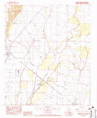
(26)- 1981 Map of Felsenthal Dam
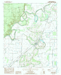
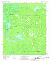 1981 Felsenthal Dam1981 Print · USGSThe Ouachita River bottomlands are captured here in the early eighties as new infrastructure began to reshape the landscape. Local historians can trace the transition from the Old Railroad Grade to modern works like the Felsenthal Lock and Dam and the Macedonia Cem.
 - 1981 Map of Empire, 1982 Print
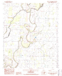
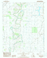
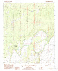
 1981 Empire1982 Print · USGSThe Arkansas-Louisiana borderlands come into focus in the early 1980s, revealing a landscape of delta bayous and small rural settlements. Genealogists and local historians can trace family ties at Millers Chapel Cem or locate the community centers of Empire and Green Grove Ch.
 - 1982 Map of Irwin Lake, 1983 Print
 1982 Irwin Lake1983 Print · USGSLouisiana's delta country at the turn of the 1980s reveals a landscape of winding sloughs and gas fields along the Morehouse and Richland parish line. Researchers can locate family landmarks like Irwin Lake Cem, Jerusalem Ch, and the Missouri Pacific rail corridor.
 - 1982 Map of Sterlington, 1983 Print
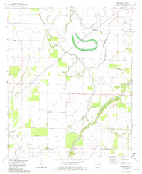
 1982 Sterlington1983 Print · USGSSterlington and the Ouachita River valley are shown here in the early eighties as a hub of river industry and parish history. Researchers can locate the Glendora Plantation, trace the Missouri Pacific rail line, and find old burial sites like Bartholomew Cem.
 - 1982 Map of Collinston East, 1983 Print
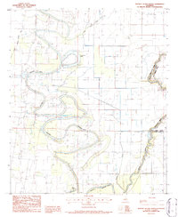
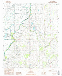
 1982 Collinston East1983 Print · USGSThe Louisiana delta near Collinston and Oak Ridge is shown here in the early 1980s, shaped by the Missouri Pacific rail line and shifting bayous. Researchers can trace local heritage at Mallette Cem, Indian Mounds, and numerous country churches.
 - 1982 Map of Collinston West, 1983 Print
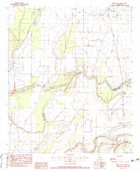
 1982 Collinston West1983 Print · USGSThe Louisiana backcountry of Morehouse Parish in the early eighties is captured here, showing the extensive Monroe Gas Field and river wetlands. Genealogists can trace family names at the Carter Cem, Ebenezer Ch, and the high ground of Trouser Hill.
 - 1982 Map of Bastrop, 1983 Print
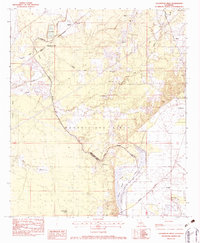
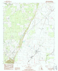
 1982 Bastrop1983 Print · USGSNortheastern Louisiana and the Mississippi River Delta are captured here in the early eighties as a landscape of bayous and river towns. Genealogists and historians can trace small communities like Mer Rouge and Oak Grove or the ancient terrain of Poverty Point State Park.
 - 1982 Map of Swartz, 1983 Print
 1982 Swartz1983 Print · USGSIn the early eighties, this corner of Ouachita Parish was a hub of natural gas extraction and conservation efforts. Researchers can trace rural lineages through Wham Cem, family roads like Stubbs-Ritchie Road, and landmarks like Bethel Ch.
 - 1984 Map of Shreveport
 1984 Shreveport1984 Print · USGSNorthern Louisiana at the peak of the 1980s reveals a landscape of massive water management projects and Cold War military hubs. Trace the rail lines of the Kansas City Southern Ry past Barksdale Air Force Base and the high ground of Driskill Mountain.2 unique versions available
 - 1985 Map of Monroe North, 1986 Print
 1985 Monroe North1986 Print · USGSNorth-central Louisiana in the mid-eighties was a landscape defined by the growth of university towns and the expansion of the natural gas industry. Researchers can trace rural family roots through landmarks like Lisbon Cem, New Hope Ch, and the many schools in Farmerville or Bernice.2 unique versions available
 - 1985 Map of El Dorado, 1986 Print
 1985 El Dorado1986 Print · USGSSouth-central Arkansas and the Louisiana borderlands appear here in the mid-1980s, defined by the energy industry and river bottomlands. Genealogists and historians can locate rural landmarks like Old Parkers Chapel Cem, the Smackover Gas Field, and the El Dorado & Wesson RR.2 unique versions available
 - 1986 Map of Crossett
 1986 Crossett1986 Print · USGSSoutheast Arkansas and the Mississippi Delta meet in the mid-1980s, revealing a landscape of rail-linked towns and river bottomlands. Researchers can trace the Missouri Pacific line through Hamburg and Parkdale or locate Millers Chapel and Winterville Mounds State Park.2 unique versions available
 - 1986 Map of Bear Skin, 1987 Print
 1986 Bear Skin1987 Print · USGSNortheast Louisiana’s bayou country is captured in the mid-1980s, showcasing the intersection of the Boeuf River and local parish lines. Genealogists and historians can trace rural settlements like Newhope and Bear Skin, alongside landmarks like the local Cem.
 - 1986 Map of Whitney Island South, 1987 Print
 1986 Whitney Island South1987 Print · USGSThe alluvial border between Richland and Morehouse Parishes is captured here in the mid-1980s, defined by the winding Boeuf River. Researchers can trace the shifting riverbed through landmarks like Point Jefferson, Old River Island, and the wetlands of Balfour Brake.
 - 1986 Map of Whitney Island North, 1987 Print
 1986 Whitney Island North1987 Print · USGSThe delta country of northeastern Louisiana is defined by its winding waterways in the 1980s. Genealogists and researchers can trace the intricate bends of Bayou Bonne Idee and locate landmarks like Horseshoe Lake and the local Cem.
 - 1987 Map of Fish Lake, 1988 Print
 1987 Fish Lake1988 Print · USGSThe Quachita River bottomlands in the late 1980s reveal a complex network of wetlands and industrial gas fields. Researchers can trace remote sites like Brantley Landing, the Potato Patch, and the oxbows of Horseshoe Lake along the parish line.
 - 1988 Map of Harrell Lake
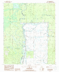
 1988 Harrell Lake1988 Print · USGSThe Louisiana river bottomlands come to life in this late-century survey of the Union and Morehouse Parish line. Genealogists and local historians can trace the waterways around Alabama Landing and explore the sloughs and brakes between Finch Lake and Butte de Morancy.
 - 1988 Map of Mer Rouge
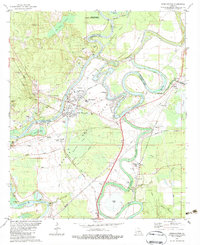
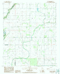
 1988 Mer Rouge1988 Print · USGSMorehouse Parish was still defined by its intricate bayous and prairie edges in the late eighties. Researchers can trace the layout of Mer Rouge, find small Cem locations, and follow the paths of Bayou Bartholomew and Little Bayou Galion.
 - 1988 Map of Bonita SW
 1988 Bonita SW1988 Print · USGSMorehouse Parish in the late eighties is defined here by its intricate network of bayous and drainage systems. Researchers can trace the meandering course of Bonne Idee Bayou and locate remote landmarks like The Swale and Bayou Galion.
 - 1988 Map of Fiske
 1988 Fiske1988 Print · USGSThe West Carroll Parish bottomlands are shown in the late 1980s, revealing a landscape shaped by the Boeuf River and its intricate drainage canals. Genealogists and local historians can trace family locations near Concord, Fiske, and several local Cem sites.
 - 1988 Map of Bastrop
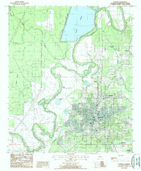 1988 Bastrop1988 Print · USGSBastrop and its surrounding wetlands are captured here in the late eighties, showing the town at a peak of municipal development. Researchers can trace the layout of outlying settlements like Newblock and Sheltons or locate family landmarks near Bussy Brake and Anderson Lake.
 - 1988 Map of Twin Oaks
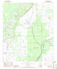
 1988 Twin Oaks1988 Print · USGSMorehouse Parish in the late eighties is defined by its winding waterways and the established Chemin-A-Haut State Park. Local historians can trace the settlement at Twin Oaks, find remote family sites near Cem labels, and locate a prominent Firetower.
 - 1988 Map of Bonita
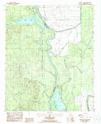
 1988 Bonita1988 Print · USGSMorehouse Parish in the late 1980s reveals a landscape shaped by both the natural winding of Bartholomew Bayou and intricate irrigation engineering. Researchers can trace the Missouri Pacific rail corridor and locate old river sites like Haynes Landing and Oak Landing.
 - 1988 Map of Goodwill
 1988 Goodwill1988 Print · USGSNortheast Louisiana in the 1980s reveals a landscape defined by its intricate waterways and parish borders. Researchers can trace the rural development of Goodwill and the complex drainage of Fluemile Slough and Big Colewa Bayou.
 - 1988 Map of Laark
 1988 Laark1988 Print · USGSNortheast Louisiana in the late 1980s shows a landscape deeply shaped by water management and rural settlement. Researchers can trace family history through the Cem near McGinty or explore the river-driven economy near Laark and the Boeuf River.
Showing maps 1-25 of 26
Top cities of Morehouse Parish
- Bastrop historical maps
- Mer Rouge historical maps
- Bonita historical maps
- Collinston historical maps
- Oak Ridge historical maps
Frequently asked questions
- What are the different types of historical maps available for Morehouse Parish?
- What is the oldest map of Morehouse Parish?
- Where can I purchase historical maps of Morehouse Parish for my home or office?
- Where can I download high-res historical maps of Morehouse Parish?
- Are there historical topographic maps available for Morehouse Parish?
- Is there historical aerial imagery available for Morehouse Parish?
- Where are historical maps of Morehouse Parish sourced from?