1960s Maps of Pointe Coupee Parish, Louisiana
Explore 31 historic maps of Pointe Coupee Parish from the 1960s. These maps offer a rare glimpse into what life looked like during the 1960s — showing old roads, neighborhoods, homes, and landmarks that have changed or disappeared over time.
Whether you're researching your family's past, planning a metal detecting trip, or studying how Pointe Coupee Parish's landscape evolved across the 1960s, these high-resolution maps are a powerful tool for exploring the history of this region.
- Focus on a specific era: All maps on this page are from the 1960s, giving you a focused view of this time period.
- See what’s changed: Compare century-old streets, trails, and buildings to today's modern landscape using overlays and satellite layers.
- Research with precision: Use these maps for genealogy, historical research, land use analysis, or educational projects.
- View, download, or print: Maps are fully viewable online in high resolution, and can be downloaded or printed for your own records.
Start exploring Pointe Coupee Parish's history through authentic maps from the 1960s. This is your window into the past.
Pointe Coupee Parish, LA maps
(31)- 1961 Map of Baton Rouge, 1966 Print
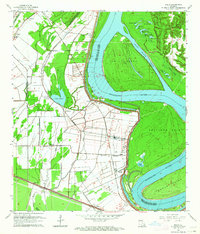
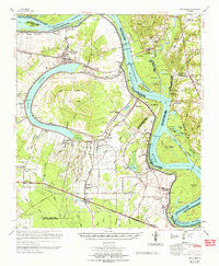
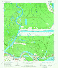
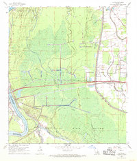
 1961 Baton Rouge1966 Print · USGSSoutheastern Louisiana in the early sixties remains a landscape of deep river bends and sprawling coastal lakes. Genealogists and historians can trace the rail-and-river economy through landmarks like Free-Nigger Point, Donaldsonville, and the Illinois Central Railroad.
 - 1962 Map of Baton Rouge
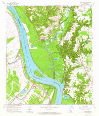
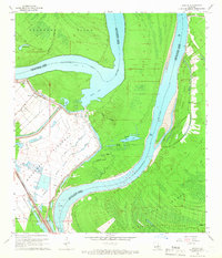
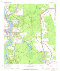
 1962 Baton Rouge1962 Print · USGSSouth Louisiana in the early sixties reveals a landscape of river-bend parishes and emerging interstate corridors. Genealogists and historians can trace family roots through historic river towns like Donaldsonville and Plaquemine, or follow the path of the Illinois Central Railroad through the swamp basins.
 - 1962 Map of Moreauville, 1963 Print
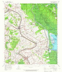
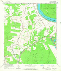
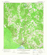
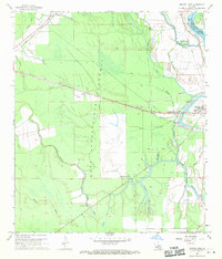
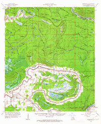 1962 Moreauville1963 Print · USGSAvoyelles Parish in the early sixties reveals a landscape of river meanders and bayou settlements shaped by the Atchafalaya. Researchers can trace rural life through landmarks like St Mark Ch, the Kansas City Southern line, and Bordelonville.2 unique versions available
 - 1962 Map of Erwinville, 1964 Print
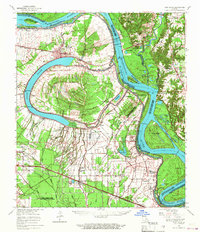
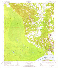
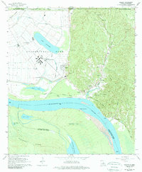
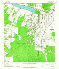 1962 Erwinville1964 Print · USGSThe West Baton Rouge and Pointe Coupee parish line comes alive in the early 1960s, showing a landscape defined by the False River and railroad-driven commerce. Genealogists can trace family footprints through sites like St Peters Ch, St Ambrose Cem, and the old post office at Erwinville P O.2 unique versions available
 - 1962 Map of New Roads, 1964 Print
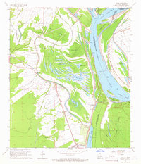
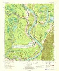
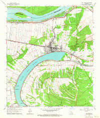 1962 New Roads1964 Print · USGSPointe Coupee Parish in the early sixties is shown here as a landscape shaped by the oxbow of the False River. Genealogists and historians can trace long-lot land patterns near New Roads and locate family landmarks like Parlange and St Catherine Chapel.4 unique versions available
 - 1962 Map of Grosse Tete, 1965 Print
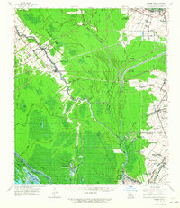 1962 Grosse Tete1965 Print · USGSThe river parishes of Louisiana come into focus during the early sixties, showing a landscape defined by industrial oil fields and historic riverfront estates. Genealogists can trace family footprints through sites like Indian Village, Levy Sch, and Grace Memorial Park Cem.2 unique versions available
 - 1963 Map of Walls, 1964 Print
 1963 Walls1964 Print · USGSWest Baton Rouge Parish in the early 1960s shows a landscape defined by the Mississippi River and its massive levee. Genealogists and local historians can trace family roots through settlements like Smithfield, Chamberlin, and Bueche, as well as numerous rural churches including Zion Traveler Ch.5 unique versions available
 - 1963 Map of Port Hudson, 1964 Print
 1963 Port Hudson1964 Print · USGSThe Mississippi River bends through the Louisiana parishes during the early sixties, revealing a landscape of historic river crossings and rail lines. Genealogists can locate family landmarks like Port Hudson National Cemetery, Hermitage, and Mt Pilgrim Ch Cem.5 unique versions available
 - 1963 Map of Arnaudville, 1966 Print
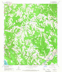
 1963 Arnaudville1966 Print · USGSThe Acadiana region comes alive in this mid-century survey of the Bayou Teche country and the Atchafalaya Basin. Local historians can trace family-named sites like La Bourgeois Plantation and Nina Station, alongside old gathering places such as Ring Zion Ch. & Cem.2 unique versions available
 - 1963 Map of New Roads, 1967 Print
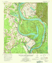
 1963 New Roads1967 Print · USGSThe oxbows and river bends of Pointe Coupee and West Baton Rouge Parishes come to life in this mid-sixties survey. Researchers can trace family roots through numerous sites like Torbert P O, St Alma Sch, and the Port Hudson National Cem.2 unique versions available
 - 1965 Map of New Roads
 1965 New Roads1965 Print · USGSThe oxbow of False River and the Mississippi's ever-changing course dominate this mid-century survey of Pointe Coupee Parish. Genealogists and historians can trace the family names and rural hamlets of the plantation era, including New Roads, Port Hudson National Cem, and the St Ambrose Cem.
 - 1965 Map of Elm Park, 1966 Print
 1965 Elm Park1966 Print · USGSWest Feliciana Parish in the mid-sixties reveals a landscape of enduring plantations and rural communities. Genealogists and historians can locate Locust Grove Cem, trace the Illinois Central line, and find the Rosenwald Sch.3 unique versions available
 - 1965 Map of Batchelor, 1966 Print
 1965 Batchelor1966 Print · USGSPointe Coupee Parish in the mid-sixties reveals a landscape shaped by the Raccourci Old River and the massive Morganza Floodway. Genealogists and local historians can trace family locations near Batchelor, Little Zion Ch, and the Texas and Pacific rail line.2 unique versions available
 - 1965 Map of Innis, 1966 Print
 1965 Innis1966 Print · USGSThe Louisiana-Mississippi borderlands in the mid-sixties reveal a landscape carved by the Mississippi River. Genealogists and historians can trace old river landings and rural landmarks like Williamsport, St Marys Cem, and Innis.2 unique versions available
 - 1965 Map of Turnbull Island, 1966 Print
 1965 Turnbull Island1966 Print · USGSTurnbull Island is captured in the mid-1960s at the junction of the Red and Mississippi Rivers. Researchers can trace the remnants of an Old Railroad Grade and locate family landmarks like Oak Grove Ch and Turnbull Cem.3 unique versions available
 - 1965 Map of Lacour, 1966 Print
 1965 Lacour1966 Print · USGSMid-century life in Pointe Coupee Parish is shaped by the great river and the massive levees of the Morganza Floodway. Genealogists and historians can trace the foundations of Lacour and find local landmarks like Jerusalem Ch and the Texas and Pacific Railway.4 unique versions available
 - 1965 Map of St. Francisville, 1966 Print
 1965 St. Francisville1966 Print · USGSWest Feliciana Parish and the Mississippi River bluffs are captured here in the mid-sixties, showing a landscape of deep ravines and historic river landings. Genealogists can locate family-named sites like Greenwood Cem, Barrow Cem, and the small settlement of Plettenberg PO.2 unique versions available
 - 1965 Map of St. Francisville, 1966 Print
 1965 St. Francisville1966 Print · USGSSt. Francisville and the West Feliciana riverfront are captured here in the mid-sixties, showing the town at a high point above the Mississippi. Researchers can trace family sites at Catalpa Plantation, Barrow Cem, and the old Dawson Sch.3 unique versions available
 - 1965 Map of Angola, 1989 Print
 1965 Angola1989 Print · USGSWest Feliciana Parish in the mid-sixties is defined by the massive bend of the Mississippi River and the riverside facility at Angola. Researchers can trace the layout of the Louisiana State Penitentiary and locate landmarks like Point Lookout Cem and St Augustine Ch.2 unique versions available
 - 1967 Map of Artonish, 1968 Print
 1967 Artonish1968 Print · USGSThe river country of the Mississippi-Louisiana border is captured here during a period of massive hydraulic engineering. Genealogists and researchers can locate historic sites like Fort Adams, the Lake Mary Oil Field, and family burial grounds such as Good Hope Cem and Ward Cem.
 - 1967 Map of Batchelor, 1969 Print
 1967 Batchelor1969 Print · USGSPointe Coupee Parish and West Feliciana Parish meet at this complex Mississippi River junction in the late sixties. Genealogists and historians can trace the foundations of Angola, explore family sites like St Marks Ch Cem, or study the massive Morganza Control Structure.
 - 1968 Map of Krotz Springs, 1969 Print
 1968 Krotz Springs1969 Print · USGSSt. Landry Parish was a landscape of intensive water management and energy extraction in the late sixties. Trace the industrial footprint of the Krotz Springs Oil and Gas Field or locate burials at Midway Cem near the riverbanks.3 unique versions available
 - 1968 Map of Lottie, 1969 Print
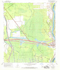
 1968 Lottie1969 Print · USGSPointe Coupee Parish is shown here in the late sixties as the industrial landscape of the Atchafalaya Basin matured. Local historians can trace the energy and rail network through the Lottie Oil and Gas Field and the Missouri Pacific line near Lottie.2 unique versions available
 - 1968 Map of Melville, 1970 Print
 1968 Melville1970 Print · USGSThe Atchafalaya basin in the late sixties reveals a landscape of levee-protected river towns and expanding energy infrastructure. Genealogists and historians can locate Melville, find rural churches like Zion Traveler Ch, and trace the Ravenswood Oil Field.2 unique versions available
 - 1968 Map of Swayze Lake, 1970 Print
 1968 Swayze Lake1970 Print · USGSSt. Landry Parish in the late 1960s is defined by the massive flood control infrastructure of the West Atchafalaya Floodway. Genealogists and local historians can trace the Texas and Pacific rail line through Sambo or locate the United Pentecostal Ch and nearby Cem.2 unique versions available
Showing maps 1-25 of 31
Top cities of Pointe Coupee Parish
Frequently asked questions
- What are the different types of historical maps available for Pointe Coupee Parish?
- What is the oldest map of Pointe Coupee Parish?
- Where can I purchase historical maps of Pointe Coupee Parish for my home or office?
- Where can I download high-res historical maps of Pointe Coupee Parish?
- Are there historical topographic maps available for Pointe Coupee Parish?
- Is there historical aerial imagery available for Pointe Coupee Parish?
- Where are historical maps of Pointe Coupee Parish sourced from?