Old Maps of Pointe Coupee Parish, Louisiana for Academic Research
Study the evolution of Pointe Coupee Parish with 204 high-resolution historic maps. Whether you're teaching, researching, or modeling changes in land use, these maps provide essential visual documentation of urban, environmental, and geographic change.
- Analyze long-term change: Track patterns in development, transportation, and natural features.
- Ideal for environmental or urban studies: Support academic projects with primary historical map data.
- Use in the classroom or lab: Educators and researchers rely on these maps to bring historical context to life.
These maps are a powerful tool for teaching, research, and visualizing how Pointe Coupee Parish has changed over the decades.
Pointe Coupee Parish, LA maps
(204)- 1906 Map of Bayou Sara
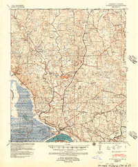
 1906 Bayou Sara1906 Print · USGSThe Feliciana parishes and the Mississippi River bottomlands come to life in this early twentieth-century survey. Genealogists can trace family footprints through river-town settlements like St Francisville or find early rail stops such as Gayden Sta (Gurley P.O.) and Slaughter.3 unique versions available
 - 1935 Map of Osca Bayou, 1938 Print
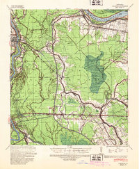
 1935 Osca Bayou1938 Print · USGSThe Atchafalaya Basin in the mid-1930s is a complex web of wetlands and early river engineering projects. Researchers can trace historic family locations and transit routes near Maringouin, Butte La Rose, and the St Joseph Ch & Cem.
 - 1939 Map of St. Francisville
 1939 St. Francisville1939 Print · USGSWest Feliciana Parish and the Mississippi River borderlands are captured here in the late 1930s. Genealogists and historians can trace the foundations of the plantation economy through landmarks like Magnolia Plantation and schools like Afton Villa Ch & Sch.3 unique versions available
 - 1939 Map of Artonish, 1945 Print
 1939 Artonish1945 Print · USGSThe river-and-rail economy of the Louisiana-Mississippi border is frozen in time just before the mid-century, showing the dense settlement of the bottomlands. Genealogists can trace family roots through numerous local landmarks like Fort Adams, Singleton Chapel & Cem, and the Black Hawk Plantation.
 - 1939 Map of Fordoche, 1948 Print
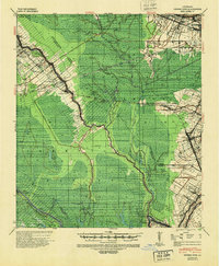
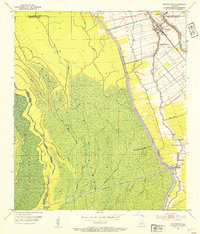
 1939 Fordoche1948 Print · USGSThe rail-and-river corridor of Pointe Coupee Parish comes alive in this late 1930s survey, showing the land just as new flood controls were being established. Researchers can trace family history through rural community anchors like Sunlight Ch & Cem, Lottie, and Elliot City.2 unique versions available
 - 1940 Map of Grosse Tete, 1950 Print
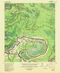
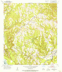
 1940 Grosse Tete1950 Print · USGSThe Louisiana river parishes are shown just before the mid-century, defined by a complex network of bayous and sprawling plantation estates. Genealogists and historians can trace family-named sites like Shady Grove Plantation, United Reformers Ch & Sch, and the Texas and Pacific RR corridor.
 - 1940 Map of Arnaudville, 1964 Print
 1940 Arnaudville1964 Print · USGSThe Cajun heartland of the 1940s is detailed here as it manages its complex relationship with the Atchafalaya. Genealogists can trace family names through landmarks like Le Bourgeois Plantation, Magenta Plantation, and the St Elizabeth Ch & Sch.
 - 1941 Map of Voorhies, 1943 Print
 1941 Voorhies1943 Print · USGSAvoyelles Parish is captured here in the early 1940s, showcasing a river-bound landscape shaped by the Red River and its many oxbows. Genealogists can trace family roots through numerous landmarks like St James Ch & Cem, Voorhies School, and Moreauville.2 unique versions available
 - 1941 Map of Batchelor, 1944 Print
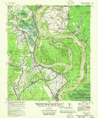
 1941 Batchelor1944 Print · USGSThe Mississippi River's powerful shifts define this corner of Louisiana in the early 1940s, from the oxbows of the Raccourci Old River to the banks of Angola. Local researchers can locate family landmarks such as Mains Plantation, St Stevens Ch, and the Lower Latanache Sch.
 - 1953 Map of Maringouin, 1954 Print
 1953 Maringouin1954 Print · USGSMaringouin and the Atchafalaya basin edge appear here in the early fifties, showing a landscape defined by the East Protection Levee. Genealogists can locate community anchors like St Peter Cem, Little Zion Ch, and the Upper Maringouin Sch.2 unique versions available
 - 1953 Map of New Roads, 1954 Print
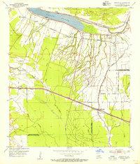
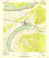 1953 New Roads1954 Print · USGSPointe Coupee Parish in the early fifties shows a landscape shaped by the massive curves of the False River and the active Mississippi River. Genealogists and local historians can trace family locations near NEW ROADS, St Catherine Chapel, and schools like Rosenwald Sch.
 - 1953 Map of Natchez, 1966 Print
 1953 Natchez1966 Print · USGSSouthwest Mississippi and the Louisiana border country come alive in this mid-century survey of the river valley and forest lands. Researchers can trace the rail lines of the Illinois Central RR and locate rural hubs like Gloster and Ferriday.3 unique versions available
 - 1954 Map of Port Hudson, 1955 Print
 1954 Port Hudson1955 Print · USGSMid-century life along the Mississippi is captured here at the intersection of five Louisiana parishes. Genealogists and local researchers can trace family landmarks like Hermitage P.O., Beech Grove Ch No 2 Cem, and the historic Port Hudson riverfront.
 - 1954 Map of Walls, 1955 Print
 1954 Walls1955 Print · USGSThe Mississippi River's shifting course in the mid-1950s defines this West Baton Rouge landscape of landings and plantations. Researchers can locate family roots at Walls, trace the Texas and Pacific rail line, or find the Indian Mounds near Bueche.
 - 1954 Map of Elm Park, 1955 Print
 1954 Elm Park1955 Print · USGSWest Feliciana Parish in the mid-fifties remains a landscape of deep creek valleys and historic estates like Troy Plantation and Cottage Plantation. Genealogists and local historians can trace family locations through Starhill Cem and rural nodes like Beechwood or the Rosendwald Sch.
 - 1954 Map of Fordoche, 1955 Print
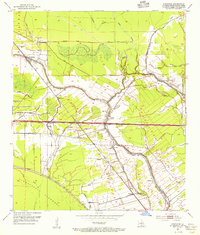 1954 Fordoche1955 Print · USGSMid-century Pointe Coupee Parish reveals a landscape defined by the intersection of the Missouri Pacific railroad and winding bayous. Genealogists and historians can locate family landmarks like Bailey Cem, Sunlight Ch, and the petroleum operations at Lottie Oil Field.2 unique versions available
 - 1954 Map of Erwinville, 1955 Print
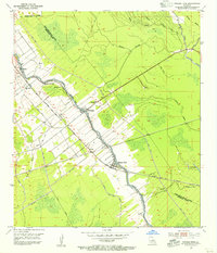
 1954 Erwinville1955 Print · USGSLouisiana bayou country in the mid-1950s is mapped here in detail along the False River oxbow and the parish boundary. Genealogists and historians can trace local landmarks like St Peters Church Cemetery, Torbert Post Office, and the Missouri Pacific rail line.
 - 1954 Map of Grosse Tete, 1955 Print
 1954 Grosse Tete1955 Print · USGSThe Bayou Grosse Tete corridor in the 1950s shows a landscape of narrow levee settlements and active rail transport. Genealogists and historians can trace family locations near Rosedale, Slacks, and Grosse Tete, or locate landmarks like St Joseph Cem and Rose Hill Ch.4 unique versions available
 - 1954 Map of Artonish, 1966 Print
 1954 Artonish1966 Print · USGSThe riverfronts of Concordia Parish and Wilkinson County are captured here in the mid-fifties, during a period of significant hydraulic engineering and transition. Genealogists and historians can trace family-named sites like Shaw Plantation, Singleton Cem, and the old military outpost at Fort Adams.
 - 1954 Map of Baton Rouge, 1974 Print
 1954 Baton Rouge1974 Print · USGSSoutheast Louisiana in the mid-fifties is captured here during a period of transition for its river and rail economies. Researchers can trace the path of the Mississippi River and find landmarks like the Bonnet Carre Spillway and Bayou Plaquemine.2 unique versions available
 - 1955 Map of Artonish
 1955 Artonish1955 Print · USGSWilkinson County and Concordia Parish in the mid-fifties are defined here by the massive plantations and river landings along the winding Mississippi River. Genealogists can trace local roots through numerous sites like Royal Oak Ch & Cem, Fort Adams, and the Torras Community Sch.
 - 1955 Map of Osca Bayou
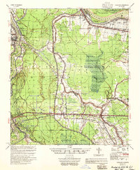
 1955 Osca Bayou1955 Print · USGSThe Atchafalaya Basin in the mid-fifties is captured here as a landscape of deep bayous and growing oil production. Genealogists and historians can trace rail-side life in Maringouin or find remote river landmarks like Butte La Rose and the Happytown Oil Field.
 - 1955 Map of Fordoche
 1955 Fordoche1955 Print · USGSMid-century Pointe Coupee Parish reveals a landscape of massive flood control projects and active bayou life during the 1950s. Genealogists and researchers can locate family landmarks like Argyle Plantation or the Zion Traveler Ch & Cem and trace the early development of the Fordoche Oil Field.
 - 1955 Map of Batchelor
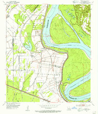
 1955 Batchelor1955 Print · USGSLouisiana's river country is captured here in the mid-fifties, showing the massive impact of cutoffs and flood control projects on local parishes. Researchers can trace the sprawling Penitentiary Farm at Angola or locate family roots at St Marys Ch & Cem and Lacour Plantation.
 - 1955 Map of Odenburg
 1955 Odenburg1955 Print · USGSLouisiana's river country comes alive in the mid-1950s as it transitions from a landing-based economy to modern rail and flood control. Researchers can trace family sites at Jacoby Chapel & Cem or locate historic river landings like Hicks Ldg and Speer Ldg.
Showing maps 1-25 of 204
Top cities of Pointe Coupee Parish
Frequently asked questions
- What are the different types of historical maps available for Pointe Coupee Parish?
- What is the oldest map of Pointe Coupee Parish?
- Where can I purchase historical maps of Pointe Coupee Parish for my home or office?
- Where can I download high-res historical maps of Pointe Coupee Parish?
- Are there historical topographic maps available for Pointe Coupee Parish?
- Is there historical aerial imagery available for Pointe Coupee Parish?
- Where are historical maps of Pointe Coupee Parish sourced from?