1960s Maps of St. Charles Parish, Louisiana
Explore 24 historic maps of St. Charles Parish from the 1960s. These maps offer a rare glimpse into what life looked like during the 1960s — showing old roads, neighborhoods, homes, and landmarks that have changed or disappeared over time.
Whether you're researching your family's past, planning a metal detecting trip, or studying how St. Charles Parish's landscape evolved across the 1960s, these high-resolution maps are a powerful tool for exploring the history of this region.
- Focus on a specific era: All maps on this page are from the 1960s, giving you a focused view of this time period.
- See what’s changed: Compare century-old streets, trails, and buildings to today's modern landscape using overlays and satellite layers.
- Research with precision: Use these maps for genealogy, historical research, land use analysis, or educational projects.
- View, download, or print: Maps are fully viewable online in high resolution, and can be downloaded or printed for your own records.
Start exploring St. Charles Parish's history through authentic maps from the 1960s. This is your window into the past.
St. Charles Parish, LA maps
(24)- 1961 Map of Baton Rouge, 1966 Print
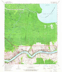
 1961 Baton Rouge1966 Print · USGSSoutheastern Louisiana in the early sixties remains a landscape of deep river bends and sprawling coastal lakes. Genealogists and historians can trace the rail-and-river economy through landmarks like Free-Nigger Point, Donaldsonville, and the Illinois Central Railroad.
 - 1962 Map of Baton Rouge
 1962 Baton Rouge1962 Print · USGSSouth Louisiana in the early sixties reveals a landscape of river-bend parishes and emerging interstate corridors. Genealogists and historians can trace family roots through historic river towns like Donaldsonville and Plaquemine, or follow the path of the Illinois Central Railroad through the swamp basins.
 - 1962 Map of Bayou Boeuf, 1963 Print
 1962 Bayou Boeuf1963 Print · USGSThe wetlands of Lafourche Parish are captured here in the early sixties, showing a landscape defined by bayous and new industrial expansion. Researchers can trace the community around Bayou Boeuf, including St Lawrence Ch and a new Southern Pacific rail line.3 unique versions available
 - 1962 Map of Lac Des Allemands, 1963 Print
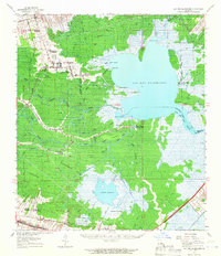
 1962 Lac Des Allemands1963 Print · USGSThe Louisiana wetlands where three parishes meet come alive in this early 1960s survey of Lac Des Allemands. Genealogists and industrial historians can trace the development of the Lac Des Allemands Gas Field and remote waterways like Bayou Chevreuil and Baie des Deux Chenes.3 unique versions available
 - 1962 Map of Reserve, 1963 Print
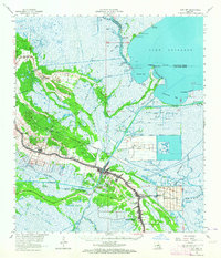
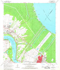
 1962 Reserve1963 Print · USGSThe Louisiana river parishes are caught in a moment of industrial transition in the early 1960s, framed by the winding Mississippi River. Genealogists and historians can trace the legacy of the sugar coast through local landmarks like San Francisco Plantation and the Wallace (PO).5 unique versions available
 - 1962 Map of Barataria, 1966 Print
 1962 Barataria1966 Print · USGSCoastal Jefferson Parish in the early 1960s reveals a unique intersection of delta settlements and a booming petroleum industry. Genealogists and historians can trace local families through recorded sites like Fleming Cem and Lafitte Cem or the industrial footprint of the Lafitte Oil Field.2 unique versions available
 - 1962 Map of Mount Airy, 1966 Print
 1962 Mount Airy1966 Print · USGSThe riverfront culture of St. John the Baptist and St. James Parishes is captured here in the early 1960s as industrial growth meets historic riverside estates. Genealogists and historians can trace family sites from Gramercy to Reserve, including landmarks like San Francisco Plantation and St Joseph Cath Ch.2 unique versions available
 - 1962 Map of Lac Des Allemands, 1966 Print
 1962 Lac Des Allemands1966 Print · USGSCoastal Louisiana in the early sixties remains a world of sprawling plantations and deep cypress wetlands. Genealogists can trace family names at Southdown or Webster, and locate community landmarks like St Lawrence Ch and Choctaw Sch.2 unique versions available
 - 1963 Map of New Orleans
 1963 New Orleans1963 Print · USGSCoastal Louisiana in the mid-twentieth century reveals a complex world of bayou settlements, expanding oil fields, and vital rail networks. Genealogists and historians can trace family roots through river towns like Thibodaux or follow the Southern Pacific line through Franklin and Patterson.4 unique versions available
 - 1963 Map of Cut Off, 1964 Print
 1963 Cut Off1964 Print · USGSCoastal Lafourche Parish is captured here in the early sixties as a thriving corridor of bayou-side settlements and industrial growth. Genealogists and historians can trace family locations near Gheens, locate the Griffin Cem, or study the footprints of Delta Farms.3 unique versions available
 - 1963 Map of Catahoula Bay, 1964 Print
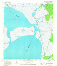
 1963 Catahoula Bay1964 Print · USGSThe Louisiana wetlands of Lafourche and St. Charles Parishes are captured here in the early 1960s. Researchers can trace the development of the Intracoastal Waterway and locate local landmarks like The Temple Shell Bank and Camardelle.3 unique versions available
 - 1965 Map of New Orleans West, 1966 Print
 1965 New Orleans West1966 Print · USGSThe Jefferson Parish suburbs and Mississippi West Bank are shown here during a period of intense mid-century growth. Genealogists and historians can trace the development of Bonnabel Place, identify family plots in Providence Memorial Park, and locate the old Westwego Airport.5 unique versions available
 - 1966 Map of New Orleans
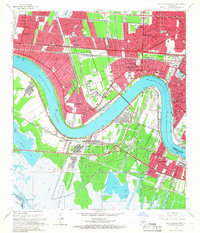
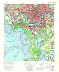
 1966 New Orleans1966 Print · USGSCoastal Louisiana in the mid-1960s reveals a transition from traditional bayou life to an intensive offshore oil and gas economy. Researchers can trace the rail lines of the Southern Pacific RR through Morgan City or locate the Eugene Island Lighthouse among the delta's shifting marshes.
 - 1966 Map of Lake Cataouatche East, 1967 Print
 1966 Lake Cataouatche East1967 Print · USGSThe Louisiana wetlands south of New Orleans appear in transition during the mid-sixties as industrial oil fields expanded through the marsh. Trace the dredging of the Millaudon Canal and Estelle Canal or locate old sites like Woods Place.5 unique versions available
 - 1967 Map of Luling, 1968 Print
 1967 Luling1968 Print · USGSLife along the Mississippi River in the late sixties is defined by busy industrial corridors and deep-rooted riverbank communities. Genealogists and researchers can trace local landmarks like St. Charles Cem, Destrehan High Sch, and the historical site of the Davis Crevasse.4 unique versions available
 - 1967 Map of La Branche, 1968 Print
 1967 La Branche1968 Print · USGSThe Louisiana shoreline meets suburban expansion in the late sixties as the area around Kenner begins to modernize. Genealogists and historians can trace the early layout of Moisant Field and the industrial activity near Good Hope.3 unique versions available
 - 1967 Map of Laplace, 1968 Print
 1967 Laplace1968 Print · USGSThe river parishes in the late sixties show a landscape defined by industrial energy and massive flood control projects. Researchers can trace the path of the Bonnet Carre Floodway and locate local landmarks like the Montz Cem and Bethune High Sch.4 unique versions available
 - 1967 Map of Lake Cataouatche West, 1968 Print
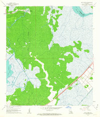
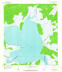
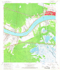
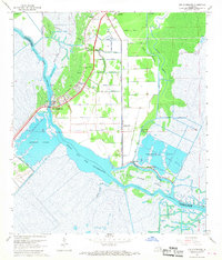
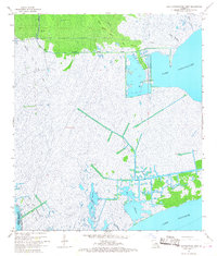 1967 Lake Cataouatche West1968 Print · USGSCoastal St. Charles Parish is captured here in the late sixties as a busy landscape of marshland industry and natural bayous. Trace the development of the Boutte Oil and Gas Field and navigation routes like Bayou Couba and the Bois Piquant Canal.5 unique versions available
 - 1967 Map of Hahnville, 1968 Print
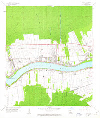
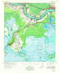
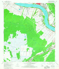 1967 Hahnville1968 Print · USGSSt. Charles Parish in the late sixties shows a riverfront defined by industry and historic settlements tucked against the wetlands. Genealogists and researchers can locate Holy Rosary Ch, St Marys Cem, and rail-side towns like Paradis and Boutte.5 unique versions available
 - 1967 Map of Bonnett Carre NE, 1968 Print
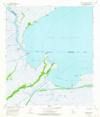
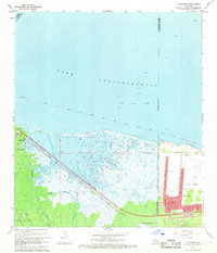
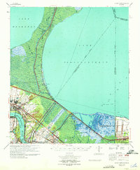
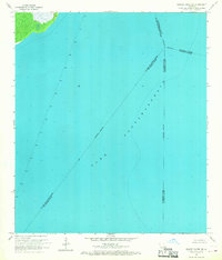 1967 Bonnett Carre NE1968 Print · USGSCoastal Louisiana in the late sixties comes into focus in this nautical survey of the open waters. Maritime researchers can trace the precise location of several lights and the convergence of parish boundaries across the expanse of Lake Pontchartrain.
 - 1967 Map of Des Allemands, 1968 Print
 1967 Des Allemands1968 Print · USGSThe Louisiana bayou country is captured here in the late sixties, showcasing the intersection of parish life and the energy industry. Trace local heritage at Antioch Ch, Shell Mound Cem, and the rail-side settlement of Des Allemands.4 unique versions available
 - 1967 Map of New Orleans, 1969 Print
 1967 New Orleans1969 Print · USGSGreater New Orleans in the mid-1960s reveals a landscape of massive engineering and urban expansion along the Mississippi River. Genealogists and local historians can trace family roots through the grids of Metairie, Gretna, and Harvey, or locate specific sites like Metairie High Sch and St Vincent de Paul Cem.
 - 1969 Map of Bonnet Carre, 1971 Print
 1969 Bonnet Carre1971 Print · USGSThe Louisiana river parishes are shown in a transitional era of flood control and petroleum expansion during the late sixties. Genealogists and historians can trace riverside settlements like Montz and Lucy, or follow the industrial corridor near the Bonnet Carre Spillway.
 - 1969 Map of Hahnville, 1971 Print
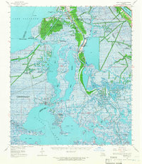
 1969 Hahnville1971 Print · USGSSt. Charles Parish in the late sixties shows the industrial evolution of the river corridor from Hahnville to Kenner. Genealogists and researchers can trace family landmarks like St Charles Cem, Antioch Ch, and the many oil fields throughout the Salvador Game Management Area.
End of results
Showing maps 1-24 of 24
Frequently asked questions
- What are the different types of historical maps available for St. Charles Parish?
- What is the oldest map of St. Charles Parish?
- Where can I purchase historical maps of St. Charles Parish for my home or office?
- Where can I download high-res historical maps of St. Charles Parish?
- Are there historical topographic maps available for St. Charles Parish?
- Is there historical aerial imagery available for St. Charles Parish?
- Where are historical maps of St. Charles Parish sourced from?