Old Maps of Mandeville, Louisiana for Academic Research
Study the evolution of Mandeville with 31 high-resolution historic maps. Whether you're teaching, researching, or modeling changes in land use, these maps provide essential visual documentation of urban, environmental, and geographic change.
- Analyze long-term change: Track patterns in development, transportation, and natural features.
- Ideal for environmental or urban studies: Support academic projects with primary historical map data.
- Use in the classroom or lab: Educators and researchers rely on these maps to bring historical context to life.
These maps are a powerful tool for teaching, research, and visualizing how Mandeville has changed over the decades.
Mandeville, LA maps
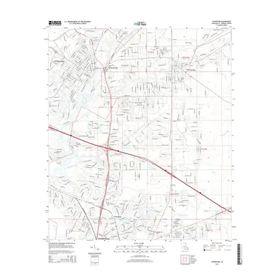
(31)- 1935 Map of Covington
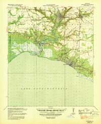
 1935 Covington1935 Print · USGSSt. Tammany Parish thrived as a river and rail hub during the mid-1930s, anchored by the bustling towns along Lake Pontchartrain. Researchers can trace the path of the Illinois Central RR and locate local landmarks like the Rosenwald Sch or the Chefuncte LH.3 unique versions available
 - 1939 Map of Covington
 1939 Covington1939 Print · USGSSt. Tammany Parish thrived as a river and rail corridor before mid-century, where the Bogue Falaya met the northern shore of Lake Pontchartrain. Genealogists and historians can trace family roots through the Rosenwald Sch, Little Zion Ch & Cem, and the old rail routes of the Illinois Central.
 - 1950 Map of Covington, 1965 Print
 1950 Covington1965 Print · USGSSt. Tammany Parish at mid-century reveals a landscape of river-port towns and growing lakeshore communities before the full expansion of the New Orleans suburbs. Genealogists can trace family sites near White Chapel, St James Ch, and the Rosenwald Sch or follow the historic Illinois Central rail line.
 - 1954 Map of Baton Rouge, 1974 Print
 1954 Baton Rouge1974 Print · USGSSoutheast Louisiana in the mid-fifties is captured here during a period of transition for its river and rail economies. Researchers can trace the path of the Mississippi River and find landmarks like the Bonnet Carre Spillway and Bayou Plaquemine.2 unique versions available
 - 1956 Map of Baton Rouge
 1956 Baton Rouge1956 Print · USGSSouth Louisiana at the height of the mid-century oil boom shows a landscape of river oxbows and rising industry. Researchers can trace family roots through river towns like Scotlandville or locate early industrial sites and Oil wells near Lake Maurepas.
 - 1961 Map of Baton Rouge, 1966 Print
 1961 Baton Rouge1966 Print · USGSSoutheastern Louisiana in the early sixties remains a landscape of deep river bends and sprawling coastal lakes. Genealogists and historians can trace the rail-and-river economy through landmarks like Free-Nigger Point, Donaldsonville, and the Illinois Central Railroad.
 - 1962 Map of Baton Rouge
 1962 Baton Rouge1962 Print · USGSSouth Louisiana in the early sixties reveals a landscape of river-bend parishes and emerging interstate corridors. Genealogists and historians can trace family roots through historic river towns like Donaldsonville and Plaquemine, or follow the path of the Illinois Central Railroad through the swamp basins.
 - 1968 Map of Covington, 1969 Print
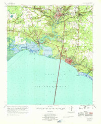
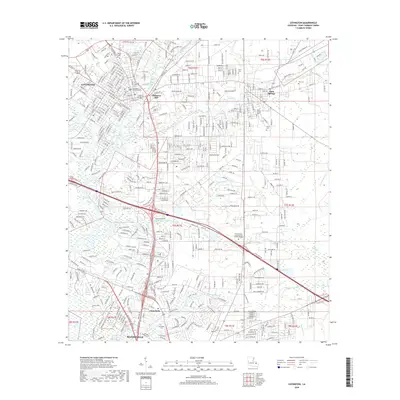
 1968 Covington1969 Print · USGSNorth of Lake Pontchartrain in the late sixties, the landscape around COVINGTON and Mandeville shows a mix of riverfront settlement and woodland institutions. Genealogists can trace family landmarks like Wilson Cem, Chinchuba Cem, and the Rosenwald Sch at the height of the railroad era.4 unique versions available
 - 1968 Map of Madisonville, 1969 Print
 1968 Madisonville1969 Print · USGSThe Tchefuncta River basin in the late sixties shows a transition from traditional river life to modern parish growth. Genealogists and local researchers can locate numerous historical burial sites and landmarks like Rosenwald Sch Cem, Penns Chapel, and Goodbee.4 unique versions available
 - 1968 Map of Mandeville, 1969 Print
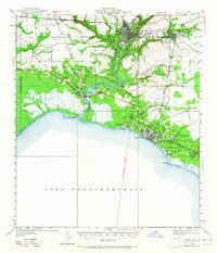
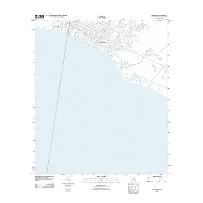
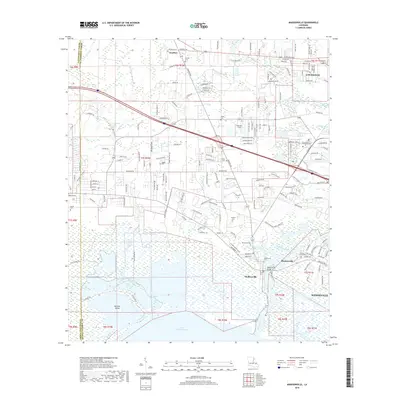
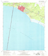 1968 Mandeville1969 Print · USGSMandeville and the northern shore of Lake Pontchartrain appear here in the late sixties as the area grew around its traditional bayou boundaries. Researchers can trace the layout of local schools like Rosenwald Sch or locate the historic Southeast Louisiana Hospital and Lewisburg waterfront.5 unique versions available
 - 1969 Map of Covington, 1971 Print
 1969 Covington1971 Print · USGSSt. Tammany Parish's north shore of Lake Pontchartrain is shown in detail during the late sixties. Trace the development of Covington and Mandeville, or locate family sites like Daussin Cem and White Chapel.
 - 1983 Map of Ponchatoula, 1984 Print
 1983 Ponchatoula1984 Print · USGSThe Lake Pontchartrain Basin and the River Parishes come into focus during the early 1980s, showcasing the region's complex water-dependent geography. Researchers can trace the rail routes of the Illinois Central Gulf Railroad and explore landmarks from Pass Manchac to Donaldsonville.2 unique versions available
 - 1998 Map of Madisonville, 2001 Print
 1998 Madisonville2001 Print · USGSThe lower Tchefuncta River and the shores of Lake Pontchartrain define this late-century landscape. Genealogists and historians can trace family roots at Helping Hands Cem, find the site of the Rosenwald Sch, or follow the Old Railroad Grade.
 - 1998 Map of Mandeville, 2001 Print
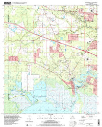
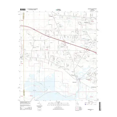
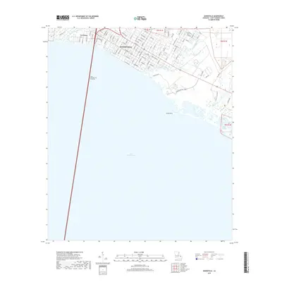
 1998 Mandeville2001 Print · USGSMandeville and the St. Tammany Parish shoreline are captured here at the close of the twentieth century. Genealogists and local historians can trace residential growth around Our Lady of the Lake Sch, the grounds of the Southeast Louisiana State Hospital, and the early path of the Lake Pontchartrain Causeway.
 - 1998 Map of Covington, 2002 Print
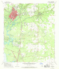
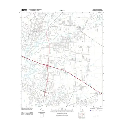
 1998 Covington2002 Print · USGSSt. Tammany Parish at the end of the century shows the growing footprints of Covington and Mandeville alongside deep-rooted rural landmarks. Trace family history at Lyons Sch Wilson Cem or locate community centers like Rose Hill Ch and St Pauls College.
 - 1999 Map of Mandeville, 2000 Print
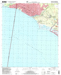
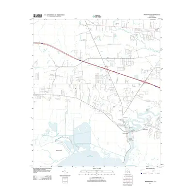
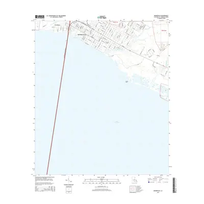
 1999 Mandeville2000 Print · USGSThe north shore of Lake Pontchartrain comes into focus at the turn of the millennium, showing a established coastal community and its surrounding marshlands. Genealogists can locate family landmarks like the Rosenwald Sch, Lewisburg, and the Southeast Louisiana State Hospital.
 - 2012 Map of Covington, 2012 Print
 2012 Covington2012 Print · USGSCovers Mandeville, including Covington, Abita Springs, and other nearby areas
 - 2012 Map of Madisonville, 2012 Print
 2012 Madisonville2012 Print · USGSCovers Mandeville, including Covington, Madisonville, and other nearby areas
 - 2012 Map of Mandeville, 2012 Print
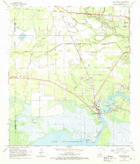
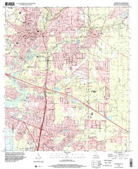
 2012 Mandeville2012 Print · USGSCovers Mandeville, including Lewisburg, St. Tammany Parish, and other nearby areas
 - 2015 Map of Madisonville, 2015 Print
 2015 Madisonville2015 Print · USGSCovers Mandeville, including Covington, Madisonville, and other nearby areas
 - 2015 Map of Covington, 2015 Print
 2015 Covington2015 Print · USGSCovers Mandeville, including Covington, Abita Springs, and other nearby areas
 - 2015 Map of Mandeville, 2015 Print
 2015 Mandeville2015 Print · USGSCovers Mandeville, including Lewisburg, St. Tammany Parish, and other nearby areas
 - 2018 Map of Madisonville, 2018 Print
 2018 Madisonville2018 Print · USGSCovers Mandeville, including Covington, Madisonville, and other nearby areas
 - 2018 Map of Covington, 2018 Print
 2018 Covington2018 Print · USGSCovers Mandeville, including Covington, Abita Springs, and other nearby areas
 - 2018 Map of Mandeville, 2018 Print
 2018 Mandeville2018 Print · USGSCovers Mandeville, including Lewisburg, St. Tammany Parish, and other nearby areas
Showing maps 1-25 of 31
Top cities near Mandeville
- New Orleans historical maps
- Covington historical maps
- Abita Springs historical maps
- Madisonville historical maps
Top neighborhoods of Mandeville
Frequently asked questions
- What are the different types of historical maps available for Mandeville?
- What is the oldest map of Mandeville?
- Where can I purchase historical maps of Mandeville for my home or office?
- Where can I download high-res historical maps of Mandeville?
- Are there historical topographic maps available for Mandeville?
- Is there historical aerial imagery available for Mandeville?
- Where are historical maps of Mandeville sourced from?