1960s Maps of Terrebonne Parish, Louisiana
Explore 33 historic maps of Terrebonne Parish from the 1960s. These maps offer a rare glimpse into what life looked like during the 1960s — showing old roads, neighborhoods, homes, and landmarks that have changed or disappeared over time.
Whether you're researching your family's past, planning a metal detecting trip, or studying how Terrebonne Parish's landscape evolved across the 1960s, these high-resolution maps are a powerful tool for exploring the history of this region.
- Focus on a specific era: All maps on this page are from the 1960s, giving you a focused view of this time period.
- See what’s changed: Compare century-old streets, trails, and buildings to today's modern landscape using overlays and satellite layers.
- Research with precision: Use these maps for genealogy, historical research, land use analysis, or educational projects.
- View, download, or print: Maps are fully viewable online in high resolution, and can be downloaded or printed for your own records.
Start exploring Terrebonne Parish's history through authentic maps from the 1960s. This is your window into the past.
Terrebonne Parish, LA maps
(33)- 1962 Map of Labadieville, 1963 Print
 1962 Labadieville1963 Print · USGSLabadieville and the surrounding sugar parishes are seen here in the early 1960s, defined by the winding course of Bayou Lafourche. Genealogists can trace family tracts at Cedar Grove Plantation or locate local landmarks like the New Belmont Sch and Freetown.4 unique versions available
 - 1962 Map of Thibodaux, 1963 Print
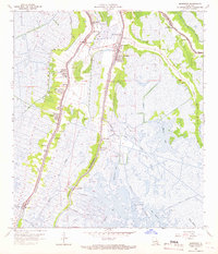
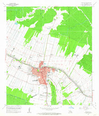 1962 Thibodaux1963 Print · USGSThibodaux and the surrounding bayou country are shown here in the early sixties, a landscape of historic sugar plantations and expanding oil fields. Genealogists and researchers can trace local landmarks like Rienzi Plantation, Thibodaux College, and the rail lines at Thibodaux Junction.4 unique versions available
 - 1962 Map of Thibodaux, 1966 Print
 1962 Thibodaux1966 Print · USGSCoastal Louisiana's river parishes are captured here in the early sixties, showing the complex overlap of plantation estates and the emerging oil industry. Researchers can trace historic family lands like Oak Alley and Madewood or locate community centers such as Labadieville and St James.
 - 1963 Map of New Orleans
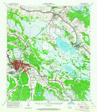
 1963 New Orleans1963 Print · USGSCoastal Louisiana in the mid-twentieth century reveals a complex world of bayou settlements, expanding oil fields, and vital rail networks. Genealogists and historians can trace family roots through river towns like Thibodaux or follow the Southern Pacific line through Franklin and Patterson.4 unique versions available
 - 1963 Map of Houma, 1964 Print
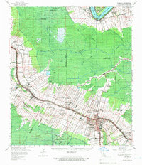
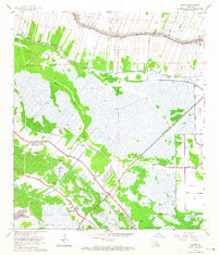
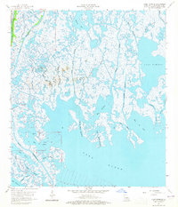
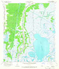
 1963 Houma1964 Print · USGSLouisiana's bayou country is captured here during a period of industrial and infrastructure growth in the early sixties. Genealogists and local historians can trace family locations near Woodlawn Cem, St John Cem, and the specialized South Terrebonne High Sch.4 unique versions available
 - 1963 Map of Houma, 1964 Print
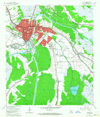
 1963 Houma1964 Print · USGSCoastal Louisiana in the early sixties is a landscape of complex bayous and expanding energy fields. Trace family history at Myrtle Grove Cem and Aragon Plantation, or follow the industrial growth around the Hollywood Gas Field.4 unique versions available
 - 1963 Map of Savoie, 1964 Print
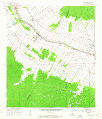
 1963 Savoie1964 Print · USGSThe Louisiana bayou country is captured here in the early sixties, showing the unique linear settlement patterns along Lafourche Bayou. Genealogists and historians can trace the Coteau Mission, St Louis Chapel, and family-named landmarks like Bell Cem.4 unique versions available
 - 1963 Map of Bourg, 1964 Print
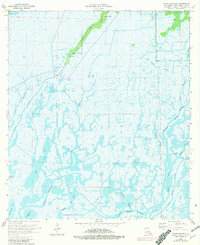
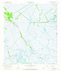
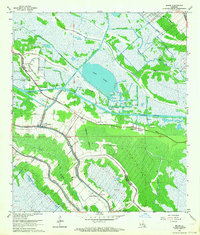 1963 Bourg1964 Print · USGSCoastal Terrebonne Parish during the early sixties shows a landscape of bayous and industrial development. Researchers can trace family roots at Matherne Cem, locate the Aragon Plantation, and see the early footprint of the BOURG GAS FIELD near Klondyke.2 unique versions available
 - 1963 Map of Gray, 1965 Print
 1963 Gray1965 Print · USGSCoastal Louisiana at the height of the mid-century oil boom reveals a landscape of deep-rooted sugar plantations and evolving industrial fields. Researchers can trace historic family lands like Magnolia Plantation or locate local landmarks including St Bridget Ch and the Price Sch.4 unique versions available
 - 1963 Map of Montegut, 1966 Print
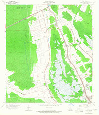
 1963 Montegut1966 Print · USGSThe coastal bayous of Terrebonne Parish in the early sixties reveal a landscape of ridge settlements and marshland industry. Genealogists and historians can trace family locations near Montegut, Chauvin, and Sarah Plantation, or locate landmarks like Dugas Cem and Sacred Heart Ch.3 unique versions available
 - 1964 Map of Bayou Sauveur
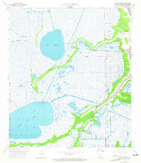
 1964 Bayou Sauveur1964 Print · USGSCoastal Terrebonne Parish in the mid-1960s reveals a landscape where life follows the natural ridges of Bayou du Large. Researchers can trace the placement of local landmarks like St Andrews Ch and the industrial footprint of the Four Isle Bay Oil and Gas Field.3 unique versions available
 - 1964 Map of Gibson, 1965 Print
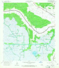
 1964 Gibson1965 Print · USGSTerrebonne and Lafourche Parishes are mapped here in the mid-1960s, showing a landscape defined by bayous and the petroleum industry. Genealogists can locate family landmarks like Rose Hill Ch and Beulah Ch or trace the early Donner Oil Field.3 unique versions available
 - 1964 Map of Lake Penchant, 1965 Print
 1964 Lake Penchant1965 Print · USGSTerrebonne Parish’s marshy interior is captured here in the mid-1960s, showing a landscape defined by deltaic waterways and early industrial canals. Researchers can trace family-named landmarks and infrastructure such as Billiot Canal, Peoples Canal, and the wooded banks of Mauvais Bois Bayou.3 unique versions available
 - 1964 Map of Lake Tambour, 1965 Print
 1964 Lake Tambour1965 Print · USGSCoastal Terrebonne Parish comes to life in the mid-1960s as an active frontier for the petroleum industry amidst the intricate Louisiana marsh. Researchers can trace the early layout of the Lapeyrouse Oil and Gas Field and identify landmarks like Portage and Bush Canal.4 unique versions available
 - 1964 Map of Gibson, 1965 Print
 1964 Gibson1965 Print · USGSSouthern Louisiana in the mid-1960s was a landscape defined by the intersection of the energy industry and historic plantations. Genealogists can trace family roots through sites like Magnolia Cem, Buzzard Roost Ch, and the Edward Daigle Drive-in Theater.3 unique versions available
 - 1964 Map of Lake Quitman, 1965 Print
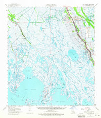
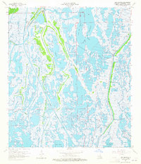 1964 Lake Quitman1965 Print · USGSCoastal Terrebonne Parish in the mid-sixties is a dense network of marsh, industry, and ancient sites. Researchers can trace the layout of Dulac Sch, find local landmarks like Cure d'ars Chapel, and locate Indian Mounds along the many bayous.3 unique versions available
 - 1964 Map of Bayou Du Large, 1965 Print
 1964 Bayou Du Large1965 Print · USGSCoastal Louisiana marshlands in the mid-1960s reveal a landscape of ridges and bayous defined by water-borne industry and isolated settlements. Researchers can locate local landmarks like Theriot, the Lower Bayou du Large Sch, and the Indian Mound near the oil fields.3 unique versions available
 - 1964 Map of Lake Mechant, 1965 Print
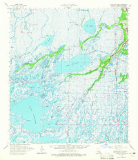
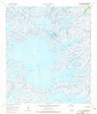 1964 Lake Mechant1965 Print · USGSThe Terrebonne Parish coast in the mid-sixties was a vast network of tidal basins and marshes centered on the expansive Lake Mechant. Genealogists and researchers can trace the historic water routes of Bayou Du Large and find early industrial markers like Oil Well sites.4 unique versions available
 - 1964 Map of Lake Felicity, 1965 Print
 1964 Lake Felicity1965 Print · USGSCoastal Terrebonne Parish in the mid-1960s is a sprawling network of marsh and open water just as industrial activity was intensifying. Researchers can trace the layout of the Bayou Jean Lacroix Oil and Gas Field and landmarks like Felicity Island and Grand Point.4 unique versions available
 - 1964 Map of Lake Theriot, 1965 Print
 1964 Lake Theriot1965 Print · USGSTerrebonne Parish wetlands in the mid-1960s were a landscape of bayou-side settlements and emerging energy fields. Trace family roots at Theriot or follow the development of industry at the South Sunrise Oil and Gas Field and Falgout Canal.3 unique versions available
 - 1964 Map of Humphreys, 1965 Print
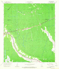
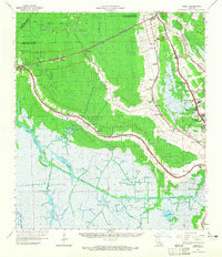
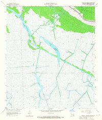
 1964 Humphreys1965 Print · USGSTerrebonne Parish settlements and oil fields thrive along the wetlands in the mid-sixties. Genealogists and historians can trace local landmarks like St Anthonys Cem, the Bayou Black Sch, and the rail siding at Hollywood.3 unique versions available
 - 1964 Map of Bayou Cocodrie, 1965 Print
 1964 Bayou Cocodrie1965 Print · USGSTerrebonne Parish’s wetlands and oil fields are captured in the mid-sixties just as industrial infrastructure was expanding through the marsh. Genealogists and researchers can locate Mt Pilgrim Ch and trace the complex network of the Intracoastal Waterway and Gibson Oil Field.3 unique versions available
 - 1964 Map of Dulac, 1965 Print
 1964 Dulac1965 Print · USGSCoastal Terrebonne Parish in the early sixties reveals a landscape of bayou-side settlements and emerging industrial infrastructure. Genealogists and local historians can locate Holy Family Cem, trace the homes along Grand Caillou, and see the early development of the South Houma Oil and Gas Field.4 unique versions available
 - 1964 Map of Lake Bully Camp, 1965 Print
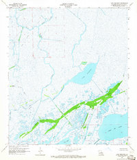
 1964 Lake Bully Camp1965 Print · USGSCoastal Lafourche and Terrebonne Parishes come into focus during the mid-sixties, showing the intersection of marshland life and the energy industry. Genealogists and historians can trace family locations along Bayou Pointe au Chien near St Peters Ch and the Lower Pointe au Chien Sch.4 unique versions available
 - 1964 Map of Lake Felicity, 1965 Print
 1964 Lake Felicity1965 Print · USGSCoastal Louisiana in the mid-sixties shows a landscape defined by the narrow ridge of Bayou Lafourche and an expansive network of wetlands. Genealogists and historians can trace family-named sites like Williams Cem, St Peters Ch, and the Lower Pointe au Chien Sch.3 unique versions available
Showing maps 1-25 of 33
Top cities of Terrebonne Parish
Frequently asked questions
- What are the different types of historical maps available for Terrebonne Parish?
- What is the oldest map of Terrebonne Parish?
- Where can I purchase historical maps of Terrebonne Parish for my home or office?
- Where can I download high-res historical maps of Terrebonne Parish?
- Are there historical topographic maps available for Terrebonne Parish?
- Is there historical aerial imagery available for Terrebonne Parish?
- Where are historical maps of Terrebonne Parish sourced from?