1990s Maps of Terrebonne Parish, Louisiana
Explore 41 historic maps of Terrebonne Parish from the 1990s. These maps offer a rare glimpse into what life looked like during the 1990s — showing old roads, neighborhoods, homes, and landmarks that have changed or disappeared over time.
Whether you're researching your family's past, planning a metal detecting trip, or studying how Terrebonne Parish's landscape evolved across the 1990s, these high-resolution maps are a powerful tool for exploring the history of this region.
- Focus on a specific era: All maps on this page are from the 1990s, giving you a focused view of this time period.
- See what’s changed: Compare century-old streets, trails, and buildings to today's modern landscape using overlays and satellite layers.
- Research with precision: Use these maps for genealogy, historical research, land use analysis, or educational projects.
- View, download, or print: Maps are fully viewable online in high resolution, and can be downloaded or printed for your own records.
Start exploring Terrebonne Parish's history through authentic maps from the 1990s. This is your window into the past.
Terrebonne Parish, LA maps
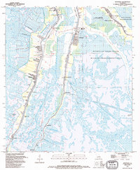
(41)- 1994 Map of Lake La Graisse
 1994 Lake La Graisse1994 Print · USGSCoastal Terrebonne Parish in the 1990s shows a landscape of tidal marshes and major energy infrastructure. Researchers can trace the extensive offshore platforms of the Lake Barre Oil and Gas Field and landmarks like Seabreeze Pass and Point Meshe.
 - 1994 Map of Montegut
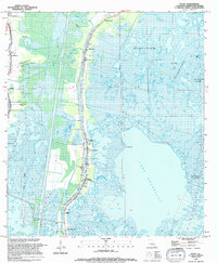
 1994 Montegut1994 Print · USGSCoastal Terrebonne Parish in the 1990s shows a landscape of bayou-side settlements and vast wetlands. Genealogists can trace family names at Sarah Plantation, Thibodaux Cem, and the St Charles Borromeo Ch along the Lafourche Parish line.
 - 1994 Map of Lake Mechant
 1994 Lake Mechant1994 Print · USGSCoastal Terrebonne Parish in the 1990s is captured as a dense network of marshes and tidal lakes where water dictates the pace of life. Trace the intricate waterways of Lake Mechant, the industrial footprint of the northern Gas Field, and landmarks like Hog Point.
 - 1994 Map of Dulac
 1994 Dulac1994 Print · USGSCoastal Terrebonne Parish comes into sharp focus during the mid-nineties, showing the traditional bayou settlements of Grand Caillou and Dulac nestled between marsh and canal. Genealogists can locate family landmarks like Celestin Cem, Carlof Cem, and the Morning Star Ch.
 - 1994 Map of Central Isles Dernieres
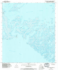
 1994 Central Isles Dernieres1994 Print · USGSCoastal Terrebonne Parish in the early nineties reveals a landscape of barrier islands and offshore energy development. Researchers can trace the shifting sands of Whiskey Island and Trinity Island or locate petroleum infrastructure within the Bay Round Gas Field and Pelican Lake Gas Field.
 - 1994 Map of Cat Island Pass
 1994 Cat Island Pass1994 Print · USGSCoastal Terrebonne Parish comes into focus in the mid-1990s, showcasing the intersection of the energy industry and the shifting Gulf shoreline. Researchers can map the exact positions of offshore platforms and tanks near Timbalier Island and Cat Island Pass.
 - 1994 Map of Dog Lake
 1994 Dog Lake1994 Print · USGSCoastal Terrebonne Parish appears here in the mid-1990s, where the intricate marshland is heavily marked by the region's energy industry. Researchers can trace historical industrial sites like the Four Isle Dome Oil and Gas Field or locate local landmarks such as China Island and Bayou John Bop.
 - 1994 Map of Western Isles Dernieres
 1994 Western Isles Dernieres1994 Print · USGSCoastal Terrebonne Parish appears in the mid-nineties as a landscape of shifting barrier islands and active offshore energy extraction. Researchers can locate specific energy sites like the Block 40 Gas Field and trace the fragile shoreline at Raccoon Island and Coon Point.
 - 1994 Map of Jacko Bay
 1994 Jacko Bay1994 Print · USGSThe Louisiana coastline in the early nineties is captured here as a landscape defined by offshore energy and tidal waters. Trace the dense network of platforms across the Lake Barre Oil and Gas Field and find landmarks like Terrebonne Island.
 - 1994 Map of Lake Penchant
 1994 Lake Penchant1994 Print · USGSCoastal Terrebonne Parish appears here in the mid-1990s as a complex network of marshland bayous and active energy production. Researchers can trace the industrial footprint across Lake Penchant and locate remote markers like Bleux Island or the Lake De Cade Gas Field.
 - 1994 Map of Cocodrie
 1994 Cocodrie1994 Print · USGSThe Louisiana coast south of Houma is shown in the mid-nineties as a hub of energy production and coastal marsh. Researchers can trace offshore platforms across the Sainte Elaine Oil Field and Bay Coon Road.
 - 1994 Map of Lake Theriot
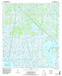
 1994 Lake Theriot1994 Print · USGSCoastal Louisiana in the mid-nineties shows a landscape where industrial canals and bayous intersect at the settlement of Theriot. Researchers can trace local landmarks like St Eloi Ch, Du Large Sch, and the expansive Lake Theriot.
 - 1994 Map of Grand Bayou Du Large
 1994 Grand Bayou Du Large1994 Print · USGSThe Terrebonne Parish coast in the 1990s shows a landscape defined by tidewater industry and shifting marshlands. Researchers can trace the footprint of the Junop Bay Oil and Gas Field and identify navigation points like Grand Bayou Du Large.2 unique versions available
 - 1994 Map of Lake Bully Camp
 1994 Lake Bully Camp1994 Print · USGSCoastal wetlands and industrial sites define this corner of Louisiana in the early nineties. Researchers can trace the intersection of marsh life and energy extraction through landmarks like The Oak Ch, the Bully Camp Gas and Oil Field, and Lake Bully Camp.
 - 1994 Map of Timbalier Island
 1994 Timbalier Island1994 Print · USGSThe Louisiana coast in the early nineties reveals a landscape of heavy industry and shifting barrier islands. Trace the density of the Caillou Island Oil and Gas Field and find Oil Platforms near Timbalier Island.
 - 1994 Map of Lake Felicity
 1994 Lake Felicity1994 Print · USGSCoastal Terrebonne Parish in the early nineties is a labyrinth of interconnected marshes and open water. Researchers can trace the industrial layout of the Bayou Jean Lacroix Oil and Gas Field and explore family-named waterways like Lake Billiot and Lake Trois Jeans.
 - 1994 Map of Lake Quitman
 1994 Lake Quitman1994 Print · USGSIn the mid-1990s, the Terrebonne Parish wetlands around Dulac were defined by a massive network of industrial canals and natural bayous. Researchers can trace family sites like Picou Cem or locate the scientific outpost of the Louisiana Universities Marine Consortium amidst the marshes.
 - 1994 Map of Bayou Sauveur
 1994 Bayou Sauveur1994 Print · USGSCoastal Terrebonne Parish in the mid-1990s is defined by its sprawling wetlands and the intensive footprint of the petroleum industry. Researchers can trace the intersection of community life and commerce at St Andrews Mission and the Four Isle Dome Oil and Gas Field.
 - 1994 Map of Eastern Isles Dernieres
 1994 Eastern Isles Dernieres1994 Print · USGSThe barrier islands of Terrebonne Parish are captured here during a peak era of offshore energy production in the nineties. Researchers can trace the footprint of the Lake Pelto Gas and Oil Field or the shifting sands of Trinity Island.
 - 1994 Map of Lake Tambour, 1995 Print
 1994 Lake Tambour1995 Print · USGSCoastal Terrebonne Parish appears as a complex web of marshes and energy infrastructure in the mid-nineties. Researchers can map the footprint of the Lapeirouse Oil and Gas Field and trace waterways like Bayou Terrebonne and Lake Tambour.
 - 1994 Map of Morgan City SE, 1998 Print
 1994 Morgan City SE1998 Print · USGSCoastal Louisiana in the mid-nineties shows a landscape defined by its intersection of natural waterways and heavy energy production. Researchers can trace the industrial footprint across North Turtle Bayou Gas Field and follow the vital Intracoastal Waterway.
 - 1994 Map of Point Au Fer NE, 1998 Print
 1994 Point Au Fer NE1998 Print · USGSCoastal Terrebonne Parish appears in the mid-1990s as a dynamic landscape of delta formation and tidal marsh. Researchers can trace the shifting shoreline and waterways like Little Hog Bayou, Shell Island Pass, and the remote Tanks near Little Bay.
 - 1994 Map of Lake Salve, 1998 Print
 1994 Lake Salve1998 Print · USGSCoastal Louisiana's shifting wetlands come into focus in the mid-nineties, showing a complex deltaic landscape where the river meets the bay. Researchers can trace the industrial footprint of the Belle Isle Gas and Oil Field and find isolated high ground like Live Oak Hammock.
 - 1994 Map of Morgan City SW, 1998 Print
 1994 Morgan City SW1998 Print · USGSCoastal Terrebonne and St. Mary Parishes are shown in the mid-1990s as a complex network of marshes and industrial sites. Researchers can trace the extensive development of the Bateman Lake Gas and Oil Field and the waterways of Avoca Island.
 - 1994 Map of Amelia, 1998 Print
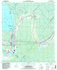 1994 Amelia1998 Print · USGSCoastal Louisiana in the mid-nineties shows an intricate landscape of energy extraction and waterborne commerce centered on Amelia. Researchers can trace the industrial footprint of the Amelia Gas Field and locate local landmarks like St Andrews Cem and the Indian Mound.
Showing maps 1-25 of 41
Top cities of Terrebonne Parish
Frequently asked questions
- What are the different types of historical maps available for Terrebonne Parish?
- What is the oldest map of Terrebonne Parish?
- Where can I purchase historical maps of Terrebonne Parish for my home or office?
- Where can I download high-res historical maps of Terrebonne Parish?
- Are there historical topographic maps available for Terrebonne Parish?
- Is there historical aerial imagery available for Terrebonne Parish?
- Where are historical maps of Terrebonne Parish sourced from?