1940s Maps of Vermilion Parish, Louisiana
Explore 21 historic maps of Vermilion Parish from the 1940s. These maps offer a rare glimpse into what life looked like during the 1940s — showing old roads, neighborhoods, homes, and landmarks that have changed or disappeared over time.
Whether you're researching your family's past, planning a metal detecting trip, or studying how Vermilion Parish's landscape evolved across the 1940s, these high-resolution maps are a powerful tool for exploring the history of this region.
- Focus on a specific era: All maps on this page are from the 1940s, giving you a focused view of this time period.
- See what’s changed: Compare century-old streets, trails, and buildings to today's modern landscape using overlays and satellite layers.
- Research with precision: Use these maps for genealogy, historical research, land use analysis, or educational projects.
- View, download, or print: Maps are fully viewable online in high resolution, and can be downloaded or printed for your own records.
Start exploring Vermilion Parish's history through authentic maps from the 1940s. This is your window into the past.
Vermilion Parish, LA maps
(21)- 1945 Map of New Orleans
 1945 New Orleans1945 Print · USGSCoastal Louisiana and the Mississippi delta are captured here just after the war, showing the region's transition into a modern industrial and transit hub. Genealogists can trace family settlements along Bayou Teche or identify rail stops for the Illinois Central and Texas & Pacific lines.
 - 1945 Map of Pecan Island NW
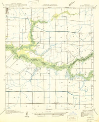
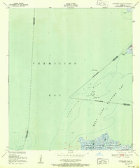
 1945 Pecan Island NW1945 Print · USGSCoastal Louisiana marshes and chenier ridges define this Vermilion Parish landscape in the mid-1940s. Local historians can trace early settlement patterns along Cane Ridge and Back Ridge or locate the historic Pecan Island PO and Mound.
 - 1945 Map of Pecan Island NE
 1945 Pecan Island NE1945 Print · USGSThe coastal marsh of Vermilion Parish was a world of water-borne transit at the end of World War II. Researchers can trace the path of the Pirogue Trail through the wetlands or locate historic high ground at Little Prairie Ridge and Front Ridge.
 - 1946 Map of Redfish Point SW
 1946 Redfish Point SW1946 Print · USGSLouisiana's marshy coastline in the 1940s reveals a landscape of remote settlements and industrial canal-cutting. Researchers can trace the early coastal community at Chenier Au Tigre, the local St Francis Ch, and the reach of the Mc Ilhenny Canal.
 - 1946 Map of Milton
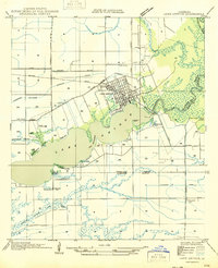
 1946 Milton1946 Print · USGSCajun country at the end of the Second World War is centered here on the winding Vermilion River. Genealogists can locate family-named landmarks like LeBlanc Sch and Langlinais Sch or trace the early paths of Maurice and Milton.
 - 1946 Map of Morse
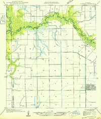
 1946 Morse1946 Print · USGSCoastal Louisiana at the end of the Second World War reveals a landscape defined by its bayous and early irrigation networks. Genealogists and researchers can locate old rail stops like Haire Sta and settlements such as Morse, Gueydan, and Lyons Point.
 - 1946 Map of Schooner Bayou SE
 1946 Schooner Bayou SE1946 Print · USGSVermilion Parish coastal marshes were undergoing significant transformation in the mid-forties as navigation projects reshaped the wetlands. Genealogists and local historians can trace the residents of Forked Island, find the local Sch, and locate ferry points near Pevley and Isle Marrone.
 - 1946 Map of Redfish Point NE
 1946 Redfish Point NE1946 Print · USGSThe marshy shoreline of Vermilion Parish appears in this mid-century survey as it was documented by Army Air Corps photography. Genealogists and maritime historians can trace the precise location of Redfish Lighthouse and the early boundaries of North Lake and Indian Point.
 - 1946 Map of Leroy
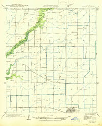
 1946 Leroy1946 Print · USGSVermilion Parish rural life in the mid-1940s is defined by its early rice irrigation systems and Acadian community centers. Researchers can locate family landmarks like Petre Cem and Broussard Cem or trace the early postal routes through Indian Bayou PO and Leroy.
 - 1946 Map of Schooner Bayou NE
 1946 Schooner Bayou NE1946 Print · USGSCoastal Vermilion Parish in the mid-forties shows a landscape of prairie agriculture and marshland managed by a dense network of canals. Genealogists can locate family landmarks such as Hebert Cem, the Broussard Sch, and the pumping station at Pine Island.
 - 1946 Map of Redfish Point SE
 1946 Redfish Point SE1946 Print · USGSThe coastal marshes of Louisiana are frozen in time just after the war, showing the vital waterways between the gulf and the bay. Researchers can trace the historic Pirogue Trail and locate coastal landmarks like Lighthouse Point and Marsh Island.
 - 1946 Map of Redfish Point NW
 1946 Redfish Point NW1946 Print · USGSThe coastal marshlands of Vermilion Parish are captured here in the mid-1940s, showing a landscape defined by tidewater bayous and isolated camps. Researchers can trace the layout of the Deep Bayou Canal and find local landmarks like Lake Town, Gordon Camp Audubon, and Pearsons Ponds.
 - 1946 Map of Lake Arthur
 1946 Lake Arthur1946 Print · USGSLake Arthur and its surrounding marshlands are shown here in the mid-forties during a period of steady coastal development. Researchers can trace family sites near St Theresa Ch, locate the Andress Gate Cem, or follow the path of the Southern Pacific railroad.
 - 1946 Map of Schooner Bayou NW
 1946 Schooner Bayou NW1946 Print · USGSCoastal Vermilion Parish in the mid-1940s reveals a landscape defined by marsh management and early infrastructure. Genealogists and local historians can locate Marceaux Sch and trace the paths of Warren Trail and the Intracoastal Waterway.
 - 1946 Map of Lafayette
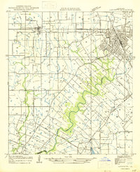 1946 Lafayette1946 Print · USGSLafayette and the surrounding Acadiana countryside are captured here in the mid-1940s as the city expanded around its educational and rail hubs. Genealogists and local historians can pinpoint the Louisiana Southwestern Institute, rural schoolhouses like Verot Sch, and the rail sidings at Tolson and Ely Junction.
 - 1946 Map of Kaplan
 1946 Kaplan1946 Print · USGSVermilion and Acadia Parishes come to life in the mid-1940s as the rice-farming landscape of southwest Louisiana expands. Trace the early streets of Kaplan, the Southern Pacific rail line, and rural landmarks like the Apshire Cem and Leleux.
 - 1946 Map of Rayne
 1946 Rayne1946 Print · USGSAcadia Parish at the close of the Second World War shows a landscape shaped by rail lines and irrigation canals. Genealogists and local researchers can locate old community centers like Ebenezer Sch and Hebron Ch, or trace the winding parish boundaries along Bayou Queue De Tortue.
 - 1946 Map of Schooner Bayou SW
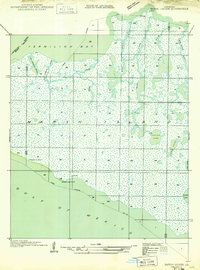
 1946 Schooner Bayou SW1946 Print · USGSCoastal Vermilion Parish in the mid-1940s reveals a vast marshland landscape defined by tidal islands and early maritime routes. Researchers can trace the Pirogue Trail across Sweet Bay or locate landmarks like Pine Island and Clear Lake.
 - 1948 Map of Cypremort Point, 1952 Print
 1948 Cypremort Point1952 Print · USGSCoastal Louisiana in the late 1940s is defined here by the vast wetlands of Marsh Island and the open waters of the Gulf bays. Researchers can trace the early petroleum footprint at Oil well sites or locate the Conservation Camp near Bird I Bayou.2 unique versions available
 - 1949 Map of Gueydan
 1949 Gueydan1949 Print · USGSThe coastal prairies of Vermilion Parish meet the bayous of Acadia in the late 1940s. Genealogists can locate the Legia Cem and trace the Southern Pacific rail line through Riceville and into the streets of Gueydan.
 - 1949 Map of Bayou Lucien
 1949 Bayou Lucien1949 Print · USGSMarsh Island was a remote landscape of tidal bayous and isolated chenier ridges in the late 1940s. Genealogists and historians can locate early coastal settlements at Chenier la Croix and trace the complex waterways of Bayou Lucien and Lucien Lake.
End of results
Showing maps 1-21 of 21
Top cities of Vermilion Parish
- Abbeville historical maps
- Kaplan historical maps
- Erath historical maps
- Gueydan historical maps
- Maurice historical maps
Frequently asked questions
- What are the different types of historical maps available for Vermilion Parish?
- What is the oldest map of Vermilion Parish?
- Where can I purchase historical maps of Vermilion Parish for my home or office?
- Where can I download high-res historical maps of Vermilion Parish?
- Are there historical topographic maps available for Vermilion Parish?
- Is there historical aerial imagery available for Vermilion Parish?
- Where are historical maps of Vermilion Parish sourced from?