1950s Maps of Vermilion Parish, Louisiana
Explore 44 historic maps of Vermilion Parish from the 1950s. These maps offer a rare glimpse into what life looked like during the 1950s — showing old roads, neighborhoods, homes, and landmarks that have changed or disappeared over time.
Whether you're researching your family's past, planning a metal detecting trip, or studying how Vermilion Parish's landscape evolved across the 1950s, these high-resolution maps are a powerful tool for exploring the history of this region.
- Focus on a specific era: All maps on this page are from the 1950s, giving you a focused view of this time period.
- See what’s changed: Compare century-old streets, trails, and buildings to today's modern landscape using overlays and satellite layers.
- Research with precision: Use these maps for genealogy, historical research, land use analysis, or educational projects.
- View, download, or print: Maps are fully viewable online in high resolution, and can be downloaded or printed for your own records.
Start exploring Vermilion Parish's history through authentic maps from the 1950s. This is your window into the past.
Vermilion Parish, LA maps
(44)- 1951 Map of Bayou Lucien, 1952 Print
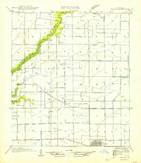
 1951 Bayou Lucien1952 Print · USGSThe coastal wetlands of Iberia Parish are documented here in the early fifties, showing the pristine state of the Marsh Island wildlife sanctuary. Explore the intricate bayou network of Bayou Lucien and landmarks like Cheniere la Croix and Oyster Reef.2 unique versions available
 - 1951 Map of Pecan Island, 1955 Print
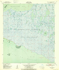
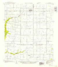
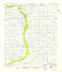
 1951 Pecan Island1955 Print · USGSCoastal Vermilion Parish comes into focus during the early fifties, showing the unique chenier ridge settlements surrounded by marsh. Researchers can trace family sites at Pecan Island, find a local Cem, and locate the early Oil Field infrastructure.5 unique versions available
 - 1951 Map of Cheniere Au Tigre, 1955 Print
 1951 Cheniere Au Tigre1955 Print · USGSCoastal Vermilion Parish in the early fifties was a world of protected marsh and remote ridge settlements. Genealogists and researchers can trace the isolated community at Cheniere au Tigre or follow the historic Pirogue Trail through the State Game Refuge.3 unique versions available
 - 1952 Map of Lake Charles
 1952 Lake Charles1952 Print · USGSSouthwest Louisiana is captured here in the mid-fifties, showing a landscape defined by the rise of the petrochemical industry and deep-water navigation. Researchers can trace family roots through numerous small-town settlements and oil developments like Nibletts Bluff, the Lockport Oil Field, and Starks.
 - 1953 Map of Jacks Point Island, 1980 Print
 1953 Jacks Point Island1980 Print · USGSCoastal Vermilion Parish is documented here in the late 1970s, showcasing the intricate marshlands and islands south of the main settlements. Researchers can trace traditional water routes like the Gang Pirogue Trail or locate remote landmarks such as Rabbit Island and Clear Lake.
 - 1954 Map of Redfish Point SE
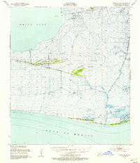
 1954 Redfish Point SE1954 Print · USGSCoastal Vermilion Parish in the early 1950s reveals a landscape of isolated marshes and maritime channels before modern erosion. Trace the historic Pirogue Trail and locate coastal landmarks like Lighthouse Point and Southwest Pass.
 - 1954 Map of Lafayette
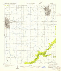
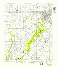 1954 Lafayette1954 Print · USGSMid-century Lafayette is captured here as the city grid expands toward the Louisiana Southwestern Institute and the Vermilion River. Genealogists can trace family tracts and small rail stops like Tolson, Scott, and Ely Junction.
 - 1954 Map of Grand Lake East SE
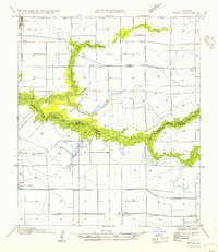
 1954 Grand Lake East SE1954 Print · USGSThe coastal marshlands of south Louisiana are mapped here in the mid-1950s, revealing a landscape where water travel was the rule. Genealogists and historians can trace traditional watercraft routes like the Guidry Pirogue Trail and landmarks like the Crowley Hunting Club.
 - 1954 Map of Redfish Point NE
 1954 Redfish Point NE1954 Print · USGSCoastal Vermilion Parish is documented here in the mid-fifties, showing the precarious shoreline and wetlands along the bay. Researchers can trace the maritime landscape through navigational markers like the Redfish Lighthouse and natural landmarks such as Red Fish Point and Indian Point.
 - 1954 Map of Schooner Bayou NW
 1954 Schooner Bayou NW1954 Print · USGSCoastal Vermilion Parish is shown here during the mid-1950s, a period defined by the expansion of marshland waterways and local infrastructure. Researchers can locate the rural Marceaux Sch, trace the path of the Warren Trail, and see the early route of the Intracoastal Waterway.
 - 1954 Map of Duson
 1954 Duson1954 Print · USGSDuson and the surrounding Acadiana prairie are captured here in the mid-1950s as a landscape of small settlements and irrigation networks. Researchers can trace local genealogy through landmarks like Indian Bayou High Sch, Kimbal Chapel, and the community of Indian.
 - 1954 Map of Leroy
 1954 Leroy1954 Print · USGSVermilion Parish in the mid-fifties is captured here as a landscape of irrigation canals and dispersed rural settlements. Family historians can locate family-named burial sites like Abshire Cem and small communities such as Leroy, Andrew, and Meaux.
 - 1954 Map of Rayne
 1954 Rayne1954 Print · USGSAcadia Parish in the mid-fifties is captured here as a landscape of productive prairie and vital rail corridors. Genealogists and local historians can trace the rural layout of Ebenezer Sch and Hebron Ch, or follow the winding Bayou Queue de Tortue as it meanders past Faulk Bridge.
 - 1954 Map of Constance Bayou SE
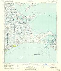
 1954 Constance Bayou SE1954 Print · USGSThe Louisiana coast south of Abbeville in the early fifties shows a pristine expanse of marsh and tidal lakes. Genealogists and historians can trace the original shoreline and drainage patterns of Flat Lake, Rollover Lake, and East Constance Bayou.
 - 1954 Map of Redfish Point SW
 1954 Redfish Point SW1954 Print · USGSCoastal Vermilion Parish in the mid-twentieth century was a landscape of remote ridges and engineered waterways. Researchers can locate the settlement at Chenier Au Tigre, find the site of St Francis Ch, and trace the path of the Cutoff Canal.
 - 1954 Map of Pecan Island SW
 1954 Pecan Island SW1954 Print · USGSCoastal Vermilion Parish marshlands are captured in detail during the early 1950s, showing the intersection of land and sea. Trace historical navigation routes such as the Pirogue Trail and identify coastal landmarks like Mulberry Island.
 - 1954 Map of Schooner Bayou SW
 1954 Schooner Bayou SW1954 Print · USGSThe coastal wetlands of Vermilion Parish are shown in the early 1950s, a time when traditional watercraft still navigated the marsh. You can trace historical water routes like the Sweet Bay Pirogue Trail or locate isolated rises such as Pebley Isle and Pine Island.
 - 1954 Map of Pecan Island NE
 1954 Pecan Island NE1954 Print · USGSCoastal Vermilion Parish marshlands are meticulously detailed in the mid-twentieth century, preserving the routes of the traditional Pirogue Trail. Researchers can trace old land claims around Front Ridge, Belle Isle, and the Old Intracoastal Waterway.
 - 1954 Map of Morse
 1954 Morse1954 Print · USGSCoastal prairie life in the mid-1950s is defined by the railroad and the complex irrigation systems of Acadiana. Genealogists and historians can trace rail stops like Haire Sta and early settlements such as Morse or Lyons Point.
 - 1954 Map of Lake Arthur
 1954 Lake Arthur1954 Print · USGSJefferson Davis Parish in the mid-twentieth century was a landscape of intricate waterways and rail-fed settlements centered on the lake. Trace rural life through family-named landmarks like Andress Gate Cem and local schoolhouses including Klondike Sch.
 - 1954 Map of Kaplan
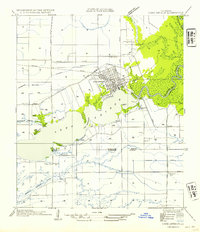
 1954 Kaplan1954 Print · USGSCoastal prairie life and agricultural development define this mid-century look at the Vermilion Parish countryside. Genealogists and local historians can trace the Southern Pacific rail line, locate the Apshire Cem, and find small communities like Leleux or Cossinade.
 - 1954 Map of Milton
 1954 Milton1954 Print · USGSLafayette and Vermilion Parish life in the 1950s is defined by the winding Vermilion River and the rural rail economy. Genealogists and local historians can trace the locations of Le Blanc Sch, the Southern Pacific line, and early tracks in Milton.
 - 1954 Map of Schooner Bayou NE
 1954 Schooner Bayou NE1954 Print · USGSThe Vermilion Parish marshlands and rice country are captured here at mid-century, centered on the rail hub at Kaplan. Researchers can locate family landmarks like Hebert Cem and the Broussard Sch among a complex network of drainage canals.
 - 1954 Map of Redfish Point NW
 1954 Redfish Point NW1954 Print · USGSCoastal Vermilion Parish is shown in its mid-century state as a wild expanse of bayous, lakes, and marsh. Researchers can trace historical navigation and remote outposts such as Gordon Camp Audubon, Toms Lake Town, and Belle Isle.
 - 1954 Map of Schooner Bayou SE
 1954 Schooner Bayou SE1954 Print · USGSCoastal Vermilion Parish in the mid-fifties is a landscape of maritime navigation and isolated prairie ridges. Researchers can trace the water-dependent settlement patterns of Forked Island, the strategic U S Locks, and family-named landmarks like Thannas Island.
Showing maps 1-25 of 44
Top cities of Vermilion Parish
- Abbeville historical maps
- Kaplan historical maps
- Erath historical maps
- Gueydan historical maps
- Maurice historical maps
Frequently asked questions
- What are the different types of historical maps available for Vermilion Parish?
- What is the oldest map of Vermilion Parish?
- Where can I purchase historical maps of Vermilion Parish for my home or office?
- Where can I download high-res historical maps of Vermilion Parish?
- Are there historical topographic maps available for Vermilion Parish?
- Is there historical aerial imagery available for Vermilion Parish?
- Where are historical maps of Vermilion Parish sourced from?