
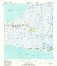
1951 Map of Pecan Island
USGS Topo · Published 1955About this map
Pecan Island emerges as a distinct linear settlement along the chenier ridges of Vermilion Parish in this mid-century survey. The landscape is defined by these narrow, elevated strands of shell and sand, including Cypress Point, Sweet Bay Ridge, and Lambert Ridge, which provided the only habitable ground amidst the surrounding marshlands. A small Cem is noted near the center of the island, reflecting the deep-rooted community ties in this isolated coastal environment.
Find a feature on this map
46 named features on this map. Tap any name to fly to it.
Don’t see what you’re looking for? This feature index may not catch every label — zoom into the map to look around manually.
Map Details
Editions of this 1951 Pecan Island Map
5 editions found
Other maps of this area

1932 · Abbeville SW
USGS Topo · 1:31,680

1932 · Constance Bayou NE
USGS Topo · 1:31,680

1932 · Pecan Island SE
USGS Topo · 1:31,680

1932 · Pecan Island SW
USGS Topo · 1:31,680

1932 · Constance Bayou SE
USGS Topo · 1:31,680

1945 · Pecan Island NW
USGS Topo · 1:31,680

1945 · Pecan Island NE
USGS Topo · 1:31,680

1946 · Redfish Point SW
USGS Topo · 1:31,680

1946 · Schooner Bayou SE
USGS Topo · 1:31,680

1946 · Redfish Point NW
USGS Topo · 1:31,680