Old Maps of Vermilion Parish, Louisiana for Hiking & Exploration
Hike through history with 169 historic maps of Vermilion Parish. Explore old trails, ghost towns, and forgotten backroads — perfect for outdoor adventurers and local explorers.
- Rediscover forgotten places: Map out old mining camps, roads, and footpaths that no longer exist on modern maps.
- Layer with modern tools: Combine with LiDAR or satellite views to plan hikes through historical terrain.
- Made for exploration: Popular among hikers, overlanders, and local history lovers.
Use these maps to find adventure and explore the hidden past of Vermilion Parish.
Vermilion Parish, LA maps
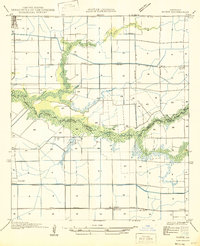
(169)- 1932 Map of Abbeville SW
 1932 Abbeville SW1932 Print · USGSCovers Vermilion Parish, including Esther, Intracoastal City, and other nearby areas
 - 1932 Map of Constance Bayou NE
 1932 Constance Bayou NE1932 Print · USGSCovers Vermilion Parish, including Cameron Parish, United States, and other nearby areas2 unique versions available
 - 1932 Map of Abbeville SE
 1932 Abbeville SE1932 Print · USGSCovers Vermilion Parish, including United States, Louisiana, and other nearby areas
 - 1932 Map of Abbeville NE
 1932 Abbeville NE1932 Print · USGSCovers Vermilion Parish, including Abbeville, Erath, and other nearby areas
 - 1932 Map of Pecan Island SE
 1932 Pecan Island SE1932 Print · USGSCovers Vermilion Parish, including United States, Louisiana, and other nearby areas
 - 1932 Map of Abbeville NW
 1932 Abbeville NW1932 Print · USGSCovers Vermilion Parish, including Abbeville, Mouton Cove, and other nearby areas
 - 1932 Map of Pecan Island SW
 1932 Pecan Island SW1932 Print · USGSCovers Vermilion Parish, including United States, Louisiana, and other nearby areas
 - 1932 Map of Constance Bayou SE
 1932 Constance Bayou SE1932 Print · USGSCovers Vermilion Parish, including Cameron Parish, United States, and other nearby areas
 - 1934 Map of Duson
 1934 Duson1934 Print · USGSCovers Vermilion Parish, including Rayne, Scott, and other nearby areas
 - 1937 Map of Derouen, 1963 Print
 1937 Derouen1963 Print · USGSCovers Vermilion Parish, including New Iberia, Avery Island, and other nearby areas
 - 1939 Map of St. Martinsville, 1946 Print
 1939 St. Martinsville1946 Print · USGSCovers Vermilion Parish, including Lafayette, New Iberia, and other nearby areas2 unique versions available
 - 1945 Map of New Orleans
 1945 New Orleans1945 Print · USGSCovers Vermilion Parish, including New Orleans, Metairie, and other nearby areas
 - 1945 Map of Pecan Island NW
 1945 Pecan Island NW1945 Print · USGSCovers Vermilion Parish, including Pecan Island, United States, and other nearby areas
 - 1945 Map of Pecan Island NE
 1945 Pecan Island NE1945 Print · USGSCovers Vermilion Parish, including United States, Louisiana, and other nearby areas
 - 1946 Map of Redfish Point SW
 1946 Redfish Point SW1946 Print · USGSCovers Vermilion Parish, including Cheniere au Tigre, United States, and other nearby areas
 - 1946 Map of Milton
 1946 Milton1946 Print · USGSCovers Vermilion Parish, including Lafayette, Youngsville, and other nearby areas
 - 1946 Map of Morse
 1946 Morse1946 Print · USGSCovers Vermilion Parish, including Gueydan, Morse, and other nearby areas
 - 1946 Map of Schooner Bayou SE
 1946 Schooner Bayou SE1946 Print · USGSCovers Vermilion Parish, including Forked Island, United States, and other nearby areas
 - 1946 Map of Redfish Point NE
 1946 Redfish Point NE1946 Print · USGSCovers Vermilion Parish, including United States, Louisiana, and other nearby areas
 - 1946 Map of Leroy
 1946 Leroy1946 Print · USGSCovers Vermilion Parish, including Maurice, Leroy, and other nearby areas
 - 1946 Map of Schooner Bayou NE
 1946 Schooner Bayou NE1946 Print · USGSCovers Vermilion Parish, including Kaplan, United States, and other nearby areas
 - 1946 Map of Redfish Point SE
 1946 Redfish Point SE1946 Print · USGSCovers Vermilion Parish, including Iberia Parish, United States, and other nearby areas
 - 1946 Map of Redfish Point NW
 1946 Redfish Point NW1946 Print · USGSCovers Vermilion Parish, including United States, Louisiana, and other nearby areas
 - 1946 Map of Lake Arthur
 1946 Lake Arthur1946 Print · USGSCovers Vermilion Parish, including Lake Arthur, Laurents Point, and other nearby areas
 - 1946 Map of Schooner Bayou NW
 1946 Schooner Bayou NW1946 Print · USGSCovers Vermilion Parish, including Marceaux, United States, and other nearby areas
Showing maps 1-25 of 169
Top cities of Vermilion Parish
- Abbeville historical maps
- Kaplan historical maps
- Erath historical maps
- Gueydan historical maps
- Maurice historical maps
Frequently asked questions
- What are the different types of historical maps available for Vermilion Parish?
- What is the oldest map of Vermilion Parish?
- Where can I purchase historical maps of Vermilion Parish for my home or office?
- Where can I download high-res historical maps of Vermilion Parish?
- Are there historical topographic maps available for Vermilion Parish?
- Is there historical aerial imagery available for Vermilion Parish?
- Where are historical maps of Vermilion Parish sourced from?