Old Maps of Vermilion Parish, Louisiana for Genealogy
Trace your family roots with 169 historic maps of Vermilion Parish. These high-res maps reveal old neighborhoods, homesites, landmarks, and streets — helping you uncover where your ancestors lived and how the area evolved over time.
- Explore historic neighborhoods: Identify where your relatives may have lived in the 1800s or 1900s.
- Compare maps over time: Trace the changes in streets, buildings, and landmarks for multi-generational research.
- Perfect for genealogy & ancestry research: Used by family historians and researchers to map out lineage and migration.
These maps are an incredible resource for exploring your personal connection to Vermilion Parish's past.
Vermilion Parish, LA maps
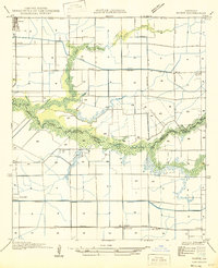
(169)- 1932 Map of Abbeville SW
 1932 Abbeville SW1932 Print · USGSCovers Vermilion Parish, including Esther, Intracoastal City, and other nearby areas
 - 1932 Map of Constance Bayou NE
 1932 Constance Bayou NE1932 Print · USGSCovers Vermilion Parish, including Cameron Parish, United States, and other nearby areas2 unique versions available
 - 1932 Map of Abbeville SE
 1932 Abbeville SE1932 Print · USGSCovers Vermilion Parish, including United States, Louisiana, and other nearby areas
 - 1932 Map of Abbeville NE
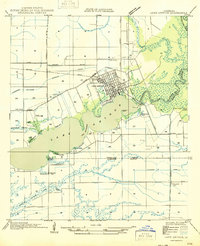
 1932 Abbeville NE1932 Print · USGSCovers Vermilion Parish, including Abbeville, Erath, and other nearby areas
 - 1932 Map of Pecan Island SE
 1932 Pecan Island SE1932 Print · USGSCovers Vermilion Parish, including United States, Louisiana, and other nearby areas
 - 1932 Map of Abbeville NW
 1932 Abbeville NW1932 Print · USGSCovers Vermilion Parish, including Abbeville, Mouton Cove, and other nearby areas
 - 1932 Map of Pecan Island SW
 1932 Pecan Island SW1932 Print · USGSCovers Vermilion Parish, including United States, Louisiana, and other nearby areas
 - 1932 Map of Constance Bayou SE
 1932 Constance Bayou SE1932 Print · USGSCovers Vermilion Parish, including Cameron Parish, United States, and other nearby areas
 - 1934 Map of Duson
 1934 Duson1934 Print · USGSCovers Vermilion Parish, including Rayne, Scott, and other nearby areas
 - 1937 Map of Derouen, 1963 Print
 1937 Derouen1963 Print · USGSCovers Vermilion Parish, including New Iberia, Avery Island, and other nearby areas
 - 1939 Map of St. Martinsville, 1946 Print
 1939 St. Martinsville1946 Print · USGSCovers Vermilion Parish, including Lafayette, New Iberia, and other nearby areas2 unique versions available
 - 1945 Map of New Orleans
 1945 New Orleans1945 Print · USGSCovers Vermilion Parish, including New Orleans, Metairie, and other nearby areas
 - 1945 Map of Pecan Island NW
 1945 Pecan Island NW1945 Print · USGSCovers Vermilion Parish, including Pecan Island, United States, and other nearby areas
 - 1945 Map of Pecan Island NE
 1945 Pecan Island NE1945 Print · USGSCovers Vermilion Parish, including United States, Louisiana, and other nearby areas
 - 1946 Map of Redfish Point SW
 1946 Redfish Point SW1946 Print · USGSCovers Vermilion Parish, including Cheniere au Tigre, United States, and other nearby areas
 - 1946 Map of Milton
 1946 Milton1946 Print · USGSCovers Vermilion Parish, including Lafayette, Youngsville, and other nearby areas
 - 1946 Map of Morse
 1946 Morse1946 Print · USGSCovers Vermilion Parish, including Gueydan, Morse, and other nearby areas
 - 1946 Map of Schooner Bayou SE
 1946 Schooner Bayou SE1946 Print · USGSCovers Vermilion Parish, including Forked Island, United States, and other nearby areas
 - 1946 Map of Redfish Point NE
 1946 Redfish Point NE1946 Print · USGSCovers Vermilion Parish, including United States, Louisiana, and other nearby areas
 - 1946 Map of Leroy
 1946 Leroy1946 Print · USGSCovers Vermilion Parish, including Maurice, Leroy, and other nearby areas
 - 1946 Map of Schooner Bayou NE
 1946 Schooner Bayou NE1946 Print · USGSCovers Vermilion Parish, including Kaplan, United States, and other nearby areas
 - 1946 Map of Redfish Point SE
 1946 Redfish Point SE1946 Print · USGSCovers Vermilion Parish, including Iberia Parish, United States, and other nearby areas
 - 1946 Map of Redfish Point NW
 1946 Redfish Point NW1946 Print · USGSCovers Vermilion Parish, including United States, Louisiana, and other nearby areas
 - 1946 Map of Lake Arthur
 1946 Lake Arthur1946 Print · USGSCovers Vermilion Parish, including Lake Arthur, Laurents Point, and other nearby areas
 - 1946 Map of Schooner Bayou NW
 1946 Schooner Bayou NW1946 Print · USGSCovers Vermilion Parish, including Marceaux, United States, and other nearby areas
Showing maps 1-25 of 169
Top cities of Vermilion Parish
- Abbeville historical maps
- Kaplan historical maps
- Erath historical maps
- Gueydan historical maps
- Maurice historical maps
Frequently asked questions
- What are the different types of historical maps available for Vermilion Parish?
- What is the oldest map of Vermilion Parish?
- Where can I purchase historical maps of Vermilion Parish for my home or office?
- Where can I download high-res historical maps of Vermilion Parish?
- Are there historical topographic maps available for Vermilion Parish?
- Is there historical aerial imagery available for Vermilion Parish?
- Where are historical maps of Vermilion Parish sourced from?