1940s Maps of Washington Parish, Louisiana
Explore 9 historic maps of Washington Parish from the 1940s. These maps offer a rare glimpse into what life looked like during the 1940s — showing old roads, neighborhoods, homes, and landmarks that have changed or disappeared over time.
Whether you're researching your family's past, planning a metal detecting trip, or studying how Washington Parish's landscape evolved across the 1940s, these high-resolution maps are a powerful tool for exploring the history of this region.
- Focus on a specific era: All maps on this page are from the 1940s, giving you a focused view of this time period.
- See what’s changed: Compare century-old streets, trails, and buildings to today's modern landscape using overlays and satellite layers.
- Research with precision: Use these maps for genealogy, historical research, land use analysis, or educational projects.
- View, download, or print: Maps are fully viewable online in high resolution, and can be downloaded or printed for your own records.
Start exploring Washington Parish's history through authentic maps from the 1940s. This is your window into the past.
Washington Parish, LA maps
(9)- 1942 Map of Husser
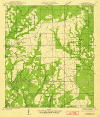
 1942 Husser1942 Print · USGSIn the early 1940s, the rural reaches of Tangipahoa Parish were a patchwork of small schools, family cemeteries, and winding creeks. Genealogists and local historians can trace community roots through sites like Stevens Cem, St Dominic Sch, and Sudville Ch.
 - 1942 Map of Thigpen
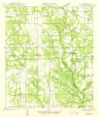
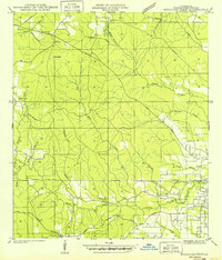
 1942 Thigpen1942 Print · USGSWashington Parish in the early 1940s is a landscape of rural family holdings and creek-side settlements. Genealogists can locate numerous family burial grounds including Magee Cem and Spencer Cem, alongside landmarks like Sheridan Store.2 unique versions available
 - 1942 Map of Wilmer
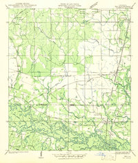
 1942 Wilmer1942 Print · USGSTangipahoa and Washington Parishes are shown in detail during the early 1940s, split by the winding Chefuncte River. Family historians can locate numerous rural burial grounds and churches such as Brumfield Cem, Cutrer Sch, and Sacred Heart Ch.
 - 1942 Map of Rio
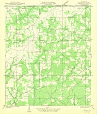
 1942 Rio1942 Print · USGSThe borderlands of Washington and St. Tammany Parishes are captured here in the early 1940s as the Bogue Chitto River winds through the southern woods. Researchers can locate many family-named landmarks including the Old Magee Cem, Rosenwald Sch, and the rail stop at Rio.
 - 1942 Map of Pools Bluff
 1942 Pools Bluff1942 Print · USGSThe Pearl River bottomlands at the start of the 1940s reveal a landscape of dense bayous and isolated river settlements. Genealogists can locate family burial grounds like Sheridan Cem and Morris Cem, or trace early transit routes such as the Float Road.
 - 1942 Map of Thomas
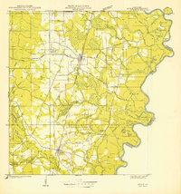
 1942 Thomas1942 Print · USGSWashington Parish at the start of the 1940s is captured here as a network of rural crossroads and family homesteads along the Mississippi border. Genealogists can trace the locations of family-named landmarks like Schilling Cem, Black Jack Sch, and the community of Hackley.
 - 1949 Map of Bogalusa East
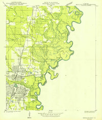 1949 Bogalusa East1949 Print · USGSThe industrial city of Bogalusa sits at the edge of the Pearl River bottomlands in the late 1940s. Researchers can trace the city's growth from Goodyear Park to the Gulf Mobile and Ohio rail lines, or locate family plots at Gann Cem and Adams Cem.
 - 1949 Map of Angie
 1949 Angie1949 Print · USGSNear the Pearl River in the late 1940s, this area of Washington Parish shows a landscape of timber and rail. Genealogists can locate family-named sites like Pleasant Valley Cem, Wesley Ray High Sch, and the community of Varnado.
 - 1949 Map of Bogalusa West
 1949 Bogalusa West1949 Print · USGSThe piney woods of Washington Parish appear here in the decade following the Great Depression, showing a landscape shaped by timber and small communities. Researchers can locate family burial grounds like Mc Ghee Cem, the Ben Ford Sch, and the Sheridan Fire Tower.
End of results
Showing maps 1-9 of 9
Top cities of Washington Parish
Frequently asked questions
- What are the different types of historical maps available for Washington Parish?
- What is the oldest map of Washington Parish?
- Where can I purchase historical maps of Washington Parish for my home or office?
- Where can I download high-res historical maps of Washington Parish?
- Are there historical topographic maps available for Washington Parish?
- Is there historical aerial imagery available for Washington Parish?
- Where are historical maps of Washington Parish sourced from?