1980s Maps of Washington Parish, Louisiana
Explore 21 historic maps of Washington Parish from the 1980s. These maps offer a rare glimpse into what life looked like during the 1980s — showing old roads, neighborhoods, homes, and landmarks that have changed or disappeared over time.
Whether you're researching your family's past, planning a metal detecting trip, or studying how Washington Parish's landscape evolved across the 1980s, these high-resolution maps are a powerful tool for exploring the history of this region.
- Focus on a specific era: All maps on this page are from the 1980s, giving you a focused view of this time period.
- See what’s changed: Compare century-old streets, trails, and buildings to today's modern landscape using overlays and satellite layers.
- Research with precision: Use these maps for genealogy, historical research, land use analysis, or educational projects.
- View, download, or print: Maps are fully viewable online in high resolution, and can be downloaded or printed for your own records.
Start exploring Washington Parish's history through authentic maps from the 1980s. This is your window into the past.
Washington Parish, LA maps
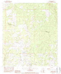
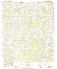
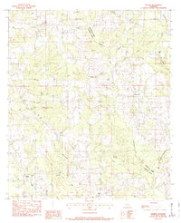
(21)- 1982 Map of Bogalusa West
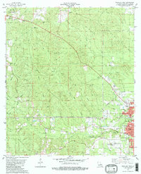 1982 Bogalusa West1982 Print · USGSThe growing city of Bogalusa and the rural reaches of Washington Parish are captured here in the early eighties. Researchers can trace family history through local sites like the Denhamtown School, Sheridan Lookout Tower, and Plainview Cemetery.2 unique versions available
 - 1982 Map of Bogalusa East
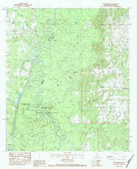
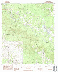
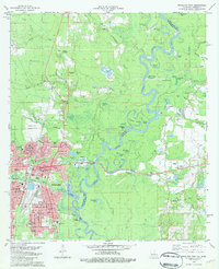 1982 Bogalusa East1982 Print · USGSBogalusa sits at the confluence of industry and nature in the early eighties as the Pearl River meanders along the state line. Genealogists can trace family names at Ponemah Cemetery, Miley Cem, and the rural crossing at Piggott Crossing.2 unique versions available
 - 1982 Map of Angie
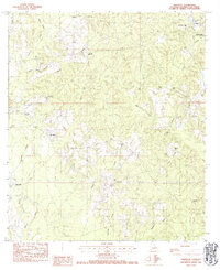
 1982 Angie1982 Print · USGSThe Louisiana-Mississippi border near the Pearl River shows a landscape of small rail-side settlements and rural parishes in the early eighties. Genealogists can locate family landmarks like Bonnie Cem, Marys Chapel, and Wesley Ray Ch along the rail corridor.
 - 1982 Map of State Line
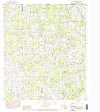
 1982 State Line1982 Print · USGSThe Louisiana-Mississippi borderlands come alive in the early eighties as a network of timberlands and rural family settlements. Genealogists can trace deep roots through dozens of local landmarks like Muster Ground Cem, Baughman, and Briarwood Ch.
 - 1983 Map of Amite
 1983 Amite1983 Print · USGSThe Florida Parishes and southern Mississippi are captured here in the early 1980s, centered on the Illinois Central Gulf rail corridor. Genealogists and historians can trace family-named sites like the Camp Moore Confederate Cem, Magnolia Ch, and the Idlewild Plantation (State University).
 - 1983 Map of Folsom, 1984 Print
 1983 Folsom1984 Print · USGSThe rural landscape of St. Tammany Parish comes to life in the early 1980s as Folsom and its surrounding homesteads are meticulously documented. Researchers can trace family sites near Stafford Cem or find local landmarks like Lee Hill Ch and New Hope Ch.
 - 1983 Map of Henleyfield, 1984 Print
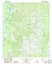
 1983 Henleyfield1984 Print · USGSThe Pearl River and Bogue Chitto bottomlands are captured here in the early 1980s. Genealogists can trace family names at Henleyfield Cem and Sheridan Cem, while outdoor historians can locate Hells Gate and Lock No 3.2 unique versions available
 - 1983 Map of Sheridan, 1984 Print
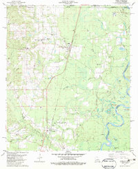
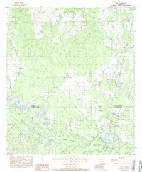
 1983 Sheridan1984 Print · USGSWashington Parish at the start of the eighties is characterized by its quiet rural settlements and winding creek bottoms. Genealogists can locate numerous family burial sites like Jenkins Cem and Thigpen Cem or community landmarks like Poplarhead Ch.
 - 1983 Map of Mount Hermon, 1984 Print
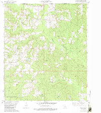
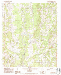
 1983 Mount Hermon1984 Print · USGSWashington Parish at the start of the 1980s reveals a landscape of quiet timberland and ancestral family plots. Genealogists and local historians can trace legacy sites like McElveen Cem, James Chapel, and the Sunny Hill Lookout Tower.
 - 1983 Map of Pine, 1984 Print
 1983 Pine1984 Print · USGSThe rural borderlands of Washington Parish and Mississippi appear in this early 1980s survey, showing a landscape of family cemeteries and creek forks. Genealogists can trace family names at Magee Cem and Schilling Cem or locate the old Missionary Ch near Pine.
 - 1983 Map of Clifton, 1984 Print
 1983 Clifton1984 Print · USGSWashington Parish at the start of the eighties shows a rural landscape shaped by the Bogue Chitto and a thriving gravel industry. Genealogists can trace family names across numerous sites like Brumfield Cem, Clifton, and New Jerusalem Ch.
 - 1983 Map of Franklinton, 1984 Print
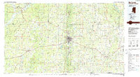
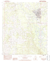 1983 Franklinton1984 Print · USGSFranklinton and the surrounding Washington Parish countryside are captured in the early eighties as a landscape of rural settlements and family homesteads. Researchers can trace local lineages through Sweet Home Cem, Corkern Cem, and the church at Canaan Ch.2 unique versions available
 - 1983 Map of Sun, 1984 Print
 1983 Sun1984 Print · USGSThe Bogue Chitto River lowlands of St. Tammany Parish are shown here in the early 1980s, revealing a landscape of winding sloughs and rail-side settlements. Genealogists can trace family landmarks like Hillview Memorial Gardens, Jerusalem Ch, and Lock No 3.
 - 1983 Map of Wilmer, 1984 Print
 1983 Wilmer1984 Print · USGSTangipahoa Parish in the early eighties maintains its rural character along the Tchefuncta River and the neighboring piney woods. Genealogists and local historians can trace dozens of family sites like Brumfield Cem and Walker Cem or locate the Wilmer Church.
 - 1983 Map of Enon, 1984 Print
 1983 Enon1984 Print · USGSSoutheastern Louisiana in the early 1980s reveals a landscape of family-named cemeteries and creek-side settlements. Genealogists can trace rural family roots at Magee Cem and Adams Cem or locate the historic Enon Lookout Tower.
 - 1984 Map of Hattiesburg
 1984 Hattiesburg1984 Print · USGSSouth Mississippi’s Pine Belt is seen here in the mid-eighties, showing the region as a hub of timber production and petroleum extraction. Trace the rail lines of the Illinois Central Gulf RR through old settlements like Richton or the energy developments at the Heidelberg Oil Field.2 unique versions available
 - 1984 Map of Bogalusa
 1984 Bogalusa1984 Print · USGSThe Pearl River basin on the Louisiana-Mississippi border comes into focus in the mid-1980s, showcasing a landscape of river-bottom swamps and timberlands. Local researchers can trace the growth of Bogalusa and Picayune or find rural landmarks like Macedonia Ch and Wheat Swamp.
 - 1984 Map of Mobile
 1984 Mobile1984 Print · USGSThe Gulf Coast at the height of the mid-eighties shows a landscape of rapid industrial growth and military significance. Researchers can trace the sprawling rail lines of the Illinois Central Gulf RR, locate the NASA Test Facility, or study the barrier island chain from Cat Island to Petit Bois Island.3 unique versions available
 - 1984 Map of Hattiesburg
 1984 Hattiesburg1984 Print · USGSSouth Mississippi’s timber and military heartland comes into focus during the mid-eighties, centering on the hub of Hattiesburg and the winding Pearl River. Researchers can trace the rail lines of the Illinois Central Gulf through old towns like Bassfield and Sumrall, or locate rural landmarks like Society Hill Ch.
 - 1984 Map of McComb
 1984 McComb1984 Print · USGSSouth Mississippi in the mid-eighties was defined by the rail corridor connecting McComb and Magnolia to the surrounding timberlands. You can trace the rural network of Pike County through landmarks like Holmesville, Percy Quin State Park, and the winding Bogue Chitto.
 - 1986 Map of Fords Creek
 1986 Fords Creek1986 Print · USGSThe Pearl River forms the border between Mississippi and Louisiana in the mid-1980s, carving a landscape of oxbow lakes and bottomlands. Researchers can trace rural landmarks like Hunt Bluff, several Cem sites, and family-named waters including John Henry Lake.
End of results
Showing maps 1-21 of 21
Top cities of Washington Parish
Frequently asked questions
- What are the different types of historical maps available for Washington Parish?
- What is the oldest map of Washington Parish?
- Where can I purchase historical maps of Washington Parish for my home or office?
- Where can I download high-res historical maps of Washington Parish?
- Are there historical topographic maps available for Washington Parish?
- Is there historical aerial imagery available for Washington Parish?
- Where are historical maps of Washington Parish sourced from?