1900s (20th Century) Maps of Franklinton, Louisiana
Explore 12 historic maps of Franklinton from the 1900s (20th Century). These maps offer a rare glimpse into what life looked like during the 1900s — showing old roads, neighborhoods, homes, and landmarks that have changed or disappeared over time.
Whether you're researching your family's past, planning a metal detecting trip, or studying how Franklinton's landscape evolved across the 1900s, these high-resolution maps are a powerful tool for exploring the history of this region.
- Focus on a specific era: All maps on this page are from the 1900s, giving you a focused view of this time period.
- See what’s changed: Compare century-old streets, trails, and buildings to today's modern landscape using overlays and satellite layers.
- Research with precision: Use these maps for genealogy, historical research, land use analysis, or educational projects.
- View, download, or print: Maps are fully viewable online in high resolution, and can be downloaded or printed for your own records.
Start exploring Franklinton's history through authentic maps from the 1900s. This is your window into the past.
Franklinton, LA maps
(12)- 1942 Map of Thigpen
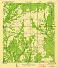 1942 Thigpen1942 Print · USGSWashington Parish in the early 1940s is a landscape of rural family holdings and creek-side settlements. Genealogists can locate numerous family burial grounds including Magee Cem and Spencer Cem, alongside landmarks like Sheridan Store.2 unique versions available
 - 1950 Map of Franklinton
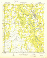 1950 Franklinton1950 Print · USGSMid-century Washington Parish comes to life through this detailed survey of the area surrounding the Bogue Chitto River. Researchers can trace family history at sites like Bickham Cem, Sunlight Ch-, and the Bellevue Sch during a time when small communities like Jenkins were still prominently mapped.
 - 1954 Map of Baton Rouge, 1974 Print
 1954 Baton Rouge1974 Print · USGSSoutheast Louisiana in the mid-fifties is captured here during a period of transition for its river and rail economies. Researchers can trace the path of the Mississippi River and find landmarks like the Bonnet Carre Spillway and Bayou Plaquemine.2 unique versions available
 - 1956 Map of Baton Rouge
 1956 Baton Rouge1956 Print · USGSSouth Louisiana at the height of the mid-century oil boom shows a landscape of river oxbows and rising industry. Researchers can trace family roots through river towns like Scotlandville or locate early industrial sites and Oil wells near Lake Maurepas.
 - 1958 Map of Franklinton, 1959 Print
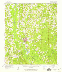 1958 Franklinton1959 Print · USGSWashington Parish in the late fifties is captured here as a landscape of timber, rails, and rural kinship. Genealogists can locate family landmarks like the Brumfield Cem and Magee Cem, or trace the path of the Gulf Mobile and Ohio through Franklinton.3 unique versions available
 - 1961 Map of Baton Rouge, 1966 Print
 1961 Baton Rouge1966 Print · USGSSoutheastern Louisiana in the early sixties remains a landscape of deep river bends and sprawling coastal lakes. Genealogists and historians can trace the rail-and-river economy through landmarks like Free-Nigger Point, Donaldsonville, and the Illinois Central Railroad.
 - 1962 Map of Baton Rouge
 1962 Baton Rouge1962 Print · USGSSouth Louisiana in the early sixties reveals a landscape of river-bend parishes and emerging interstate corridors. Genealogists and historians can trace family roots through historic river towns like Donaldsonville and Plaquemine, or follow the path of the Illinois Central Railroad through the swamp basins.
 - 1976 Map of Franklinton SE, 1977 Print
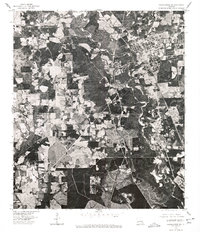
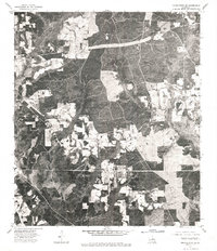 1976 Franklinton SE1977 Print · USGSWashington Parish in the mid-seventies is revealed through direct aerial imagery in this specialized orthophotomap. Researchers can examine the physical layout of the Sheridan settlement and trace the exact footprint of forest clearings and rural homesteads.
 - 1976 Map of Franklinton SW, 1977 Print
 1976 Franklinton SW1977 Print · USGSWashington Parish at the height of the 1970s is captured here through detailed aerial photography, showing the town of Franklinton and the surrounding river bottomlands. Researchers can trace the winding course of the Bogue Chitto and examine the clear-cut edges of rural homesteads and timber operations.
 - 1983 Map of Amite
 1983 Amite1983 Print · USGSThe Florida Parishes and southern Mississippi are captured here in the early 1980s, centered on the Illinois Central Gulf rail corridor. Genealogists and historians can trace family-named sites like the Camp Moore Confederate Cem, Magnolia Ch, and the Idlewild Plantation (State University).
 - 1983 Map of Sheridan, 1984 Print
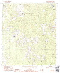 1983 Sheridan1984 Print · USGSWashington Parish at the start of the eighties is characterized by its quiet rural settlements and winding creek bottoms. Genealogists can locate numerous family burial sites like Jenkins Cem and Thigpen Cem or community landmarks like Poplarhead Ch.
 - 1983 Map of Franklinton, 1984 Print
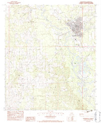 1983 Franklinton1984 Print · USGSFranklinton and the surrounding Washington Parish countryside are captured in the early eighties as a landscape of rural settlements and family homesteads. Researchers can trace local lineages through Sweet Home Cem, Corkern Cem, and the church at Canaan Ch.2 unique versions available
End of results
Showing maps 1-12 of 12
Top cities near Franklinton
Frequently asked questions
- What are the different types of historical maps available for Franklinton?
- What is the oldest map of Franklinton?
- Where can I purchase historical maps of Franklinton for my home or office?
- Where can I download high-res historical maps of Franklinton?
- Are there historical topographic maps available for Franklinton?
- Is there historical aerial imagery available for Franklinton?
- Where are historical maps of Franklinton sourced from?