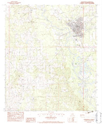
1983 Map of Franklinton
USGS Topo · Published 1984About this map
Franklinton sits as the central hub of this Washington Parish survey, positioned where the Bogue Chitto river winds past the town's grid. The landscape is defined by the winding river valley and numerous smaller tributaries like Mile Creek and Daniel Branch. This 1983 edition captures a dense network of family-named cemeteries and rural churches that reflect the area's genealogical depth, including Magee Cem, Stafford Cem, and Sweet Rest Cem. Small settlements such as Wildblood, Bickham, and Jenkins are connected by a web of local roads, while Bowling Green High Sch marks a key educational landmark for the parish. The map reveals the balance between the established town center and the surrounding rural communities like Bonner and Richardson, providing a clear view of the settlement patterns before modern expansion altered the rural character of the parish.
Find a feature on this map
40 named features on this map. Tap any name to fly to it.
Don’t see what you’re looking for? This feature index may not catch every label — zoom into the map to look around manually.
Map Details
Editions of this 1983 Franklinton Map
2 editions found
Other maps of this area

1939 · Zona
USGS Topo · 1:31,680

1939 · Sunny Hill
USGS Topo · 1:31,680

1939 · Clifton
USGS Topo · 1:31,680

1942 · Husser
USGS Topo · 1:31,680

1942 · Thigpen
USGS Topo · 1:31,680

1942 · Wilmer
USGS Topo · 1:31,680

1942 · Thomas
USGS Topo · 1:31,680

1950 · Folsom
USGS Topo · 1:31,680

1950 · Franklinton
USGS Topo · 1:31,680

1954 · Folsom
USGS Topo · 1:62,500