1980s Maps of Cumberland County, Maine
Explore 20 historic maps of Cumberland County from the 1980s. These maps offer a rare glimpse into what life looked like during the 1980s — showing old roads, neighborhoods, homes, and landmarks that have changed or disappeared over time.
Whether you're researching your family's past, planning a metal detecting trip, or studying how Cumberland County's landscape evolved across the 1980s, these high-resolution maps are a powerful tool for exploring the history of this region.
- Focus on a specific era: All maps on this page are from the 1980s, giving you a focused view of this time period.
- See what’s changed: Compare century-old streets, trails, and buildings to today's modern landscape using overlays and satellite layers.
- Research with precision: Use these maps for genealogy, historical research, land use analysis, or educational projects.
- View, download, or print: Maps are fully viewable online in high resolution, and can be downloaded or printed for your own records.
Start exploring Cumberland County's history through authentic maps from the 1980s. This is your window into the past.
Cumberland County, ME maps
(20)- 1980 Map of Brunswick
 1980 Brunswick1980 Print · USGSCoastal Maine transitions from the academic halls of Brunswick to the tidal flats of Merrymeeting Bay in the early eighties. Genealogists and historians can trace family plots at Riverside Cem or locate the sprawling Brunswick Naval Air Station.3 unique versions available
 - 1980 Map of Bath
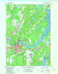
 1980 Bath1980 Print · USGSMid-coast Maine’s maritime heritage is on full display here in the early eighties, centered on the historic shipbuilding hub of BATH. Researchers can trace old family names at Oak Grove Cem or locate former school sites like Dike Sch and Morse High Sch.3 unique versions available
 - 1980 Map of Gray, 1981 Print
 1980 Gray1981 Print · USGSThe Gray and New Gloucester area in the early eighties shows a transition from rural landscape to modern thoroughfare. Researchers can trace the layout of Shaker Village, the Pineland Hospital and Training Center, and old rail stops at Intervale.3 unique versions available
 - 1981 Map of Raymond
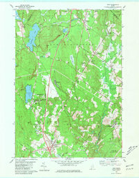
 1981 Raymond1981 Print · USGSThe Lakes Region of Maine is captured here in the early 1980s as seasonal recreation and local heritage intersect. Researchers can trace family roots at Riverside Cemetery or locate landmarks like Union Chapel, Suckerville, and the Jordan-Small School.3 unique versions available
 - 1981 Map of Mechanic Falls
 1981 Mechanic Falls1981 Print · USGSAndroscoggin County comes to life in the early 1980s as a region of mills, rails, and recreational waters. Genealogists and local historians can trace the foundations of Mechanic Falls or locate the White Oak Hill Ch and Tenney Cem near the shores of Tripp Pond.
 - 1981 Map of Minot
 1981 Minot1981 Print · USGSIn the early eighties, the river valleys and hilltops of Androscoggin County show a landscape shaped by rail, water, and early aviation. Genealogists and historians can trace family locations through Mt Auburn Cem, locate the Moussam Sch, or follow the Maine Central railroad line through Danville.
 - 1983 Map of Norway
 1983 Norway1983 Print · USGSThe twin villages of Norway and South Paris are captured in the early 1980s, showcasing the area's transition from its industrial roots to a lakeside community. Researchers can trace the Canadian National rail line and locate genealogical sites like Pine Grove Cem and Otisfield Gore.
 - 1983 Map of Steep Falls, 1984 Print
 1983 Steep Falls1984 Print · USGSMaine's riverfront settlements and family farmsteads are detailed here in the early 1980s. Genealogists can locate numerous family burial sites like Emerson-Thorne Cem and Lord Cem, or trace the winding Saco River past Steep Falls.2 unique versions available
 - 1983 Map of Waterford Flat, 1984 Print
 1983 Waterford Flat1984 Print · USGSOxford County in the early eighties preserves a landscape of quiet village centers and deep-woods summer camps. Genealogists can trace family lines at Bisbee Town Cem and Pim Vale Cem, or locate historic hubs like Waterford Flat and Sodom.
 - 1983 Map of Casco, 1984 Print
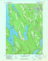
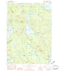
 1983 Casco1984 Print · USGSCumberland County’s lakes and ridges are captured here in the early 1980s, showcasing the rural character of Otisfield and Casco. Genealogists and local historians can locate early landmarks like Bell Hill Meeting House, Scribners Mill, and the Otisfield Central School.
 - 1983 Map of Standish, 1984 Print
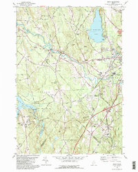
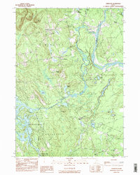
 1983 Standish1984 Print · USGSThe Saco River valley in the early 1980s reveals a network of rural hamlets and small-town Maine life before modern expansion. Genealogists and local historians can trace family locations through numerous sites like Meeting House Hill Cem, Shaw Mills, and Tylers Corner.
 - 1983 Map of Sebago Lake, 1984 Print
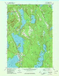
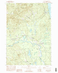
 1983 Sebago Lake1984 Print · USGSCumberland County’s lakefront and forest lands are documented here during the early eighties, capturing the character of Standish and Raymond. Researchers can trace the Maine Central rail line and locate community staples like Richville, the Johnson Sch, and Friendship Cem.2 unique versions available
 - 1983 Map of North Sebago, 1984 Print
 1983 North Sebago1984 Print · USGSThe Sebago and Bridgton area in the early eighties shows a rural landscape of inland lakes and high ridges before modern expansion. Researchers can find dozens of family burial sites like Haley Cem and trace old routes through Sebago Center and Convene.3 unique versions available
 - 1983 Map of Limington, 1984 Print
 1983 Limington1984 Print · USGSYork County in the early eighties shows a landscape of traditional river settlements and new lakeside growth. Genealogists and local historians can locate Chadbournes Mills, the Emory Mem Sch, and family landmarks near Higgins Corner.2 unique versions available
 - 1983 Map of Bridgton, 1984 Print
 1983 Bridgton1984 Print · USGSThe Maine lakes region in the early eighties is captured here, centered on the village of Bridgton between Long Lake and Highland Lake. Genealogists can trace family lines through several burial grounds like Ridge Cem and Trafton Cem or locate the old Maple Ridge Sch.
 - 1983 Map of Naples, 1984 Print
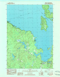
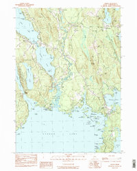 1983 Naples1984 Print · USGSThe Cumberland County lake country shows its late-century character through the intricate waterway system connecting Long Lake and Sebago Lake. Genealogists and local historians can trace family burial sites like Maxfield Cem and Skinner Cem near the historic Songo Lock.3 unique versions available
 - 1985 Map of Bath, 1986 Print
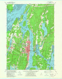
 1985 Bath1986 Print · USGSMidcoast Maine in the mid-eighties shows a landscape of deep-water harbors and strategic military installations. Researchers can trace the coastal rail lines of the Maine Central RR and locate landmarks from Popham Beach to the remote Monhegan Plantation.2 unique versions available
 - 1985 Map of Kittery, 1986 Print
 1985 Kittery1986 Print · USGSThe Maine and New Hampshire borderlands are shown here in the mid-eighties, centered on the strategic Piscataqua River harbor. Genealogists and historians can trace the development of coastal towns like York or locate the sprawling Portsmouth Naval Shipyard and Pease Air Force Base.2 unique versions available
 - 1985 Map of Portland, 1986 Print
 1985 Portland1986 Print · USGSThe Maine coast and Sebago Lake region are captured in the mid-1980s, showcasing the transition from traditional maritime centers to a modern transportation hub. Genealogists and historians can trace rail lines like the Grand Trunk RR and find local landmarks such as the U.S. Marine Hospital or Old Orchard Beach.2 unique versions available
 - 1986 Map of Lewiston
 1986 Lewiston1986 Print · USGSMaine’s industrial river valleys and western mountain foothills are captured here in the mid-eighties as rail and road networks tied the region together. Genealogists and historians can trace the development of mill towns and lakefront settlements from Lisbon to Bethel, following the Androscoggin River and the path of the Maine Central Railroad.2 unique versions available
End of results
Showing maps 1-20 of 20
Top cities of Cumberland County
- Portland historical maps
- South Portland historical maps
- Scarborough historical maps
- Brunswick historical maps
- Westbrook historical maps
- Windham historical maps
See more
Frequently asked questions
- What are the different types of historical maps available for Cumberland County?
- What is the oldest map of Cumberland County?
- Where can I purchase historical maps of Cumberland County for my home or office?
- Where can I download high-res historical maps of Cumberland County?
- Are there historical topographic maps available for Cumberland County?
- Is there historical aerial imagery available for Cumberland County?
- Where are historical maps of Cumberland County sourced from?