Old Maps of Penobscot, Maine for Metal Detecting
Plan your next treasure hunt with 60 historic maps of Penobscot. Find old homesites, ghost towns, trails, and gathering spots that may be lost to time — perfect for identifying promising metal detecting locations.
- Locate forgotten sites: Uncover places like long-lost settlements, abandoned rail lines, or gathering spots.
- Plan better hunts: Use map overlays combined with LiDAR or satellite views to narrow in on historically rich areas.
- Made for detectorists: Thousands of hobbyists use these maps to discover relics, coins, and hidden history.
Use these historic maps to boost your research and find new opportunities beneath the surface of Penobscot.
Penobscot, ME maps
(60)- 1900 Map of Orland
 1900 Orland1900 Print · USGSMaine's interior hills and glacial lakes are shown in detail at the turn of the century as the rail lines reached into Hancock County. Trace the development of small settlements like East Orland and Dedham, or locate the early U.S. Fish Hatchery near Green Lake.6 unique versions available
 - 1900 Map of Bucksport
 1900 Bucksport1900 Print · USGSThe Penobscot River corridor is captured here at the turn of the century as a vital artery for rail, river, and granite industries. Genealogists and historians can trace family-named corners and landmarks like Fort Knox, the Quarry at Mt Waldo, and Prospect Ferry.
 - 1902 Map of Bucksport
 1902 Bucksport1902 Print · USGSCoastal Maine at the turn of the century centered on the maritime and rail traffic of the Penobscot River valley. Genealogists and historians can trace old family settlements from Newburg Village to Orrington, alongside industrial landmarks like the Quarry and the historic fortifications at Fort Knox.6 unique versions available
 - 1902 Map of Castine
 1902 Castine1902 Print · USGSPenobscot Bay at the dawn of the 1900s shows a thriving maritime landscape of island settlements and harbor towns. Genealogists and historians can trace old homesteads and coastal landmarks near Ft. George, Northport Camp Ground, and the various landings of Islesboro.
 - 1904 Map of Castine
 1904 Castine1904 Print · USGSPenobscot Bay at the turn of the century shows a maritime landscape of bustling ports and emerging summer colonies. Genealogists and historians can trace old coastal settlements like Castine, locate the grounds of Ft. George, and follow the Steamboat Routes that linked the mainland to Dark Harbor.7 unique versions available
 - 1904 Map of Bluehill
 1904 Bluehill1904 Print · USGSCoastal Hancock County at the turn of the century shows a maritime landscape of interconnected peninsulas and island settlements. Genealogists can trace family lines in Sedgwick, Brooksville, and Bluehill, or locate landmarks like Bluehill Mineral Spring and the STEAMBOAT landing at Haven.5 unique versions available
 - 1905 Map of Penobscot Bay
 1905 Penobscot Bay1905 Print · USGSThe Maine coastline at the dawn of the twentieth century was a bustling network of maritime trade and summer retreats. Genealogists and historians can trace the foundations of coastal life through the STEAMBOAT ROUTE, the Northport Camp Ground, and settlements like Sargentville.3 unique versions available
 - 1941 Map of Castine, 1959 Print
 1941 Castine1959 Print · USGSPenobscot Bay and its storied coastal villages appear here in the early 1940s, showing the intersection of maritime trade and rural Maine life. Genealogists and historians can trace the rail terminals at Mack Pt, local schools like Park Sch, and the historical site of Fort George.4 unique versions available
 - 1942 Map of Orland
 1942 Orland1942 Print · USGSIn the early 1940s, the rugged interior between the Penobscot River and Ellsworth was a landscape of high summits and conservation-focused industry. Genealogists and historians can trace old homesteads and landmarks like Bucks Mills, the U S Fish Hatchery, and the scattered settlements of East Orland and North Ellsworth.
 - 1942 Map of Bucksport
 1942 Bucksport1942 Print · USGSThe mid-century Penobscot River valley is captured here just as the river-and-rail economy defined local life. Genealogists and historians can trace family-named crossroads like Nealeys Corner and Ellingwoods Corner or locate the landmark Fort Knox and Prospect Ferry.
 - 1943 Map of Castine
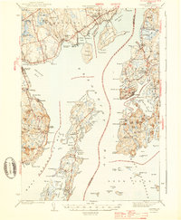 1943 Castine1943 Print · USGSMid-century Penobscot Bay life is charted here during the early 1940s, from the historic streets of the mainland to the isolated island harbors. Genealogists can trace family connections at Bethany Chapel or locate the old Farnham Sch and the rail depot at Searsport Sta.3 unique versions available
 - 1944 Map of Blue Hill
 1944 Blue Hill1944 Print · USGSHancock County’s rugged coastline and seafaring villages are captured here in the mid-1940s, just as modern infrastructure began to bridge these isolated peninsulas. Genealogists can trace family roots through sites like Hilltop Cem, the Grays Corner Sch, and the Deer Isle-Sedgwick Bridge.3 unique versions available
 - 1948 Map of Bangor
 1948 Bangor1948 Print · USGSThe Maine coast and its industrial river valleys are captured here shortly after the war, showing the vital shipping and rail hubs of the late 1940s. Genealogists and historians can trace the tracks of the Maine Central RR connecting Bangor, Augusta, and Old Town.
 - 1948 Map of Bucksport
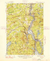 1948 Bucksport1948 Print · USGSMid-coast Maine at the end of the 1940s reveals a bustling corridor of river commerce and rail transport along the Penobscot River. Researchers can trace old family lines at Wiswell Cem, locate the historic Fort Knox State Park, and follow the tracks of the Bangor and Aroostook through towns like Winterport.2 unique versions available
 - 1948 Map of Orland
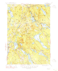 1948 Orland1948 Print · USGSHancock and Penobscot counties are shown here just after the war, when rural hamlets and lakeside retreats defined the landscape. Researchers can locate the Annear Copper Mine, the US Fish Hatchery, and numerous family burial grounds like Evergreen Cemetery.2 unique versions available
 - 1955 Map of Orland, 1956 Print
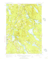 1955 Orland1956 Print · USGSCoastal Maine in the mid-fifties is captured here as a landscape of interconnected ponds and granite ridges. Genealogists and historians can trace family-named landmarks like Condon Hill, locate the U S Fish Hatchery, and find the Annear Copper Mine.4 unique versions available
 - 1955 Map of Bucksport, 1957 Print
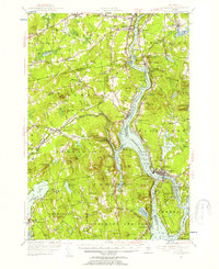 1955 Bucksport1957 Print · USGSThe Penobscot River valley thrives as a rail and maritime corridor during the mid-fifties, anchored by the industrial activities at Mt Waldo. Genealogists and historians can locate legacy family sites including Wiswell Cem, Nealys Corner, and the historic Fort Knox State Park.4 unique versions available
 - 1956 Map of Bangor, 1966 Print
 1956 Bangor1966 Print · USGSMid-century Maine comes alive in this survey of the rugged coast and river valleys during the 1950s. Genealogists and historians can trace the vital rail corridors of the Maine Central RR connecting timber towns like Old Town to the coast at Bar Harbor.3 unique versions available
 - 1957 Map of Blue Hill, 1959 Print
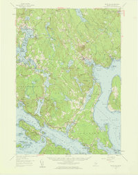 1957 Blue Hill1959 Print · USGSCoastal Hancock County in the late fifties reveals a maritime world of interconnected bays and small village centers. Genealogists and historians can trace family roots through sites like Number Three Chapel, Forest Home Cem, and the old docks at South Blue Hill.4 unique versions available
 - 1960 Map of Bangor
 1960 Bangor1960 Print · USGSCentral Maine in the sixties reveals a landscape of river-powered industry and sprawling coastal island chains. Researchers can trace the rail corridors of the Maine Central or locate mid-century aviation landmarks like Dow Air Force Base.
 - 1961 Map of Bangor
 1961 Bangor1961 Print · USGSMid-century Maine comes alive through its busy river ports and rocky archipelagoes during a period of steady maritime and rail commerce. Researchers can trace the path of the Maine Central railroad and locate coastal landmarks from Acadia National Park to Vinalhaven Island.
 - 1973 Map of Castine, 1977 Print
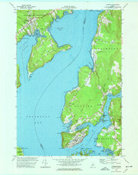 1973 Castine1977 Print · USGSThe Maine coast near the confluence of the Penobscot and Bagaduce Rivers is captured here in the early 1970s. Local historians can trace the foundations of Ft George, the route of the British Canal, and the grounds of the Maritime Academy in Castine.3 unique versions available
 - 1981 Map of Penobscot
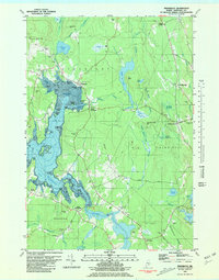 1981 Penobscot1981 Print · USGSThe coastal waters of the Bagaduce River and Northern Bay define this corner of Maine in the early eighties. Researchers can trace historic family burial sites like Leach Cem or locate old settlements at South Penobscot and North Brooksville.2 unique versions available
 - 1981 Map of Blue Hill
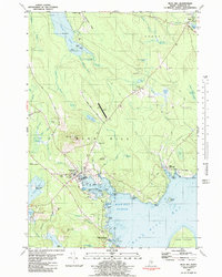 1981 Blue Hill1981 Print · USGSCoastal Maine's maritime and industrial character is preserved here in the early eighties. Researchers can trace family history through the Early Settlers Cemetery or locate landmarks like Stevens Academy and the old Blue Hill Airport.2 unique versions available
 - 1981 Map of Branch Lake, 1982 Print
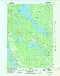 1981 Branch Lake1982 Print · USGSHancock County’s lakelands are captured here in the early 1980s, documenting the rural communities of North Ellsworth and West Surry. Researchers can trace the Maine Central rail line, locate small family plots like Gott Cem, and explore the shoreline of Branch Lake.2 unique versions available
Showing maps 1-25 of 60
Top cities near Penobscot
- Ellsworth historical maps
- Hampden historical maps
- Bucksport historical maps
- Winterport historical maps
- Orrington historical maps
- Blue Hill historical maps
See more
Top neighborhoods of Penobscot
- West Penobscot historical maps
- South Penobscot historical maps
- North Penobscot historical maps
- Marks Corner historical maps
Frequently asked questions
- What are the different types of historical maps available for Penobscot?
- What is the oldest map of Penobscot?
- Where can I purchase historical maps of Penobscot for my home or office?
- Where can I download high-res historical maps of Penobscot?
- Are there historical topographic maps available for Penobscot?
- Is there historical aerial imagery available for Penobscot?
- Where are historical maps of Penobscot sourced from?