Old Maps of Pittston, Maine for Genealogy
Trace your family roots with 30 historic maps of Pittston. These high-res maps reveal old neighborhoods, homesites, landmarks, and streets — helping you uncover where your ancestors lived and how the area evolved over time.
- Explore historic neighborhoods: Identify where your relatives may have lived in the 1800s or 1900s.
- Compare maps over time: Trace the changes in streets, buildings, and landmarks for multi-generational research.
- Perfect for genealogy & ancestry research: Used by family historians and researchers to map out lineage and migration.
These maps are an incredible resource for exploring your personal connection to Pittston's past.
Pittston, ME maps
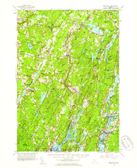
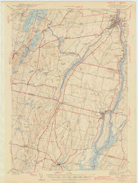
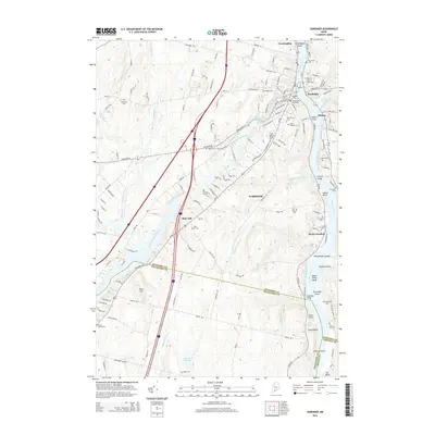
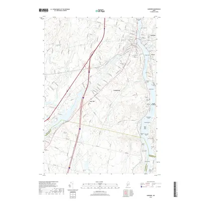
(30)- 1892 Map of Gardiner
 1892 Gardiner1892 Print · USGSThe Kennebec River valley in the 1890s was a bustling corridor of rail and river commerce. Genealogists and historians can trace old homesteads and landings from Gardiner down to Bowdoinham, including points like Ship Yard Pt and the grounds of the Richmond Campmeeting.7 unique versions available
 - 1893 Map of Wiscasset
 1893 Wiscasset1893 Print · USGSThe coastal and inland reaches of Lincoln County come alive in the 1890s, centered on the shipping and rail hub of Wiscasset. Trace the paths of the Maine Central Railroad and find early settlements like Head Tide, Dresden Mills, and Damariscotta Mills.7 unique versions available
 - 1943 Map of Gardiner
 1943 Gardiner1943 Print · USGSThe Kennebec River valley in the early 1940s reveals a landscape of riverside industry and inland farming communities. Researchers can trace ancestral roots through dozens of local schoolhouses like J F Stevens Sch and family crossroads such as Spears Cor or Starbird Cor.4 unique versions available
 - 1944 Map of Wiscasset
 1944 Wiscasset1944 Print · USGSThe Sheepscot and Damariscotta rivers define this mid-coast Maine region in the 1940s as the rail and river economy persists. Trace family history at Head Tide, the Whitefield Memorial Hospital, or early schoolhouses like Alna Center Sch.4 unique versions available
 - 1948 Map of Bangor
 1948 Bangor1948 Print · USGSThe Maine coast and its industrial river valleys are captured here shortly after the war, showing the vital shipping and rail hubs of the late 1940s. Genealogists and historians can trace the tracks of the Maine Central RR connecting Bangor, Augusta, and Old Town.
 - 1956 Map of Bangor, 1966 Print
 1956 Bangor1966 Print · USGSMid-century Maine comes alive in this survey of the rugged coast and river valleys during the 1950s. Genealogists and historians can trace the vital rail corridors of the Maine Central RR connecting timber towns like Old Town to the coast at Bar Harbor.3 unique versions available
 - 1957 Map of Wiscasset, 1959 Print
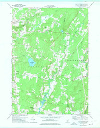
 1957 Wiscasset1959 Print · USGSThe Sheepscot and Damariscotta river valleys are shown in the late 1950s, a landscape of tidal flats and inland ponds. Genealogists can trace family landmarks like Goodspeed Cem, St Denis Ch, and the old settlements at Head Tide or Dresden Mills.4 unique versions available
 - 1957 Map of Gardiner, 1959 Print
 1957 Gardiner1959 Print · USGSThe Kennebec River valley in the late fifties shows a landscape of riverfront industry and rural crossroads. Genealogists and historians can trace family-named sites like Batchelders Crossing or Litchfield Academy and explore the complex waters of Swan Island.3 unique versions available
 - 1960 Map of Bangor
 1960 Bangor1960 Print · USGSCentral Maine in the sixties reveals a landscape of river-powered industry and sprawling coastal island chains. Researchers can trace the rail corridors of the Maine Central or locate mid-century aviation landmarks like Dow Air Force Base.
 - 1961 Map of Bangor
 1961 Bangor1961 Print · USGSMid-century Maine comes alive through its busy river ports and rocky archipelagoes during a period of steady maritime and rail commerce. Researchers can trace the path of the Maine Central railroad and locate coastal landmarks from Acadia National Park to Vinalhaven Island.
 - 1970 Map of Wiscasset, 1974 Print
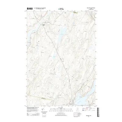
 1970 Wiscasset1974 Print · USGSCoastal Lincoln County is documented here during the early 1970s, showing the intricate relationship between the Sheepscot River and the village of Wiscasset. Genealogists can trace family landmarks across several townships, from Dresden Mills to ancestral burial sites like Herriman Cem and Marston Cem.2 unique versions available
 - 1970 Map of East Pittston, 1974 Print
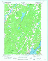
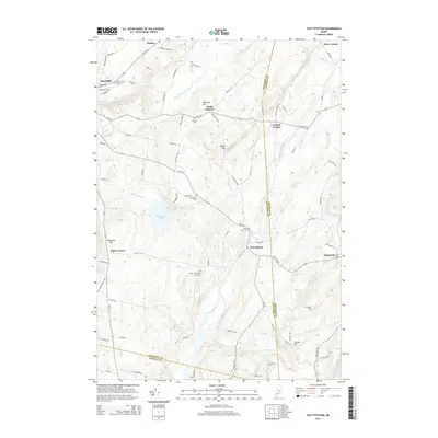
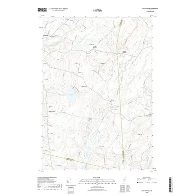
 1970 East Pittston1974 Print · USGSCoastal Kennebec County as it appeared in the early seventies shows a landscape of tidal rivers and quiet crossroads. Genealogists can trace established family names and burial sites at Butman Cem, Goodspeed Cem, and Trainor Corner.2 unique versions available
 - 1980 Map of Gardiner
 1980 Gardiner1980 Print · USGSGardiner and the Kennebec River valley are captured in the early 1980s as modern turnpike travel intersected with traditional riverfront industry. Genealogists can locate several burial grounds like St Josephs Cem and trace historical sites such as the Colburn House State Mem.3 unique versions available
 - 1980 Map of Gardiner, 1991 Print
 1980 Gardiner1991 Print · USGSMid-century Kennebec County comes alive in this 1940s survey of the river-and-rail corridor. Genealogists can trace family landmarks like Hathorn Hill, locate small rural schools such as Adams Sch, and find ancestors in Evergreen Cem.
 - 1984 Map of Augusta
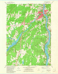
 1984 Augusta1984 Print · USGSMid-coast and central Maine were undergoing steady change in the mid-eighties as traditional river and coastal industries met expanding recreation. You can trace the Maine Central RR through Augusta or explore the rugged shoreline from Rockland Harbor up to Mount Megunticook.
 - 2011 Map of Gardiner, 2011 Print
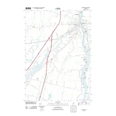 2011 Gardiner2011 Print · USGSCovers Pittston, including Gardiner, West Gardiner, and other nearby areas
 - 2011 Map of Wiscasset, 2011 Print
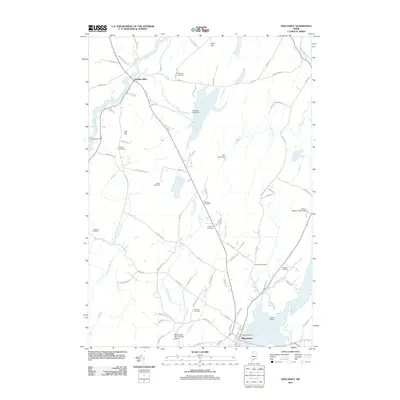 2011 Wiscasset2011 Print · USGSCovers Pittston, including Wiscasset, Woolwich, and other nearby areas
 - 2011 Map of East Pittston, 2011 Print
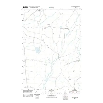 2011 East Pittston2011 Print · USGSCovers Pittston, including Chelsea, Whitefield, and other nearby areas
 - 2014 Map of Wiscasset, 2014 Print
 2014 Wiscasset2014 Print · USGSCovers Pittston, including Wiscasset, Woolwich, and other nearby areas
 - 2014 Map of Gardiner, 2014 Print
 2014 Gardiner2014 Print · USGSCovers Pittston, including Gardiner, West Gardiner, and other nearby areas
 - 2014 Map of East Pittston, 2014 Print
 2014 East Pittston2014 Print · USGSCovers Pittston, including Chelsea, Whitefield, and other nearby areas
 - 2018 Map of East Pittston, 2018 Print
 2018 East Pittston2018 Print · USGSCovers Pittston, including Chelsea, Whitefield, and other nearby areas
 - 2018 Map of Gardiner, 2018 Print
 2018 Gardiner2018 Print · USGSCovers Pittston, including Gardiner, West Gardiner, and other nearby areas
 - 2018 Map of Wiscasset, 2018 Print
 2018 Wiscasset2018 Print · USGSCovers Pittston, including Wiscasset, Woolwich, and other nearby areas
 - 2021 Map of Wiscasset, 2021 Print
 2021 Wiscasset2021 Print · USGSCovers Pittston, including Wiscasset, Woolwich, and other nearby areas
Showing maps 1-25 of 30
Top cities near Pittston
- Brunswick historical maps
- Augusta historical maps
- Topsham historical maps
- Bath historical maps
- Winthrop historical maps
- Gardiner historical maps
See more
Top neighborhoods of Pittston
Frequently asked questions
- What are the different types of historical maps available for Pittston?
- What is the oldest map of Pittston?
- Where can I purchase historical maps of Pittston for my home or office?
- Where can I download high-res historical maps of Pittston?
- Are there historical topographic maps available for Pittston?
- Is there historical aerial imagery available for Pittston?
- Where are historical maps of Pittston sourced from?