Old Maps of Jefferson, Maine for Metal Detecting
Plan your next treasure hunt with 52 historic maps of Jefferson. Find old homesites, ghost towns, trails, and gathering spots that may be lost to time — perfect for identifying promising metal detecting locations.
- Locate forgotten sites: Uncover places like long-lost settlements, abandoned rail lines, or gathering spots.
- Plan better hunts: Use map overlays combined with LiDAR or satellite views to narrow in on historically rich areas.
- Made for detectorists: Thousands of hobbyists use these maps to discover relics, coins, and hidden history.
Use these historic maps to boost your research and find new opportunities beneath the surface of Jefferson.
Jefferson, ME maps
(52)- 1893 Map of Vassalboro
 1893 Vassalboro1893 Print · USGSMaine's heartland in the 1890s reveals a network of mill villages and lakeside settlements along the Kennebec River. Genealogists can trace early homesteads and landmarks near China Lake, North Vassalboro, and the rural crossroads of Weeks Mills.5 unique versions available
 - 1893 Map of Wiscasset
 1893 Wiscasset1893 Print · USGSThe coastal and inland reaches of Lincoln County come alive in the 1890s, centered on the shipping and rail hub of Wiscasset. Trace the paths of the Maine Central Railroad and find early settlements like Head Tide, Dresden Mills, and Damariscotta Mills.7 unique versions available
 - 1898 Map of Vassalboro, 1935 Print
 1898 Vassalboro1935 Print · USGSKennebec County at the close of the nineteenth century reveals a landscape of mill towns and interconnected lakes. Researchers can trace the early industrial footprint at Weeks Mills and Cooper Mills or follow the path of the Maine Central R.R. along the Kennebec River.
 - 1913 Map of Waldoboro
 1913 Waldoboro1913 Print · USGSCoastal Lincoln and Knox counties come alive in this pre-war survey, showing a landscape of tightly-knit villages and rural school districts connected by the river and rail. Researchers can trace ancestral footprints at the Old Dutch Church, Winslows Mills, and the Benners Corner Cem.2 unique versions available
 - 1915 Map of Waldoboro
 1915 Waldoboro1915 Print · USGSCoastal Lincoln County is surveyed here in the early twentieth century, showing a landscape defined by tidal rivers and small farming hamlets. Genealogists can locate family-named sites like Flanders Corner and rural institutions such as the Branch School and Broad Cove PO.5 unique versions available
 - 1916 Map of Liberty
 1916 Liberty1916 Print · USGSMid-coast Maine at the start of the Great War was a patchwork of small townships and family farmsteads connected by narrow-gauge rails. Researchers can locate dozens of country schools and named crossroads such as The Kingdom, Hibberts Gore, and Woodmans Mills.6 unique versions available
 - 1941 Map of Waldoboro
 1941 Waldoboro1941 Print · USGSThe Medomak River valley and its surrounding coastal hills are captured here just as the war began. You can trace early twentieth-century rail connections at Glendon Station, find family-named crossroads like Whitney Corner, and locate local landmarks such as Winslows Mills.
 - 1941 Map of Vassalboro, 1954 Print
 1941 Vassalboro1954 Print · USGSCentral Maine in the early 1940s reveals a landscape of lakeside settlements and scattered rural schoolhouses between the Kennebec and Sheepscot rivers. Genealogists can trace family roots through sites like Oak Grove Seminary, Friends Cem, and Weeks Mills.2 unique versions available
 - 1942 Map of Liberty
 1942 Liberty1942 Print · USGSWaldo and Lincoln County lands are documented here just before mid-century, showing a landscape of rural schools and family-named corners. Genealogists can trace property near Hibberts Gore or locate ancestral homesites near Handy Sch and Montville Post Office.
 - 1943 Map of Vassalboro
 1943 Vassalboro1943 Print · USGSCentral Maine in the early 1940s is a landscape of expansive lake systems and interconnected mill villages. Researchers can trace the heritage of local institutions like Oak Grove Seminary, the stop at Windsor Station, and the historic Friends Cem.
 - 1944 Map of Wiscasset
 1944 Wiscasset1944 Print · USGSThe Sheepscot and Damariscotta rivers define this mid-coast Maine region in the 1940s as the rail and river economy persists. Trace family history at Head Tide, the Whitefield Memorial Hospital, or early schoolhouses like Alna Center Sch.4 unique versions available
 - 1948 Map of Bangor
 1948 Bangor1948 Print · USGSThe Maine coast and its industrial river valleys are captured here shortly after the war, showing the vital shipping and rail hubs of the late 1940s. Genealogists and historians can trace the tracks of the Maine Central RR connecting Bangor, Augusta, and Old Town.
 - 1950 Map of Liberty
 1950 Liberty1950 Print · USGSMid-century Waldo County and its neighbors are defined here by a network of crossroad hamlets and upland ridges just after the war. Local historians can trace the foundations of The Kingdom, identify family sites near Hutchins Corner, or locate rural schoolhouses like Hallidale Sch.
 - 1950 Map of Waldoboro
 1950 Waldoboro1950 Print · USGSThe Medomak River valley and the coastal hills of Lincoln County are captured here in the mid-century, prior to modern suburban expansion. Genealogists and historians can locate old landmarks like Nobleboro Station, Winslow Mills, and numerous neighborhood schools like Duckpuddle Sch.
 - 1956 Map of Vassalboro, 1958 Print
 1956 Vassalboro1958 Print · USGSThe Kennebec River valley and the shores of China Lake are captured here during the mid-fifties. Researchers can trace historic institutions and rural centers like the Oak Grove Seminary, Erskine Academy, and the Windsor Fairgrounds.3 unique versions available
 - 1956 Map of Bangor, 1966 Print
 1956 Bangor1966 Print · USGSMid-century Maine comes alive in this survey of the rugged coast and river valleys during the 1950s. Genealogists and historians can trace the vital rail corridors of the Maine Central RR connecting timber towns like Old Town to the coast at Bar Harbor.3 unique versions available
 - 1957 Map of Wiscasset, 1959 Print
 1957 Wiscasset1959 Print · USGSThe Sheepscot and Damariscotta river valleys are shown in the late 1950s, a landscape of tidal flats and inland ponds. Genealogists can trace family landmarks like Goodspeed Cem, St Denis Ch, and the old settlements at Head Tide or Dresden Mills.4 unique versions available
 - 1960 Map of Bangor
 1960 Bangor1960 Print · USGSCentral Maine in the sixties reveals a landscape of river-powered industry and sprawling coastal island chains. Researchers can trace the rail corridors of the Maine Central or locate mid-century aviation landmarks like Dow Air Force Base.
 - 1961 Map of Bangor
 1961 Bangor1961 Print · USGSMid-century Maine comes alive through its busy river ports and rocky archipelagoes during a period of steady maritime and rail commerce. Researchers can trace the path of the Maine Central railroad and locate coastal landmarks from Acadia National Park to Vinalhaven Island.
 - 1961 Map of Razorville, 1964 Print
 1961 Razorville1964 Print · USGSCoastal Maine's interior comes into focus during the early sixties, showing a landscape of unincorporated gores and rural plantations. Genealogists can trace family names at Hannan Cem and Lenfest Cem or locate the Sandhill Sch near Sandhill Corner.3 unique versions available
 - 1965 Map of Jefferson, 1967 Print
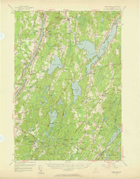
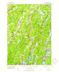
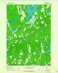
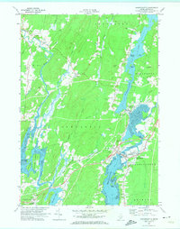
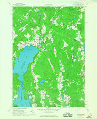 1965 Jefferson1967 Print · USGSMid-coast Maine’s wooded hills and lakefronts are captured here in the mid-1960s, showing a landscape of small crossroads and river rapids. Researchers can trace family-named locales like Kennedy Corner, Orffs Corner, and the rural community of North Waldoboro along the Medomak River.4 unique versions available
 - 1970 Map of Damariscotta, 1974 Print
 1970 Damariscotta1974 Print · USGSThe mid-coast Maine landscape around the Damariscotta River is captured here in the 1970s, showing the vital link between the inland lake and the sea. Trace family history at St Patricks Ch or locate family plots in Alna Cem and Barstow Cem.2 unique versions available
 - 1970 Map of North Whitefield, 1974 Print
 1970 North Whitefield1974 Print · USGSLincoln County in the early 1970s reveals a landscape of dense woodlands and interconnected waterways along the Sheepscot River. Genealogists can trace family roots through numerous local landmarks like St Denis Ch, Calvary Cem, and the settlement of South Jefferson.3 unique versions available
 - 1975 Map of Vassalboro SE, 1980 Print
 1975 Vassalboro SE1980 Print · USGSKennebec County agriculture and river-valley settlements are captured in high detail in the mid-1970s. Genealogists and local historians can trace the exact buildings and field patterns of rural centers like Weeks Mills, Coopers Mills, and Windsorville.
 - 1982 Map of Weeks Mills, 1983 Print
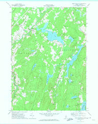
 1982 Weeks Mills1983 Print · USGSKennebec County in the early eighties is a landscape of river valleys and small crossroads settlements. Genealogists and historians can locate family burial grounds like Chadwick Hill Cem or trace the rural footprint of Erskine Academy and the Windsor Fairgrounds.2 unique versions available
Showing maps 1-25 of 52
Top cities near Jefferson
- Augusta historical maps
- Warren historical maps
- Sidney historical maps
- Vassalboro historical maps
- China historical maps
- Wiscasset historical maps
See more
Top neighborhoods of Jefferson
- Camp Wavus historical maps
- Kennedy Corner historical maps
- North Jefferson historical maps
- South Jefferson historical maps
Frequently asked questions
- What are the different types of historical maps available for Jefferson?
- What is the oldest map of Jefferson?
- Where can I purchase historical maps of Jefferson for my home or office?
- Where can I download high-res historical maps of Jefferson?
- Are there historical topographic maps available for Jefferson?
- Is there historical aerial imagery available for Jefferson?
- Where are historical maps of Jefferson sourced from?