Old Maps of Blanchard Township, Maine for Genealogy
Trace your family roots with 20 historic maps of Blanchard Township. These high-res maps reveal old neighborhoods, homesites, landmarks, and streets — helping you uncover where your ancestors lived and how the area evolved over time.
- Explore historic neighborhoods: Identify where your relatives may have lived in the 1800s or 1900s.
- Compare maps over time: Trace the changes in streets, buildings, and landmarks for multi-generational research.
- Perfect for genealogy & ancestry research: Used by family historians and researchers to map out lineage and migration.
These maps are an incredible resource for exploring your personal connection to Blanchard Township's past.
Blanchard Township, ME maps
(20)- 1948 Map of Kingsbury, 1953 Print
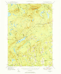 1948 Kingsbury1953 Print · USGSCovers Blanchard Township, including Athens, Harmony, and other nearby areas3 unique versions available
 - 1950 Map of Kingsbury
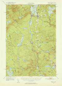
 1950 Kingsbury1950 Print · USGSCovers Blanchard Township, including Athens, Harmony, and other nearby areas2 unique versions available
 - 1951 Map of Greenville, 1952 Print
 1951 Greenville1952 Print · USGSCovers Blanchard Township, including Greenville, Monson, and other nearby areas6 unique versions available
 - 1954 Map of Millinocket, 1968 Print
 1954 Millinocket1968 Print · USGSCovers Blanchard Township, including Old Town, Lincoln, and other nearby areas3 unique versions available
 - 1958 Map of Millinocket
 1958 Millinocket1958 Print · USGSCovers Blanchard Township, including Old Town, Lincoln, and other nearby areas
 - 1960 Map of Millinocket
 1960 Millinocket1960 Print · USGSCovers Blanchard Township, including Old Town, Lincoln, and other nearby areas3 unique versions available
 - 1975 Map of Kingsbury NE, 1980 Print
 1975 Kingsbury NE1980 Print · USGSCovers Blanchard Township, including Parkman, Abbot, and other nearby areas
 - 1975 Map of Kingsbury NW, 1980 Print
 1975 Kingsbury NW1980 Print · USGSCovers Blanchard Township, including Kingsbury Plantation, Bald Mountain Township, and other nearby areas
 - 1977 Map of Monson West, 1981 Print
 1977 Monson West1981 Print · USGSCovers Blanchard Township, including Monson, Shirley, and other nearby areas
 - 1977 Map of Bald Mountain Pond, 1981 Print
 1977 Bald Mountain Pond1981 Print · USGSCovers Blanchard Township, including Shirley, East Moxie Township, and other nearby areas
 - 1986 Map of Dover-Foxcroft
 1986 Dover-Foxcroft1986 Print · USGSCovers Blanchard Township, including Dover-Foxcroft, Dexter, and other nearby areas
 - 1989 Map of Bald Mtn Pond
 1989 Bald Mtn Pond1989 Print · USGSCovers Blanchard Township, including Shirley, East Moxie Township, and other nearby areas
 - 1989 Map of Monson West
 1989 Monson West1989 Print · USGSCovers Blanchard Township, including Monson, Shirley, and other nearby areas
 - 1989 Map of Whetstone Pond
 1989 Whetstone Pond1989 Print · USGSCovers Blanchard Township, including Parkman, Abbot, and other nearby areas
 - 1989 Map of Foster Ridge
 1989 Foster Ridge1989 Print · USGSCovers Blanchard Township, including Kingsbury Plantation, Bald Mountain Township, and other nearby areas
 - 1994 Map of Dover-Foxcroft
 1994 Dover-Foxcroft1994 Print · USGSCovers Blanchard Township, including Dover-Foxcroft, Dexter, and other nearby areas
 - 2024 Map of Whetstone Pond, 2024 Print
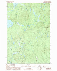
 2024 Whetstone Pond2024 Print · USGSCovers Blanchard Township, including Parkman, Abbot, and other nearby areas
 - 2024 Map of Bald Mountain Pond, 2024 Print
 2024 Bald Mountain Pond2024 Print · USGSCovers Blanchard Township, including Shirley, Bald Mountain Township, and other nearby areas
 - 2024 Map of Foster Ridge, 2024 Print
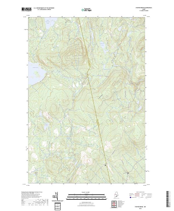 2024 Foster Ridge2024 Print · USGSCovers Blanchard Township, including Kingsbury Plantation, Mayfield Township, and other nearby areas
 - 2024 Map of Monson West, 2024 Print
 2024 Monson West2024 Print · USGSCovers Blanchard Township, including Monson, Shirley, and other nearby areas
End of results
Showing maps 1-20 of 20
Top cities near Blanchard Township
- Greenville historical maps
- Guilford historical maps
- Bingham historical maps
- Harmony historical maps
- Parkman historical maps
- Abbot historical maps
See more
Frequently asked questions
- What are the different types of historical maps available for Blanchard Township?
- What is the oldest map of Blanchard Township?
- Where can I purchase historical maps of Blanchard Township for my home or office?
- Where can I download high-res historical maps of Blanchard Township?
- Are there historical topographic maps available for Blanchard Township?
- Is there historical aerial imagery available for Blanchard Township?
- Where are historical maps of Blanchard Township sourced from?