2020s Maps of Blanchard Township, Maine
Explore 8 historic maps of Blanchard Township from the 2020s. These maps offer a rare glimpse into what life looked like during the 2020s — showing old roads, neighborhoods, homes, and landmarks that have changed or disappeared over time.
Whether you're researching your family's past, planning a metal detecting trip, or studying how Blanchard Township's landscape evolved across the 2020s, these high-resolution maps are a powerful tool for exploring the history of this region.
- Focus on a specific era: All maps on this page are from the 2020s, giving you a focused view of this time period.
- See what’s changed: Compare century-old streets, trails, and buildings to today's modern landscape using overlays and satellite layers.
- Research with precision: Use these maps for genealogy, historical research, land use analysis, or educational projects.
- View, download, or print: Maps are fully viewable online in high resolution, and can be downloaded or printed for your own records.
Start exploring Blanchard Township's history through authentic maps from the 2020s. This is your window into the past.
Blanchard Township, ME maps
(8)- 2021 Map of Whetstone Pond, 2021 Print
 2021 Whetstone Pond2021 Print · USGSCovers Blanchard Township, including Parkman, Abbot, and other nearby areas
 - 2021 Map of Bald Mountain Pond, 2021 Print
 2021 Bald Mountain Pond2021 Print · USGSCovers Blanchard Township, including Shirley, Bald Mountain Township, and other nearby areas
 - 2021 Map of Monson West, 2021 Print
 2021 Monson West2021 Print · USGSCovers Blanchard Township, including Monson, Shirley, and other nearby areas
 - 2021 Map of Foster Ridge, 2021 Print
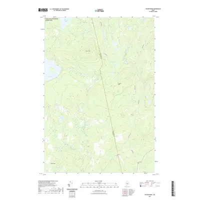 2021 Foster Ridge2021 Print · USGSCovers Blanchard Township, including Kingsbury Plantation, Mayfield Township, and other nearby areas
 - 2024 Map of Whetstone Pond, 2024 Print
 2024 Whetstone Pond2024 Print · USGSPiscataquis County remains a landscape of deep woods and isolated waters in this modern survey. Genealogists and outdoorsmen can trace access routes to Whetstone Pond, Piper Pond, and the high elevations of Russell Mtn.
 - 2024 Map of Bald Mountain Pond, 2024 Print
 2024 Bald Mountain Pond2024 Print · USGSThe Maine woods at the Piscataquis and Somerset border are captured here in the twenty-first century. Genealogists and hikers can trace the Appalachian National Scenic Trail past Hatch Falls or locate burials at the Shirley Mills Cem.
 - 2024 Map of Foster Ridge, 2024 Print
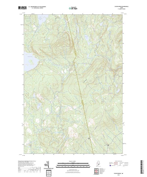 2024 Foster Ridge2024 Print · USGSSomerset County is shown in this contemporary study as a dense network of water bodies and ridgelines along the Piscataquis County line. Researchers can trace historic family burial sites at Hilton Cem or follow the high-country path of the Appalachian National Scenic Trail.
 - 2024 Map of Monson West, 2024 Print
 2024 Monson West2024 Print · USGSIn this contemporary look at the Piscataquis County woods, the Maine landscape is defined by the winding Appalachian National Scenic Trail. Researchers can trace old family roots and historic settlements from Shirley Mills down to the New Blanchard Cem near the banks of the Piscataquis River.
End of results
Showing maps 1-8 of 8
Top cities near Blanchard Township
- Greenville historical maps
- Guilford historical maps
- Bingham historical maps
- Harmony historical maps
- Parkman historical maps
- Abbot historical maps
See more
Frequently asked questions
- What are the different types of historical maps available for Blanchard Township?
- What is the oldest map of Blanchard Township?
- Where can I purchase historical maps of Blanchard Township for my home or office?
- Where can I download high-res historical maps of Blanchard Township?
- Are there historical topographic maps available for Blanchard Township?
- Is there historical aerial imagery available for Blanchard Township?
- Where are historical maps of Blanchard Township sourced from?