1970s Maps of Washington County, Maine
Explore 18 historic maps of Washington County from the 1970s. These maps offer a rare glimpse into what life looked like during the 1970s — showing old roads, neighborhoods, homes, and landmarks that have changed or disappeared over time.
Whether you're researching your family's past, planning a metal detecting trip, or studying how Washington County's landscape evolved across the 1970s, these high-resolution maps are a powerful tool for exploring the history of this region.
- Focus on a specific era: All maps on this page are from the 1970s, giving you a focused view of this time period.
- See what’s changed: Compare century-old streets, trails, and buildings to today's modern landscape using overlays and satellite layers.
- Research with precision: Use these maps for genealogy, historical research, land use analysis, or educational projects.
- View, download, or print: Maps are fully viewable online in high resolution, and can be downloaded or printed for your own records.
Start exploring Washington County's history through authentic maps from the 1970s. This is your window into the past.
Washington County, ME maps
(18)- 1975 Map of Nicatous Lake SE, 1980 Print
 1975 Nicatous Lake SE1980 Print · USGSThe timberlands and glacial waters of Hancock County come into focus in the mid-1970s. Trace the logging roads through the forest and locate landmarks like Sabao Mountain in this detailed aerial orthophoto.
 - 1975 Map of Danforth NE, 1980 Print
 1975 Danforth NE1980 Print · USGSThe international boundary at the Maine-New Brunswick line is captured here in the mid-seventies, showing the lakeside settlements along the eastern border. Genealogists can trace early homestead footprints near Danforth and landing sites like Butterfield Landing.
 - 1975 Map of Danforth NW, 1980 Print
 1975 Danforth NW1980 Print · USGSAroostook County's wooded interior is documented in the mid-1970s, showcasing the remote settlements and river systems of northern Maine. Researchers can trace land use around South Bancroft and locate properties between Mattawamkeag River and Lower Hot Brook Lake.
 - 1975 Map of Wytopitlock SE, 1980 Print
 1975 Wytopitlock SE1980 Print · USGSMaine's interior timberlands are captured in high-altitude detail during the mid-seventies, showing the intersection of water and forest management. Trace the precise 1975 shoreline of the Mattawamkeag River and the winding course of Meadow Brook.
 - 1975 Map of Scraggly Lake SW, 1980 Print
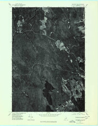
 1975 Scraggly Lake SW1980 Print · USGSCovers Washington County, including Carroll Plantation, Pukakon Township, and other nearby areas
 - 1975 Map of Danforth SE, 1980 Print
 1975 Danforth SE1980 Print · USGSThe Maine woods surrounding Baskahegan Lake are captured in high detail during the mid-seventies. Researchers can trace the winding course of Baskahegan Stream as it flows toward the small settlement of Eaton.
 - 1975 Map of Wabassus Lake NE, 1980 Print
 1975 Wabassus Lake NE1980 Print · USGSThe northern Maine woods around Washington County are captured in this mid-seventies aerial survey. Researchers can trace the layout of GRAND LAKE STREAM and identify the terrain of Wabassus Mountain and the winding Little River.
 - 1975 Map of Springfield SE, 1980 Print
 1975 Springfield SE1980 Print · USGSJunior Lake and the surrounding Maine timberlands are captured in photographic detail during the mid-seventies. Researchers can examine the unaltered shorelines of Junior Lake and the rural layout of Springfield in this unique aerial perspective.
 - 1975 Map of Wytopitlock NE, 1980 Print
 1975 Wytopitlock NE1980 Print · USGSNorthern Maine timberlands and riverfront settlements are captured in this mid-1970s aerial survey. Trace the historic footprints of Bancroft and Wytopitlock along the winding Mattawamkeag River.
 - 1975 Map of Nicatous Lake NE, 1980 Print
 1975 Nicatous Lake NE1980 Print · USGSThe interior of Hancock County is captured in this mid-seventies aerial survey, showing the deep woods of eastern Maine. Researchers can examine the shoreline and surrounding timber around Duck Lake to see the landscape as it stood before modern development.
 - 1975 Map of Springfield NE, 1980 Print
 1975 Springfield NE1980 Print · USGSPenobscot County timberlands and remote homesteads are captured in this mid-seventies aerial survey. Researchers can trace land clearings and rural roads connecting Prentiss, Thompson Corners, and Carroll along the Mattakeunk Stream.
 - 1975 Map of Wabassus Lake SW, 1980 Print
 1975 Wabassus Lake SW1980 Print · USGSWashington County's timberlands are seen in detail during the mid-seventies through this aerial orthophotoquad. Researchers can trace the untouched terrain surrounding Fletcher Peak, Bald Mountain, and the quiet slopes of Knox Mountain.
 - 1975 Map of Scraggly Lake NE, 1980 Print
 1975 Scraggly Lake NE1980 Print · USGSThe Maine timberlands and the southern reaches of Baskahegan Lake are captured here in the mid-1970s. Researchers can trace the era's logging roads and the winding course of Baskahegan Stream through the dense forest canopy.
 - 1975 Map of Wabassus Lake SE, 1980 Print
 1975 Wabassus Lake SE1980 Print · USGSThe Maine wilderness of Washington County is captured in this mid-seventies aerial survey, showing the landscape's raw texture and timber roads. Researchers can study the shorelines of Third Machias Lake and Monroe Lake as they appeared decades ago.
 - 1975 Map of Wabassus Lake NW, 1980 Print
 1975 Wabassus Lake NW1980 Print · USGSThe Maine North Woods and the jagged eastern shores of West Grand Lake are captured here in the mid-seventies. Researchers can trace forest management patterns and lake topography near the heights of Dark Cove Mountain.
 - 1975 Map of Danforth SW, 1980 Print
 1975 Danforth SW1980 Print · USGSThe dense forests of Washington County are seen in high detail during the mid-seventies, showing the timberlands and waterways near Danforth. Researchers can trace the rugged topography of Stetson Mountain and the winding paths of the West Branch and East Branch.
 - 1975 Map of Scraggly Lake NW, 1980 Print
 1975 Scraggly Lake NW1980 Print · USGSThe northern Maine woods appear in the mid-1970s as a dense, undeveloped landscape of timber and water. Genealogists and outdoorsmen can trace the natural flow of the Stream and Brook through this remote backcountry.
 - 1976 Map of Eastport
 1976 Eastport1976 Print · USGSThe maritime borderlands of Maine and Nova Scotia come alive in this mid-seventies survey of the Downeast coast. Genealogists and historians can trace the shoreline settlements of Eastport, Lubec, and Machias, or cross the channel to find Acadian villages like Church Point and Meteghan Centre.
End of results
Showing maps 1-18 of 18
Top cities of Washington County
- Calais historical maps
- Machias historical maps
- Milbridge historical maps
- East Machias historical maps
- Baileyville historical maps
- Eastport historical maps
See more
Frequently asked questions
- What are the different types of historical maps available for Washington County?
- What is the oldest map of Washington County?
- Where can I purchase historical maps of Washington County for my home or office?
- Where can I download high-res historical maps of Washington County?
- Are there historical topographic maps available for Washington County?
- Is there historical aerial imagery available for Washington County?
- Where are historical maps of Washington County sourced from?