Old Maps of Calvert County, Maryland for Metal Detecting
Plan your next treasure hunt with 129 historic maps of Calvert County. Find old homesites, ghost towns, trails, and gathering spots that may be lost to time — perfect for identifying promising metal detecting locations.
- Locate forgotten sites: Uncover places like long-lost settlements, abandoned rail lines, or gathering spots.
- Plan better hunts: Use map overlays combined with LiDAR or satellite views to narrow in on historically rich areas.
- Made for detectorists: Thousands of hobbyists use these maps to discover relics, coins, and hidden history.
Use these historic maps to boost your research and find new opportunities beneath the surface of Calvert County.
Calvert County, MD maps
(129)- 1892 Map of Leonardtown
 1892 Leonardtown1892 Print · USGSSt. Mary's County at the end of the nineteenth century was a world of river wharves and tobacco landings. Trace the path of the Proposed Drum Point R.R. and locate family landmarks like Sotterly or Reeder Wharf along the Patuxent River.
 - 1892 Map of Drum Point
 1892 Drum Point1892 Print · USGSThe lower Chesapeake Bay and Patuxent River shoreline appear here in the early 1890s, when maritime trade governed local life. Genealogists and historians can locate old post offices like Lusby and Jarboesville or trace the early waterfront at Solomon and Drum Pt. L.H.2 unique versions available
 - 1892 Map of Prince Frederick
 1892 Prince Frederick1892 Print · USGSCalvert County at the end of the Victorian era is captured here as a landscape of tobacco landings and emerging rail. Researchers can trace the Drum Point Railroad Proposed or locate old water-access points like Magruder Ferry and Leitches Wharf.
 - 1892 Map of Owensville
 1892 Owensville1892 Print · USGSCoastal Anne Arundel County comes alive in the 1890s, showing a world of tidewater landings and proposed rail lines. Trace old property locations near Obligation (Butler Tav.) or the early waterfront hubs of West River (Galesville) and Tracy Landing.
 - 1893 Map of Sharps Island
 1893 Sharps Island1893 Print · USGSThe Eastern Shore of Maryland is seen here in the 1890s, when Sharps Island and its lighthouse still commanded the mouth of the Choptank. Researchers can trace historic shorelines and early settlements like Tilghman and Neavitt before significant coastal erosion changed the bay.3 unique versions available
 - 1895 Map of Prince Frederick
 1895 Prince Frederick1895 Print · USGSMaryland's tobacco country and river-bound peninsulas are captured in the late nineteenth century before modern bridges spanned the waters. You can trace the path of the Drum Point Proposed R. R. or locate historic river landings like Magruder Ferry and Leitches Wharf.
 - 1895 Map of Leonardtown
 1895 Leonardtown1895 Print · USGSSouthern Maryland in the 1890s is captured here as a river-centric landscape of wharves and crossroads. Researchers can trace the early maritime economy through landings like Reeder Wharf and Forest Wharf, or locate family sites in Hollywood and Leonardtown.
 - 1895 Map of Nomini
 1895 Nomini1895 Print · USGSSouthern Maryland and the Virginia tidewater shores meet along the Potomac in this late nineteenth-century survey. Genealogists can trace family holdings and river landings from Charlotte Hall down to Sotterly and the Nomini Ferry.
 - 1895 Map of Owensville
 1895 Owensville1895 Print · USGSCoastal Anne Arundel County comes alive in this late nineteenth-century survey, from the winding Patuxent River to the shores of Herring Bay. Genealogists and local historians can trace the route of the Proposed Drum Point Railroad and find long-standing settlements like Obligation (Butler Tav.) and West River (Galesville).2 unique versions available
 - 1898 Map of Choptank
 1898 Choptank1898 Print · USGSThe Maryland Eastern Shore and its intricate Chesapeake coastline are documented here in the late 1890s. Genealogists can trace family roots in Annapolis or Easton, while maritime historians can locate historic landings such as Corners Wharf and Wye Landing.2 unique versions available
 - 1898 Map of Nomini
 1898 Nomini1898 Print · USGSMaryland and Virginia's Tidewater region comes alive in the late nineteenth century as a world of river landings, rail terminals, and rural crossroads. Researchers can trace the maritime economy through Nomini Ferry and Stone Wharf, or locate ancestral homesteads near Charlotte Hall and Potomac Mills.5 unique versions available
 - 1898 Map of St. Marys
 1898 St. Marys1898 Print · USGSMaryland's tidewater region is captured here in the late nineteenth century, showing the intricate geography of the lower Chesapeake. Genealogists can trace family roots through old landings and villages like Great Mills, Toddville, and Solomons.2 unique versions available
 - 1899 Map of Patuxent
 1899 Patuxent1899 Print · USGSSouthern Maryland in the late nineteenth century was a world of river wharves and emerging rail lines. Genealogists can trace family names across landings and settlements like Bladensburg, Upper Marlboro, and Piscataway Reform School before the landscape was modernised.3 unique versions available
 - 1901 Map of Drum Point
 1901 Drum Point1901 Print · USGSThe maritime heart of the lower Chesapeake Bay comes alive in this turn-of-the-century survey of the Calvert and St. Mary’s coastline. Genealogists and historians can trace old landings and light stations like Millstone Landing, Spencers Wharf, and the Drum Pt. L.H. at the mouth of the Patuxent River.
 - 1901 Map of Prince Frederick
 1901 Prince Frederick1901 Print · USGSThe Tidewater region of Maryland is captured here at the dawn of the twentieth century, when river travel and steamship wharves still defined the local economy. Researchers can locate vanished landings and ferry crossings like Magruder Ferry, Leitch Wharf, and Lower Marlboro.
 - 1901 Map of Leonardtown
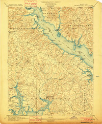 1901 Leonardtown1901 Print · USGSMaryland's tidewater country at the turn of the century is defined by its deep reliance on the river and bay. Genealogists and historians can trace the vital maritime economy through old landings and wharves like Sotterly Wharf, Abells Wharf, and Coburns Wharf.3 unique versions available
 - 1904 Map of Sharps Island
 1904 Sharps Island1904 Print · USGSThe Eastern Shore at the turn of the century shows a world of tidewater landings and island communities along the Choptank River. Genealogists and maritime historians can trace early settlements like Neavitt and Avalon, or locate the original site of the Sharps Island L.H.3 unique versions available
 - 1905 Map of Owensville
 1905 Owensville1905 Print · USGSCoastal Maryland in the early twentieth century was a landscape of tide-water wharves and rural post offices. Genealogists can trace family connections through sites like Owensville West River PO, Hartges Wharf, and Mitchellville PO.5 unique versions available
 - 1905 Map of Drum Point
 1905 Drum Point1905 Print · USGSThe Chesapeake Bay shoreline at the turn of the century shows a landscape defined by deep-water landings and remote island settlements. Genealogists and maritime historians can trace early wharves and landings like Spencers Wharf, Millstone Landing, and the village of Solomons.4 unique versions available
 - 1906 Map of St. Marys
 1906 St. Marys1906 Print · USGSChesapeake Bay and the Potomac River converge in this 1906 survey of the Maryland and Virginia tidewater. Historians can trace the region's maritime heritage through dozens of named landings and islands, from Solomons Id. to the remote reaches of Smith Island.4 unique versions available
 - 1906 Map of Patuxent
 1906 Patuxent1906 Print · USGSThe Tidewater region of Maryland and the outskirts of the District of Columbia are shown here at the turn of the century. Researchers can trace the early footprints of Maryland Agril. College, find riverfront infrastructure at Milltown Landing, and follow long-established routes like the Marlboro Turnpike.4 unique versions available
 - 1908 Map of Choptank
 1908 Choptank1908 Print · USGSMaryland's Eastern Shore and the Chesapeake Bay are captured here at the start of the twentieth century, showing a world of steamships and rail. Genealogists can trace family names at St Michaels, Oxford, and waterfront landings like Claiborne or Arundel on the Bay.5 unique versions available
 - 1910 Map of Prince Frederick
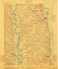 1910 Prince Frederick1910 Print · USGSCoastal Calvert County comes alive in the early twentieth century, showing a landscape defined by the Patuxent River and the bay. Genealogists can trace old wharves and family settlements from Lower Marlboro to the Chesapeake Beach RR line.3 unique versions available
 - 1936 Map of Leonardtown
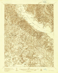 1936 Leonardtown1936 Print · USGSSt. Mary's County wharves and rural parishes are captured in detail during the mid-1930s. Genealogists can trace family footprints at Old All Faith Ch, identify old school sites like Maryland Springs Sch, or locate historic landings such as Williams Wharf.
 - 1938 Map of Prince Frederick
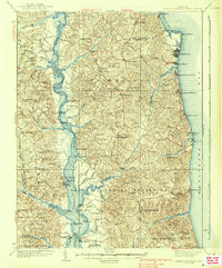 1938 Prince Frederick1938 Print · USGSCalvert County at the height of the 1930s reveals a Maryland landscape defined by tobacco farming and bay-front resorts. Researchers can locate vanished rural landmarks like the Cedar Hill Sch, explore the wharves at Deep Landing, or trace the early layout of Chesapeake Beach.3 unique versions available
Showing maps 1-25 of 129
Top cities of Calvert County
- Chesapeake Ranch Estates historical maps
- Chesapeake Beach historical maps
- Solomons historical maps
- Drum Point historical maps
- Dunkirk historical maps
- Prince Frederick historical maps
See more
Frequently asked questions
- What are the different types of historical maps available for Calvert County?
- What is the oldest map of Calvert County?
- Where can I purchase historical maps of Calvert County for my home or office?
- Where can I download high-res historical maps of Calvert County?
- Are there historical topographic maps available for Calvert County?
- Is there historical aerial imagery available for Calvert County?
- Where are historical maps of Calvert County sourced from?