1980s Maps of Caroline County, Maryland
Explore 7 historic maps of Caroline County from the 1980s. These maps offer a rare glimpse into what life looked like during the 1980s — showing old roads, neighborhoods, homes, and landmarks that have changed or disappeared over time.
Whether you're researching your family's past, planning a metal detecting trip, or studying how Caroline County's landscape evolved across the 1980s, these high-resolution maps are a powerful tool for exploring the history of this region.
- Focus on a specific era: All maps on this page are from the 1980s, giving you a focused view of this time period.
- See what’s changed: Compare century-old streets, trails, and buildings to today's modern landscape using overlays and satellite layers.
- Research with precision: Use these maps for genealogy, historical research, land use analysis, or educational projects.
- View, download, or print: Maps are fully viewable online in high resolution, and can be downloaded or printed for your own records.
Start exploring Caroline County's history through authentic maps from the 1980s. This is your window into the past.
Caroline County, MD maps
(7)- 1983 Map of Washington East, 1984 Print
 1983 Washington East1984 Print · USGSThe Chesapeake Bay region in the early eighties shows the Maryland capital and its suburbs meeting the maritime traditions of the Eastern Shore. Researchers can trace land patterns from Andrews Air Force Base to waterfront settlements like Oxford and Chesapeake Beach.2 unique versions available
 - 1984 Map of Dover, 1985 Print
 1984 Dover1985 Print · USGSThe Delaware Bay coastline and its surrounding communities are captured here in the mid-1980s. Genealogists and historians can trace the growth of Dover, locate rural landmarks like St Augustine, or study the rail networks of CONRAIL and the Dover Air Force Base.
 - 1984 Map of Seaford, 1986 Print
 1984 Seaford1986 Print · USGSCoastal Delaware and the Maryland borderlands are captured here in the mid-eighties as modern tourism and traditional agriculture coexist. Researchers can trace the rail-and-river routes through Seaford, explore inland millponds like Chipman Pond, or study the shoreline at Cape Henlopen.2 unique versions available
 - 1988 Map of Preston
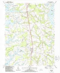
 1988 Preston1988 Print · USGSThe Maryland Eastern Shore in the 1980s is defined by its deep river bends and rural crossroads. Researchers can trace family history through the Maryland Veterans Cem (Eastern Shore) and local settlements like Linchester, Bruceville, and Preston.
 - 1988 Map of Federalsburg
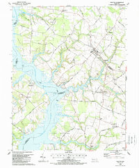
 1988 Federalsburg1988 Print · USGSMaryland's Eastern Shore comes to life in the late eighties as the towns of Federalsburg and Hurlock anchor a landscape of creeks and crossroads. Trace family roots and local history through rural landmarks like Friendship Ch, Harrison Ferry Bridge, and Browns Landing.
 - 1988 Map of Trappe
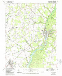
 1988 Trappe1988 Print · USGSThe Eastern Shore of Maryland in the late eighties reveals a landscape of deep tidal necks and historic crossroads. Genealogists can trace family footprints at Ivytown, the Hole-in-the-Wall Cem, and the old maritime hub at Trappe Landing.
 - 1989 Map of Washington
 1989 Washington1989 Print · USGSThe Potomac River valley and Chesapeake Bay are shown in comprehensive detail during the late 1980s. Genealogists and historians can trace the transition from urban Alexandria to the rural Northern Neck, locating landmarks like Mount Vernon and Stratford Hall.
End of results
Showing maps 1-7 of 7
Top cities of Caroline County
- Denton historical maps
- Federalsburg historical maps
- Greensboro historical maps
- Ridgely historical maps
- Preston historical maps
- Goldsboro historical maps
See more
Frequently asked questions
- What are the different types of historical maps available for Caroline County?
- What is the oldest map of Caroline County?
- Where can I purchase historical maps of Caroline County for my home or office?
- Where can I download high-res historical maps of Caroline County?
- Are there historical topographic maps available for Caroline County?
- Is there historical aerial imagery available for Caroline County?
- Where are historical maps of Caroline County sourced from?