Old Maps of Caroline County, Maryland for Academic Research
Study the evolution of Caroline County with 137 high-resolution historic maps. Whether you're teaching, researching, or modeling changes in land use, these maps provide essential visual documentation of urban, environmental, and geographic change.
- Analyze long-term change: Track patterns in development, transportation, and natural features.
- Ideal for environmental or urban studies: Support academic projects with primary historical map data.
- Use in the classroom or lab: Educators and researchers rely on these maps to bring historical context to life.
These maps are a powerful tool for teaching, research, and visualizing how Caroline County has changed over the decades.
Caroline County, MD maps
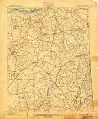
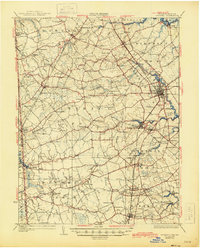
(137)- 1898 Map of Choptank
 1898 Choptank1898 Print · USGSThe Maryland Eastern Shore and its intricate Chesapeake coastline are documented here in the late 1890s. Genealogists can trace family roots in Annapolis or Easton, while maritime historians can locate historic landings such as Corners Wharf and Wye Landing.2 unique versions available
 - 1899 Map of Dover
 1899 Dover1899 Print · USGSDelaware and Maryland river country thrived in the late nineteenth century as a network of landings and rail lines. Trace old wharves at Cassidy Ldg., explore the area around Bohemia Mills, or locate maritime landmarks like Bombay Hook Light.2 unique versions available
 - 1904 Map of Oxford
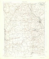
 1904 Oxford1904 Print · USGSCoastal Maryland at the start of the twentieth century was a world of steamships, rail landings, and tide-driven commerce. Genealogists can trace early homesteads and watermen's hubs near Cambridge, Oxford, and the landing at Trappe Ldg.3 unique versions available
 - 1905 Map of Denton
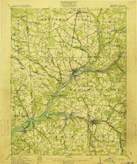
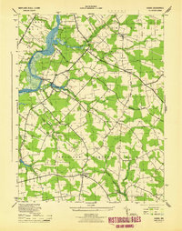
 1905 Denton1905 Print · USGSMaryland's Eastern Shore appears at the height of its riverboat and rail era, centered on the Choptank River. Genealogists and historians can trace the Steamboat Route to Wayman Wharf or locate old community hubs like American Corners and the Laurel Grove Church.3 unique versions available
 - 1905 Map of Barclay
 1905 Barclay1905 Print · USGSUpper Delmarva at the start of the twentieth century was a landscape of rail-connected farming towns and river landings. Trace family roots and old property lines near Sudlersville, the Ashland Hayden P O, and the Benedictine Convent.3 unique versions available
 - 1905 Map of Hurlock
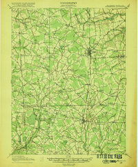
 1905 Hurlock1905 Print · USGSDorchester and Caroline Counties thrive on a river-and-rail economy at the turn of the century. Genealogists can trace family roots through landings and crossings like Tennalls Wharf, Harrison Ferry, and the junction at Hurlock.3 unique versions available
 - 1906 Map of Dover
 1906 Dover1906 Print · USGSCentral Delaware and Maryland's Eastern Shore appear at the start of the twentieth century, focused on the bustling rail-and-river economy. Genealogists can trace old family landing sites and crossroads villages like Bohemia Mills, Deakyneville Ldg., and Seven Hickories.3 unique versions available
 - 1908 Map of Choptank
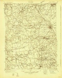
 1908 Choptank1908 Print · USGSMaryland's Eastern Shore and the Chesapeake Bay are captured here at the start of the twentieth century, showing a world of steamships and rail. Genealogists can trace family names at St Michaels, Oxford, and waterfront landings like Claiborne or Arundel on the Bay.5 unique versions available
 - 1915 Map of Seaford
 1915 Seaford1915 Print · USGSCoastal Sussex County and the Maryland borderlands are seen here at a time when river traffic and rail lines were the lifeblood of the region. Researchers can trace the Steamboat Route up to Seaford or locate ancestral sites like Cannons Ferry and Cokesbury School.4 unique versions available
 - 1918 Map of Harrington
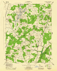
 1918 Harrington1918 Print · USGSThe Kent and Sussex County borderlands at the end of the Great War reveal a landscape of busy rail corridors and small schoolhouses. Researchers can trace the legacy of rural education at Union Chapel School or locate family roots near Harrington and Hickman.4 unique versions available
 - 1920 Map of Dover
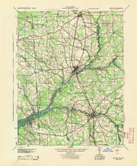
 1920 Dover1920 Print · USGSThe Maryland and Delaware borderlands at the end of the Great War reveal a landscape of tidewater landings and evolving rail lines. Trace family roots and vanished wharves through Fredericktown, the Mason and Dixon Line, and the Bombay Hook Light.
 - 1926 Map of Wyoming
 1926 Wyoming1926 Print · USGSCentral Delaware in the mid-twenties shows a landscape defined by the Pennsylvania RR and a dense network of rural schoolhouses. Researchers can locate family landmarks at Wrights Crossroads, Voshell Mill, or the many parish sites like Bryn Zion Church.
 - 1930 Map of Wyoming, 1945 Print
 1930 Wyoming1945 Print · USGSCentral Delaware in the mid-1920s reveals a structured landscape of rural school districts and railroad-connected towns surrounding the capital. Genealogists and historians can trace family locations near landmarks like Voshell Mill, the County Poor Farm, or many rural schoolhouses like Lockwood Sch.
 - 1931 Map of Wyoming
 1931 Wyoming1931 Print · USGSKent County and the Maryland borderlands are seen here between the world wars, a landscape of rail-connected towns and rural districts. Genealogists can trace family lines through numerous sites like Dinaus Corner, the County Poor Farm, and Bethel church.2 unique versions available
 - 1942 Map of Trappe, 1962 Print
 1942 Trappe1962 Print · USGSMaryland's Eastern Shore appears here in the early 1940s, showing a landscape defined by tidal necks and the Pennsylvania railroad. Genealogists and local historians can trace small settlements like Stumptown, rural sites such as Union Ch, and several family burial grounds including Merrick Cem.3 unique versions available
 - 1943 Map of Trappe
 1943 Trappe1943 Print · USGSCoastal Talbot County in the early 1940s is mapped here in detail, showing a landscape of fertile necks and winding tidal creeks. Researchers can trace family roots at Union Church or Merrick Cemetery and locate rail history at Trappe Station.
 - 1944 Map of Denton
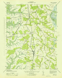
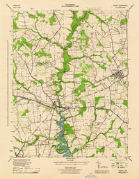
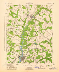 1944 Denton1944 Print · USGSCaroline County's riverfront and agricultural heartland are shown here in the mid-1940s as the Choptank River economy transition from water to rail and road. Genealogists can trace family landmarks like Sewell Mills, Cokers Cem, and the Lockerman Sch in Denton.5 unique versions available
 - 1944 Map of Preston
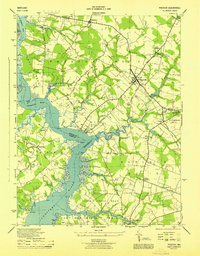 1944 Preston1944 Print · USGSMaryland's Eastern Shore transitions from river commerce to rail-driven agriculture during the mid-forties. Genealogists can trace family roots through numerous local landmarks, from Wright Wharf to country churches like Coppins Chapel and Bethesda Ch.3 unique versions available
 - 1944 Map of Federalsburg
 1944 Federalsburg1944 Print · USGSThe Eastern Shore of Maryland in the mid-1940s centered on the rail and river trade through Federalsburg and Hurlock. Family historians can trace rural roots through landmarks like Solomons Temple Church, the ferry crossing at Harrison Ferry Bridge, and early railroad corridors.3 unique versions available
 - 1944 Map of Price
 1944 Price1944 Print · USGSQueen Anne's County was a landscape of quiet agricultural hamlets and country parishes during the mid-forties. Genealogists and local historians can trace family roots through landmarks like Bethany Church, the St Gertrude Academy, or the settlement of Price along the Pennsylvania railroad line.4 unique versions available
 - 1944 Map of Ridgely
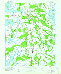
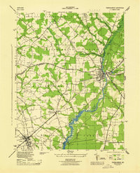
 1944 Ridgely1944 Print · USGSThe Eastern Shore counties of Caroline, Queen Anne's, and Talbot meet along the Tuckahoe Creek during the final years of the war. Researchers can trace the rail corridor of the Baltimore and Eastern and find local landmarks like Adolph Landing and Allan Church.4 unique versions available
 - 1944 Map of Seaford
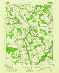
 1944 Seaford1944 Print · USGSWestern Sussex County is shown at a mid-century peak of river and rail commerce, featuring the Nanticoke River Steamboat Route. Genealogists can trace family footprints across dozens of local school sites and river crossings like Cannons Ferry and Baileys Landing.
 - 1944 Map of Hobbs
 1944 Hobbs1944 Print · USGSCaroline County is documented here during the war years, showing a landscape of small crossroads settlements and river landings. Trace the location of family homes and local landmarks like Todds Chapel, American Corners, and the Old RR Grade near Hobbs.3 unique versions available
 - 1944 Map of Goldsboro
 1944 Goldsboro1944 Print · USGSCaroline County and the surrounding Eastern Shore agricultural lands are shown here in the mid-1940s. Genealogists and local historians can trace the rail-side growth of Goldsboro and Henderson or locate rural sites like Ervings Chapel and Bethel School.4 unique versions available
 - 1944 Map of Fowling Creek
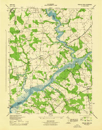 1944 Fowling Creek1944 Print · USGSMaryland's Eastern Shore during the mid-1940s highlights a landscape deeply tied to its river landings and country parishes. Genealogists and local historians can trace family roots through Mt Zion Ch and Cem, Bells Chapel, and old wharves like Ganey Wharf.4 unique versions available
Showing maps 1-25 of 137
Top cities of Caroline County
- Denton historical maps
- Federalsburg historical maps
- Greensboro historical maps
- Ridgely historical maps
- Preston historical maps
- Goldsboro historical maps
See more
Frequently asked questions
- What are the different types of historical maps available for Caroline County?
- What is the oldest map of Caroline County?
- Where can I purchase historical maps of Caroline County for my home or office?
- Where can I download high-res historical maps of Caroline County?
- Are there historical topographic maps available for Caroline County?
- Is there historical aerial imagery available for Caroline County?
- Where are historical maps of Caroline County sourced from?