1980s Maps of Franklin County, Massachusetts
Explore 7 historic maps of Franklin County from the 1980s. These maps offer a rare glimpse into what life looked like during the 1980s — showing old roads, neighborhoods, homes, and landmarks that have changed or disappeared over time.
Whether you're researching your family's past, planning a metal detecting trip, or studying how Franklin County's landscape evolved across the 1980s, these high-resolution maps are a powerful tool for exploring the history of this region.
- Focus on a specific era: All maps on this page are from the 1980s, giving you a focused view of this time period.
- See what’s changed: Compare century-old streets, trails, and buildings to today's modern landscape using overlays and satellite layers.
- Research with precision: Use these maps for genealogy, historical research, land use analysis, or educational projects.
- View, download, or print: Maps are fully viewable online in high resolution, and can be downloaded or printed for your own records.
Start exploring Franklin County's history through authentic maps from the 1980s. This is your window into the past.
Franklin County, MA maps
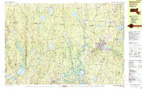
(7)- 1985 Map of Holyoke, 1986 Print
 1985 Holyoke1986 Print · USGSThe Pioneer Valley and surrounding uplands appear here in the mid-eighties, showing a landscape defined by the Connecticut River and modern highway expansion. Genealogists and historians can trace rail lines like the Central Vermont Railway and locate regional landmarks from Mount Tom State Reservation to the Quabbin Reservoir.2 unique versions available
 - 1986 Map of Albany
 1986 Albany1986 Print · USGSThe Capital District and the tri-state highlands come into focus during the mid-eighties as urban growth meets the edge of the Green Mountains. Researchers can trace historic industrial sites and landmarks like the Watervliet Arsenal, the Bennington Battle Monument, and the grounds of Rensselaer Polytechnic Institute.
 - 1986 Map of Keene
 1986 Keene1986 Print · USGSThe tri-state borderlands of the Connecticut River Valley come alive in this mid-eighties survey of southern Vermont, New Hampshire, and Massachusetts. Genealogists and historians can trace rail-era villages like Ashuelot and Millers Falls alongside landmarks like Marlboro College and Monadnock Mountain.3 unique versions available
 - 1988 Map of Winchendon
 1988 Winchendon1988 Print · USGSNorthern Worcester County and the New Hampshire borderlands are captured here in the late eighties, showing a landscape defined by mill towns and river valleys. Genealogists can locate family sites near Riverside Cemetery, Old Center Cemetery, or the residential clusters in Winchendon Center and South Royalston.2 unique versions available
 - 1988 Map of Athol
 1988 Athol1988 Print · USGSWorcester County settlement and industry are shown here in the late twentieth century, centered on the growing corridor between Athol and Templeton. Family historians can trace ancestral plots and local landmarks like St Johns Cem, the Church in the Wildwood, and Brooks Village.2 unique versions available
 - 1988 Map of North Adams
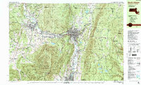 1988 North Adams1988 Print · USGSThe northern Berkshires of the late eighties are defined by the collegiate atmosphere of Williamstown and the industrial heritage of North Adams. Researchers can trace the path of the Appalachian Trail over Mt Greylock or locate family plots in Beth Israel Cem and Southlawn Cem.
 - 1989 Map of Albany
 1989 Albany1989 Print · USGSThe tri-state intersection of New York, Vermont, and Massachusetts comes alive in the late 1980s, centered on the historic river confluence of the Capital District. Researchers can trace the extensive rail lines of the D & H RR and explore high peaks like Mount Greylock or the reaches of the Tomhannock Reservoir.2 unique versions available
End of results
Showing maps 1-7 of 7
Top cities of Franklin County
- Greenfield historical maps
- Montague historical maps
- Orange historical maps
- Deerfield historical maps
- Sunderland historical maps
- Northfield historical maps
See more
Frequently asked questions
- What are the different types of historical maps available for Franklin County?
- What is the oldest map of Franklin County?
- Where can I purchase historical maps of Franklin County for my home or office?
- Where can I download high-res historical maps of Franklin County?
- Are there historical topographic maps available for Franklin County?
- Is there historical aerial imagery available for Franklin County?
- Where are historical maps of Franklin County sourced from?