1950s Maps of Franklin County, Massachusetts
Explore 15 historic maps of Franklin County from the 1950s. These maps offer a rare glimpse into what life looked like during the 1950s — showing old roads, neighborhoods, homes, and landmarks that have changed or disappeared over time.
Whether you're researching your family's past, planning a metal detecting trip, or studying how Franklin County's landscape evolved across the 1950s, these high-resolution maps are a powerful tool for exploring the history of this region.
- Focus on a specific era: All maps on this page are from the 1950s, giving you a focused view of this time period.
- See what’s changed: Compare century-old streets, trails, and buildings to today's modern landscape using overlays and satellite layers.
- Research with precision: Use these maps for genealogy, historical research, land use analysis, or educational projects.
- View, download, or print: Maps are fully viewable online in high resolution, and can be downloaded or printed for your own records.
Start exploring Franklin County's history through authentic maps from the 1950s. This is your window into the past.
Franklin County, MA maps
(15)- 1950 Map of North Adams
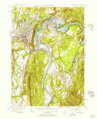
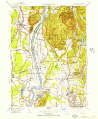
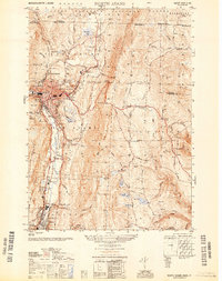 1950 North Adams1950 Print · USGSThe Hoosic River valley hums with industry and transit at the mid-point of the century. Genealogists and industrial historians can trace the Boston and Maine RR line, the famous Mohawk Trail, and the Hoosac Tunnel Central Shaft.
 - 1950 Map of Shutesbury, 1958 Print
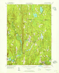
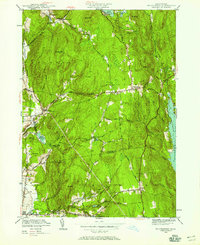 1950 Shutesbury1958 Print · USGSThe hill towns of Franklin and Hampshire Counties are captured here at mid-century, just as the Quabbin Reservoir reached its full extent. Genealogists and researchers can trace old family roads and locate landmarks like the Rhodes Sch, West Cem, and the small settlement of Cooleyville.2 unique versions available
 - 1950 Map of Heath, 1958 Print
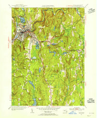
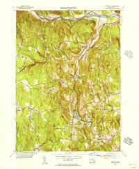
 1950 Heath1958 Print · USGSFranklin County hill towns appear in detail during the early 1950s, showing a landscape of upland farms and mountain ridges. Researchers can locate family sites near Davis Mine, Maple Grove Cem, and several one-room schoolhouses like North Sch.
 - 1952 Map of Quabbin Reservoir, 1953 Print
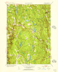
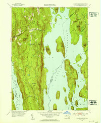 1952 Quabbin Reservoir1953 Print · USGSCentral Massachusetts in the early fifties reveals the massive transformation of the Swift River Valley following the reservoir's creation. Genealogists and historians can trace the surviving portions of North Prescott and Cooleyville or locate the site of the Baffle Dam.3 unique versions available
 - 1952 Map of Winsor Dam, 1953 Print
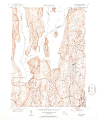 1952 Winsor Dam1953 Print · USGSHampshire and Worcester Counties are seen here in the early fifties following the transformative creation of the reservoir. Genealogists and researchers can trace the new shoreline and legacy landmarks like Winsor Dam, Quabbin Park, and West Ware.4 unique versions available
 - 1954 Map of Royalston, 1955 Print
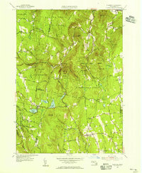
 1954 Royalston1955 Print · USGSThe Worcester County highlands and the New Hampshire border are documented here in the mid-fifties as the railroad era transitioned into the age of modern state highways. Researchers can trace ancestral locations near the Raymond Sch, follow the path of the Boston and Maine Railroad, or locate landmarks like Doane Falls.3 unique versions available
 - 1954 Map of Greenfield, 1956 Print
 1954 Greenfield1956 Print · USGSThe Connecticut River valley thrives in the mid-1950s as a hub of industry, transport, and education. Researchers can trace the storied campuses of Deerfield Academy and Eagle Brook Sch or locate rail junctions at Montague Sta.2 unique versions available
 - 1954 Map of Athol, 1956 Print
 1954 Athol1956 Print · USGSAthol and Phillipston are captured during the mid-fifties, showing a landscape defined by the Millers River industry and the extensive Harvard Forest. Researchers can locate numerous burial sites like Doe Valley Cem and industrial markers such as the Phillipston Mill.3 unique versions available
 - 1955 Map of Plainfield, 1956 Print
 1955 Plainfield1956 Print · USGSThe northern Berkshires in the mid-1950s appear as a landscape of interconnected state forests and quiet upland hamlets. Researchers can trace family sites at Hilltop Cem, visit School No 7, or explore the terrain around Windsor Jambs and Hallockville.4 unique versions available
 - 1955 Map of Mt Toby, 1956 Print
 1955 Mt Toby1956 Print · USGSThe Pioneer Valley in the mid-fifties is defined by the winding Connecticut River and the growing University of Massachusetts campus. Genealogists and local historians can trace the development of old settlements like East Whately, rural depots like Whately Sta, and historic burial grounds including North Amherst Cem.2 unique versions available
 - 1955 Map of Ashfield, 1956 Print
 1955 Ashfield1956 Print · USGSThe hill towns of Franklin County appear here in the mid-fifties, showing a landscape shaped by the Berkshire foothills and the Deerfield River. Researchers can trace rural lineages through old village sites like Buckland Four Corners, remote cemeteries like Leavitt Cem, and named peaks such as Moonshine Hill.3 unique versions available
 - 1955 Map of Goshen, 1956 Print
 1955 Goshen1956 Print · USGSThe Berkshire foothills of Hampshire County are shown in the mid-1950s, a period of transition for these upland villages. Trace local genealogy and land history at Goshen Cem, the settlement of Lithia, and the camps around Highland Lakes.3 unique versions available
 - 1956 Map of Albany, 1968 Print
 1956 Albany1968 Print · USGSThe industrial heart of the Northeast is revealed in the mid-1950s, from the Hudson Valley to the Connecticut River. Researchers can trace the legacy of the Quabbin Reservoir, locate Westover Air Force Base, or follow the Rutland RR through the Green Mountains.2 unique versions available
 - 1957 Map of Albany
 1957 Albany1957 Print · USGSThe Tri-State region and Connecticut River Valley are captured here during a period of significant postwar growth and infrastructure expansion. Genealogists and historians can trace the rail-and-river economy through landmarks like the Boston and Maine railroad, Quabbin Reservoir, and Westover Air Force Base.
 - 1959 Map of Albany
 1959 Albany1959 Print · USGSThe Hudson and Connecticut River valleys are captured here during the late fifties, showing the region's dense rail networks and massive water projects. Researchers can trace the New York State Thruway or locate local landmarks like Mt Greylock and the Quabbin Reservoir.
End of results
Showing maps 1-15 of 15
Top cities of Franklin County
- Greenfield historical maps
- Montague historical maps
- Orange historical maps
- Deerfield historical maps
- Sunderland historical maps
- Northfield historical maps
See more
Frequently asked questions
- What are the different types of historical maps available for Franklin County?
- What is the oldest map of Franklin County?
- Where can I purchase historical maps of Franklin County for my home or office?
- Where can I download high-res historical maps of Franklin County?
- Are there historical topographic maps available for Franklin County?
- Is there historical aerial imagery available for Franklin County?
- Where are historical maps of Franklin County sourced from?