1950s Maps of Leominster, Massachusetts
Explore 8 historic maps of Leominster from the 1950s. These maps offer a rare glimpse into what life looked like during the 1950s — showing old roads, neighborhoods, homes, and landmarks that have changed or disappeared over time.
Whether you're researching your family's past, planning a metal detecting trip, or studying how Leominster's landscape evolved across the 1950s, these high-resolution maps are a powerful tool for exploring the history of this region.
- Focus on a specific era: All maps on this page are from the 1950s, giving you a focused view of this time period.
- See what’s changed: Compare century-old streets, trails, and buildings to today's modern landscape using overlays and satellite layers.
- Research with precision: Use these maps for genealogy, historical research, land use analysis, or educational projects.
- View, download, or print: Maps are fully viewable online in high resolution, and can be downloaded or printed for your own records.
Start exploring Leominster's history through authentic maps from the 1950s. This is your window into the past.
Leominster, MA maps
(8)- 1950 Map of Clinton, 1952 Print
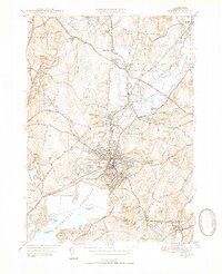 1950 Clinton1952 Print · USGSMid-century Worcester County comes to life here, showing the busy industrial valley of the Nashua River and the expanding Wachusett Reservoir shoreline. Trace the footprints of South Lancaster institutions and vanished landmarks like the Bolton Airport and Ponakin Mill.4 unique versions available
 - 1950 Map of Sterling, 1952 Print
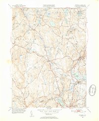 1950 Sterling1952 Print · USGSThe Sterling area in the early fifties shows a landscape shaped by the Wachusett Reservoir and the Boston and Maine Railroad. Trace family history at Legge Cem, visit the Sterling Camp Grounds, or locate the Butterick Sch.4 unique versions available
 - 1950 Map of Shirley, 1958 Print
 1950 Shirley1958 Print · USGSMid-century development spreads through the Worcester and Middlesex county lines during this era of growth. Genealogists and local historians can trace family plots in St Cecelia Cemetery or locate old school sites like the White Sch and the Industrial School.
 - 1953 Map of Fitchburg
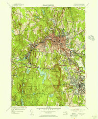
 1953 Fitchburg1953 Print · USGSMid-century Worcester County comes to life during a period of steady growth and established rail commerce. Local historians can trace family roots at Prospect Hill Cemetery or explore the development of Blackburne Village and the Fitchburg Leominster Airport.
 - 1954 Map of Fitchburg, 1956 Print
 1954 Fitchburg1956 Print · USGSThe industrial corridor of the Nashua River valley is captured here in the mid-1950s, showing the dense rail networks of Fitchburg and Leominster. Local researchers can trace family landmarks like Forest Hill Cemetery or find historic works such as Carter Mill.3 unique versions available
 - 1955 Map of Shirley
 1955 Shirley1955 Print · USGSCentral Massachusetts at mid-century shows the significant expansion of military life and rail transit near the Nashua River. Trace local family roots at St Leo Cem or explore the extensive footprint of Fort Devens Military Reservation and the Boston and Maine Railroad.2 unique versions available
 - 1956 Map of Boston, 1967 Print
 1956 Boston1967 Print · USGSThe Massachusetts coastline and industrial interior are seen here during the mid-century peak of suburban and highway expansion. Researchers can trace historic harbor defenses like Fort Revere, local landmarks such as Faneuil Hall, and the vast Parker River National Wildlife Refuge.6 unique versions available
 - 1958 Map of Boston
 1958 Boston1958 Print · USGSEastern Massachusetts and southern New Hampshire are shown at the height of the industrial era, before the full expansion of the interstate system. Trace coastal defenses at Fort Warren, historic rail lines like the Boston and Maine, and the development of the Mass. 128 corridor.2 unique versions available
End of results
Showing maps 1-8 of 8
Top cities near Leominster
- Worcester historical maps
- Nashua historical maps
- Fitchburg historical maps
- Marlborough historical maps
- Shrewsbury historical maps
- Gardner historical maps
See more
Top neighborhoods of Leominster
- Gates Crossing historical maps
- West Leominster historical maps
- North Leominster historical maps
- Monument Square Historic District historical maps
Frequently asked questions
- What are the different types of historical maps available for Leominster?
- What is the oldest map of Leominster?
- Where can I purchase historical maps of Leominster for my home or office?
- Where can I download high-res historical maps of Leominster?
- Are there historical topographic maps available for Leominster?
- Is there historical aerial imagery available for Leominster?
- Where are historical maps of Leominster sourced from?