1960s Maps of Macomb County, Michigan
Explore 20 historic maps of Macomb County from the 1960s. These maps offer a rare glimpse into what life looked like during the 1960s — showing old roads, neighborhoods, homes, and landmarks that have changed or disappeared over time.
Whether you're researching your family's past, planning a metal detecting trip, or studying how Macomb County's landscape evolved across the 1960s, these high-resolution maps are a powerful tool for exploring the history of this region.
- Focus on a specific era: All maps on this page are from the 1960s, giving you a focused view of this time period.
- See what’s changed: Compare century-old streets, trails, and buildings to today's modern landscape using overlays and satellite layers.
- Research with precision: Use these maps for genealogy, historical research, land use analysis, or educational projects.
- View, download, or print: Maps are fully viewable online in high resolution, and can be downloaded or printed for your own records.
Start exploring Macomb County's history through authentic maps from the 1960s. This is your window into the past.
Macomb County, MI maps
(20)- 1961 Map of Detroit, 1973 Print
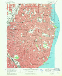
 1961 Detroit1973 Print · USGSThe international border between Michigan and Ontario was a bustling industrial corridor in the early sixties. Researchers can trace the transit networks and riverfront infrastructure connecting Detroit to Windsor via the Detroit-Windsor Tunnel and major air hubs like Willow Run Airport.2 unique versions available
 - 1965 Map of Detroit
 1965 Detroit1965 Print · USGSThe industrial corridor between Michigan and Ontario is captured here at mid-century, showing the dense rail and river networks of the Great Lakes. Local historians can trace the paths of the Grand Trunk Western RR and locate key landmarks like Selfridge Air Force Base and Grosse Ile.
 - 1968 Map of Armada, 1970 Print
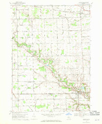
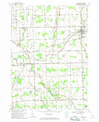 1968 Armada1970 Print · USGSMacomb County agriculture and transportation intersect in the late sixties as the village of Armada thrives alongside the Grand Trunk Western railroad. Researchers can locate family roots at Bruce and Armada Cem or trace history at Wolcott Mills.2 unique versions available
 - 1968 Map of Allenton, 1970 Print
 1968 Allenton1970 Print · USGSThe rural townships of St. Clair County are captured here in the late sixties, showing a landscape of small villages and established farmsteads. Researchers can trace family history through the Scotch Settlement Cem, the West Berlin Ch, and the active Berlin Oil Field.
 - 1968 Map of Goodells, 1970 Print
 1968 Goodells1970 Print · USGSSt. Clair County's rural townships in the late sixties remain centered on the rail-and-river economy of the Grand Trunk Western. Genealogists can trace family roots through the Kenockee Cem, the Lambs Sch, and the Goodells Mission.2 unique versions available
 - 1968 Map of Waldenburg, 1970 Print
 1968 Waldenburg1970 Print · USGSMacomb County is captured in the late sixties as its traditional farming roots met growing suburban interest and private aviation. Genealogists can trace family landmarks like the Macomb Center Cem or local school sites including St Peters Sch and St Isidores Sch.3 unique versions available
 - 1968 Map of Utica, 1970 Print
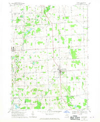
 1968 Utica1970 Print · USGSThe Macomb and Oakland county line comes alive in the late sixties, showing the suburban growth surrounding Rochester and Utica. Genealogists can trace family roots through numerous sites like Stony Creek Cem, Disco, and Washington.4 unique versions available
 - 1968 Map of Romeo, 1970 Print
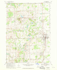 1968 Romeo1970 Print · USGSThe village of Romeo and its surrounding townships appear in the late sixties as a landscape of glacial lakes and growing parklands. Researchers can locate family burial plots at Brabb Cem, the historic Clifton Mill, and early municipal landmarks like the Grange Hall.2 unique versions available
 - 1968 Map of Memphis, 1970 Print
 1968 Memphis1970 Print · USGSCrossing the St. Clair and Macomb county line in the late sixties, this area shows a landscape defined by the winding Belle River and the Grand Trunk Western rail line. Genealogists can locate family landmarks such as the Memphis Cem, All Saints Ch, and the Foley Sch Sparling.
 - 1968 Map of Almont, 1970 Print
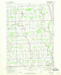
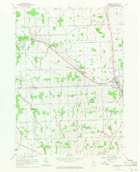
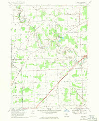
 1968 Almont1970 Print · USGSLapeer County is captured in the late sixties as a traditional farming landscape beginning to modernize. Genealogists and historians can trace family-named sites like Hunters Cem and Hough Cem or follow the Grand Trunk Western rail line through Dryden.2 unique versions available
 - 1968 Map of New Baltimore, 1971 Print
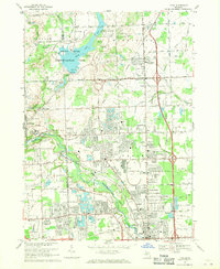
 1968 New Baltimore1971 Print · USGSNorthern Lake St. Clair coastal life is captured here in the late sixties as residential expansion meets industrial utility. Genealogists and local historians can locate Sacred Heart Cem, the Motor City Drag Strip, and Fair Haven Sch.2 unique versions available
 - 1968 Map of New Haven, 1971 Print
 1968 New Haven1971 Print · USGSNorthern Macomb County is shown in the late sixties as the shoreline of Lake St Clair fills with suburban developments. Genealogists can locate family landmarks like Hart Cem, Fairchild Chapel, and the Lenox Gas Storage Field.3 unique versions available
 - 1968 Map of Grosse Pointe, 1971 Print
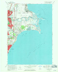
 1968 Grosse Pointe1971 Print · USGSThe Grosse Pointe shoreline and Detroit's eastern neighborhoods are shown here in the late sixties, just as modern shopping centers and residential grids were fully established. Genealogists and local historians can locate early burial sites like Mt Calvary Sch Cem and landmarks such as the Grosse Pointe Yacht Club and Chandler Park.4 unique versions available
 - 1968 Map of Mt Clemens East, 1971 Print
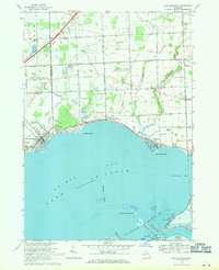
 1968 Mt Clemens East1971 Print · USGSMacomb County's Lake St. Clair shoreline comes alive in this late-sixties record of suburban growth and military activity. Researchers can trace local heritage through landmarks like Selfridge Air Force Base, St Huberts Ch, and Metropolitan Beach.4 unique versions available
 - 1968 Map of Richmond, 1971 Print
 1968 Richmond1971 Print · USGSMacomb County agriculture and rail life thrive in the late sixties between the hubs of Armada and Richmond. Genealogists can trace family roots at Bates Cem and St Mary Ch, while historians can follow the Grand Trunk Western line.2 unique versions available
 - 1968 Map of Warren, 1971 Print
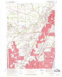
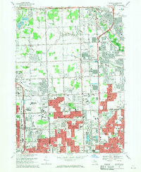 1968 Warren1971 Print · USGSThe Detroit suburbs were in the midst of a massive postwar boom when this survey was conducted. Genealogists and local historians can trace dozens of neighborhood schools and churches, from Holy Trinity Cem to the early days of the Oakland Mall Shopping Center.5 unique versions available
 - 1968 Map of St. Clair Flats, 1971 Print
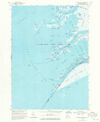 1968 St. Clair Flats1971 Print · USGSThe St. Clair River delta is captured here in the late sixties, showing the complex borderlands between Michigan and Ontario. Genealogists and local historians can trace the unique water-based geography of Harsens Island, Riverside, and the Walpole Island Indian Reserve.2 unique versions available
 - 1968 Map of Mt Clemens West, 1971 Print
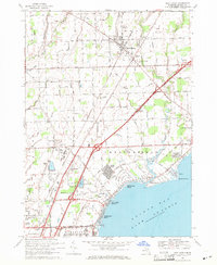
 1968 Mt Clemens West1971 Print · USGSMacomb County enters a period of significant suburban expansion in the late sixties as residential neighborhoods fill the space between historical townships. Researchers can trace the development of Sterling Heights and Roseville through landmarks like Resurrection Cemetery and the Mc Kinley Airport.4 unique versions available
 - 1968 Map of Adair, 1971 Print
 1968 Adair1971 Print · USGSThe rural landscapes of St. Clair and Macomb counties come alive in this late-sixties study of the area between the Belle and Puttygut rivers. Genealogists can trace family footprints through numerous cemeteries like Kittridge Cem and vanished landmarks in Muttonville and Snyderville.3 unique versions available
 - 1968 Map of Highland Park, 1971 Print
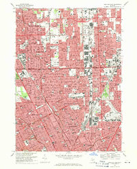 1968 Highland Park1971 Print · USGSThe northern Detroit metropolitan area is shown here in its mid-century maturity, featuring the densely packed street grids of industrial enclaves. Genealogists can trace family neighborhoods near Mt Olivet Cem, St Florian High Sch, or along the Grand Trunk Western RR.4 unique versions available
End of results
Showing maps 1-20 of 20
Top cities of Macomb County
- Sterling Heights historical maps
- Warren historical maps
- Clinton Township historical maps
- Macomb Township historical maps
- Shelby Charter Township historical maps
- Saint Clair Shores historical maps
See more
Frequently asked questions
- What are the different types of historical maps available for Macomb County?
- What is the oldest map of Macomb County?
- Where can I purchase historical maps of Macomb County for my home or office?
- Where can I download high-res historical maps of Macomb County?
- Are there historical topographic maps available for Macomb County?
- Is there historical aerial imagery available for Macomb County?
- Where are historical maps of Macomb County sourced from?