Old Maps of Macomb County, Michigan for Academic Research
Study the evolution of Macomb County with 184 high-resolution historic maps. Whether you're teaching, researching, or modeling changes in land use, these maps provide essential visual documentation of urban, environmental, and geographic change.
- Analyze long-term change: Track patterns in development, transportation, and natural features.
- Ideal for environmental or urban studies: Support academic projects with primary historical map data.
- Use in the classroom or lab: Educators and researchers rely on these maps to bring historical context to life.
These maps are a powerful tool for teaching, research, and visualizing how Macomb County has changed over the decades.
Macomb County, MI maps
(184)- 1905 Map of Detroit
 1905 Detroit1905 Print · USGSDetroit and its surrounding townships are shown at a pivotal moment of expansion during the early 1900s. Genealogists and historians can trace the development of early suburbs like Highland Park and Royal Oak along major transit arteries like Grand River Ave. and the numerous electric railways.2 unique versions available
 - 1905 Map of Grosse Pointe
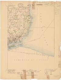 1905 Grosse Pointe1905 Print · USGSCoastal Wayne County at the turn of the century shows an era of transit-driven growth along Lake St Clair. Researchers can trace the early layout of Grosse Pointe Shores, the grounds of Belle Isle Park, and the route of the Grand Trunk R R.4 unique versions available
 - 1908 Map of Rochester
 1908 Rochester1908 Print · USGSSoutheast Michigan at the turn of the century shows a bustling landscape of early electric railways and rural township life. Genealogists and local historians can trace the foundations of Rochester, Birmingham, and Utica, alongside vanished landmarks like Snell School and the Stone Shop.3 unique versions available
 - 1912 Map of Mt Clemens
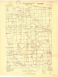
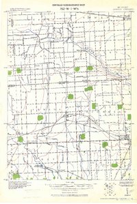
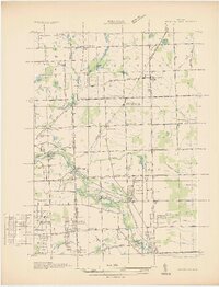
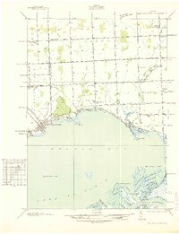
 1912 Mt Clemens1912 Print · USGSMacomb County at the dawn of the aviation age shows a landscape shaped by the winding Clinton River and the arrival of Selfridge Aviation Field. Genealogists and historians can locate legacy settlements like Waldenburg and early industrial sites like the Macomb Sugar Factory.
 - 1914 Map of Armada
 1914 Armada1914 Print · USGSMacomb and St. Clair Counties are seen here in the years before the Great War as a productive agricultural landscape tied together by rail. Researchers can trace historic farmstead locations and early rural infrastructure, from Wolcotts Mill Pond to the busy Grand Trunk R. R. junctions at Armada and Richmond.
 - 1914 Map of Algonac
 1914 Algonac1914 Print · USGSThe St. Clair River delta and Harsens Island are captured here before the mid-century shoreline changes. Genealogists can locate family holdings near Starrville or trace the early waterfront developments of Sans Souci P.O. and Tashmoo Park.
 - 1918 Map of Detroit
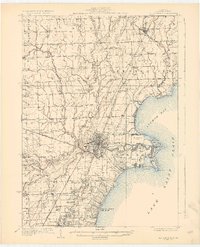
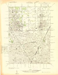
 1918 Detroit1918 Print · USGSDetroit and its surrounding townships appear at the height of the early industrial era, captured just after the close of the Great War. Local researchers can trace the growth of the Ford Motor Co. empire near Navarre P.O. and explore the historic rail corridors of Hamtramck and Royal Oak.
 - 1918 Map of Grosse Pointe
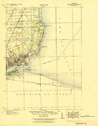 1918 Grosse Pointe1918 Print · USGSThe Lake St. Clair shoreline comes alive in this late-era survey of Wayne and Macomb counties, showing the region just as the Grosse Pointes were formalizing. Trace early electric transit via the Detroit and Port Huron Electric Line and locate vanished stops at Labadies or Claireview.
 - 1924 Map of Detroit
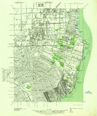
 1924 Detroit1924 Print · USGSDetroit and its industrial satellites thrive during the peak of the automotive era. Genealogists and historians can trace the early factory footprints of Dodge Bros. or locate old neighborhood landmarks like Navarre P. O. and Mt. Olivet Cemetery.
 - 1928 Map of Armada
 1928 Armada1928 Print · USGSMacomb and St. Clair counties are shown here in the early twentieth century as agriculture and rail travel dominated the landscape. Genealogists can trace family roots through specific locales like Doyle P.O., Sullicks Corners, and the mill at Wolcots Mill Pond.
 - 1928 Map of Hicky
 1928 Hicky1928 Print · USGSSt. Clair County's rural townships and railway hubs are captured here in the years following the Great War. Researchers can locate vanished landmarks and post offices like Lambs P.O. or trace the early paths of the Fort Gratiot Turnpike and Grand Trunk R. R.
 - 1929 Map of Mt Clemens
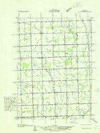
 1929 Mt Clemens1929 Print · USGSMacomb County at the end of the twenties shows a landscape of growing towns and early aviation history along the Lake Saint Clair shoreline. Genealogists and historians can trace local landmarks like Selfridge Field, the Grand Trunk Railroad, and numerous parish schools from Fraser to New Haven.4 unique versions available
 - 1934 Map of Detroit
 1934 Detroit1934 Print · USGSThe Detroit riverfront and its rising industrial suburbs are captured here during the peak of the automotive boom. Genealogists and historians can trace the early footprints of the Ford Motor Co and local landmarks like Olivet Cemetery or the State Fair Grounds.
 - 1936 Map of Warren
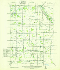 1936 Warren1936 Print · USGSThe Macomb and Oakland county line in the mid-1930s shows a landscape of small townships and early subdivisions. Genealogists can trace family roots through numerous local schools like Berz Sch or find historic burials at Warren Cem and Memorial Park Cem.
 - 1936 Map of New Haven
 1936 New Haven1936 Print · USGSCoastal Macomb County and the shores of Lake St Clair are captured here during the mid-1930s, showing a landscape defined by drainage districts and rail transport. Researchers can locate vanished landmarks like Chesterfield Sta, rural schoolhouses such as Bates Sch, and the Grand Trunk railroad line.
 - 1936 Map of Washington
 1936 Washington1936 Print · USGSMacomb County townships were transitioning from rural agriculture to automotive industry in the mid-1930s. Genealogists and historians can trace the Packard Proving Grounds, Ferry Morse Seed Co Farms, and old burial sites like Washington Cem.
 - 1936 Map of Highland Park
 1936 Highland Park1936 Print · USGSGreater Detroit and the enclaves of Highland Park and Hamtramck are captured here in the mid-1930s as urban growth pushes north. Researchers can pinpoint early neighborhoods, local schools like Henry Ford Sch, and the grounds of the Michigan State Fair.
 - 1936 Map of Waldenburg
 1936 Waldenburg1936 Print · USGSMacomb County in the mid-thirties remains a landscape of drainage ditches and schoolhouse crossroads before the post-war suburban shift. Genealogists can locate family landmarks like the Macomb Center Cem and schools such as Prestonville Sch and Warner Sch.
 - 1936 Map of Selfridge Field
 1936 Selfridge Field1936 Print · USGSThe Macomb County shoreline and the early aviation footprint of Selfridge Field are preserved here during the mid-1930s. Researchers can trace the riverfront growth of Lakeside and find local landmarks like School No 3 and Point Rosa.
 - 1936 Map of New Baltimore
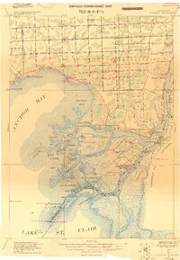
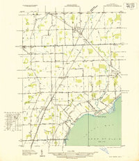
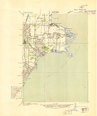
 1936 New Baltimore1936 Print · USGSAnchor Bay and the coastal settlements of Macomb and St. Clair Counties come alive in the mid-1930s just as aerial mapping was perfecting local detail. Genealogists and historians can trace family locations near New Baltimore, St Pauls Ch, and rural schools like Poplar Grove Sch.
 - 1936 Map of Grosse Pointe
 1936 Grosse Pointe1936 Print · USGSThe Detroit lakeshore and its rising suburbs are captured here in the mid-1930s, showing a landscape of yacht clubs, golf courses, and dense street grids. Trace the growth of Grosse Pointe Shores and Roseville or locate landmarks like Jefferson Beach and the Erin Cem.
 - 1936 Map of Mt Clemens
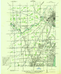 1936 Mt Clemens1936 Print · USGSMacomb County is captured here in the mid-1930s, showing the early suburban development radiating from Mt Clemens along the Clinton River. Researchers can trace old family burial grounds like Sterling Grove Cem and local schoolhouses including Nicke Sch and Garfield Sch.
 - 1939 Map of New Baltimore
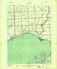 1939 New Baltimore1939 Print · USGSThe Lake St. Clair shoreline at the end of the thirties was a region of marshy deltas and small lakefront villages. You can trace early parish roots and rural life at Sacred Heart Cem, Big Stone Sch, and the unique waterways around Dickinson Island.
 - 1939 Map of Adair
 1939 Adair1939 Print · USGSSt. Clair County in the late 1930s shows a landscape of established farmsteads and a remarkably high density of rural schools and churches. Genealogists can trace family footprints through sites like Pink Sch, Columbus Cem, and the village of Adair.
 - 1939 Map of Goodells
 1939 Goodells1939 Print · USGSSt. Clair County's agricultural heartland is documented here just before the Second World War, showing the township-based life of Wales and Kenockee. Researchers can locate family-named landmarks like Beach Sch, the St Clair County Infirmary, and the Kenockee Cem.
Showing maps 1-25 of 184
Top cities of Macomb County
- Sterling Heights historical maps
- Warren historical maps
- Clinton Township historical maps
- Macomb Township historical maps
- Shelby Charter Township historical maps
- Saint Clair Shores historical maps
See more
Frequently asked questions
- What are the different types of historical maps available for Macomb County?
- What is the oldest map of Macomb County?
- Where can I purchase historical maps of Macomb County for my home or office?
- Where can I download high-res historical maps of Macomb County?
- Are there historical topographic maps available for Macomb County?
- Is there historical aerial imagery available for Macomb County?
- Where are historical maps of Macomb County sourced from?