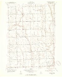
1950s Maps of Macomb County, Michigan
Explore 18 historic maps of Macomb County from the 1950s. These maps offer a rare glimpse into what life looked like during the 1950s — showing old roads, neighborhoods, homes, and landmarks that have changed or disappeared over time.
Whether you're researching your family's past, planning a metal detecting trip, or studying how Macomb County's landscape evolved across the 1950s, these high-resolution maps are a powerful tool for exploring the history of this region.
- Focus on a specific era: All maps on this page are from the 1950s, giving you a focused view of this time period.
- See what’s changed: Compare century-old streets, trails, and buildings to today's modern landscape using overlays and satellite layers.
- Research with precision: Use these maps for genealogy, historical research, land use analysis, or educational projects.
- View, download, or print: Maps are fully viewable online in high resolution, and can be downloaded or printed for your own records.
Start exploring Macomb County's history through authentic maps from the 1950s. This is your window into the past.
Macomb County, MI maps
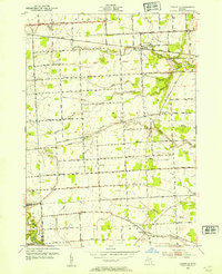
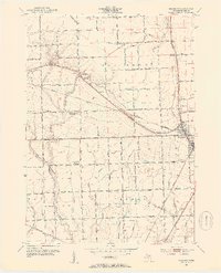
(18)- 1952 Map of Allenton, 1953 Print
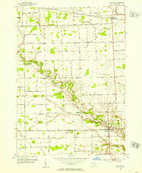
 1952 Allenton1953 Print · USGSIn the early fifties, the agricultural townships of Berlin and Mussey remained a landscape of rural schoolhouses and family cemeteries. Researchers can still locate landmarks like Gould Sch, West Berlin Ch, and the Scotch Settlement Cem.2 unique versions available
 - 1952 Map of Memphis, 1953 Print
 1952 Memphis1953 Print · USGSNear the St. Clair and Macomb county line in the early fifties, the town of Memphis anchored a landscape of river valleys and small farming districts. Researchers can find numerous country schoolhouses like Doyle Sch and trace the path of the Grand Trunk railroad.2 unique versions available
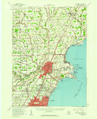
 - 1952 Map of Mt Clemens West, 1953 Print
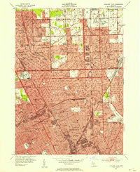
 1952 Mt Clemens West1953 Print · USGSMacomb County was undergoing rapid postwar development in the early fifties as suburbs pushed north from Detroit. Genealogists and historians can trace the foundations of Fraser, Broad Acres, and St Clair Shores alongside landmarks like Joy Airport and the Grand Trunk Railway.2 unique versions available
 - 1952 Map of Warren, 1953 Print
 1952 Warren1953 Print · USGSSoutheastern Michigan at the dawn of the 1950s reveals a patchwork of established farms and emerging suburbs along the county line. Genealogists can trace family footprints at Warren Cem and find early schoolhouses like Colerain Sch or Burr Sch.2 unique versions available
 - 1952 Map of Grosse Pointe, 1953 Print
 1952 Grosse Pointe1953 Print · USGSThe Lake St. Clair shoreline and Detroit's northeast suburbs are captured here during the post-war population boom. Researchers can trace mid-century neighborhood growth and find dozens of local landmarks like the Grosse Pointe Yacht Club and Assumption Sch & Cem.2 unique versions available
 - 1952 Map of St. Clair Flats, 1954 Print
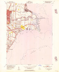
 1952 St. Clair Flats1954 Print · USGSThe St. Clair River delta is captured here in the early fifties, showing a labyrinth of islands and navigable channels along the international border. Genealogists and historians can trace old homesteads on Harsens Island or locate the Coast Guard Station and the settlement of Riverside.
 - 1952 Map of Adair, 1954 Print
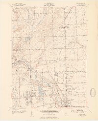
 1952 Adair1954 Print · USGSEastern Michigan’s rural townships are captured here in the early fifties, showing the transition from traditional farming communities to a modernizing road network. Genealogists can locate family landmarks like Columbus Cem, Pink Sch, and the community of Adair.2 unique versions available
 - 1952 Map of Highland Park, 1954 Print
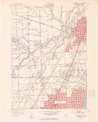
 1952 Highland Park1954 Print · USGSMid-century Detroit and its northern enclave cities show a bustling urban landscape at the height of the industrial era. Trace neighborhood roots across Highland Park and Hamtramck using landmarks like Evergreen Cemetery and the City Airport.2 unique versions available
 - 1952 Map of Utica, 1954 Print
 1952 Utica1954 Print · USGSSoutheast Michigan was entering a period of rapid post-war growth when this survey recorded the rural townships and growing centers of Macomb and Oakland Counties. Researchers can trace family history at sites like Disco Sch and Utica Cem, or locate landmarks such as the large Proving Grounds.2 unique versions available
 - 1952 Map of Mt Clemens East, 1954 Print
 1952 Mt Clemens East1954 Print · USGSMacomb County's shoreline was undergoing rapid suburbanization in the early fifties as the automotive and defense sectors expanded. Researchers can trace the massive footprint of Selfridge Air Force Base and locate community anchors like St Louis Sch and Lakeside.2 unique versions available
 - 1952 Map of New Baltimore, 1954 Print
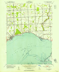 1952 New Baltimore1954 Print · USGSThe Macomb and St. Clair County shoreline comes alive in this mid-century survey of the Anchor Bay waterfront. Researchers can trace family roots through numerous local landmarks, including Fair Haven Sch, St Marys Cem, and the old settlement of Peters.2 unique versions available
 - 1952 Map of Goodells, 1954 Print
 1952 Goodells1954 Print · USGSMid-century St. Clair County is captured here during a period of established rural farming and community life. Genealogists and historians can trace family land proximity to local landmarks like the County Infirmary, Kenockee Cem, and rural schoolhouses such as Beach Sch.2 unique versions available
 - 1952 Map of Waldenburg, 1954 Print
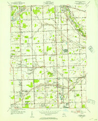
 1952 Waldenburg1954 Print · USGSMid-century Macomb County reveals a landscape of grid-roads and rural schoolhouses just before the suburban expansion of the Detroit area. Trace the roots of local communities at Waldenburg, Preston Corners, and St Peters Sch, or locate family sites near Macomb Center Cem.2 unique versions available
 - 1952 Map of Armada, 1954 Print
 1952 Armada1954 Print · USGSThe village of Armada and surrounding Macomb County townships are captured here in the early fifties during a period of steady rural development. Genealogists can locate family landmarks like Procter Cem or trace rural education at Cascade Sch and Priest Sch.2 unique versions available
 - 1952 Map of New Haven, 1954 Print
 1952 New Haven1954 Print · USGSMacomb County's shoreline and rural interior are captured here in the early fifties, from the bustling rail corridor at New Haven to the Anchor Bay coast. Genealogists and local historians can locate several family-named landmarks and institutions, including Harris Sch, Hart Cem, and the Selfridge Air Force Base.2 unique versions available
 - 1952 Map of Richmond, 1954 Print
 1952 Richmond1954 Print · USGSThe rural borderlands of Macomb and St. Clair counties come to life in the early fifties, showing a landscape of specialized drainage and local school districts. Genealogists can trace family roots at Richmond Cem or find vanished landmarks like the Clay Road Sch and Howe Sch.2 unique versions available
 - 1952 Map of Mt Clemens, 1959 Print
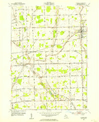
 1952 Mt Clemens1959 Print · USGSIn the early fifties, Macomb County saw rapid suburban growth around the massive Selfridge Air Force Base and Lake St. Clair. Genealogists can trace early neighborhood roots and family landmarks like McKinley Airport, Moravian Sch, and St Paul Cem.
 - 1954 Map of Detroit
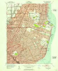
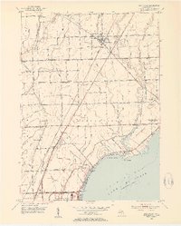
 1954 Detroit1954 Print · USGSThe Detroit metro and its Ontario neighbors are shown at the height of the mid-century industrial era, just as the suburbs were rapidly expanding. Researchers can trace the massive rail networks of the Wabash Railroad or locate landmarks like Grosse Ile and Selfridge Air Force Base.
End of results
Showing maps 1-18 of 18
Top cities of Macomb County
- Sterling Heights historical maps
- Warren historical maps
- Clinton Township historical maps
- Macomb Township historical maps
- Shelby Charter Township historical maps
- Saint Clair Shores historical maps
See more
Frequently asked questions
- What are the different types of historical maps available for Macomb County?
- What is the oldest map of Macomb County?
- Where can I purchase historical maps of Macomb County for my home or office?
- Where can I download high-res historical maps of Macomb County?
- Are there historical topographic maps available for Macomb County?
- Is there historical aerial imagery available for Macomb County?
- Where are historical maps of Macomb County sourced from?