1980s Maps of Wells Township, Michigan
Explore 10 historic maps of Wells Township from the 1980s. These maps offer a rare glimpse into what life looked like during the 1980s — showing old roads, neighborhoods, homes, and landmarks that have changed or disappeared over time.
Whether you're researching your family's past, planning a metal detecting trip, or studying how Wells Township's landscape evolved across the 1980s, these high-resolution maps are a powerful tool for exploring the history of this region.
- Focus on a specific era: All maps on this page are from the 1980s, giving you a focused view of this time period.
- See what’s changed: Compare century-old streets, trails, and buildings to today's modern landscape using overlays and satellite layers.
- Research with precision: Use these maps for genealogy, historical research, land use analysis, or educational projects.
- View, download, or print: Maps are fully viewable online in high resolution, and can be downloaded or printed for your own records.
Start exploring Wells Township's history through authentic maps from the 1980s. This is your window into the past.
Wells Township, MI maps
(10)- 1982 Map of Escanaba
 1982 Escanaba1982 Print · USGSUpper Peninsula timber and mining country come to life in this early 1980s survey of the lakefront and forest interior. Trace family roots and industrial history through settlements like Norway and Gladstone, or locate the Appleton Mine and Fernwood Cem near the rail lines.
 - 1983 Map of Gwinn
 1983 Gwinn1983 Print · USGSThe heart of Michigan's Marquette Iron Range is captured here during the 1980s, when mining and military operations defined the local landscape. Genealogists and industrial historians can trace the tracks of the Chicago and North Western to the National Mine or the airman's life at K I Sawyer Air Force Base.2 unique versions available
 - 1986 Map of Helps
 1986 Helps1986 Print · USGSUpper Peninsula timberlands and the quiet settlements of Helps and Faunus are captured here in the mid-1980s. Local researchers can trace the path of the Old Railroad Grade and locate remote water bodies like Stephenson Lake.
 - 1986 Map of Northland
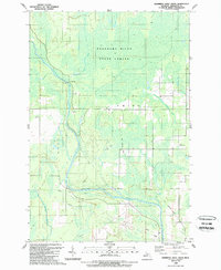
 1986 Northland1986 Print · USGSThe woodlands of Marquette County are captured in the mid-1980s as forestry and small settlements define the Upper Peninsula landscape. Genealogists and local historians can trace the Northland townsite and its local Cem, or follow the winding Ford River and Escanaba River through the Escanaba River State Forest.
 - 1986 Map of Northland NE, 1987 Print
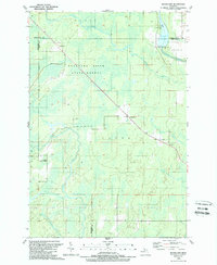
 1986 Northland NE1987 Print · USGSThe Upper Peninsula interior comes into focus in the mid-1980s, centered on the junction of the Escanaba River and its West Branch. Trace timber-access trails through the Copper Country State Forest or find old landmarks like Landon Lake and the Gravel Pit.
 - 1989 Map of Swimming Hole Creek
 1989 Swimming Hole Creek1989 Print · USGSMarquette County's northern woods are documented in the late eighties, showing a landscape shaped by the Escanaba River. Genealogists and local historians can trace the Old Railroad Grade or locate landmarks like Bonnie Landing Field.
 - 1989 Map of Woodlawn
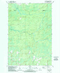
 1989 Woodlawn1989 Print · USGSThe Michigan Upper Peninsula's interior is captured in the late 1980s, showcasing the intersection of the Delta, Marquette, and Menominee county lines. Researchers can locate the Cedardale Community Chapel, the Boney Falls Dam on the Escanaba River, and small settlements like Woodlawn.
 - 1989 Map of La Branche
 1989 La Branche1989 Print · USGSUpper Peninsula timberland and river systems are documented here in the late eighties, just as the regional landscape was being managed for forest conservation. Researchers can trace the winding Ford River through the Escanaba River State Forest or locate the small settlement of La Branche.
 - 1989 Map of Anderson Lake
 1989 Anderson Lake1989 Print · USGSMarquette County's forested interior is documented here in the late eighties, showing a landscape shaped by the Escanaba River. You can trace the Old Railroad Grade and locate Deshambo near the river's West Branch.
 - 1989 Map of Arnold
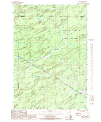
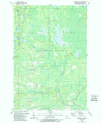
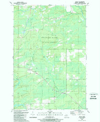 1989 Arnold1989 Print · USGSMarquette County's timber and rail heritage is on full display in the late eighties, showing the quiet township of Wells. You can trace the Old Railroad Grade and locate family landmarks like Forest Home Cem and the Twp School.
End of results
Showing maps 1-10 of 10
Top cities near Wells Township
Top neighborhoods of Wells Township
- Reade historical maps
- Mashek historical maps
- Watson historical maps
- Arnold historical maps
- Northland historical maps
Frequently asked questions
- What are the different types of historical maps available for Wells Township?
- What is the oldest map of Wells Township?
- Where can I purchase historical maps of Wells Township for my home or office?
- Where can I download high-res historical maps of Wells Township?
- Are there historical topographic maps available for Wells Township?
- Is there historical aerial imagery available for Wells Township?
- Where are historical maps of Wells Township sourced from?