Old Maps of Wells Township, Michigan for Academic Research
Study the evolution of Wells Township with 68 high-resolution historic maps. Whether you're teaching, researching, or modeling changes in land use, these maps provide essential visual documentation of urban, environmental, and geographic change.
- Analyze long-term change: Track patterns in development, transportation, and natural features.
- Ideal for environmental or urban studies: Support academic projects with primary historical map data.
- Use in the classroom or lab: Educators and researchers rely on these maps to bring historical context to life.
These maps are a powerful tool for teaching, research, and visualizing how Wells Township has changed over the decades.
Wells Township, MI maps
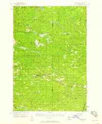
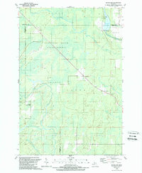
(68)- 1932 Map of Helena NW
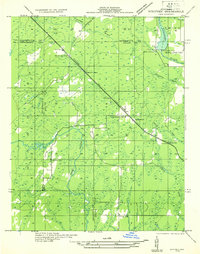
 1932 Helena NW1932 Print · USGSMarquette County's timber and mining lands are shown here in the early 1930s, punctuated by remote industrial outposts and expansive wetlands. You can locate old logging sites like Victor Larson Camp and the Gardner Mine along the Escanaba River corridor.
 - 1932 Map of Whitney NE
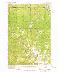
 1932 Whitney NE1932 Print · USGSThe Upper Peninsula interior during the early 1930s was a landscape of timber-hauling railroads and remote hydro projects. Researchers can locate small communities like Woodlawn and Hendricks or trace the schools and dams along the Escanaba River.
 - 1932 Map of Helena SW
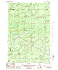
 1932 Helena SW1932 Print · USGSMarquette County’s timber country comes into focus in the early 1930s, showing the railroad and logging camps that drove the regional economy. Researchers can locate vanished sites like John Bruce Camp, the Finnish Sch, and the Arnold PO along the Escanaba and Lake Superior line.
 - 1932 Map of Helena
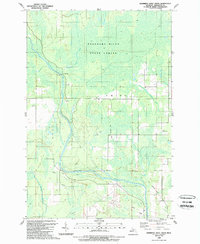
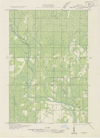 1932 Helena1932 Print · USGSMarquette County's river valleys and rail corridors are captured here in the early thirties as the region transitioned from logging camps to settled townships. Researchers can locate community anchors like the Town Hall and Lincoln Sch or trace the early industrial footprint of the Chicago and Northwestern railroad.2 unique versions available
 - 1951 Map of Helena SW
 1951 Helena SW1951 Print · USGSMarquette County's logging and rail corridor is captured here in the early 1950s, showing the intersection of timber camps and rural school life. Researchers can trace the Escanaba and Lake Superior line to Watson, the Arnold PO, and the Finnish Sch.
 - 1951 Map of Helena
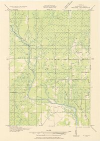 1951 Helena1951 Print · USGSMarquette County in the early thirties shows a landscape of river-driven industry and rural school districts. Genealogists and historians can trace the foundations of local education at Ewing Sch and Lincoln Sch or locate the sites of Finn Camp and Sherkeys Camp.2 unique versions available
 - 1951 Map of Helena NW
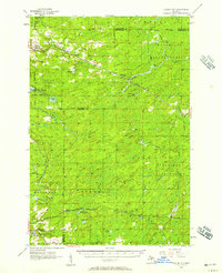
 1951 Helena NW1951 Print · USGSMarquette County’s interior during the early 1950s was a landscape of remote camps and heavy industry centered on the Escanaba River. Genealogists and historians can trace old logging outposts like Faucett Camp and the rail operations of the Chicago and North Western.
 - 1954 Map of Escanaba, 1967 Print
 1954 Escanaba1967 Print · USGSThe Upper Peninsula and Door County shorelines meet here in the mid-fifties, showing the vital maritime and timber networks of the Great Lakes. Researchers can trace historic rail lines, old fire lookouts like the Stonington Fire Tower, and island settlements such as Washington Island.2 unique versions available
 - 1956 Map of Foster City, 1957 Print
 1956 Foster City1957 Print · USGSNorthern Menominee County is seen here during the mid-fifties, dominated by timber management and rail transit. Genealogists can trace the early community at Foster City or locate family plots at the Waucedah Township Cem.3 unique versions available
 - 1957 Map of Escanaba
 1957 Escanaba1957 Print · USGSThe Upper Peninsula and Door County shorelines meet in the mid-fifties, capturing a landscape of timber, iron, and maritime trade. Genealogists and local historians can trace the Chicago & North Western RR through settlements like Hermansville or locate St Vitals Church and the Potawatome Indian Reservation.
 - 1957 Map of Northland, 1958 Print
 1957 Northland1958 Print · USGSThe Upper Peninsula interior shows its mid-century character during the late 1950s, where rail lines still connected remote forest outposts. Trace the old rail stops at Northland and Alfred or locate the Alfred Lookout Tower and Education Camp near the Ford River.2 unique versions available
 - 1958 Map of Escanaba
 1958 Escanaba1958 Print · USGSNorthern Lake Michigan maritime commerce and timberlands are captured here in the mid-fifties. Genealogists and historians can trace rail networks like the Escanaba and Lake Superior or locate island settlements such as Detroit Harbor and Fish Creek.
 - 1958 Map of Marquette, 1968 Print
 1958 Marquette1968 Print · USGSThe Upper Peninsula’s central corridor is captured here in the mid-twentieth century as mining and timber industries thrived alongside new military installations. Genealogists and historians can trace the rail lines of the Soo Line Railroad through settlements like Gwinn, Turin, and Chatham.2 unique versions available
 - 1960 Map of Marquette
 1960 Marquette1960 Print · USGSUpper Peninsula mining and maritime commerce reach their peak in the late fifties across the Lake Superior shoreline. Genealogists and historians can locate remote settlements like Big Bay and Dukes, while tracing the Cyr Mine and the active rail lines of the Lake Superior and Ishpeming railroad.
 - 1961 Map of Marquette
 1961 Marquette1961 Print · USGSUpper Peninsula life in the early sixties centered on the iron docks and timber stands of the Lake Superior shore. Genealogists and historians can trace rail-to-port connections via the Lake Superior and Ishpeming Railroad and locate active sites like Republic Mine or the K.I. Sawyer Air Force Base.
 - 1963 Map of Watson, 1964 Print
 1963 Watson1964 Print · USGSUpper Peninsula timber and rail country come into focus during the early sixties, showing the remote settlements of Watson and Arnold. Genealogists and researchers can locate the Forest Home Cem, the Gardner Mine, and the historic Arnold Lookout Tower.
 - 1963 Map of Schaffer, 1965 Print
 1963 Schaffer1965 Print · USGSUpper Peninsula timber and rail corridors define the landscape in the early sixties, showing the vital connections between the forests and regional industry. Researchers can trace the legacy of small settlements like Perronville and Schaffer or locate the Cornell Ch and Schaffer Cem along the Ford River.2 unique versions available
 - 1968 Map of Marquette, 1977 Print
 1968 Marquette1977 Print · USGSThe Upper Peninsula iron range and Lake Superior coastline are captured here in the late sixties. Genealogists and historians can trace the rail-to-port infrastructure and the Cold War presence of K I Sawyer Air Force Base alongside towns like Ishpeming and Munising.
 - 1982 Map of Escanaba
 1982 Escanaba1982 Print · USGSUpper Peninsula timber and mining country come to life in this early 1980s survey of the lakefront and forest interior. Trace family roots and industrial history through settlements like Norway and Gladstone, or locate the Appleton Mine and Fernwood Cem near the rail lines.
 - 1983 Map of Gwinn
 1983 Gwinn1983 Print · USGSThe heart of Michigan's Marquette Iron Range is captured here during the 1980s, when mining and military operations defined the local landscape. Genealogists and industrial historians can trace the tracks of the Chicago and North Western to the National Mine or the airman's life at K I Sawyer Air Force Base.2 unique versions available
 - 1986 Map of Helps
 1986 Helps1986 Print · USGSUpper Peninsula timberlands and the quiet settlements of Helps and Faunus are captured here in the mid-1980s. Local researchers can trace the path of the Old Railroad Grade and locate remote water bodies like Stephenson Lake.
 - 1986 Map of Northland
 1986 Northland1986 Print · USGSThe woodlands of Marquette County are captured in the mid-1980s as forestry and small settlements define the Upper Peninsula landscape. Genealogists and local historians can trace the Northland townsite and its local Cem, or follow the winding Ford River and Escanaba River through the Escanaba River State Forest.
 - 1986 Map of Northland NE, 1987 Print
 1986 Northland NE1987 Print · USGSThe Upper Peninsula interior comes into focus in the mid-1980s, centered on the junction of the Escanaba River and its West Branch. Trace timber-access trails through the Copper Country State Forest or find old landmarks like Landon Lake and the Gravel Pit.
 - 1989 Map of Swimming Hole Creek
 1989 Swimming Hole Creek1989 Print · USGSMarquette County's northern woods are documented in the late eighties, showing a landscape shaped by the Escanaba River. Genealogists and local historians can trace the Old Railroad Grade or locate landmarks like Bonnie Landing Field.
 - 1989 Map of Woodlawn
 1989 Woodlawn1989 Print · USGSThe Michigan Upper Peninsula's interior is captured in the late 1980s, showcasing the intersection of the Delta, Marquette, and Menominee county lines. Researchers can locate the Cedardale Community Chapel, the Boney Falls Dam on the Escanaba River, and small settlements like Woodlawn.
Showing maps 1-25 of 68
Top cities near Wells Township
Top neighborhoods of Wells Township
- Reade historical maps
- Mashek historical maps
- Watson historical maps
- Arnold historical maps
- Northland historical maps
Frequently asked questions
- What are the different types of historical maps available for Wells Township?
- What is the oldest map of Wells Township?
- Where can I purchase historical maps of Wells Township for my home or office?
- Where can I download high-res historical maps of Wells Township?
- Are there historical topographic maps available for Wells Township?
- Is there historical aerial imagery available for Wells Township?
- Where are historical maps of Wells Township sourced from?