2020s Maps of Estral Beach, Berlin Charter Township
Explore 1 historic maps of Estral Beach from the 2020s. These maps offer a rare glimpse into what life looked like during the 2020s — showing old roads, neighborhoods, homes, and landmarks that have changed or disappeared over time.
Whether you're researching your family's past, planning a metal detecting trip, or studying how Estral Beach's landscape evolved across the 2020s, these high-resolution maps are a powerful tool for exploring the history of this region.
- Focus on a specific era: All maps on this page are from the 2020s, giving you a focused view of this time period.
- See what’s changed: Compare century-old streets, trails, and buildings to today's modern landscape using overlays and satellite layers.
- Research with precision: Use these maps for genealogy, historical research, land use analysis, or educational projects.
- View, download, or print: Maps are fully viewable online in high resolution, and can be downloaded or printed for your own records.
Start exploring Estral Beach's history through authentic maps from the 2020s. This is your window into the past.
Estral Beach, Berlin Charter Township maps
(1)- 2023 Map of Estral Beach, 2023 Print
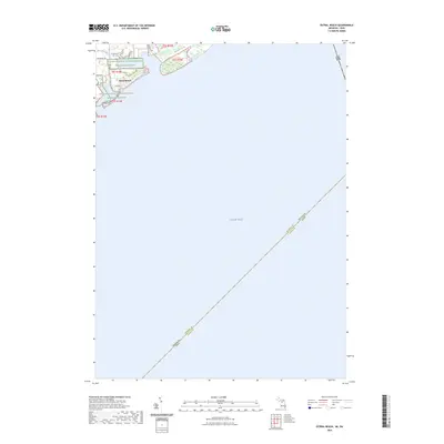 2023 Estral Beach2023 Print · USGSEstral Beach occupies a narrow strip of Michigan’s Lake Erie coastline in the early 2020s, bordered by significant conservation lands. Researchers can trace the layout of the lakeshore community along Center St and its interface with the Detroit River International Wildlife Refuge.
End of results
Showing maps 1-1 of 1
Top cities near Estral Beach
- Taylor historical maps
- Brownstown Charter Township historical maps
- Van Buren Charter Township historical maps
- Southgate historical maps
- Wyandotte historical maps
- Romulus historical maps
See more
Frequently asked questions
- What are the different types of historical maps available for Estral Beach?
- What is the oldest map of Estral Beach?
- Where can I purchase historical maps of Estral Beach for my home or office?
- Where can I download high-res historical maps of Estral Beach?
- Are there historical topographic maps available for Estral Beach?
- Is there historical aerial imagery available for Estral Beach?
- Where are historical maps of Estral Beach sourced from?