1980s Maps of Van Buren County, Michigan
Explore 19 historic maps of Van Buren County from the 1980s. These maps offer a rare glimpse into what life looked like during the 1980s — showing old roads, neighborhoods, homes, and landmarks that have changed or disappeared over time.
Whether you're researching your family's past, planning a metal detecting trip, or studying how Van Buren County's landscape evolved across the 1980s, these high-resolution maps are a powerful tool for exploring the history of this region.
- Focus on a specific era: All maps on this page are from the 1980s, giving you a focused view of this time period.
- See what’s changed: Compare century-old streets, trails, and buildings to today's modern landscape using overlays and satellite layers.
- Research with precision: Use these maps for genealogy, historical research, land use analysis, or educational projects.
- View, download, or print: Maps are fully viewable online in high resolution, and can be downloaded or printed for your own records.
Start exploring Van Buren County's history through authentic maps from the 1980s. This is your window into the past.
Van Buren County, MI maps
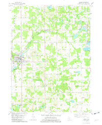
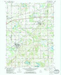
(19)- 1981 Map of Bloomingdale, 1982 Print
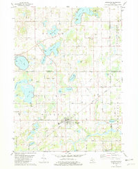
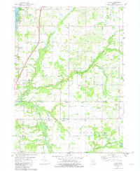
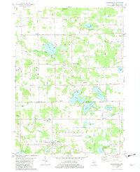 1981 Bloomingdale1982 Print · USGSThe borderlands of Van Buren and Allegan counties were a patchwork of small farms and numerous glacial lakes in the early eighties. Genealogists can locate several local burial grounds including Spring Grove Cem, Indian Cem, and Packtown Cem.
 - 1981 Map of McDonald, 1982 Print
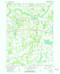
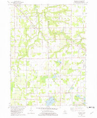 1981 McDonald1982 Print · USGSIn the early 1980s, these rural townships west of Bangor were defined by the Chesapeake and Ohio railroad and a grid of family orchards. Researchers can trace historic settlements like McDonald and Toquin or locate family sites near Monk Cem and the Wood Sch.
 - 1981 Map of Covert, 1982 Print
 1981 Covert1982 Print · USGSCoastal Van Buren County in the early eighties shows a landscape of dunes and developing lakeside communities along the lake. Researchers can trace family sites near Fish Corners, the Chesapeake and Ohio tracks, and the Fish Cem.
 - 1981 Map of Twin Lakes, 1982 Print
 1981 Twin Lakes1982 Print · USGSSouthwestern Michigan’s lake country and the Dowagiac River valley are shown in detail during the early eighties. Researchers can locate family burial sites at North Wayne Cem and Gage Cem or trace the Amtrak line through Glenwood.
 - 1981 Map of Marcellus, 1982 Print
 1981 Marcellus1982 Print · USGSMarcellus and the surrounding lake country of Cass County are captured here in the early eighties as the rail-and-road network remained central to rural life. Researchers can trace the Grand Trunk Western line, locate family plots at Bly Cem, or find old gathering spots like Harmony Chapel.
 - 1981 Map of Sister Lakes, 1982 Print
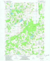
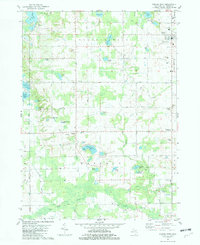
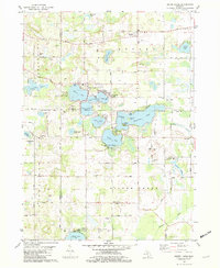 1981 Sister Lakes1982 Print · USGSThe lake country of Southwest Michigan is captured here in the early eighties, showcasing a dense network of resort communities and rural parish life. Genealogists and local historians can locate early burial sites like Keeler Cemetery, the historic Red Mill, and schools such as Indian Lake School.
 - 1981 Map of Pullman, 1982 Print
 1981 Pullman1982 Print · USGSSouthwestern Michigan’s lake country is captured here in the early eighties as a mix of recreation and resource extraction. Trace family sites near Pullman or find old landmarks like Burrows Sch and the Sacred Heart Cem.
 - 1981 Map of Hartford, 1982 Print
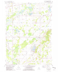
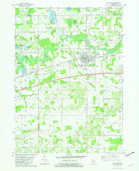 1981 Hartford1982 Print · USGSHartford and its surrounding rural townships are documented here in the early eighties as the rail and highway corridor thrived. Genealogists can locate family sites at Maple Hill Cem and Fairview Memorial Cem or trace community life at Woodside Sch and Stoughton Corners.
 - 1981 Map of Lacota, 1982 Print
 1981 Lacota1982 Print · USGSLake Michigan's shoreline meets the rural townships of Casco and Geneva in the early eighties. Genealogists and local historians can trace family plots at Stuller Cemetery or Chambers Cemetery and explore the historic crossroads of Kibbie and Lacota.
 - 1981 Map of Gobles East, 1982 Print
 1981 Gobles East1982 Print · USGSVan Buren and Kalamazoo Counties are shown in the early eighties, where a high concentration of inland lakes meets a legacy of rail and conservation. Trace the Old Railroad Grade past Mentha or locate the Wolf Lake State Fish Hatchery.2 unique versions available
 - 1981 Map of Paw Paw, 1982 Print
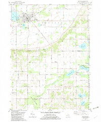
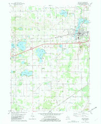 1981 Paw Paw1982 Print · USGSPaw Paw and its surrounding township are captured in the early eighties as the village expanded near the river and rail lines. Local historians can trace family roots at Prospect Hill Cemetery or locate old landmarks like the Cedar Street Sch and Maple Isle.
 - 1981 Map of South Haven, 1982 Print
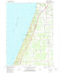
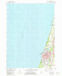 1981 South Haven1982 Print · USGSThe Lake Michigan shoreline of Van Buren County comes into focus in the early 1980s, centered on the busy port of South Haven. Genealogists and local historians can trace the town's growth through landmarks like the Hebrew Cemetery, the Chesapeake and Ohio rail line, and Miami Park.
 - 1981 Map of Bangor, 1982 Print
 1981 Bangor1982 Print · USGSVan Buren County in the early eighties shows a landscape shaped by the Black River and the railroad. Genealogists can trace family names at Arlington Hill Cem or Coburn Cem and locate rural landmarks like Arlington Center Sch.
 - 1981 Map of Gobles West, 1982 Print
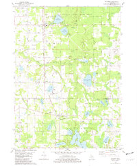
 1981 Gobles West1982 Print · USGSVan Buren County in the early eighties exhibits a landscape of glacial lakes and quiet crossroads during a period of steady rural development. Researchers can find family-named landmarks like Robinson Cem, the landing at School Section Lake, and the small aviation field at Wesler Airfield.
 - 1981 Map of Decatur, 1982 Print
 1981 Decatur1982 Print · USGSDecatur and the surrounding lake country of Van Buren and Cass Counties are captured here in the early eighties. Genealogists and local researchers can locate numerous country burial grounds and small settlements, including Lakeside Cem, Rose Hill Cem, and the village of Volinia.
 - 1981 Map of Merson, 1982 Print
 1981 Merson1982 Print · USGSThe borderlands of Allegan and Van Buren counties are shown in the early eighties as a mix of lakeland recreation and rural industry. Genealogists and local historians can trace family-named sites like Blackman Cem and Earl Cem or locate the Trowbridge Dam along the river.
 - 1981 Map of Lawton, 1982 Print
 1981 Lawton1982 Print · USGSIn the early eighties, this pocket of Van Buren County thrived on its rail-linked villages and diverse agricultural landscape. Researchers can trace family history through sites like Oak Grove Cem and Harwick Cem or locate the old Amtrak corridor and Mattawan Airpark.
 - 1981 Map of Lawrence, 1982 Print
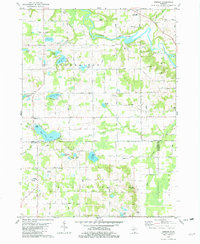
 1981 Lawrence1982 Print · USGSThe village of Lawrence and its surrounding townships are shown here in the early eighties as a hub of river-and-rail activity. Genealogists can trace family sites at Hill Cem and Prospect Lake Cem, or locate the small community of Fritzburg.
 - 1982 Map of Kalamazoo, 1983 Print
 1982 Kalamazoo1983 Print · USGSThe Kalamazoo River valley in the early eighties shows a landscape of growing suburban centers and heavy rail infrastructure. Genealogists and researchers can trace the limits of Kalamazoo and Battle Creek or locate landmarks like Fort Custer National Cemetery and Gull Lake.
End of results
Showing maps 1-19 of 19
Top cities of Van Buren County
Frequently asked questions
- What are the different types of historical maps available for Van Buren County?
- What is the oldest map of Van Buren County?
- Where can I purchase historical maps of Van Buren County for my home or office?
- Where can I download high-res historical maps of Van Buren County?
- Are there historical topographic maps available for Van Buren County?
- Is there historical aerial imagery available for Van Buren County?
- Where are historical maps of Van Buren County sourced from?