2020s Maps of Van Buren County, Michigan
Explore 19 historic maps of Van Buren County from the 2020s. These maps offer a rare glimpse into what life looked like during the 2020s — showing old roads, neighborhoods, homes, and landmarks that have changed or disappeared over time.
Whether you're researching your family's past, planning a metal detecting trip, or studying how Van Buren County's landscape evolved across the 2020s, these high-resolution maps are a powerful tool for exploring the history of this region.
- Focus on a specific era: All maps on this page are from the 2020s, giving you a focused view of this time period.
- See what’s changed: Compare century-old streets, trails, and buildings to today's modern landscape using overlays and satellite layers.
- Research with precision: Use these maps for genealogy, historical research, land use analysis, or educational projects.
- View, download, or print: Maps are fully viewable online in high resolution, and can be downloaded or printed for your own records.
Start exploring Van Buren County's history through authentic maps from the 2020s. This is your window into the past.
Van Buren County, MI maps
(19)- 2023 Map of Sister Lakes, 2023 Print
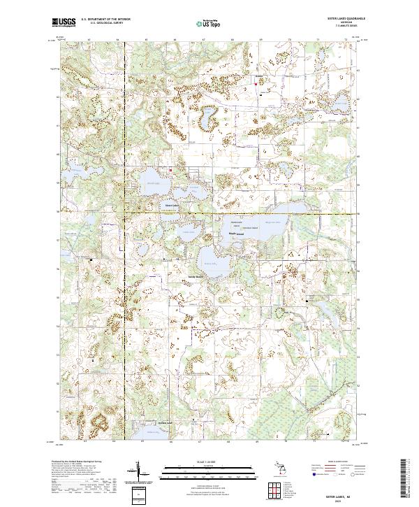 2023 Sister Lakes2023 Print · USGSThe interconnected waters of southwest Michigan are captured here in the early twenty-first century, showing the established communities of Sister Lakes and Keeler. Researchers can trace family history through numerous local sites including Keeler Cem, Indian Lake Cem, and the Sacred Heart of Mary Cem.
 - 2023 Map of Pullman, 2023 Print
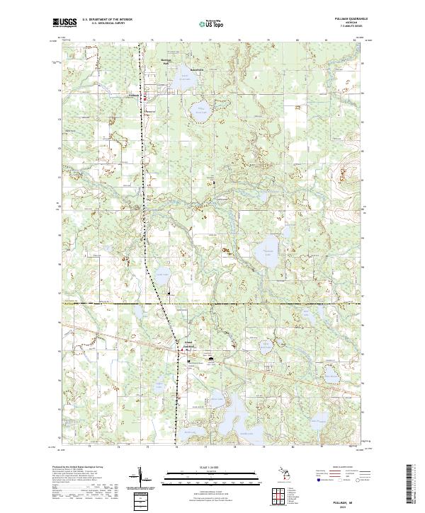 2023 Pullman2023 Print · USGSAllegan and Van Buren counties meet here in a landscape defined by many small lakes and rural townships. Genealogists and historians can locate several local burial grounds including Saints Cem and the Lee Township Cem, alongside settlements like Pullman and Grand Junction.
 - 2023 Map of Bangor, 2023 Print
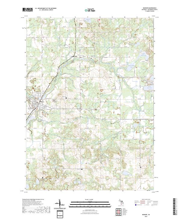 2023 Bangor2023 Print · USGSThe rural agricultural lands of Van Buren County are captured here in the early 2020s, centered on the communities of Bangor and Breedsville. Genealogists can trace numerous family burial sites across the township, including Arlington Hill Cem, Southard Cem, and Hoppin Cem.
 - 2023 Map of Twin Lakes, 2023 Print
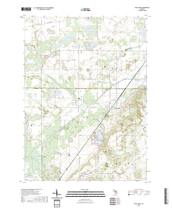 2023 Twin Lakes2023 Print · USGSThe borderlands of Van Buren and Cass Counties appear here in the early 2020s, showing a landscape defined by its glacial lakes and agricultural drainage. Local historians can locate Glenwood and several area burial sites like Hamilton Cem and North Wayne Cem.
 - 2023 Map of McDonald, 2023 Print
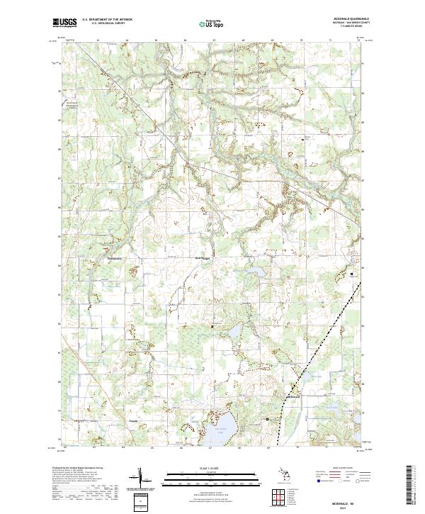 2023 McDonald2023 Print · USGSVan Buren County in the early 2020s remains a region of quiet lakeside settlements and ancestral burial grounds. Researchers can trace the layout of small communities like West Bangor and McDonald or locate historic sites such as Van Auken Cem and Monks Cem.
 - 2023 Map of Covert, 2023 Print
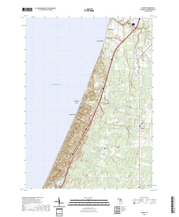 2023 Covert2023 Print · USGSThe Lake Michigan shoreline of Van Buren County appears here during a period of modern recreation and legacy agriculture. Researchers can trace the coastal bluffs of Thunder Mountain or locate family plots at Covert Cem and the Fish Cem near the town of Covert.
 - 2023 Map of Coloma, 2023 Print
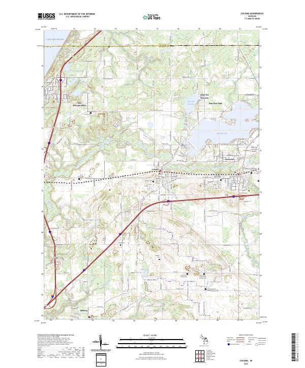 2023 Coloma2023 Print · USGSBerrien County is captured in this modern survey during a period of established lakeside recreation and rural settlement. Genealogists and local historians can locate many family burial sites, including Coloma Cem and Millburg Cem, while tracing the course of the Paw Paw River.
 - 2023 Map of Lacota, 2023 Print
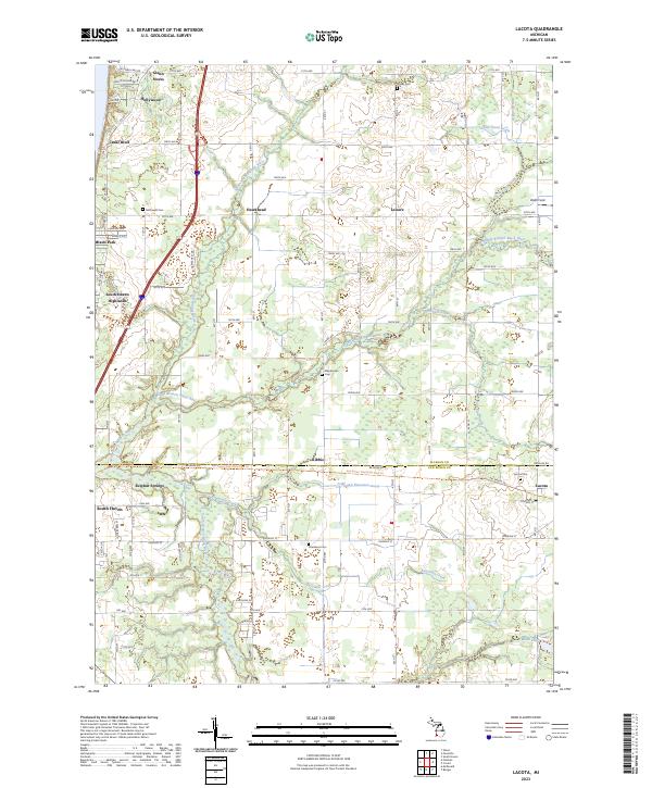 2023 Lacota2023 Print · USGSCoastal Allegan and Van Buren counties are captured here in the early twenty-first century as lakefront communities meet an inland river network. Trace local family roots at McDowell Cem and Lacota Cem, or explore the historical path of the Kal-haven Trail State Park Trl.
 - 2023 Map of Lawrence, 2023 Print
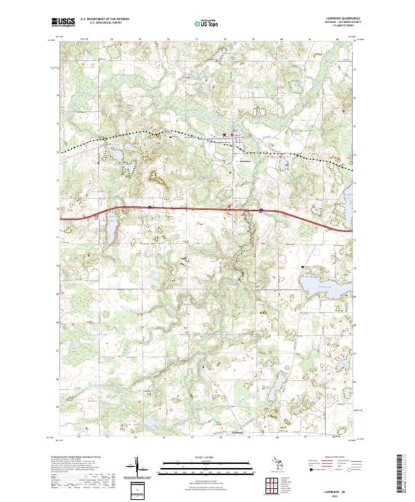 2023 Lawrence2023 Print · USGSThe village of Lawrence and its surrounding lake country are shown here in the modern era, situated along the winding Paw Paw River. Genealogists and local historians can locate Hill Cem, Prospect Lake Cem, and the small settlement of Fritzburg.
 - 2023 Map of South Haven, 2023 Print
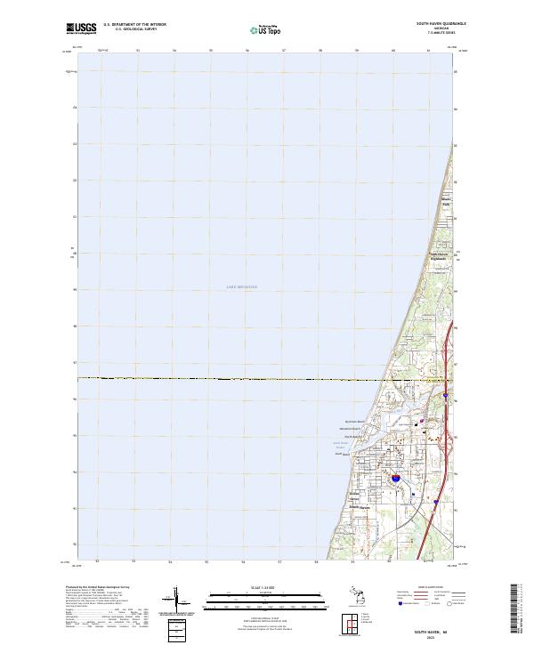 2023 South Haven2023 Print · USGSSouth Haven and its surrounding lakefront communities are captured here in the early 2020s. Genealogists and historians can locate Lake View Cemetery, trace the Van Buren Trail State Park Trail, and explore neighborhoods like Indian Grove.
 - 2023 Map of Hartford, 2023 Print
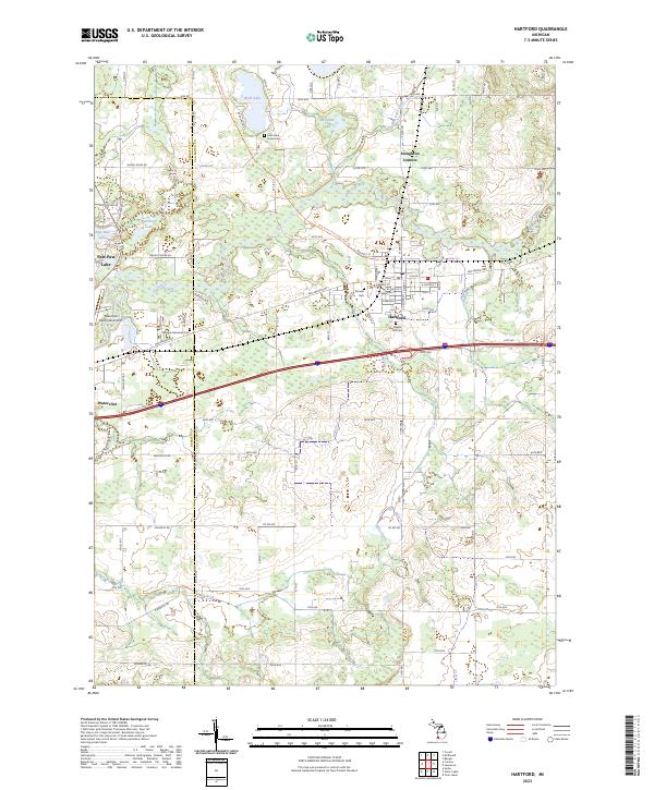 2023 Hartford2023 Print · USGSThe rural landscape of Van Buren County is captured here in the early twenty-first century, showing the town of Hartford and the winding Paw Paw River. Genealogists can trace family locations near Rush Lake Indian Cem, Pioneer Cem, and Stoughton Corners.
 - 2023 Map of Decatur, 2023 Print
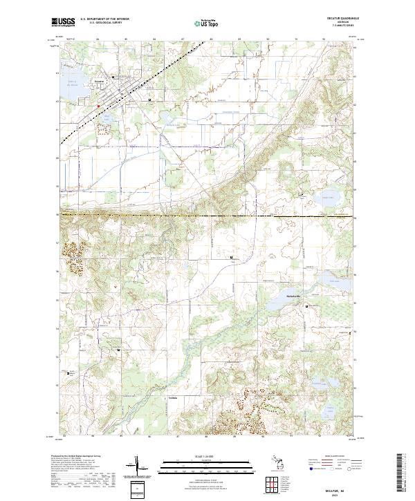 2023 Decatur2023 Print · USGSDecatur and the surrounding farmlands of Van Buren and Cass Counties are documented here in recent years. Researchers can locate numerous local burial sites like Crane Cem and Rose Hill Cem, or trace the waters of Dowagiac Creek near Nicholsville.
 - 2023 Map of Marcellus, 2023 Print
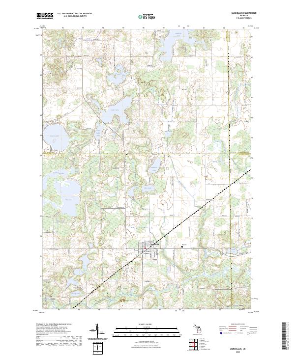 2023 Marcellus2023 Print · USGSMarcellus and the surrounding glacial lake country are captured here at the junction of four Michigan counties. Genealogists and local historians can trace family-named sites like Huyck Graves Cem, the quiet waters of Bankson Lake, and the rural grid of Marcellus.
 - 2023 Map of Bloomingdale, 2023 Print
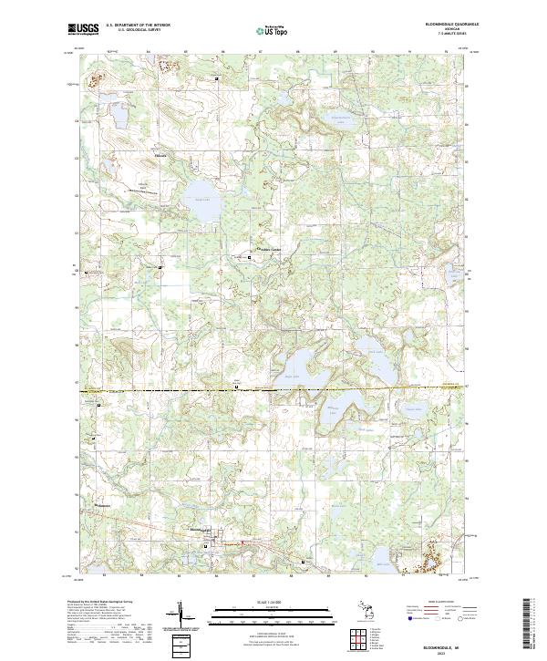 2023 Bloomingdale2023 Print · USGSBloomingdale and the surrounding lake country of Van Buren and Allegan Counties are shown here in recent detail. Researchers can locate several historical burial sites like Spring Grove Cem and Pierceson Cem or trace the path of the Kal-haven Trail State Park Trl.
 - 2023 Map of Merson, 2023 Print
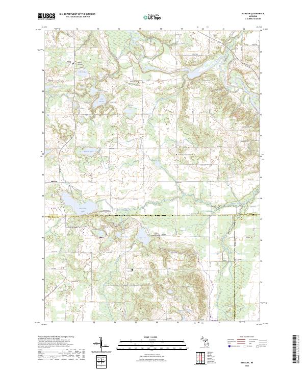 2023 Merson2023 Print · USGSAllegan County's agricultural and lake country is captured here in the early 2020s, showing a landscape defined by traditional section roads and glacial hydrology. Researchers can trace local history through the Trowbridge Methodist Cem, Earl Cem, and the rural settlement of Merson.
 - 2023 Map of Paw Paw, 2023 Print
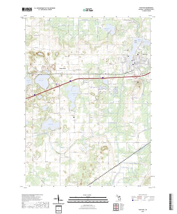 2023 Paw Paw2023 Print · USGSThe village of Paw Paw is captured here in the early twenty-first century as the civic heart of Van Buren County. Genealogists and local historians can locate the Van Buren County Courthouse and several historic burial grounds including Pioneer Cem and Prospect Hill Cem.
 - 2023 Map of Lawton, 2023 Print
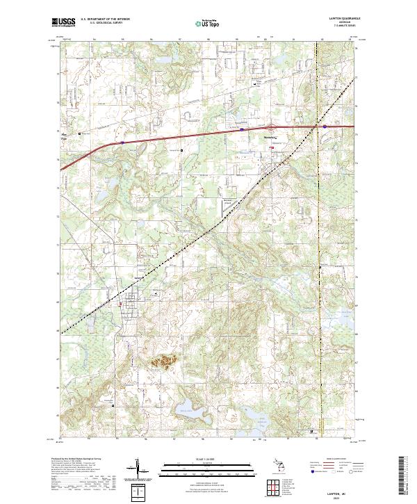 2023 Lawton2023 Print · USGSThe village of Lawton and the surrounding Van Buren County wetlands appear in high detail during this contemporary era. Local researchers can trace family plots across numerous sites like Maple Grove Cem or follow the Lawton Drain to the river forks.
 - 2023 Map of Gobles East, 2023 Print
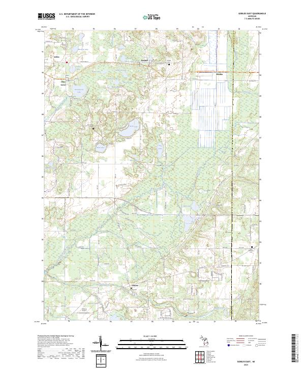 2023 Gobles East2023 Print · USGSVan Buren County's lake-dotted interior is captured here as it appeared in the early 2020s, showing the intersection of rural life and natural wetlands. Genealogists can locate family sites near Kendall Cem and Almena Cem or trace the historic rail line now used as the Kal-Haven Trail State Park Trl.
 - 2023 Map of Gobles West, 2023 Print
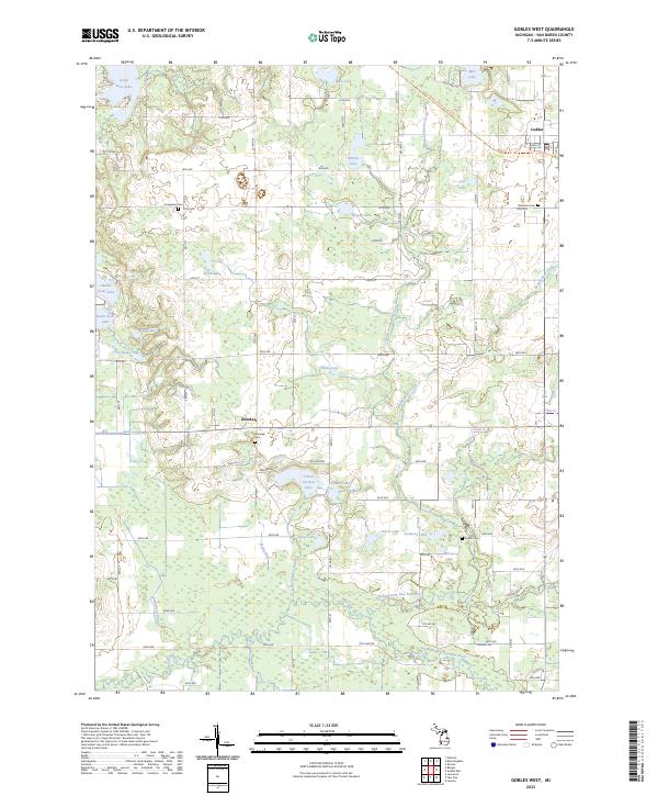 2023 Gobles West2023 Print · USGSVan Buren County's lake-strewn landscape is captured here in the early twenty-first century, centered on the rural community of Glendale. Genealogists and historians can locate family burial plots at Evergreen Cem or Austin Cem and trace the Kal-Haven Trail State Park Trl corridor.
End of results
Showing maps 1-19 of 19
Top cities of Van Buren County
Frequently asked questions
- What are the different types of historical maps available for Van Buren County?
- What is the oldest map of Van Buren County?
- Where can I purchase historical maps of Van Buren County for my home or office?
- Where can I download high-res historical maps of Van Buren County?
- Are there historical topographic maps available for Van Buren County?
- Is there historical aerial imagery available for Van Buren County?
- Where are historical maps of Van Buren County sourced from?