Old Maps of Van Buren County, Michigan for Metal Detecting
Plan your next treasure hunt with 135 historic maps of Van Buren County. Find old homesites, ghost towns, trails, and gathering spots that may be lost to time — perfect for identifying promising metal detecting locations.
- Locate forgotten sites: Uncover places like long-lost settlements, abandoned rail lines, or gathering spots.
- Plan better hunts: Use map overlays combined with LiDAR or satellite views to narrow in on historically rich areas.
- Made for detectorists: Thousands of hobbyists use these maps to discover relics, coins, and hidden history.
Use these historic maps to boost your research and find new opportunities beneath the surface of Van Buren County.
Van Buren County, MI maps
(135)- 1927 Map of Hartford, 1943 Print
 1927 Hartford1943 Print · USGSVan Buren County agriculture and lakeside leisure meet in the late 1920s as Hartford and Lawrence thrive along the Pere Marquette rail line. Researchers can locate numerous rural schoolhouses, the historic Red Mill, and early resort development at Sister Lakes and Woodland Beach.3 unique versions available
 - 1927 Map of Bangor, 1959 Print
 1927 Bangor1959 Print · USGSVan Buren and Allegan counties show a landscape of thriving lakeside resorts and rail-fed farming towns in the late twenties. Trace family roots at Kibbie Chapel or the many local schools like Garden of Eden School and Arlington Center School.2 unique versions available
 - 1927 Map of Benton Harbor, 1964 Print
 1927 Benton Harbor1964 Print · USGSBenton Harbor and St. Joseph dominate the Lake Michigan shoreline in this late 1920s survey of Berrien County commerce and transit. Genealogists can locate dozens of rural schoolhouses like Bacon Sch and Hull Sch alongside local landmarks like the House of David.
 - 1927 Map of South Haven, 1972 Print
 1927 South Haven1972 Print · USGSThe Lake Michigan shoreline of Van Buren County flourished as a resort and agricultural destination during the late twenties. You can trace the Pere Marquette rail line through South Haven and Covert, or find old schoolhouses like Law Sch and Fish Sch.
 - 1930 Map of South Haven
 1930 South Haven1930 Print · USGSSouthwest Michigan's lakeshore comes alive in this early Depression-era survey, showing the bustling port of South Haven and its surrounding resort beaches. Genealogists and local historians can trace rural school districts like Fish Sch and landmarks such as the Emanuel Home and Thunder Mtn.4 unique versions available
 - 1930 Map of Benton Harbor
 1930 Benton Harbor1930 Print · USGSBerrien County's lakefront and river valleys appear in high detail during the late Prohibition era. Genealogists can trace family names through dozens of rural landmarks like Twelve Corners, Crystal Springs Cem, and the House of David.4 unique versions available
 - 1931 Map of Bangor
 1931 Bangor1931 Print · USGSCoastal resorts and interior farmsteads meet in this early 1930s survey of the Michigan lakefront and the Black River basin. Researchers can trace the PERE MARQUETTE rail line through Grand Junction or locate family sites like Kibbie Chapel and Gardner of Eden Sch.3 unique versions available
 - 1931 Map of Hartford
 1931 Hartford1931 Print · USGSVan Buren County and the northern edge of Cass County appear here in the late twenties, defined by a dense landscape of glacial lakes and river bottomlands. Researchers can locate early country schools like Brague Sch, the Red Mill on Silver Creek, and historic crossroads including Keeler and Fritzburg.2 unique versions available
 - 1943 Map of South Haven
 1943 South Haven1943 Print · USGSThe Lake Michigan shoreline at South Haven was a bustling intersection of rail transport and lakeside tourism during the early 1940s. Genealogists and historians can trace old schoolhouses like Fish Sch, the path of the Pere Marquette railroad, and established retreats at Palisades Park.
 - 1943 Map of Bangor
 1943 Bangor1943 Print · USGSVan Buren and Allegan counties appear here during the wartime years, when the railway was still the lifeblood of rural Michigan. Genealogists can trace hundreds of farmsteads near Grand Junction, Kibbie, and historic schools like Garden Of Eden Sch.
 - 1944 Map of Marcellus, 1965 Print
 1944 Marcellus1965 Print · USGSSouthwest Michigan townships in Van Buren and Cass counties are documented here during the mid-1940s as a landscape of interconnected glacial lakes and rail lines. Researchers can trace old rural schools like Durkee Sch, the Pere Marquette rail corridor, and family burial grounds such as Wildey Cem.3 unique versions available
 - 1946 Map of Marcellus
 1946 Marcellus1946 Print · USGSThe rural landscape of Cass and Van Buren counties comes alive in the mid-1940s, showing a transition between railroad hubs and quiet farming hamlets. Genealogists can locate family-named landmarks such as Chamberlain Cem and historic schools like Porter Center Sch or Shannon Sch.2 unique versions available
 - 1946 Map of Gobles, 1948 Print
 1946 Gobles1948 Print · USGSVan Buren County was a landscape of small school districts and lakeside camps just after the war. You can trace the New York Central rail line through Kendall, locate the Wolf Lake Fish Hatchery, and find family roots at the Robinson Cem.
 - 1948 Map of Gobles
 1948 Gobles1948 Print · USGSVan Buren County was a landscape of small farmsteads and scattered schoolhouses just after the war. Family historians can locate rural landmarks like Robinson Cem, the Wolf Lake Fish Hatchery, and dozens of local schools including Evergreen Sch and Almena Sch.3 unique versions available
 - 1949 Map of Gobles
 1949 Gobles1949 Print · USGSVan Buren and Allegan counties appear here at the end of the 1940s, a landscape defined by small-town rail stops and a dense network of country schools. Researchers can trace family sites near Robinson Cem, explore the old New York Central line through Berlamont, or locate the Wolf Lake Fish Hatchery.2 unique versions available
 - 1958 Map of Racine, 1971 Print
 1958 Racine1971 Print · USGSThe Lake Michigan shoreline in the late fifties was a study in contrasts between the industrial bustle of Kenosha and the quiet woods of the Allegan State Forest. Genealogists and historians can trace the urban footprint of Evanston or locate strategic sites like Fort Sheridan and the Wind Point Light.3 unique versions available
 - 1958 Map of Grand Rapids, 1973 Print
 1958 Grand Rapids1973 Print · USGSSouthern Michigan at the peak of the postwar era shows a landscape of burgeoning cities and new interstate highways. Trace family roots and regional growth in Grand Rapids, Battle Creek, and the glacial lake country around Gun Lake or Gull Lake.2 unique versions available
 - 1961 Map of Grand Rapids
 1961 Grand Rapids1961 Print · USGSSouthern Michigan at the dawn of the 1960s reveals a region shaped by major river systems and a robust rail network. Trace mid-century industrial growth and land use from Grand Rapids to the Fort Custer Military Reservation and Gun Lake.
 - 1962 Map of Grand Rapids
 1962 Grand Rapids1962 Print · USGSMid-century Southern Michigan is mapped here at a time of massive growth, showing the expanding urban footprints of Grand Rapids and Lansing. Researchers can trace the legacy of the Grand Trunk Western RR, find historic boundaries of the Fort Custer Military Reservation, or locate sporting camps around Gun Lake.2 unique versions available
 - 1962 Map of Racine
 1962 Racine1962 Print · USGSThe Lake Michigan shoreline in the early sixties reveals a fascinating contrast between the dense industrial rail hubs of RACINE and CHICAGO and the forested dunes of Michigan. Local historians can trace military installations like Fort Sheridan or explore the numerous inland retreats around Paw Paw Lake and Sister Lakes.
 - 1970 Map of Coloma, 1973 Print
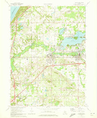 1970 Coloma1973 Print · USGSSouthwestern Michigan's orchard and lake country is captured here during the 1970s, as regional commerce followed the Paw Paw River and rail lines. Researchers can trace family ties through several local burial grounds like St Joseph Cem and Coloma Cem, or locate landmarks such as the Watervliet Mun Airport.2 unique versions available
 - 1981 Map of Bloomingdale, 1982 Print
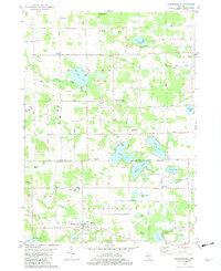 1981 Bloomingdale1982 Print · USGSThe borderlands of Van Buren and Allegan counties were a patchwork of small farms and numerous glacial lakes in the early eighties. Genealogists can locate several local burial grounds including Spring Grove Cem, Indian Cem, and Packtown Cem.
 - 1981 Map of McDonald, 1982 Print
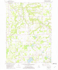 1981 McDonald1982 Print · USGSIn the early 1980s, these rural townships west of Bangor were defined by the Chesapeake and Ohio railroad and a grid of family orchards. Researchers can trace historic settlements like McDonald and Toquin or locate family sites near Monk Cem and the Wood Sch.
 - 1981 Map of Covert, 1982 Print
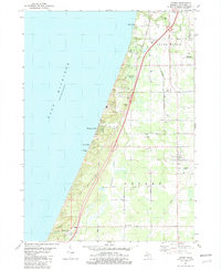 1981 Covert1982 Print · USGSCoastal Van Buren County in the early eighties shows a landscape of dunes and developing lakeside communities along the lake. Researchers can trace family sites near Fish Corners, the Chesapeake and Ohio tracks, and the Fish Cem.
 - 1981 Map of Twin Lakes, 1982 Print
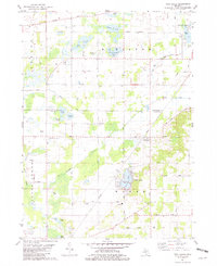 1981 Twin Lakes1982 Print · USGSSouthwestern Michigan’s lake country and the Dowagiac River valley are shown in detail during the early eighties. Researchers can locate family burial sites at North Wayne Cem and Gage Cem or trace the Amtrak line through Glenwood.
Showing maps 1-25 of 135
Top cities of Van Buren County
Frequently asked questions
- What are the different types of historical maps available for Van Buren County?
- What is the oldest map of Van Buren County?
- Where can I purchase historical maps of Van Buren County for my home or office?
- Where can I download high-res historical maps of Van Buren County?
- Are there historical topographic maps available for Van Buren County?
- Is there historical aerial imagery available for Van Buren County?
- Where are historical maps of Van Buren County sourced from?