Old Maps of Aitkin County, Minnesota for Metal Detecting
Plan your next treasure hunt with 354 historic maps of Aitkin County. Find old homesites, ghost towns, trails, and gathering spots that may be lost to time — perfect for identifying promising metal detecting locations.
- Locate forgotten sites: Uncover places like long-lost settlements, abandoned rail lines, or gathering spots.
- Plan better hunts: Use map overlays combined with LiDAR or satellite views to narrow in on historically rich areas.
- Made for detectorists: Thousands of hobbyists use these maps to discover relics, coins, and hidden history.
Use these historic maps to boost your research and find new opportunities beneath the surface of Aitkin County.
Aitkin County, MN maps
(354)- 1912 Map of Deerwood, 1963 Print
 1912 Deerwood1963 Print · USGSIn the decade before the region's full industrialization, this survey captures the lake-country settlements of Deerwood and Crosby just as the Northern Pacific railroad was driving local growth. Genealogists can locate dozens of early district schools and local landmarks like Doris Church and Katrine School.2 unique versions available
 - 1913 Map of Cuyuna, 1963 Print
 1913 Cuyuna1963 Print · USGSBefore the height of northern Minnesota's iron boom, this area centered on the nascent village of Cuyuna and the logging town of Emily. Genealogists and researchers can trace the early township school system through sites like Mud Brook School and Keeler School, or follow the competing routes of the Northern Pacific and Minneapolis St Paul and Sault Ste Marie railroads.2 unique versions available
 - 1914 Map of Deerwood
 1914 Deerwood1914 Print · USGSCrow Wing and Aitkin counties are captured here just before the First World War, showing the growth of iron range towns and lakeside settlements. Genealogists and researchers can trace early rural life through nearly twenty numbered schoolhouses, the Dorris Church, and railroad stops at Crosby and Ironton.3 unique versions available
 - 1914 Map of Aitkin, 1966 Print
 1914 Aitkin1966 Print · USGSAitkin and the surrounding wetlands are shown here just before the First World War, as the river-and-rail economy shaped the landscape. Genealogists can locate numerous rural schoolhouses and early settlements like Rossburg, Hassman, and the Lone Pine School.
 - 1915 Map of Aitkin
 1915 Aitkin1915 Print · USGSAitkin County in the mid-1910s was a hub of river transport and rail expansion, centered on the growing village of Aitkin. You can trace the path of the Northern Pacific railroad through Rossburg and find rural landmarks like Lone Pine School and Waukenabo Lake.4 unique versions available
 - 1915 Map of Cuyuna
 1915 Cuyuna1915 Print · USGSCrow Wing and Aitkin counties are captured here just before the First World War, as railroads and mining began to transform the lake-heavy landscape. Genealogists can locate many numbered district schools and settlements like Emily, Manganese, and Dean Lake.3 unique versions available
 - 1916 Map of Wealthwood
 1916 Wealthwood1916 Print · USGSThe north shore of Mille Lacs Lake is captured in the mid-1910s during a period of rural schoolhouse expansion and early shoreline settlement. Genealogists can locate family landmarks like Carlson School, the Town Hall, and pioneer hubs at Wealthwood or Malmo.4 unique versions available
 - 1953 Map of Duluth, 1964 Print
 1953 Duluth1964 Print · USGSNortheastern Minnesota and northwestern Wisconsin are shown here during a period of industrial maturity and expanding conservation. Genealogists and historians can trace rail-connected towns like McGrath and Wahkon, or locate heritage sites within the Fond du Lac Indian Reservation.2 unique versions available
 - 1954 Map of Hibbing, 1966 Print
 1954 Hibbing1966 Print · USGSNorthern Minnesota's Iron Range thrives during the mid-1960s, showing the industrial landscape between the Mesabi Range and the Mississippi River. Genealogists and historians can trace the rail lines of the Great Northern RR through mining hubs like Hibbing and Virginia.3 unique versions available
 - 1957 Map of Hibbing
 1957 Hibbing1957 Print · USGSNorthern Minnesota's Iron Range is shown at its industrial peak in the mid-fifties, dominated by the massive iron pits and rail corridors of the Mesabi Range. Researchers can trace the rail networks of the Duluth Missabe and Iron Range and locate mining hubs like Hibbing, Virginia, and Bovey.
 - 1958 Map of Hibbing
 1958 Hibbing1958 Print · USGSThe Mesabi Iron Range reached its mid-century height during this era, defining the landscape between Grand Rapids and Virginia. Genealogists and historians can trace the mining-town networks of Hibbing and Chisholm or locate numerous iron mines and rail spurs.
 - 1958 Map of Duluth
 1958 Duluth1958 Print · USGSNortheastern Minnesota and the Wisconsin borderlands are shown in detail during the late 1950s, centered on the bustling rail yards and ports of Duluth. You can trace the historic routes of the Soo Line and Duluth Missabe & Iron Range through small towns like McGrath, Bruno, and Wrenshall.
 - 1964 Map of Hibbing
 1964 Hibbing1964 Print · USGSNorthern Minnesota’s iron-rich corridor is captured here during a peak era of mid-century industrial activity. Researchers can trace the rail-to-mine connections through Mesabi Range towns like Hibbing and Virginia or locate lakefront settlements near Pokegama Lake.
 - 1968 Map of Onamia NW, 1970 Print
 1968 Onamia NW1970 Print · USGSThe southwestern reaches of Mille Lacs Lake are captured here in the late sixties, showcasing a landscape defined by conservation and recreation. Researchers can trace the early boundaries of Mille Lacs Kathio State Park and locate offshore landmarks like Spirit Island.2 unique versions available
 - 1968 Map of Kroschel NW, 1970 Print
 1968 Kroschel NW1970 Print · USGSThe Snake River corridor at the Aitkin and Kanabec county line is captured here in the late sixties, showing a landscape transitioning into protected state forests. Researchers can trace the bounds of Solana State Forest and locate fishing spots at Lake Five and Long Lake.2 unique versions available
 - 1968 Map of Wahkon North, 1970 Print
 1968 Wahkon North1970 Print · USGSThe southern shores of Mille Lacs Lake are captured here in the late sixties, showing the transition between conservation lands and local settlements. Researchers can trace the layout of Wahkon, the trails of Father Hennepin State Park, and landmarks like Hennepin Island.2 unique versions available
 - 1968 Map of Isle, 1970 Print
 1968 Isle1970 Print · USGSThe southeast corner of Mille Lacs Lake thrived in the late sixties as a crossroads of rail travel and lakeside recreation. Genealogists and local historians can trace the foundations of Isle, find remote country stops like Opstead, and locate family burial sites at Holden Cem and Redtop Cem.
 - 1968 Map of Giese, 1970 Print
 1968 Giese1970 Print · USGSThe tri-county border of Aitkin, Pine, and Kanabec counties in the late sixties reveals a landscape of deep woods and interconnected glacial lakes. Genealogists and local historians can trace the rural infrastructure of Giese, including the Lakeview Sch, Township Cem, and the winding Pine River.
 - 1968 Map of Vineland, 1970 Print
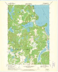 1968 Vineland1970 Print · USGSThe southwestern shores of Mille Lacs Lake are captured here in the late sixties, centered on the settlement of Vineland. Researchers can trace local history through the Alliance Mission, Lakewood Cem, and the boundaries of Mille Lacs Kathio State Park.
 - 1968 Map of Mc Grath, 1970 Print
 1968 Mc Grath1970 Print · USGSAitkin and Kanabec County in the late 1960s reveal a quiet landscape of wetlands and river bends centered on the SOO LINE railroad. Local researchers can trace family landmarks at Grace Cem or explore the early footprints of McGrath and Bergman.2 unique versions available
 - 1969 Map of Solana, 1971 Print
 1969 Solana1971 Print · USGSAitkin County forestry and rail transport are the focus here in the late sixties, where active timber management meets early industrial remnants. Local historians can trace the Soo Line and the Old Railroad Grade near Solana, or locate the White Pine Lookout Tower.2 unique versions available
 - 1969 Map of Arthyde, 1971 Print
 1969 Arthyde1971 Print · USGSNear the border of Aitkin and Pine Counties in the late sixties, this survey shows a landscape of deep forests and winding wetlands. Researchers can trace the Soo Line railroad near Arthyde, locate the Cem by Rhine Lake, and follow the Truck Trail into the heart of the Solana State Forest.
 - 1969 Map of Thor NE, 1971 Print
 1969 Thor NE1971 Print · USGSAitkin County’s northern woods and wetlands are captured here in the late sixties as conservation lands began to shape the region. Genealogists and local historians can trace landmarks like St Johns Ch, the Townhall, and old Gravel Pits along the Rice River.2 unique versions available
 - 1969 Map of Thor SE, 1971 Print
 1969 Thor SE1971 Print · USGSAitkin County’s northern woods and wetlands are captured in the late sixties, showcasing the intersection of the Soo Line and the Snake River. Researchers can locate Dads Corner, the Pliny Cem, and the Calvary Ch amidst the Solvana State Forest.
 - 1969 Map of Thor SW, 1971 Print
 1969 Thor SW1971 Print · USGSAitkin County in the late sixties reveals a landscape of sprawling wetlands and small township centers. Genealogists can trace local history through sites like Malmo Cem, Ostlund Cem, and the rural Townhall located near Borden Creek.
Showing maps 1-25 of 354
Top cities of Aitkin County
- Aitkin historical maps
- Hill City historical maps
- Glen historical maps
- McGregor historical maps
- Waukenabo historical maps
- Malmo historical maps
See more
Frequently asked questions
- What are the different types of historical maps available for Aitkin County?
- What is the oldest map of Aitkin County?
- Where can I purchase historical maps of Aitkin County for my home or office?
- Where can I download high-res historical maps of Aitkin County?
- Are there historical topographic maps available for Aitkin County?
- Is there historical aerial imagery available for Aitkin County?
- Where are historical maps of Aitkin County sourced from?