Old Maps of Cass County, Minnesota for Hiking & Exploration
Hike through history with 454 historic maps of Cass County. Explore old trails, ghost towns, and forgotten backroads — perfect for outdoor adventurers and local explorers.
- Rediscover forgotten places: Map out old mining camps, roads, and footpaths that no longer exist on modern maps.
- Layer with modern tools: Combine with LiDAR or satellite views to plan hikes through historical terrain.
- Made for exploration: Popular among hikers, overlanders, and local history lovers.
Use these maps to find adventure and explore the hidden past of Cass County.
Cass County, MN maps
(454)- 1916 Map of Pillager, 1957 Print
 1916 Pillager1957 Print · USGSThe Brainerd Lakes region at the start of the twentieth century shows a landscape of growing settlements and interconnected waterways. Genealogists and historians can trace the foundations of local communities through several rural schoolhouses and the early paths of the Northern Pacific railroad through Pillager and Barrows.2 unique versions available
 - 1919 Map of Pillager
 1919 Pillager1919 Print · USGSThe Gull Lake region in the years before the Great War shows a landscape transitioning between early frontier settlement and a burgeoning vacation destination. Genealogists can locate numerous rural schoolhouses like Home Brook School and Franzon School alongside the historic Grand View Lodge.3 unique versions available
 - 1919 Map of Leader, 1943 Print
 1919 Leader1943 Print · USGSCass County in the years following the Great War shows a landscape being transformed by drainage projects and early rural settlement. Genealogists and historians can trace the locations of numerous schools and vanished communities like Popler, Graff, and Leader.
 - 1953 Map of Duluth, 1964 Print
 1953 Duluth1964 Print · USGSNortheastern Minnesota and northwestern Wisconsin are shown here during a period of industrial maturity and expanding conservation. Genealogists and historians can trace rail-connected towns like McGrath and Wahkon, or locate heritage sites within the Fond du Lac Indian Reservation.2 unique versions available
 - 1953 Map of Brainerd, 1966 Print
 1953 Brainerd1966 Print · USGSCentral Minnesota's lake country and iron ranges are detailed in the mid-fifties, showing the intersection of industry and wilderness. Researchers can locate specific local landmarks like the Crow Wing County Courthouse or trace the early paths of the Soo Line Railroad and the Cuyuna Range Iron Mines.3 unique versions available
 - 1954 Map of Baxter, 1955 Print
 1954 Baxter1955 Print · USGSBaxter and the lake-country of central Minnesota are captured here in the mid-1950s as a burgeoning transportation and recreation hub. Genealogists and local historians can trace family-named sites like Oak Land Cem, the Plumly Sch (Abandoned), and the rail-side community of Barrows.5 unique versions available
 - 1954 Map of Pillager, 1955 Print
 1954 Pillager1955 Print · USGSCentral Minnesota's river-and-rail corridor is captured here in the mid-1950s, highlighting the transition from rural school districts to larger state and military lands. Trace the legacy of Pillager and its Pillager Dam alongside Wildwood Cem and the Pillsbury State Forest.4 unique versions available
 - 1954 Map of Bemidji, 1966 Print
 1954 Bemidji1966 Print · USGSNorthern Minnesota's lake country and timberlands are captured here at a mid-century peak of rail and road expansion. Genealogists and historians can trace family roots through numerous small settlements like Mahnomen, Clearbrook, and Walker, while locating local landmarks such as White Earth Church.4 unique versions available
 - 1954 Map of Hibbing, 1966 Print
 1954 Hibbing1966 Print · USGSNorthern Minnesota's Iron Range thrives during the mid-1960s, showing the industrial landscape between the Mesabi Range and the Mississippi River. Genealogists and historians can trace the rail lines of the Great Northern RR through mining hubs like Hibbing and Virginia.3 unique versions available
 - 1957 Map of Brainerd
 1957 Brainerd1957 Print · USGSNorth-central Minnesota's lake-rich landscape is captured in the mid-1950s as a crossroads of rail, river, and forest. Genealogists and historians can trace the paths of the Great Northern and Soo Line railroads through hubs like Brainerd, Wadena, and Detroit Lakes.
 - 1957 Map of Bemidji
 1957 Bemidji1957 Print · USGSNorthern Minnesota in the mid-fifties is defined by its massive lake systems and the sprawling timberlands of the Chippewa National Forest. Genealogists and researchers can trace old rail lines like the Great Northern RR and locate settlements such as Moberg, Naytahwaush, and Lake Itasca.
 - 1957 Map of Hibbing
 1957 Hibbing1957 Print · USGSNorthern Minnesota's Iron Range is shown at its industrial peak in the mid-fifties, dominated by the massive iron pits and rail corridors of the Mesabi Range. Researchers can trace the rail networks of the Duluth Missabe and Iron Range and locate mining hubs like Hibbing, Virginia, and Bovey.
 - 1958 Map of Bemidji
 1958 Bemidji1958 Print · USGSNorthern Minnesota in the late fifties is a vast landscape of tribal lands and timber forests tied together by rail. Genealogists and researchers can trace old rail stops and lakeside communities from Walker to Fosston, or explore the source of the Mississippi at Lake Itasca.
 - 1958 Map of Hibbing
 1958 Hibbing1958 Print · USGSThe Mesabi Iron Range reached its mid-century height during this era, defining the landscape between Grand Rapids and Virginia. Genealogists and historians can trace the mining-town networks of Hibbing and Chisholm or locate numerous iron mines and rail spurs.
 - 1958 Map of Brainerd
 1958 Brainerd1958 Print · USGSCentral Minnesota in the late fifties is a landscape of dense lake chains, rail hubs, and sprawling state forests. Genealogists and local historians can trace old property alignments near the Mississippi River or locate family sites in Brainerd, Little Falls, and Detroit Lakes.
 - 1958 Map of Duluth
 1958 Duluth1958 Print · USGSNortheastern Minnesota and the Wisconsin borderlands are shown in detail during the late 1950s, centered on the bustling rail yards and ports of Duluth. You can trace the historic routes of the Soo Line and Duluth Missabe & Iron Range through small towns like McGrath, Bruno, and Wrenshall.
 - 1959 Map of Nisswa, 1960 Print
 1959 Nisswa1960 Print · USGSNisswa and the Brainerd Lakes region are captured in the late fifties, showcasing a landscape of dense state forests and interconnected waterways. Genealogists and local historians can locate the Portview Sch, the Nisswa Cem, and the historic Northern Pacific rail line.4 unique versions available
 - 1959 Map of Pine River, 1960 Print
 1959 Pine River1960 Print · USGSThe township of Barclay and the city of Pine River are shown here in the late fifties as a major northern rail and water hub. Genealogists and local historians can locate the Maple Hill Ch Cem, the Apostolic Ch, and the route of the Northern Pacific railroad.3 unique versions available
 - 1959 Map of Jenkins, 1960 Print
 1959 Jenkins1960 Print · USGSThe village of Jenkins and its surrounding lake country are documented here in the late fifties, showcasing the area's transition into a premier recreational and timber region. Genealogists and local historians can locate the Clover Hill School, Jenkins Cemetery, and the route of the Northern Pacific railroad.4 unique versions available
 - 1959 Map of Pine River SW, 1960 Print
 1959 Pine River SW1960 Print · USGSCass County lake country in the late fifties shows a landscape of quiet rural settlements and winding waterways. Genealogists and local historians can trace the community around Mayo, locate the Stony Brook Sch, or find the Mayo Creek Cem.2 unique versions available
 - 1963 Map of Motley SE, 1964 Print
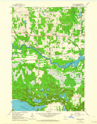 1963 Motley SE1964 Print · USGSThe river and rail corridors of Morrison and Cass counties are frozen in time during the early 1960s. You can trace the Northern Pacific line across the Crow Wing River or locate local landmarks like the Motley Lookout Tower and Camp Shamineau.
 - 1963 Map of Motley, 1964 Print
 1963 Motley1964 Print · USGSThe confluence of the Crow Wing and Long Prairie Rivers defines this pocket of central Minnesota in the early sixties. Genealogists and local historians can trace the footprint of Motley and Philbrook, along with sites like School No 1212 and St James Cem.2 unique versions available
 - 1964 Map of Hibbing
 1964 Hibbing1964 Print · USGSNorthern Minnesota’s iron-rich corridor is captured here during a peak era of mid-century industrial activity. Researchers can trace the rail-to-mine connections through Mesabi Range towns like Hibbing and Virginia or locate lakefront settlements near Pokegama Lake.
 - 1965 Map of Brainerd
 1965 Brainerd1965 Print · USGSNorth-central Minnesota in the mid-fifties presents a complex landscape of sprawling lake systems and established rail corridors. Genealogists and historians can trace the growth of timber towns along the Northern Pacific RR and explore early borders of the White Earth Indian Reservation or Tamarac National Wildlife Refuge.
 - 1966 Map of Staples NE, 1967 Print
 1966 Staples NE1967 Print · USGSWadena County at the height of the mid-sixties reveals a river-laced landscape where the Crow Wing River divides local townships. Genealogists can locate Montrose Cem and Covenant Ch, while aviation enthusiasts can trace the early layout of the Staples Municipal Airport.2 unique versions available
Showing maps 1-25 of 454
Top cities of Cass County
- Sylvan historical maps
- Lake Shore historical maps
- East Gull Lake historical maps
- Walker historical maps
- Pine River historical maps
- Cass Lake historical maps
See more
Frequently asked questions
- What are the different types of historical maps available for Cass County?
- What is the oldest map of Cass County?
- Where can I purchase historical maps of Cass County for my home or office?
- Where can I download high-res historical maps of Cass County?
- Are there historical topographic maps available for Cass County?
- Is there historical aerial imagery available for Cass County?
- Where are historical maps of Cass County sourced from?