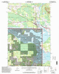
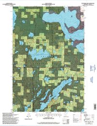
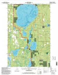
1990s Maps of Cass County, Minnesota
Explore 39 historic maps of Cass County from the 1990s. These maps offer a rare glimpse into what life looked like during the 1990s — showing old roads, neighborhoods, homes, and landmarks that have changed or disappeared over time.
Whether you're researching your family's past, planning a metal detecting trip, or studying how Cass County's landscape evolved across the 1990s, these high-resolution maps are a powerful tool for exploring the history of this region.
- Focus on a specific era: All maps on this page are from the 1990s, giving you a focused view of this time period.
- See what’s changed: Compare century-old streets, trails, and buildings to today's modern landscape using overlays and satellite layers.
- Research with precision: Use these maps for genealogy, historical research, land use analysis, or educational projects.
- View, download, or print: Maps are fully viewable online in high resolution, and can be downloaded or printed for your own records.
Start exploring Cass County's history through authentic maps from the 1990s. This is your window into the past.
Cass County, MN maps
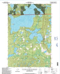
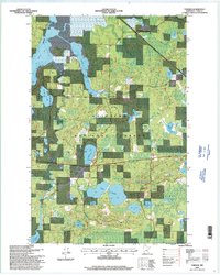
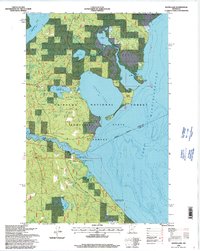
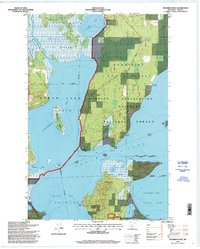
(39)- 1992 Map of Pokegama Lake
 1992 Pokegama Lake1992 Print · USGSItasca County in the early nineties showcases the industrial pulse of the Iron Range and the vast waters of the north woods. Trace the rail lines of the Duluth Missabe and Iron Range Railway or locate old settlements like Wawina and Calumet.
 - 1994 Map of Aitkin
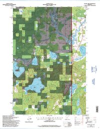
 1994 Aitkin1994 Print · USGSIn the mid-1990s, the lake country of central Minnesota remained a patchwork of state forests and rail-linked settlements. Researchers can trace the legacy of the Soo Line through towns like McGregor and Aitkin, or explore the vast reaches of the Savanna State Forest and Rice Lake.
 - 1996 Map of Woman Lake, 1998 Print
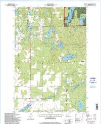
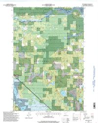
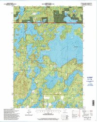 1996 Woman Lake1998 Print · USGSCass County lake country is captured here in the mid-1990s, showcasing the extensive waters within the Chippewa National Forest. Genealogists and outdoor historians can trace the shorelines of Woman Lake, Baby Lake, and the Goose Lake Trail System.
 - 1996 Map of Goose Lake, 1998 Print
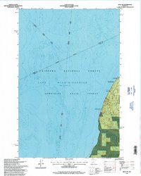
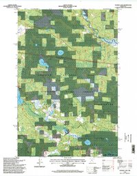
 1996 Goose Lake1998 Print · USGSCass County’s lake-heavy interior is documented here during the mid-nineties, showing the intersection of several major conservation districts. Trace the geography of the Leech Lake Indian Reservation or locate landmarks like Elevenmile Corner and the Johnson Lake Trail System.2 unique versions available
 - 1996 Map of Ottertail Point, 1998 Print
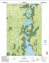
 1996 Ottertail Point1998 Print · USGSLeech Lake and the surrounding Northwoods appear in the mid-nineties as a mosaic of state, federal, and tribal lands. Researchers can trace the boundaries of the Leech Lake Indian Reservation and locate seasonal National Forest Permitted Recreation Residences near Stony Point.
 - 1996 Map of Thunder Lake, 1998 Print
 1996 Thunder Lake1998 Print · USGSIn the mid-1990s, this Cass County landscape remained a dense network of managed timber and glacial waters. Researchers can trace forest boundaries and remote landmarks like Ben Draper Lookout, Thunder Lake, and Big Rice Lake.
 - 1996 Map of Hackensack, 1998 Print
 1996 Hackensack1998 Print · USGSThe lake-strewn landscape around Hackensack is captured here in the late twentieth century as public forests and shoreline properties matured. Genealogists and researchers can locate Hillcrest Cem, the local Townhall, and landmarks like the Birch Lake Lookout.
 - 1996 Map of Bena NW, 1998 Print
 1996 Bena NW1998 Print · USGSLake Winnibigoshish and the surrounding northern Minnesota forests are captured here in the mid-1990s. Researchers can locate recreation-specific landmarks like Birches, the National Forest Permitted Resort, and several Boat Ramp sites.
 - 1996 Map of Crystal Lake, 1998 Print
 1996 Crystal Lake1998 Print · USGSHubbard County in the 1990s was a landscape of dense state forests and glacial water bodies. Genealogists and local historians can trace family locations near Akeley or locate burial sites at Akeley Cemetery and White Oak Cemetery.
 - 1996 Map of Sucker Lakes, 1998 Print
 1996 Sucker Lakes1998 Print · USGSCass County’s lake country is captured here in the mid-1990s, showcasing the intersection of tribal lands and national forest management. Trace the Soo Line railroad through Schley or locate secluded water features like Life Raft Lake and the Cuba Hill Lookout.
 - 1996 Map of Tobique, 1998 Print
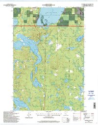
 1996 Tobique1998 Print · USGSCass County's lake-rich landscape is captured here during the 1990s as it was managed within the Chippewa National Forest. Genealogists and outdoorsmen can trace the drainage of the Boy River and locate landmarks like the local Cemetery and Twin Lakes.
 - 1996 Map of Andrusia Lake, 1998 Print
 1996 Andrusia Lake1998 Print · USGSThe lake-strewn border of Beltrami and Cass counties is captured here in the late nineties, where the Mississippi River feeds into Andrusia Lake. Genealogists and local historians can locate the old settlement of Farris, its namesake Farris Cem, and the Minnie-Wa-Kan Camp.
 - 1996 Map of Deer River, 1998 Print
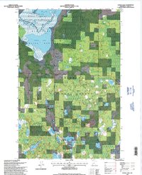
 1996 Deer River1998 Print · USGSThe Mississippi River and White Oak Lake define the Itasca County landscape in the 1990s. Researchers can locate Olivet Cemetery, King School, and the community of Zemple among the forest and wetlands.
 - 1996 Map of Town Line Lake, 1998 Print
 1996 Town Line Lake1998 Print · USGSCass County’s lake country is captured here in the mid-nineties, showing the intersection of tribal and national forest lands. Local historians can locate the St Edwards Cemetery, the Church Camp on Rabbit Lake, and water access points at Town Line Lake.
 - 1996 Map of Pike Bay, 1998 Print
 1996 Pike Bay1998 Print · USGSThe shorelines of Pike Bay and Cass Lake are shown during the mid-nineties as the region balanced timber management with growing recreational use. Researchers can locate the Thompson Cemetery, trace the Soo Line tracks, and find secluded landmarks like Thirteen Lake.
 - 1996 Map of Raven Lake, 1998 Print
 1996 Raven Lake1998 Print · USGSIn the mid-1990s, the lake-studded forests of Itasca and Cass Counties remained a critical junction for the upper Mississippi and local recreation. Researchers can locate seasonal homes at National Forest Permitted Recreational Residences or trace the shoreline from Ravens Point to Sugar Island.
 - 1996 Map of Sugar Lake, 1998 Print
 1996 Sugar Lake1998 Print · USGSThe Mississippi River corridor near the Cass and Itasca county line is captured here in the mid-1990s as a hub of conservation and timberland. Outdoor historians and genealogists can locate the West Cohasset Chapel, trace the Sugar Lake Trail System, or explore the bounds of Schoolcraft State Park.
 - 1996 Map of Boy River, 1998 Print
 1996 Boy River1998 Print · USGSCass County's lake-studded timberlands are captured here in the mid-nineties, showing a landscape managed for both wildlife and forestry. Researchers can locate the Arlington Cemetery, trace the winding Boy River, or study the boundaries of the Leech Lake Indian Res.
 - 1996 Map of Nushka Lake, 1998 Print
 1996 Nushka Lake1998 Print · USGSThe Mississippi headwaters region in the mid-1990s is captured here, showing the intersection of tribal, state, and federal lands. Researchers can trace forest management and water control projects like Bear Brook Impoundment and Sixmile Lake.
 - 1996 Map of Little Winnibigoshish Lake, 1998 Print
 1996 Little Winnibigoshish Lake1998 Print · USGSItasca County in the late nineties is documented here as a landscape of interconnected waterways and protected forest. Researchers can locate the Winnie Dam, a local Cemetery, and specific lakeside features like Sugarbush Point or the Fish Hatchery.2 unique versions available
 - 1996 Map of Portage Lake, 1998 Print
 1996 Portage Lake1998 Print · USGSThe Cass County shoreline and forest interiors are captured here in the mid-1990s, where public lands and tribal territories intersect. Researchers can trace historical settlement at Ryan Village, locate family roots at Rabbits Cemetery, and study the landscape around Federal Dam.
 - 1996 Map of Webb Lake, 1998 Print
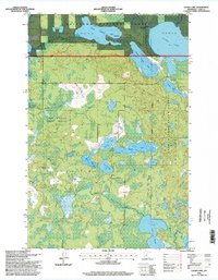
 1996 Webb Lake1998 Print · USGSCass County’s lake country is captured here in the mid-nineties, showing a densely forested landscape managed by the Forest Service. Outdoor enthusiasts and researchers can trace the North Country Trail or locate remote access points on Stony Lake and Pleasant Lake.
 - 1996 Map of Laura Lake, 1998 Print
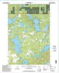
 1996 Laura Lake1998 Print · USGSCass County’s Northwoods landscape is captured here in the mid-nineties, showing a densely forested region defined by conservation lands and glacial waters. Researchers can trace the varied shorelines of Laura Lake and Inguadona Lake or locate early industrial sites like the local Gravel Pits.
 - 1996 Map of Steamboat Bay, 1998 Print
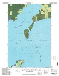
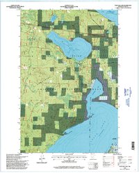
 1996 Steamboat Bay1998 Print · USGSThe Leech Lake region in the mid-nineties shows a landscape defined by the Chippewa Indian Reservation and overlapping state and national forests. Researchers can trace the winding Heartland Trail or locate features like Minnesota Island and the Pine Point Natural Area.
 - 1996 Map of Walker, 1998 Print
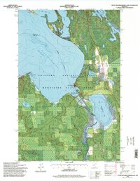
 1996 Walker1998 Print · USGSWalker and the Leech Lake shoreline are shown in the late nineties as a hub for forestry and recreation within the Leech Lake Indian Reservation. Genealogists and local historians can trace the grounds of Evergreen Cemetery, the Ah-gwah-ching State Nursing Home, and the old settlement at Onigum.
Showing maps 1-25 of 39
Top cities of Cass County
- Sylvan historical maps
- Lake Shore historical maps
- East Gull Lake historical maps
- Walker historical maps
- Pine River historical maps
- Cass Lake historical maps
See more
Frequently asked questions
- What are the different types of historical maps available for Cass County?
- What is the oldest map of Cass County?
- Where can I purchase historical maps of Cass County for my home or office?
- Where can I download high-res historical maps of Cass County?
- Are there historical topographic maps available for Cass County?
- Is there historical aerial imagery available for Cass County?
- Where are historical maps of Cass County sourced from?