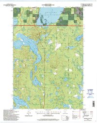
1996 Map of Thunder Lake
USGS Topo · Published 1998About this map
Chippewa National Forest and Land O Lakes State Forest converge in this water-rich pocket of Cass County, defined by a complex glacial landscape of interconnected lakes and conservation areas. The map is anchored by the expansive waters of Thunder Lake and Big Rice Lake, the latter of which includes a dedicated Wildlife Area. To the east, the Smoky Hollow State Wildlife Area covers the terrain of Smoky Hollow, illustrating the region's 20th-century focus on managed wilderness and habitat preservation.
Find a feature on this map
32 named features on this map. Tap any name to fly to it.
Don’t see what you’re looking for? This feature index may not catch every label — zoom into the map to look around manually.
Map Details
Editions of this 1996 Thunder Lake Map
This is the sole edition of this map. No revisions or reprints were ever made.
Other maps of this area

1953 · Duluth
USGS Topo · 1:250,000

1953 · Brainerd
USGS Topo · 1:250,000

1954 · Bemidji
USGS Topo · 1:250,000

1954 · Hibbing
USGS Topo · 1:250,000

1957 · Brainerd
USGS Topo · 1:250,000

1957 · Bemidji
USGS Topo · 1:250,000

1957 · Hibbing
USGS Topo · 1:250,000

1958 · Bemidji
USGS Topo · 1:250,000

1958 · Hibbing
USGS Topo · 1:250,000

1958 · Brainerd
USGS Topo · 1:250,000